![](/images/other/stat-length.png)
- Randonnées
- A pied
- Portugal
- Centre
- Guarda
Guarda, Centre, A pied : Les meilleures randonnées, itinéraires, parcours, balades et promenades
Guarda : découvrez les meilleures randonnées : 41 a pied et 8 marche. Tous ces circuits, parcours, itinéraires et activités en plein air sont disponibles dans nos applications SityTrail pour smartphones et tablettes.
Les meilleurs parcours (48)
![Randonnée A pied U. F. Vide e Cabeça - Rota dos Meandros (da Ribeira do Piódão) - Photo](https://media.geolcdn.com/t/350/260/fabc2d3b-8fc0-4505-b925-288edcf7358e.jpeg&format=jpg&maxdim=2)
![A pied A pied](https://static1.geolcdn.com/sitytour/trail-icons/100.png)
Km
A pied
![](/images/other/stat-length.png)
![](https://static1.geolcdn.com/siteimages/upload/files/1508320355ic_sort_den_pos_24dp.png)
![](https://static1.geolcdn.com/siteimages/upload/files/1508320355ic_sort_den_neg_24dp.png)
![](https://static1.geolcdn.com/siteimages/upload/files/16400158638029165_repeat_loop_refresh_sync_direction_icon.png)
• Randonnée créée par Associação das Aldeias de Montanha.
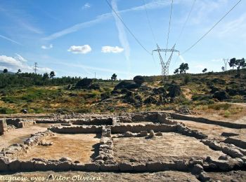
![Randonnée A pied U.F Celorico, São Pedro e Santa Maria e Vila Boa do Mondego - Trilho de São Gens - Photo](https://media.geolcdn.com/t/350/260/17dd9575-1013-4f0b-b8d1-4d8f6b7ee935.jpeg&format=jpg&maxdim=2)
![A pied A pied](https://static1.geolcdn.com/sitytour/trail-icons/100.png)
Km
A pied
![](/images/other/stat-length.png)
![](https://static1.geolcdn.com/siteimages/upload/files/1508320355ic_sort_den_pos_24dp.png)
![](https://static1.geolcdn.com/siteimages/upload/files/1508320355ic_sort_den_neg_24dp.png)
![](https://static1.geolcdn.com/siteimages/upload/files/16400158638029165_repeat_loop_refresh_sync_direction_icon.png)
• Randonnée créée par Município de Celorico da Beira.
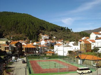
![Randonnée A pied - Rota do Sameiro - Derivação - Photo](https://media.geolcdn.com/t/350/260/4e30c6ad-8c31-40f8-9bd1-c3a2cde722af.jpeg&format=jpg&maxdim=2)
![A pied A pied](https://static1.geolcdn.com/sitytour/trail-icons/100.png)
Km
A pied
![](/images/other/stat-length.png)
![](https://static1.geolcdn.com/siteimages/upload/files/1508320355ic_sort_den_pos_24dp.png)
![](https://static1.geolcdn.com/siteimages/upload/files/1508320355ic_sort_den_neg_24dp.png)
![](https://static1.geolcdn.com/siteimages/upload/files/16400158638029165_repeat_loop_refresh_sync_direction_icon.png)
• Randonnée créée par Município de Manteigas. Site web: https://manteigastrilhosverdes.com/portfolio_page/sameiro/
![Randonnée A pied Manteigas São Pedro - Rota dos Poios Brancos - Derivação 1 - Photo](https://media.geolcdn.com/t/350/260/75bf4c15-3b20-47c2-aa2c-f86456ce9c2a.jpeg&format=jpg&maxdim=2)
![A pied A pied](https://static1.geolcdn.com/sitytour/trail-icons/100.png)
Km
A pied
![](/images/other/stat-length.png)
![](https://static1.geolcdn.com/siteimages/upload/files/1508320355ic_sort_den_pos_24dp.png)
![](https://static1.geolcdn.com/siteimages/upload/files/1508320355ic_sort_den_neg_24dp.png)
![](https://static1.geolcdn.com/siteimages/upload/files/16400158638029165_repeat_loop_refresh_sync_direction_icon.png)
• Randonnée créée par Município de Manteigas. Site web: https://manteigastrilhosverdes.com/portfolio_page/poios-bran...
![Randonnée A pied Manteigas Santa Maria - Rota da Reboleira - Photo](https://media.geolcdn.com/t/350/260/4e30c6ad-8c31-40f8-9bd1-c3a2cde722af.jpeg&format=jpg&maxdim=2)
![A pied A pied](https://static1.geolcdn.com/sitytour/trail-icons/100.png)
Km
A pied
![](/images/other/stat-length.png)
![](https://static1.geolcdn.com/siteimages/upload/files/1508320355ic_sort_den_pos_24dp.png)
![](https://static1.geolcdn.com/siteimages/upload/files/1508320355ic_sort_den_neg_24dp.png)
![](https://static1.geolcdn.com/siteimages/upload/files/16400158638029165_repeat_loop_refresh_sync_direction_icon.png)
• Randonnée créée par Município de Manteigas. Site web: https://manteigastrilhosverdes.com/portfolio_page/reboleira/
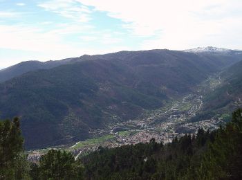
![Randonnée A pied Manteigas Santa Maria - Rota das Quartelas - Photo](https://media.geolcdn.com/t/350/260/aa18a6d1-cff8-48aa-a701-cf4d8ea72841.jpeg&format=jpg&maxdim=2)
![A pied A pied](https://static1.geolcdn.com/sitytour/trail-icons/100.png)
Km
A pied
![](/images/other/stat-length.png)
![](https://static1.geolcdn.com/siteimages/upload/files/1508320355ic_sort_den_pos_24dp.png)
![](https://static1.geolcdn.com/siteimages/upload/files/1508320355ic_sort_den_neg_24dp.png)
![](https://static1.geolcdn.com/siteimages/upload/files/16400158638029165_repeat_loop_refresh_sync_direction_icon.png)
• Randonnée créée par Município de Manteigas. Site web: https://manteigastrilhosverdes.com/portfolio_page/quartelas/
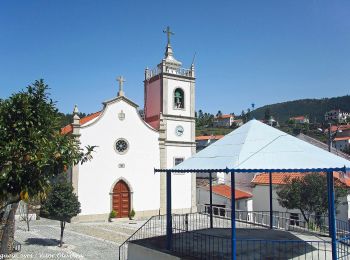
![Randonnée A pied Sameiro - Rota da Azinha - Photo](https://media.geolcdn.com/t/350/260/6d15c07f-009d-412a-8b05-e33ac79412ff.jpeg&format=jpg&maxdim=2)
![A pied A pied](https://static1.geolcdn.com/sitytour/trail-icons/100.png)
Km
A pied
![](/images/other/stat-length.png)
![](https://static1.geolcdn.com/siteimages/upload/files/1508320355ic_sort_den_pos_24dp.png)
![](https://static1.geolcdn.com/siteimages/upload/files/1508320355ic_sort_den_neg_24dp.png)
![](https://static1.geolcdn.com/siteimages/upload/files/16400158638029165_repeat_loop_refresh_sync_direction_icon.png)
• Randonnée créée par Município de Manteigas. Site web: https://manteigastrilhosverdes.com/portfolio_page/azinha/
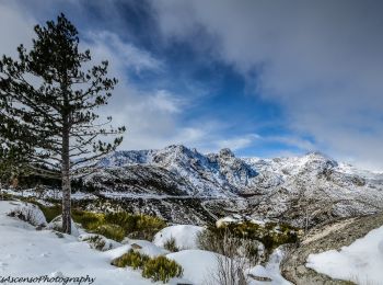
![Randonnée A pied Alvoco da Serra - Rota do Glaciar - Photo](https://media.geolcdn.com/t/350/260/3bac841e-13ba-49cb-8a33-d826d2552d7a.jpeg&format=jpg&maxdim=2)
![A pied A pied](https://static1.geolcdn.com/sitytour/trail-icons/100.png)
Km
A pied
![](/images/other/stat-length.png)
![](https://static1.geolcdn.com/siteimages/upload/files/1508320355ic_sort_den_pos_24dp.png)
![](https://static1.geolcdn.com/siteimages/upload/files/1508320355ic_sort_den_neg_24dp.png)
![](https://static1.geolcdn.com/siteimages/upload/files/16400158638029165_repeat_loop_refresh_sync_direction_icon.png)
• Randonnée créée par Município de Manteigas. Site web: https://manteigastrilhosverdes.com/portfolio_page/glaciar/
![Randonnée A pied Manteigas São Pedro - Rota dos Poios Brancos - Photo](https://media.geolcdn.com/t/350/260/e3feba70-9aaa-47d5-b1f9-c9e0932753f5.jpeg&format=jpg&maxdim=2)
![A pied A pied](https://static1.geolcdn.com/sitytour/trail-icons/100.png)
Km
A pied
![](/images/other/stat-length.png)
![](https://static1.geolcdn.com/siteimages/upload/files/1508320355ic_sort_den_pos_24dp.png)
![](https://static1.geolcdn.com/siteimages/upload/files/1508320355ic_sort_den_neg_24dp.png)
![](https://static1.geolcdn.com/siteimages/upload/files/16400158638029165_repeat_loop_refresh_sync_direction_icon.png)
• Randonnée créée par Município de Manteigas. Site web: https://manteigastrilhosverdes.com/portfolio_page/poios-bran...
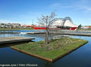
![Randonnée A pied Guarda - Trilho do Jarmelo - Photo](https://media.geolcdn.com/t/350/260/908a5743-6655-430d-8796-d0cf914a54a1.jpeg&format=jpg&maxdim=2)
![A pied A pied](https://static1.geolcdn.com/sitytour/trail-icons/100.png)
Km
A pied
![](/images/other/stat-length.png)
![](https://static1.geolcdn.com/siteimages/upload/files/1508320355ic_sort_den_pos_24dp.png)
![](https://static1.geolcdn.com/siteimages/upload/files/1508320355ic_sort_den_neg_24dp.png)
![](https://static1.geolcdn.com/siteimages/upload/files/16400158638029165_repeat_loop_refresh_sync_direction_icon.png)
• Randonnée créée par Município da Guarda. Symbole: Yellow over Red
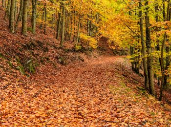
![Randonnée A pied Manteigas Santa Maria - Rota do Corredor de Mouros - Photo](https://media.geolcdn.com/t/350/260/0c989035-e929-4cee-b8c2-1c7580e7c639.jpeg&format=jpg&maxdim=2)
![A pied A pied](https://static1.geolcdn.com/sitytour/trail-icons/100.png)
Km
A pied
![](/images/other/stat-length.png)
![](https://static1.geolcdn.com/siteimages/upload/files/1508320355ic_sort_den_pos_24dp.png)
![](https://static1.geolcdn.com/siteimages/upload/files/1508320355ic_sort_den_neg_24dp.png)
![](https://static1.geolcdn.com/siteimages/upload/files/16400158638029165_repeat_loop_refresh_sync_direction_icon.png)
• Randonnée créée par Município de Manteigas. Symbole: Yellow over Red Site web: http://manteigastrilhosverdes.com/p...
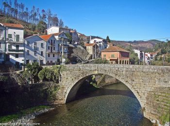
![Randonnée A pied U. F. Vide e Cabeça - Rota da Ribeira de Loriga - Photo](https://media.geolcdn.com/t/350/260/6888ea55-6f6d-45d0-9256-ec32c32c1d12.jpeg&format=jpg&maxdim=2)
![A pied A pied](https://static1.geolcdn.com/sitytour/trail-icons/100.png)
Km
A pied
![](/images/other/stat-length.png)
![](https://static1.geolcdn.com/siteimages/upload/files/1508320355ic_sort_den_pos_24dp.png)
![](https://static1.geolcdn.com/siteimages/upload/files/1508320355ic_sort_den_neg_24dp.png)
![](https://static1.geolcdn.com/siteimages/upload/files/16400158638029165_repeat_loop_refresh_sync_direction_icon.png)
• Randonnée créée par Município de Seia.
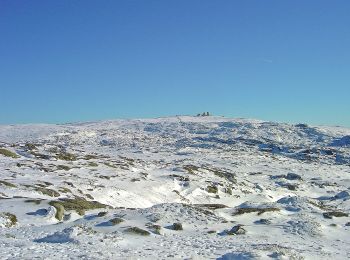
![Randonnée A pied Loriga - Rota da Garganta de Loriga - Photo](https://media.geolcdn.com/t/350/260/8ddda6e5-d9db-49f7-b0e1-1854bccb1174.jpeg&format=jpg&maxdim=2)
![A pied A pied](https://static1.geolcdn.com/sitytour/trail-icons/100.png)
Km
A pied
![](/images/other/stat-length.png)
![](https://static1.geolcdn.com/siteimages/upload/files/1508320355ic_sort_den_pos_24dp.png)
![](https://static1.geolcdn.com/siteimages/upload/files/1508320355ic_sort_den_neg_24dp.png)
![](https://static1.geolcdn.com/siteimages/upload/files/16400158638029165_repeat_loop_refresh_sync_direction_icon.png)
• Randonnée créée par Município de Seia.
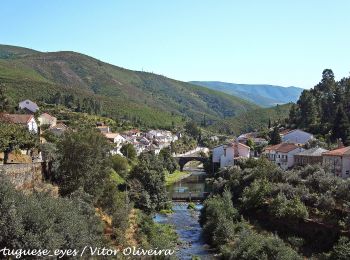
![Randonnée A pied Alvoco da Serra - Rota da Ribeira de Alvoco - Photo](https://media.geolcdn.com/t/350/260/ea9cc1e0-3ea8-4b83-aa8e-f6fbffe754da.jpeg&format=jpg&maxdim=2)
![A pied A pied](https://static1.geolcdn.com/sitytour/trail-icons/100.png)
Km
A pied
![](/images/other/stat-length.png)
![](https://static1.geolcdn.com/siteimages/upload/files/1508320355ic_sort_den_pos_24dp.png)
![](https://static1.geolcdn.com/siteimages/upload/files/1508320355ic_sort_den_neg_24dp.png)
![](https://static1.geolcdn.com/siteimages/upload/files/16400158638029165_repeat_loop_refresh_sync_direction_icon.png)
• Randonnée créée par Município de Seia.
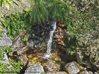
![Randonnée A pied U. F. Seia, São Romão e Lapa dos Dinheiros - Rota da Caniça - Photo](https://media.geolcdn.com/t/350/260/799408df-44e3-4624-b9fb-11db7eddfbf2.jpeg&format=jpg&maxdim=2)
![A pied A pied](https://static1.geolcdn.com/sitytour/trail-icons/100.png)
Km
A pied
![](/images/other/stat-length.png)
![](https://static1.geolcdn.com/siteimages/upload/files/1508320355ic_sort_den_pos_24dp.png)
![](https://static1.geolcdn.com/siteimages/upload/files/1508320355ic_sort_den_neg_24dp.png)
![](https://static1.geolcdn.com/siteimages/upload/files/16400158638029165_repeat_loop_refresh_sync_direction_icon.png)
• Randonnée créée par Município de Seia.
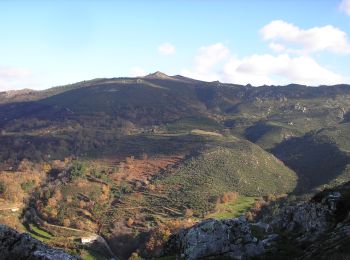
![Randonnée A pied Folgosinho - Rota dos Galhardos - Photo](https://media.geolcdn.com/t/350/260/44c9ffb6-3396-470f-9c75-8c58c7c40df6.jpeg&format=jpg&maxdim=2)
![A pied A pied](https://static1.geolcdn.com/sitytour/trail-icons/100.png)
Km
A pied
![](/images/other/stat-length.png)
![](https://static1.geolcdn.com/siteimages/upload/files/1508320355ic_sort_den_pos_24dp.png)
![](https://static1.geolcdn.com/siteimages/upload/files/1508320355ic_sort_den_neg_24dp.png)
![](https://static1.geolcdn.com/siteimages/upload/files/16400158638029165_repeat_loop_refresh_sync_direction_icon.png)
• Randonnée créée par Município de Gouveia.
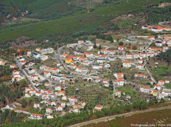
![Randonnée A pied Sazes da Beira - Rota do Volfrâmio - Photo](https://media.geolcdn.com/t/350/260/ec4c263e-3e7d-467f-bb4f-92ace547ac21.jpeg&format=jpg&maxdim=2)
![A pied A pied](https://static1.geolcdn.com/sitytour/trail-icons/100.png)
Km
A pied
![](/images/other/stat-length.png)
![](https://static1.geolcdn.com/siteimages/upload/files/1508320355ic_sort_den_pos_24dp.png)
![](https://static1.geolcdn.com/siteimages/upload/files/1508320355ic_sort_den_neg_24dp.png)
![](https://static1.geolcdn.com/siteimages/upload/files/16400158638029165_repeat_loop_refresh_sync_direction_icon.png)
• Randonnée créée par Município de Seia.
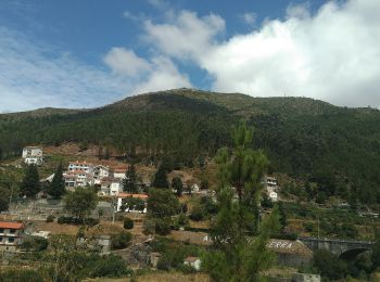
![Randonnée A pied Alvoco da Serra - Rota do Pastoreio - Photo](https://media.geolcdn.com/t/350/260/ad60b477-c772-4c4b-8953-724392d8016f.jpeg&format=jpg&maxdim=2)
![A pied A pied](https://static1.geolcdn.com/sitytour/trail-icons/100.png)
Km
A pied
![](/images/other/stat-length.png)
![](https://static1.geolcdn.com/siteimages/upload/files/1508320355ic_sort_den_pos_24dp.png)
![](https://static1.geolcdn.com/siteimages/upload/files/1508320355ic_sort_den_neg_24dp.png)
![](https://static1.geolcdn.com/siteimages/upload/files/16400158638029165_repeat_loop_refresh_sync_direction_icon.png)
• Randonnée créée par Município de Seia.
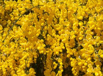
![Randonnée A pied Maçainhas - Trilho de Maçainhas - Photo](https://media.geolcdn.com/t/350/260/27b5f27a-b063-4d85-974c-acbfce84b347.jpeg&format=jpg&maxdim=2)
![A pied A pied](https://static1.geolcdn.com/sitytour/trail-icons/100.png)
Km
A pied
![](/images/other/stat-length.png)
![](https://static1.geolcdn.com/siteimages/upload/files/1508320355ic_sort_den_pos_24dp.png)
![](https://static1.geolcdn.com/siteimages/upload/files/1508320355ic_sort_den_neg_24dp.png)
![](https://static1.geolcdn.com/siteimages/upload/files/16400158638029165_repeat_loop_refresh_sync_direction_icon.png)
• Randonnée créée par Município da Guarda. Symbole: Yellow over Red
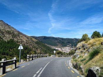
![Randonnée A pied Manteigas Santa Maria - Rota do Carvão - Photo](https://media.geolcdn.com/t/350/260/75848a2d-6fd9-4409-9059-129354b5038f.jpeg&format=jpg&maxdim=2)
![A pied A pied](https://static1.geolcdn.com/sitytour/trail-icons/100.png)
Km
A pied
![](/images/other/stat-length.png)
![](https://static1.geolcdn.com/siteimages/upload/files/1508320355ic_sort_den_pos_24dp.png)
![](https://static1.geolcdn.com/siteimages/upload/files/1508320355ic_sort_den_neg_24dp.png)
![](https://static1.geolcdn.com/siteimages/upload/files/16400158638029165_repeat_loop_refresh_sync_direction_icon.png)
• Site web: http://cm-manteigas.pt/diretorio/rota-de-percursos-pedestres/
20 randonnées affichées sur 48
Application GPS de randonnée GRATUITE
Activités
Régions proches
- Aldeia de Santo António e Sabugal
- Almeida
- Alvoco da Serra
- Castanheira
- Castelo Mendo, Ade, Monteperobolço e Mesquitela
- Escalhão
- Figueira de Castelo Rodrigo
- Fóios
- Folgosinho
- Freixeda de Torrão, Quintã de Pero Martins e Penha de Águia
- Gouveia
- Guarda
- Guilheiro
- Loriga
- Maçainhas
- Mangualde da Serra e Aldeias
- Manteigas Santa Maria
- Manteigas São Pedro
- Melo e Nabais
- Pena Verde
- Rio de Mel
- Sabugueiro
- Sameiro
- Santa Marinha e São Martinho
- Santana da Azinha
- Sazes da Beira
- Trancoso e Souto Maior
- U. F. Seia, São Romão e Lapa dos Dinheiros
- U. F. Vide e Cabeça
- U.F Celorico, São Pedro e Santa Maria e Vila Boa do Mondego
- Vale da Amoreira
- Valezim
- Valhelhas