![](/images/other/stat-length.png)
- Randonnées
- A pied
- Portugal
- Nord
Nord, Portugal, A pied : Les meilleures randonnées, itinéraires, parcours, balades et promenades
Nord : découvrez les meilleures randonnées : 187 a pied, 71 marche et 5 course à pied. Tous ces circuits, parcours, itinéraires et activités en plein air sont disponibles dans nos applications SityTrail pour smartphones et tablettes.
Les meilleurs parcours (263)
![Randonnée A pied - Trilho do Tua - Photo](https://media.geolcdn.com/t/350/260/6fed6eb8-6f9b-4a5f-8dd8-8885b2d740b2.jpeg&format=jpg&maxdim=2)
![A pied A pied](https://static1.geolcdn.com/sitytour/trail-icons/100.png)
Km
A pied
![](/images/other/stat-length.png)
![](https://static1.geolcdn.com/siteimages/upload/files/1508320355ic_sort_den_pos_24dp.png)
![](https://static1.geolcdn.com/siteimages/upload/files/1508320355ic_sort_den_neg_24dp.png)
![](https://static1.geolcdn.com/siteimages/upload/files/16400158638029165_repeat_loop_refresh_sync_direction_icon.png)
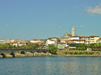
• Randonnée créée par Camara Municipal de Mirandela. Site web: http://www.visitmirandela.com/uploads/writer_file/doc...
![Randonnée A pied - Trilho do Lobo Atlântico - Photo](https://media.geolcdn.com/t/350/260/5ba811a4-fc38-43d0-b473-94c34ec2d7c8.jpeg&format=jpg&maxdim=2)
![A pied A pied](https://static1.geolcdn.com/sitytour/trail-icons/100.png)
Km
A pied
![](/images/other/stat-length.png)
![](https://static1.geolcdn.com/siteimages/upload/files/1508320355ic_sort_den_pos_24dp.png)
![](https://static1.geolcdn.com/siteimages/upload/files/1508320355ic_sort_den_neg_24dp.png)
![](https://static1.geolcdn.com/siteimages/upload/files/16400158638029165_repeat_loop_refresh_sync_direction_icon.png)
• Randonnée créée par Município de Ponte de Lima/CIM Alto Minho.
![Randonnée A pied Monte Córdova - Histórico Pré-Industrial - Photo](https://media.geolcdn.com/t/350/260/e77fbb42-89bf-400a-823a-b3f42d9274fe.jpeg&format=jpg&maxdim=2)
![A pied A pied](https://static1.geolcdn.com/sitytour/trail-icons/100.png)
Km
A pied
![](/images/other/stat-length.png)
![](https://static1.geolcdn.com/siteimages/upload/files/1508320355ic_sort_den_pos_24dp.png)
![](https://static1.geolcdn.com/siteimages/upload/files/1508320355ic_sort_den_neg_24dp.png)
![](https://static1.geolcdn.com/siteimages/upload/files/16400158638029165_repeat_loop_refresh_sync_direction_icon.png)
• Randonnée créée par Camara Municipal de Santo Tirso.
![Randonnée A pied Folhadela - Percurso pedestre do Douro Vinhateiro III - Photo](https://media.geolcdn.com/t/350/260/83ecfee0-97e3-4dbe-93fb-8ce0c7efdfca.jpeg&format=jpg&maxdim=2)
![A pied A pied](https://static1.geolcdn.com/sitytour/trail-icons/100.png)
Km
A pied
![](/images/other/stat-length.png)
![](https://static1.geolcdn.com/siteimages/upload/files/1508320355ic_sort_den_pos_24dp.png)
![](https://static1.geolcdn.com/siteimages/upload/files/1508320355ic_sort_den_neg_24dp.png)
![](https://static1.geolcdn.com/siteimages/upload/files/16400158638029165_repeat_loop_refresh_sync_direction_icon.png)
• Randonnée créée par Centro de Ciencia Viva - Vila real.
![Randonnée A pied Campeã - Percurso Pedestre do Mineiro - Photo](https://media.geolcdn.com/t/350/260/a26b5f92-28f6-41d5-9b1f-07bb281a0eb3.jpeg&format=jpg&maxdim=2)
![A pied A pied](https://static1.geolcdn.com/sitytour/trail-icons/100.png)
Km
A pied
![](/images/other/stat-length.png)
![](https://static1.geolcdn.com/siteimages/upload/files/1508320355ic_sort_den_pos_24dp.png)
![](https://static1.geolcdn.com/siteimages/upload/files/1508320355ic_sort_den_neg_24dp.png)
![](https://static1.geolcdn.com/siteimages/upload/files/16400158638029165_repeat_loop_refresh_sync_direction_icon.png)
• Randonnée créée par Centro Ciencia Viva - Vila Real.
![Randonnée A pied Campeã - Percurso Pedestre das Florestas do Marão - Photo](https://media.geolcdn.com/t/350/260/bea96ade-82f7-4fa9-ab0b-726b05bf4c34.jpeg&format=jpg&maxdim=2)
![A pied A pied](https://static1.geolcdn.com/sitytour/trail-icons/100.png)
Km
A pied
![](/images/other/stat-length.png)
![](https://static1.geolcdn.com/siteimages/upload/files/1508320355ic_sort_den_pos_24dp.png)
![](https://static1.geolcdn.com/siteimages/upload/files/1508320355ic_sort_den_neg_24dp.png)
![](https://static1.geolcdn.com/siteimages/upload/files/16400158638029165_repeat_loop_refresh_sync_direction_icon.png)
• Randonnée créée par Centro Ciencia Vica - Vila Real.
![Randonnée A pied Vilar de Ferreiros - Levada de Piscaredo - Photo](https://media.geolcdn.com/t/350/260/f1870e4d-b731-41eb-9864-5ad51b82aff4.jpeg&format=jpg&maxdim=2)
![A pied A pied](https://static1.geolcdn.com/sitytour/trail-icons/100.png)
Km
A pied
![](/images/other/stat-length.png)
![](https://static1.geolcdn.com/siteimages/upload/files/1508320355ic_sort_den_pos_24dp.png)
![](https://static1.geolcdn.com/siteimages/upload/files/1508320355ic_sort_den_neg_24dp.png)
![](https://static1.geolcdn.com/siteimages/upload/files/16400158638029165_repeat_loop_refresh_sync_direction_icon.png)
• Randonnée créée par Camara Municipal de Mondim de Basto.
![Randonnée A pied Bravães - Trilho Românico de Bravães a S. Martinho de Crasto - Photo](https://media.geolcdn.com/t/350/260/c1281364-597e-4ae4-9718-41f7219e8046.jpeg&format=jpg&maxdim=2)
![A pied A pied](https://static1.geolcdn.com/sitytour/trail-icons/100.png)
Km
A pied
![](/images/other/stat-length.png)
![](https://static1.geolcdn.com/siteimages/upload/files/1508320355ic_sort_den_pos_24dp.png)
![](https://static1.geolcdn.com/siteimages/upload/files/1508320355ic_sort_den_neg_24dp.png)
![](https://static1.geolcdn.com/siteimages/upload/files/16400158638029165_repeat_loop_refresh_sync_direction_icon.png)
• Randonnée créée par Camara Municipal de Ponte da Barca.
![Randonnée A pied São Jorge e Ermelo - Ecovia do Ermelo - Photo](https://media.geolcdn.com/t/350/260/b03fc189-bb7f-4693-923a-e99f2c946cbf.jpeg&format=jpg&maxdim=2)
![A pied A pied](https://static1.geolcdn.com/sitytour/trail-icons/100.png)
Km
A pied
![](/images/other/stat-length.png)
![](https://static1.geolcdn.com/siteimages/upload/files/1508320355ic_sort_den_pos_24dp.png)
![](https://static1.geolcdn.com/siteimages/upload/files/1508320355ic_sort_den_neg_24dp.png)
![](https://static1.geolcdn.com/siteimages/upload/files/16400158638029165_repeat_loop_refresh_sync_direction_icon.png)
• Randonnée créée par Camara Municipal dos Arcos de Valdevez.
![Randonnée A pied Soajo - Romeiros da Peneda – Rota de Soajo (Ligação ao Mezio) - Photo](https://media.geolcdn.com/t/350/260/dd92e101-f588-4d83-818c-c174924529a5.jpeg&format=jpg&maxdim=2)
![A pied A pied](https://static1.geolcdn.com/sitytour/trail-icons/100.png)
Km
A pied
![](/images/other/stat-length.png)
![](https://static1.geolcdn.com/siteimages/upload/files/1508320355ic_sort_den_pos_24dp.png)
![](https://static1.geolcdn.com/siteimages/upload/files/1508320355ic_sort_den_neg_24dp.png)
![](https://static1.geolcdn.com/siteimages/upload/files/16400158638029165_repeat_loop_refresh_sync_direction_icon.png)
• Randonnée créée par Câmara Municipal de Arcos de Valdevez.
![Randonnée A pied Soajo - Caminhos do Pão e Caminhos da Fé (Percurso Longo) - Photo](https://media.geolcdn.com/t/350/260/cf81bae1-2829-458c-bd3c-13bf2cad7f93.jpeg&format=jpg&maxdim=2)
![A pied A pied](https://static1.geolcdn.com/sitytour/trail-icons/100.png)
Km
A pied
![](/images/other/stat-length.png)
![](https://static1.geolcdn.com/siteimages/upload/files/1508320355ic_sort_den_pos_24dp.png)
![](https://static1.geolcdn.com/siteimages/upload/files/1508320355ic_sort_den_neg_24dp.png)
![](https://static1.geolcdn.com/siteimages/upload/files/16400158638029165_repeat_loop_refresh_sync_direction_icon.png)
• Randonnée créée par Camara Municipal de Arcos de Valdevez.
![Randonnée A pied São Jorge e Ermelo - Trilho dos Romeiros do Ermelo - Photo](https://media.geolcdn.com/t/350/260/a78dbd61-e34d-4a01-85bf-4e1260d0146b.jpeg&format=jpg&maxdim=2)
![A pied A pied](https://static1.geolcdn.com/sitytour/trail-icons/100.png)
Km
A pied
![](/images/other/stat-length.png)
![](https://static1.geolcdn.com/siteimages/upload/files/1508320355ic_sort_den_pos_24dp.png)
![](https://static1.geolcdn.com/siteimages/upload/files/1508320355ic_sort_den_neg_24dp.png)
![](https://static1.geolcdn.com/siteimages/upload/files/16400158638029165_repeat_loop_refresh_sync_direction_icon.png)
• Randonnée créée par Camara Municipal de Arcos de Valdevez.
![Randonnée A pied Aboim da Nóbrega e Gondomar - Trilho de Terras da Nóbrega - Photo](https://media.geolcdn.com/t/350/260/401b4e82-7c41-4b0c-9ea2-12a0b93045e2.jpeg&format=jpg&maxdim=2)
![A pied A pied](https://static1.geolcdn.com/sitytour/trail-icons/100.png)
Km
A pied
![](/images/other/stat-length.png)
![](https://static1.geolcdn.com/siteimages/upload/files/1508320355ic_sort_den_pos_24dp.png)
![](https://static1.geolcdn.com/siteimages/upload/files/1508320355ic_sort_den_neg_24dp.png)
![](https://static1.geolcdn.com/siteimages/upload/files/16400158638029165_repeat_loop_refresh_sync_direction_icon.png)
• Randonnée créée par Município de Ponte da Barca.
![Randonnée A pied Vilar da Veiga - Trilho dos Currais - Photo](https://media.geolcdn.com/t/350/260/a6786d5d-a36f-4450-a6ca-1c2fe6d07e05.jpeg&format=jpg&maxdim=2)
![A pied A pied](https://static1.geolcdn.com/sitytour/trail-icons/100.png)
Km
A pied
![](/images/other/stat-length.png)
![](https://static1.geolcdn.com/siteimages/upload/files/1508320355ic_sort_den_pos_24dp.png)
![](https://static1.geolcdn.com/siteimages/upload/files/1508320355ic_sort_den_neg_24dp.png)
![](https://static1.geolcdn.com/siteimages/upload/files/16400158638029165_repeat_loop_refresh_sync_direction_icon.png)
• A rede de Trilhos Pedestres na Senda de Miguel Torga - Terras de Bouro, pretende ser uma homenagem a um dos maiores v...
![Randonnée A pied Vilar do Torno e Alentém - Caminho do Românico 1 - Photo](https://media.geolcdn.com/t/350/260/b95d359a-7b97-4c69-a187-e3aecfaa0c84.jpeg&format=jpg&maxdim=2)
![A pied A pied](https://static1.geolcdn.com/sitytour/trail-icons/100.png)
Km
A pied
![](/images/other/stat-length.png)
![](https://static1.geolcdn.com/siteimages/upload/files/1508320355ic_sort_den_pos_24dp.png)
![](https://static1.geolcdn.com/siteimages/upload/files/1508320355ic_sort_den_neg_24dp.png)
![](https://static1.geolcdn.com/siteimages/upload/files/16400158638029165_repeat_loop_refresh_sync_direction_icon.png)
• Randonnée créée par Municipio de Lousada.
![Randonnée A pied Bustelo - Caminho do Românico 2 - Photo](https://media.geolcdn.com/t/350/260/04400d1e-ae1f-4882-b180-13ee5e77bc1d.jpeg&format=jpg&maxdim=2)
![A pied A pied](https://static1.geolcdn.com/sitytour/trail-icons/100.png)
Km
A pied
![](/images/other/stat-length.png)
![](https://static1.geolcdn.com/siteimages/upload/files/1508320355ic_sort_den_pos_24dp.png)
![](https://static1.geolcdn.com/siteimages/upload/files/1508320355ic_sort_den_neg_24dp.png)
![](https://static1.geolcdn.com/siteimages/upload/files/16400158638029165_repeat_loop_refresh_sync_direction_icon.png)
• Randonnée créée par Municipio de Lousada.
![Randonnée A pied Ansiāes - Rio Marão - Photo](https://media.geolcdn.com/t/350/260/1e5e866e-6525-4732-babd-d1f73f833172.jpeg&format=jpg&maxdim=2)
![A pied A pied](https://static1.geolcdn.com/sitytour/trail-icons/100.png)
Km
A pied
![](/images/other/stat-length.png)
![](https://static1.geolcdn.com/siteimages/upload/files/1508320355ic_sort_den_pos_24dp.png)
![](https://static1.geolcdn.com/siteimages/upload/files/1508320355ic_sort_den_neg_24dp.png)
![](https://static1.geolcdn.com/siteimages/upload/files/16400158638029165_repeat_loop_refresh_sync_direction_icon.png)
• Randonnée créée par Municipio de Amarante.
![Randonnée A pied Outeiro - Da Monumental Basílica de Santo Cristo de Outeiro à imponência do Rio Sabor - Photo](https://media.geolcdn.com/t/350/260/2b25f6e3-1e3f-47ae-afa0-73e507f5af31.jpeg&format=jpg&maxdim=2)
![A pied A pied](https://static1.geolcdn.com/sitytour/trail-icons/100.png)
Km
A pied
![](/images/other/stat-length.png)
![](https://static1.geolcdn.com/siteimages/upload/files/1508320355ic_sort_den_pos_24dp.png)
![](https://static1.geolcdn.com/siteimages/upload/files/1508320355ic_sort_den_neg_24dp.png)
![](https://static1.geolcdn.com/siteimages/upload/files/16400158638029165_repeat_loop_refresh_sync_direction_icon.png)
• Randonnée créée par Municipio de Bragança.
![Randonnée A pied Sortes - Nas Faldas da Serra da Nogueira - Photo](https://media.geolcdn.com/t/350/260/ba6a3e5a-fa7a-45c4-a4e5-cedc3f4ed6a5.jpeg&format=jpg&maxdim=2)
![A pied A pied](https://static1.geolcdn.com/sitytour/trail-icons/100.png)
Km
A pied
![](/images/other/stat-length.png)
![](https://static1.geolcdn.com/siteimages/upload/files/1508320355ic_sort_den_pos_24dp.png)
![](https://static1.geolcdn.com/siteimages/upload/files/1508320355ic_sort_den_neg_24dp.png)
![](https://static1.geolcdn.com/siteimages/upload/files/16400158638029165_repeat_loop_refresh_sync_direction_icon.png)
• Randonnée créée par Municipio de Bragança.
![Randonnée A pied Entre Ambos-os-Rios, Ermida e Germil - Trilho de Entre Ambos-os-Rios à Ermida - Photo](https://media.geolcdn.com/t/350/260/f1a28a54-3420-4b07-8dbc-ceaa3bd64262.jpeg&format=jpg&maxdim=2)
![A pied A pied](https://static1.geolcdn.com/sitytour/trail-icons/100.png)
Km
A pied
![](/images/other/stat-length.png)
![](https://static1.geolcdn.com/siteimages/upload/files/1508320355ic_sort_den_pos_24dp.png)
![](https://static1.geolcdn.com/siteimages/upload/files/1508320355ic_sort_den_neg_24dp.png)
![](https://static1.geolcdn.com/siteimages/upload/files/16400158638029165_repeat_loop_refresh_sync_direction_icon.png)
• Randonnée créée par Município de Ponte da Barca.
20 randonnées affichées sur 263