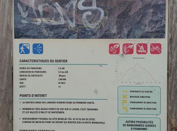
![](/images/other/stat-length.png)
- Randonnées
- A pied
- France
- Inconnu
Inconnu, France, A pied : Les meilleures randonnées, itinéraires, parcours, balades et promenades
Inconnu : découvrez les meilleures randonnées : 3 a pied, 91 marche, 4 course à pied et 1 trail. Tous ces circuits, parcours, itinéraires et activités en plein air sont disponibles dans nos applications SityTrail pour smartphones et tablettes.
Les meilleurs parcours (99)
![Randonnée Marche Hienghène - Hienghène - Cascade de Tao (Nouvelle Calédonie) - Photo](https://media.geolcdn.com/t/350/260/aa9cadaf-6c05-48e2-9522-dbf7528029e5.jpg&format=jpg&maxdim=2)
![Marche Marche](https://static1.geolcdn.com/sitytour/trail-icons/101.png)
Km
Marche
![](/images/other/stat-length.png)
![](https://static1.geolcdn.com/siteimages/upload/files/1508320355ic_sort_den_pos_24dp.png)
![](https://static1.geolcdn.com/siteimages/upload/files/1508320355ic_sort_den_neg_24dp.png)
![](https://static1.geolcdn.com/siteimages/upload/files/16400158638029165_repeat_loop_refresh_sync_direction_icon.png)
• Province Nord
![Randonnée Marche Poindimié - GR Nord - St Thomas au portail Totem (Nouvelle Calédonie) - Photo](https://media.geolcdn.com/t/350/260/69c7aab0-b986-4d00-aed7-00c530a7b43b.jpg&format=jpg&maxdim=2)
![Marche Marche](https://static1.geolcdn.com/sitytour/trail-icons/101.png)
Km
Marche
![](/images/other/stat-length.png)
![](https://static1.geolcdn.com/siteimages/upload/files/1508320355ic_sort_den_pos_24dp.png)
![](https://static1.geolcdn.com/siteimages/upload/files/1508320355ic_sort_den_neg_24dp.png)
![](https://static1.geolcdn.com/siteimages/upload/files/16400158638029165_repeat_loop_refresh_sync_direction_icon.png)
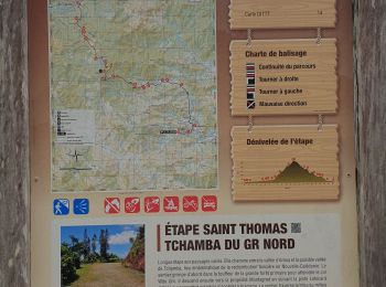
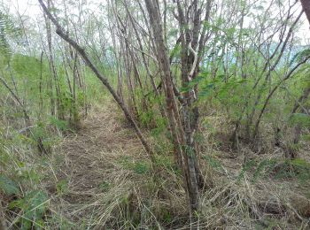
• Poindimié Sens St Thomas - Tchamba
![Randonnée Marche Poindimié - GR Nord - Épave avion Dakota (Nouvelle Calédonie) - Photo](https://media.geolcdn.com/t/350/260/1d3a7b40-b631-4e4a-9e06-3bc097d1bc1f.jpg&format=jpg&maxdim=2)
![Marche Marche](https://static1.geolcdn.com/sitytour/trail-icons/101.png)
Km
Marche
![](/images/other/stat-length.png)
![](https://static1.geolcdn.com/siteimages/upload/files/1508320355ic_sort_den_pos_24dp.png)
![](https://static1.geolcdn.com/siteimages/upload/files/1508320355ic_sort_den_neg_24dp.png)
![](https://static1.geolcdn.com/siteimages/upload/files/16400158638029165_repeat_loop_refresh_sync_direction_icon.png)
• A la découverte d'un avion Dakota (transport de courrier) crashé le 31 mars 1946 sur le secteur de la tribu de Pombeï...
![Randonnée Marche Hienghène - Les Roches de la Ouaïème - Hienghène (NC) - Photo](https://media.geolcdn.com/t/350/260/fc68ab44-9e70-4f53-80fd-2362eaf3485d.jpg&format=jpg&maxdim=2)
![Marche Marche](https://static1.geolcdn.com/sitytour/trail-icons/101.png)
Km
Marche
![](/images/other/stat-length.png)
![](https://static1.geolcdn.com/siteimages/upload/files/1508320355ic_sort_den_pos_24dp.png)
![](https://static1.geolcdn.com/siteimages/upload/files/1508320355ic_sort_den_neg_24dp.png)
![](https://static1.geolcdn.com/siteimages/upload/files/16400158638029165_repeat_loop_refresh_sync_direction_icon.png)
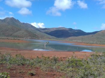
• Nouvelle Calédonie Province Nord - Hienghène
![Randonnée Marche Voh - Mont Kathépaïak - Coeur de Voh - Nouvelle Calédonie - Photo](https://media.geolcdn.com/t/350/260/3a4797e4-a8d0-419e-ab4d-4f9740b3d67a.jpg&format=jpg&maxdim=2)
![Marche Marche](https://static1.geolcdn.com/sitytour/trail-icons/101.png)
Km
Marche
![](/images/other/stat-length.png)
![](https://static1.geolcdn.com/siteimages/upload/files/1508320355ic_sort_den_pos_24dp.png)
![](https://static1.geolcdn.com/siteimages/upload/files/1508320355ic_sort_den_neg_24dp.png)
![](https://static1.geolcdn.com/siteimages/upload/files/16400158638029165_repeat_loop_refresh_sync_direction_icon.png)
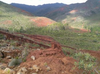
• Mont Kathépaïak : 622m Départ depuis l'arrière du lottissement à Voh. Piste jusqu'au sommet sans ombre.
![Randonnée Marche Poindimié - Sentier de Koyaboa - Poindimié (Nouvelle Calédonie) - Photo](https://media.geolcdn.com/t/350/260/8e696856-98d4-471c-9860-e2c6d311c96a.jpg&format=jpg&maxdim=2)
![Marche Marche](https://static1.geolcdn.com/sitytour/trail-icons/101.png)
Km
Marche
![](/images/other/stat-length.png)
![](https://static1.geolcdn.com/siteimages/upload/files/1508320355ic_sort_den_pos_24dp.png)
![](https://static1.geolcdn.com/siteimages/upload/files/1508320355ic_sort_den_neg_24dp.png)
![](https://static1.geolcdn.com/siteimages/upload/files/16400158638029165_repeat_loop_refresh_sync_direction_icon.png)
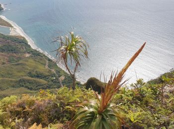
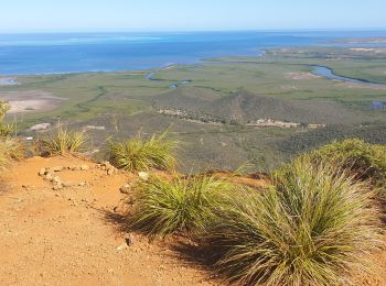
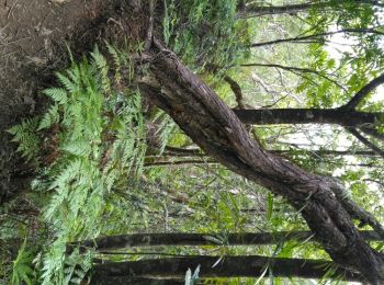
• Points de vue sur les vallée d'Ina et de Napoémien et l'ilôt Tibarama. Nombreuses fougères arborescentes. Végétation ...
![Marche Marche](https://static1.geolcdn.com/sitytour/trail-icons/101.png)
Km
Marche
![](/images/other/stat-length.png)
![](https://static1.geolcdn.com/siteimages/upload/files/1508320355ic_sort_den_pos_24dp.png)
![](https://static1.geolcdn.com/siteimages/upload/files/1508320355ic_sort_den_neg_24dp.png)
![](https://static1.geolcdn.com/siteimages/upload/files/16400158638029165_repeat_loop_refresh_sync_direction_icon.png)
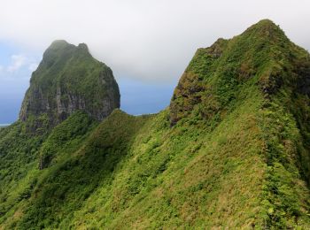
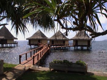
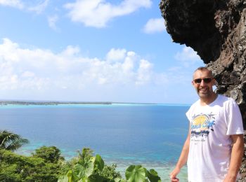
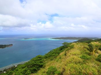
• La montagne de Bora Bora a deux sommets. Le plus haut, Otemanu, culmine à 727m, le second 661m est le Mont Pahia. Le ...
![Randonnée Marche Mont Dore - Ascension du Mont Dore - Photo](https://media.geolcdn.com/t/350/260/ext.jpg?maxdim=2&url=https%3A%2F%2Fstatic1.geolcdn.com%2Fsiteimages%2Fupload%2Ffiles%2F1553511878bg_sport_marche.png)
![Marche Marche](https://static1.geolcdn.com/sitytour/trail-icons/101.png)
Km
Marche
![](/images/other/stat-length.png)
![](https://static1.geolcdn.com/siteimages/upload/files/1508320355ic_sort_den_pos_24dp.png)
![](https://static1.geolcdn.com/siteimages/upload/files/1508320355ic_sort_den_neg_24dp.png)
![](https://static1.geolcdn.com/siteimages/upload/files/16400158638029165_repeat_loop_refresh_sync_direction_icon.png)
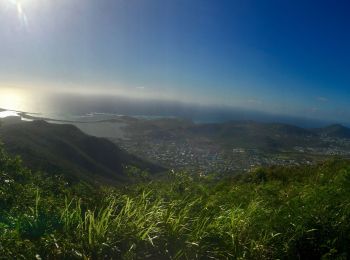
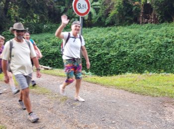
• Une très belle vue sur Nouméa. Attention à la descente technique !
![Randonnée Marche Papeete - Rando Tahiti vallée de Fautaua - Photo](https://media.geolcdn.com/t/350/260/7fad8c72-d81e-4eed-bb97-1a0d33154ff9.jpg&format=jpg&maxdim=2)
![Marche Marche](https://static1.geolcdn.com/sitytour/trail-icons/101.png)
Km
Marche
![](/images/other/stat-length.png)
![](https://static1.geolcdn.com/siteimages/upload/files/1508320355ic_sort_den_pos_24dp.png)
![](https://static1.geolcdn.com/siteimages/upload/files/1508320355ic_sort_den_neg_24dp.png)
![](https://static1.geolcdn.com/siteimages/upload/files/16400158638029165_repeat_loop_refresh_sync_direction_icon.png)
![Randonnée A pied Yaté - GR® NC1 - Photo](https://media.geolcdn.com/t/350/260/bd1a876c-fba4-4e18-aafa-e2c2a2cb31cb.jpeg&format=jpg&maxdim=2)
![A pied A pied](https://static1.geolcdn.com/sitytour/trail-icons/100.png)
Km
A pied
![](/images/other/stat-length.png)
![](https://static1.geolcdn.com/siteimages/upload/files/1508320355ic_sort_den_pos_24dp.png)
![](https://static1.geolcdn.com/siteimages/upload/files/1508320355ic_sort_den_neg_24dp.png)
![](https://static1.geolcdn.com/siteimages/upload/files/16400158638029165_repeat_loop_refresh_sync_direction_icon.png)
• Autorisation de Ludovic FRIT
![Randonnée A pied Tumaraa - FR-TRV - Photo](https://media.geolcdn.com/t/350/260/5c519274-8288-4d73-ade8-2addae351ceb.jpeg&format=jpg&maxdim=2)
![A pied A pied](https://static1.geolcdn.com/sitytour/trail-icons/100.png)
Km
A pied
![](/images/other/stat-length.png)
![](https://static1.geolcdn.com/siteimages/upload/files/1508320355ic_sort_den_pos_24dp.png)
![](https://static1.geolcdn.com/siteimages/upload/files/1508320355ic_sort_den_neg_24dp.png)
![](https://static1.geolcdn.com/siteimages/upload/files/16400158638029165_repeat_loop_refresh_sync_direction_icon.png)
![Randonnée Marche Nuku Hiva - Haatuatua - Photo](https://media.geolcdn.com/t/350/260/6e23c1c4-cf1c-4b8a-a7e4-cccd5aaf4518.jpg&format=jpg&maxdim=2)
![Marche Marche](https://static1.geolcdn.com/sitytour/trail-icons/101.png)
Km
Marche
![](/images/other/stat-length.png)
![](https://static1.geolcdn.com/siteimages/upload/files/1508320355ic_sort_den_pos_24dp.png)
![](https://static1.geolcdn.com/siteimages/upload/files/1508320355ic_sort_den_neg_24dp.png)
![](https://static1.geolcdn.com/siteimages/upload/files/16400158638029165_repeat_loop_refresh_sync_direction_icon.png)
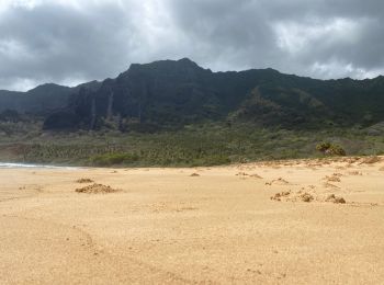
• Petite randonnée de Anaho à Haatuatua
![Randonnée Marche Saint-Martin (France) - De la B.O au Pic Paradis - Photo](https://media.geolcdn.com/t/350/260/52ec7e3e-31ef-45fd-b0a0-0ebc7e87b44f.jpeg&format=jpg&maxdim=2)
![Marche Marche](https://static1.geolcdn.com/sitytour/trail-icons/101.png)
Km
Marche
![](/images/other/stat-length.png)
![](https://static1.geolcdn.com/siteimages/upload/files/1508320355ic_sort_den_pos_24dp.png)
![](https://static1.geolcdn.com/siteimages/upload/files/1508320355ic_sort_den_neg_24dp.png)
![](https://static1.geolcdn.com/siteimages/upload/files/16400158638029165_repeat_loop_refresh_sync_direction_icon.png)
• Dans l'île de Saint Martin, Une randonnée pour monter au Pic Paradis en partant du bas de la Baie Orientale.
![Randonnée Marche Païta - parcours randonnée - Photo](https://media.geolcdn.com/t/350/260/ba0a928b-f61e-475a-9ddc-0c9546483308.jpg&format=jpg&maxdim=2)
![Marche Marche](https://static1.geolcdn.com/sitytour/trail-icons/101.png)
Km
Marche
![](/images/other/stat-length.png)
![](https://static1.geolcdn.com/siteimages/upload/files/1508320355ic_sort_den_pos_24dp.png)
![](https://static1.geolcdn.com/siteimages/upload/files/1508320355ic_sort_den_neg_24dp.png)
![](https://static1.geolcdn.com/siteimages/upload/files/16400158638029165_repeat_loop_refresh_sync_direction_icon.png)
• parcours randonnée
![Randonnée Marche Uturoa - Mont Temehani 13 km 700 m deniv - Photo](https://media.geolcdn.com/t/350/260/3f7b5bd1-d987-4380-9361-08b220eb659c.jpg&format=jpg&maxdim=2)
![Marche Marche](https://static1.geolcdn.com/sitytour/trail-icons/101.png)
Km
Marche
![](/images/other/stat-length.png)
![](https://static1.geolcdn.com/siteimages/upload/files/1508320355ic_sort_den_pos_24dp.png)
![](https://static1.geolcdn.com/siteimages/upload/files/1508320355ic_sort_den_neg_24dp.png)
![](https://static1.geolcdn.com/siteimages/upload/files/16400158638029165_repeat_loop_refresh_sync_direction_icon.png)
![Randonnée Marche Dumbéa - Pic Malaoui depuis le Mont-Koghi - Photo](https://media.geolcdn.com/t/350/260/ext.jpg?maxdim=2&url=https%3A%2F%2Fservices.sitytrail.com%2FGeolivesWS%2FDownloadMedia.ashx%3FTrailID%3D964748%26Media%3Dfix__20180513141312.jpg)
![Marche Marche](https://static1.geolcdn.com/sitytour/trail-icons/101.png)
Km
Marche
![](/images/other/stat-length.png)
![](https://static1.geolcdn.com/siteimages/upload/files/1508320355ic_sort_den_pos_24dp.png)
![](https://static1.geolcdn.com/siteimages/upload/files/1508320355ic_sort_den_neg_24dp.png)
![](https://static1.geolcdn.com/siteimages/upload/files/16400158638029165_repeat_loop_refresh_sync_direction_icon.png)
• A une vingtaine de minutes de Nouméa, cette petite randonnée bien sympathique permet de marcher dans la forêt avant d...
![Randonnée Marche Dumbéa - Marmites du diable - Photo](https://media.geolcdn.com/t/350/260/ext.jpg?maxdim=2&url=https%3A%2F%2Fservices.sitytrail.com%2FGeolivesWS%2FDownloadMedia.ashx%3FTrailID%3D953525%26Media%3Dfix__20180429122521.jpg)
![Marche Marche](https://static1.geolcdn.com/sitytour/trail-icons/101.png)
Km
Marche
![](/images/other/stat-length.png)
![](https://static1.geolcdn.com/siteimages/upload/files/1508320355ic_sort_den_pos_24dp.png)
![](https://static1.geolcdn.com/siteimages/upload/files/1508320355ic_sort_den_neg_24dp.png)
![](https://static1.geolcdn.com/siteimages/upload/files/16400158638029165_repeat_loop_refresh_sync_direction_icon.png)
• Direction Dumbea, sur route de Koé. Se garer au niveau du parking du diable. Randonnée très facile à faire y/c avec d...
![Randonnée Marche Mont Dore - La coulée au Mont-Dore - Photo](https://media.geolcdn.com/t/350/260/ext.jpg?maxdim=2&url=https%3A%2F%2Fservices.sitytrail.com%2FGeolivesWS%2FDownloadMedia.ashx%3FTrailID%3D948544%26Media%3Dfix__20180422141721.jpg)
![Marche Marche](https://static1.geolcdn.com/sitytour/trail-icons/101.png)
Km
Marche
![](/images/other/stat-length.png)
![](https://static1.geolcdn.com/siteimages/upload/files/1508320355ic_sort_den_pos_24dp.png)
![](https://static1.geolcdn.com/siteimages/upload/files/1508320355ic_sort_den_neg_24dp.png)
![](https://static1.geolcdn.com/siteimages/upload/files/16400158638029165_repeat_loop_refresh_sync_direction_icon.png)
• Située sur la commune du Mont-Dore, cette rando n'est pas vraiment balisée (quelques fanions ici ou là) et nécessité ...
![Marche Marche](https://static1.geolcdn.com/sitytour/trail-icons/101.png)
Km
Marche
![](/images/other/stat-length.png)
![](https://static1.geolcdn.com/siteimages/upload/files/1508320355ic_sort_den_pos_24dp.png)
![](https://static1.geolcdn.com/siteimages/upload/files/1508320355ic_sort_den_neg_24dp.png)
![](https://static1.geolcdn.com/siteimages/upload/files/16400158638029165_repeat_loop_refresh_sync_direction_icon.png)
20 randonnées affichées sur 99
Application GPS de randonnée GRATUITE