![](/images/other/stat-length.png)
- Randonnées
- A pied
- Allemagne
- Bavière
- Landkreis Kulmbach
Landkreis Kulmbach, Bavière, A pied : Les meilleures randonnées, itinéraires, parcours, balades et promenades
Landkreis Kulmbach : découvrez les meilleures randonnées : 79 a pied. Tous ces circuits, parcours, itinéraires et activités en plein air sont disponibles dans nos applications SityTrail pour smartphones et tablettes.
Les meilleurs parcours (79)
![Randonnée A pied Stadtsteinach - FrankenwaldSteigla Zum Forstmeistersprung - Photo](https://media.geolcdn.com/t/350/260/b31e5a42-d32a-4788-ad42-72a77bd2b7b5.jpeg&format=jpg&maxdim=2)
![A pied A pied](https://static1.geolcdn.com/sitytour/trail-icons/100.png)
Km
A pied
![](/images/other/stat-length.png)
![](https://static1.geolcdn.com/siteimages/upload/files/1508320355ic_sort_den_pos_24dp.png)
![](https://static1.geolcdn.com/siteimages/upload/files/1508320355ic_sort_den_neg_24dp.png)
![](https://static1.geolcdn.com/siteimages/upload/files/16400158638029165_repeat_loop_refresh_sync_direction_icon.png)
• Randonnée créée par Frankenwaldverein.
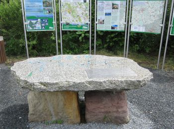
![Randonnée A pied Kasendorf - Verbindungsweg Lindenberg - Katschenreuth - Photo](https://media.geolcdn.com/t/350/260/0d5381b5-6451-4526-b7d8-e2e0164c5bce.jpeg&format=jpg&maxdim=2)
![A pied A pied](https://static1.geolcdn.com/sitytour/trail-icons/100.png)
Km
A pied
![](/images/other/stat-length.png)
![](https://static1.geolcdn.com/siteimages/upload/files/1508320355ic_sort_den_pos_24dp.png)
![](https://static1.geolcdn.com/siteimages/upload/files/1508320355ic_sort_den_neg_24dp.png)
![](https://static1.geolcdn.com/siteimages/upload/files/16400158638029165_repeat_loop_refresh_sync_direction_icon.png)
• Randonnée créée par Markt Thurnau. Symbole: Rotes Andreaskreuz auf weißem Hintergrund
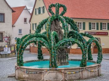
![Randonnée A pied Thurnau - Thurnau Rundweg Blauer Ring - Photo](https://media.geolcdn.com/t/350/260/d7b62db0-5d1f-44d8-a090-730690e75b5f.jpeg&format=jpg&maxdim=2)
![A pied A pied](https://static1.geolcdn.com/sitytour/trail-icons/100.png)
Km
A pied
![](/images/other/stat-length.png)
![](https://static1.geolcdn.com/siteimages/upload/files/1508320355ic_sort_den_pos_24dp.png)
![](https://static1.geolcdn.com/siteimages/upload/files/1508320355ic_sort_den_neg_24dp.png)
![](https://static1.geolcdn.com/siteimages/upload/files/16400158638029165_repeat_loop_refresh_sync_direction_icon.png)
• Randonnée créée par Markt Thurnau. Symbole: Blauer Ring auf weißem Hintergrund
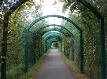
![Randonnée A pied Kasendorf - Rundweg Roter Ring Thurnau - Photo](https://media.geolcdn.com/t/350/260/bcecfbe5-6717-41bc-b57e-077bc6802b47.jpeg&format=jpg&maxdim=2)
![A pied A pied](https://static1.geolcdn.com/sitytour/trail-icons/100.png)
Km
A pied
![](/images/other/stat-length.png)
![](https://static1.geolcdn.com/siteimages/upload/files/1508320355ic_sort_den_pos_24dp.png)
![](https://static1.geolcdn.com/siteimages/upload/files/1508320355ic_sort_den_neg_24dp.png)
![](https://static1.geolcdn.com/siteimages/upload/files/16400158638029165_repeat_loop_refresh_sync_direction_icon.png)
• Randonnée créée par Markt Thurnau. Symbole: Roter Ring auf weißem Hintergrund
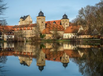
![Randonnée A pied Thurnau - Rundweg Krug Thurnau - Photo](https://media.geolcdn.com/t/350/260/152fdf4f-ac94-4e09-baa6-01627d5cd1c7.jpeg&format=jpg&maxdim=2)
![A pied A pied](https://static1.geolcdn.com/sitytour/trail-icons/100.png)
Km
A pied
![](/images/other/stat-length.png)
![](https://static1.geolcdn.com/siteimages/upload/files/1508320355ic_sort_den_pos_24dp.png)
![](https://static1.geolcdn.com/siteimages/upload/files/1508320355ic_sort_den_neg_24dp.png)
![](https://static1.geolcdn.com/siteimages/upload/files/16400158638029165_repeat_loop_refresh_sync_direction_icon.png)
• Randonnée créée par Markt Thurnau. Symbole: Stilisierter schwarzer Krug in schwarzem Kreis auf weißem Hintergrund
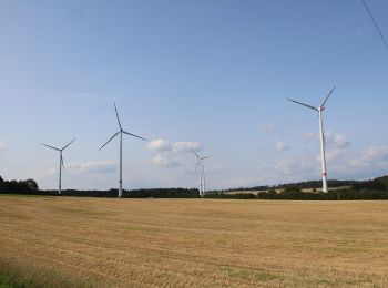
![Randonnée A pied Thurnau - Tannfeld Kinder-Naturbegegungsweg - Photo](https://media.geolcdn.com/t/350/260/7ca6128e-2b08-4eee-9761-27484f1b59d3.jpeg&format=jpg&maxdim=2)
![A pied A pied](https://static1.geolcdn.com/sitytour/trail-icons/100.png)
Km
A pied
![](/images/other/stat-length.png)
![](https://static1.geolcdn.com/siteimages/upload/files/1508320355ic_sort_den_pos_24dp.png)
![](https://static1.geolcdn.com/siteimages/upload/files/1508320355ic_sort_den_neg_24dp.png)
![](https://static1.geolcdn.com/siteimages/upload/files/16400158638029165_repeat_loop_refresh_sync_direction_icon.png)
• Randonnée créée par Gemeinde Tannfeld. Symbole: Waldwiesel auf weißem Hintergrund
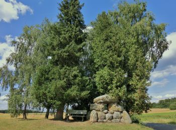
![Randonnée A pied Wonsees - Rundwanderweg blauer Ring - Photo](https://media.geolcdn.com/t/350/260/be4429f4-4295-4ae3-bd5f-a675ea71e1d9.jpeg&format=jpg&maxdim=2)
![A pied A pied](https://static1.geolcdn.com/sitytour/trail-icons/100.png)
Km
A pied
![](/images/other/stat-length.png)
![](https://static1.geolcdn.com/siteimages/upload/files/1508320355ic_sort_den_pos_24dp.png)
![](https://static1.geolcdn.com/siteimages/upload/files/1508320355ic_sort_den_neg_24dp.png)
![](https://static1.geolcdn.com/siteimages/upload/files/16400158638029165_repeat_loop_refresh_sync_direction_icon.png)
• Symbole: Blauer Ring auf weißem Hintergrund
![Randonnée A pied Wonsees - Wonsees Rundwanderweg roter Ring - Photo](https://media.geolcdn.com/t/350/260/d406bcc3-a10c-46ac-9d22-900ef624702c.jpeg&format=jpg&maxdim=2)
![A pied A pied](https://static1.geolcdn.com/sitytour/trail-icons/100.png)
Km
A pied
![](/images/other/stat-length.png)
![](https://static1.geolcdn.com/siteimages/upload/files/1508320355ic_sort_den_pos_24dp.png)
![](https://static1.geolcdn.com/siteimages/upload/files/1508320355ic_sort_den_neg_24dp.png)
![](https://static1.geolcdn.com/siteimages/upload/files/16400158638029165_repeat_loop_refresh_sync_direction_icon.png)
• Randonnée créée par Gemeinde Wonsees. Symbole: Roter Ring auf weißem Hintergrund
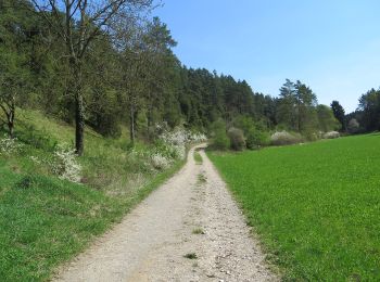
![Randonnée A pied Wonsees - Wacholderweg Wonsees - Photo](https://media.geolcdn.com/t/350/260/22a22661-ea8f-43f2-9035-b9f41ee36c86.jpeg&format=jpg&maxdim=2)
![A pied A pied](https://static1.geolcdn.com/sitytour/trail-icons/100.png)
Km
A pied
![](/images/other/stat-length.png)
![](https://static1.geolcdn.com/siteimages/upload/files/1508320355ic_sort_den_pos_24dp.png)
![](https://static1.geolcdn.com/siteimages/upload/files/1508320355ic_sort_den_neg_24dp.png)
![](https://static1.geolcdn.com/siteimages/upload/files/16400158638029165_repeat_loop_refresh_sync_direction_icon.png)
• Randonnée créée par Gemeinde Wonsees. Symbole: Schwarzer Wacholderzweig auf gelbem Hintergrund
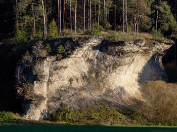
![Randonnée A pied Wonsees - Schirradorf Rundwanderweg 4 - Photo](https://media.geolcdn.com/t/350/260/7313764d-ae4a-464f-b457-1cc80e419261.jpeg&format=jpg&maxdim=2)
![A pied A pied](https://static1.geolcdn.com/sitytour/trail-icons/100.png)
Km
A pied
![](/images/other/stat-length.png)
![](https://static1.geolcdn.com/siteimages/upload/files/1508320355ic_sort_den_pos_24dp.png)
![](https://static1.geolcdn.com/siteimages/upload/files/1508320355ic_sort_den_neg_24dp.png)
![](https://static1.geolcdn.com/siteimages/upload/files/16400158638029165_repeat_loop_refresh_sync_direction_icon.png)
• Randonnée créée par Markt Wonsees. Markierung sehr unvollständig Symbole: Schwarze 4 weißem Hintergrund
![Randonnée A pied Thurnau - Tannfeld Rundweg Schwarzer Ring - Photo](https://media.geolcdn.com/t/350/260/7ca6128e-2b08-4eee-9761-27484f1b59d3.jpeg&format=jpg&maxdim=2)
![A pied A pied](https://static1.geolcdn.com/sitytour/trail-icons/100.png)
Km
A pied
![](/images/other/stat-length.png)
![](https://static1.geolcdn.com/siteimages/upload/files/1508320355ic_sort_den_pos_24dp.png)
![](https://static1.geolcdn.com/siteimages/upload/files/1508320355ic_sort_den_neg_24dp.png)
![](https://static1.geolcdn.com/siteimages/upload/files/16400158638029165_repeat_loop_refresh_sync_direction_icon.png)
• Randonnée créée par Gemeinde Thurnau. Symbole: Schwarzer Ring auf weißem Hintergrund
![Randonnée A pied Thurnau - Verbindungsweg Thurnau - Lindenberg - Photo](https://media.geolcdn.com/t/350/260/76368953-61c3-440f-8a92-c295589ff0cb.jpeg&format=jpg&maxdim=2)
![A pied A pied](https://static1.geolcdn.com/sitytour/trail-icons/100.png)
Km
A pied
![](/images/other/stat-length.png)
![](https://static1.geolcdn.com/siteimages/upload/files/1508320355ic_sort_den_pos_24dp.png)
![](https://static1.geolcdn.com/siteimages/upload/files/1508320355ic_sort_den_neg_24dp.png)
![](https://static1.geolcdn.com/siteimages/upload/files/16400158638029165_repeat_loop_refresh_sync_direction_icon.png)
• Randonnée créée par Markt Thurnau. Symbole: Rotes V auf weißem Hintergrund
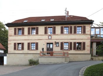
![Randonnée A pied Presseck - FrankenwaldSteigla Rund um die Gaaßleitn - Photo](https://media.geolcdn.com/t/350/260/c13dccbd-8adc-44fe-849d-80404a7bce76.jpeg&format=jpg&maxdim=2)
![A pied A pied](https://static1.geolcdn.com/sitytour/trail-icons/100.png)
Km
A pied
![](/images/other/stat-length.png)
![](https://static1.geolcdn.com/siteimages/upload/files/1508320355ic_sort_den_pos_24dp.png)
![](https://static1.geolcdn.com/siteimages/upload/files/1508320355ic_sort_den_neg_24dp.png)
![](https://static1.geolcdn.com/siteimages/upload/files/16400158638029165_repeat_loop_refresh_sync_direction_icon.png)
• Randonnée créée par Frankenwaldverein.
![Randonnée A pied Presseck - Kreuzstein-Weg KU 53 - Photo](https://media.geolcdn.com/t/350/260/c13dccbd-8adc-44fe-849d-80404a7bce76.jpeg&format=jpg&maxdim=2)
![A pied A pied](https://static1.geolcdn.com/sitytour/trail-icons/100.png)
Km
A pied
![](/images/other/stat-length.png)
![](https://static1.geolcdn.com/siteimages/upload/files/1508320355ic_sort_den_pos_24dp.png)
![](https://static1.geolcdn.com/siteimages/upload/files/1508320355ic_sort_den_neg_24dp.png)
![](https://static1.geolcdn.com/siteimages/upload/files/16400158638029165_repeat_loop_refresh_sync_direction_icon.png)
• Randonnée créée par Frankenwaldverein e.V.. Symbole: grün KU53 auf weißem Grund Site web: https://www.frankenwaldv...
![Randonnée A pied Kulmbach - Baumgartener-Weg KU 43 - Photo](https://media.geolcdn.com/t/350/260/85b5fd57-d67b-44b6-b248-08b6332396a2.jpeg&format=jpg&maxdim=2)
![A pied A pied](https://static1.geolcdn.com/sitytour/trail-icons/100.png)
Km
A pied
![](/images/other/stat-length.png)
![](https://static1.geolcdn.com/siteimages/upload/files/1508320355ic_sort_den_pos_24dp.png)
![](https://static1.geolcdn.com/siteimages/upload/files/1508320355ic_sort_den_neg_24dp.png)
![](https://static1.geolcdn.com/siteimages/upload/files/16400158638029165_repeat_loop_refresh_sync_direction_icon.png)
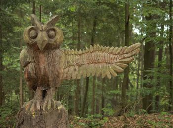
• Randonnée créée par Frankenwaldverein.
![Randonnée A pied Kulmbach - FrankenwaldSteigla Rehberg-Weg - Photo](https://media.geolcdn.com/t/350/260/fe750e58-2249-4712-bfea-4b3e74311acd.jpeg&format=jpg&maxdim=2)
![A pied A pied](https://static1.geolcdn.com/sitytour/trail-icons/100.png)
Km
A pied
![](/images/other/stat-length.png)
![](https://static1.geolcdn.com/siteimages/upload/files/1508320355ic_sort_den_pos_24dp.png)
![](https://static1.geolcdn.com/siteimages/upload/files/1508320355ic_sort_den_neg_24dp.png)
![](https://static1.geolcdn.com/siteimages/upload/files/16400158638029165_repeat_loop_refresh_sync_direction_icon.png)
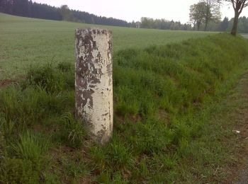
• Randonnée créée par Frankenwaldverein.
![Randonnée A pied Marktleugast - Brunnen-Weg KU 71 - Photo](https://media.geolcdn.com/t/350/260/578ef37a-2e20-4fd2-97f4-600fdcfabc9d.jpeg&format=jpg&maxdim=2)
![A pied A pied](https://static1.geolcdn.com/sitytour/trail-icons/100.png)
Km
A pied
![](/images/other/stat-length.png)
![](https://static1.geolcdn.com/siteimages/upload/files/1508320355ic_sort_den_pos_24dp.png)
![](https://static1.geolcdn.com/siteimages/upload/files/1508320355ic_sort_den_neg_24dp.png)
![](https://static1.geolcdn.com/siteimages/upload/files/16400158638029165_repeat_loop_refresh_sync_direction_icon.png)
• Randonnée créée par Frankenwaldverein. Symbole: grün KU71 auf weißem Grund
![Randonnée A pied Wonsees - Rundwanderweg gelber Ring - Photo](https://media.geolcdn.com/t/350/260/7313764d-ae4a-464f-b457-1cc80e419261.jpeg&format=jpg&maxdim=2)
![A pied A pied](https://static1.geolcdn.com/sitytour/trail-icons/100.png)
Km
A pied
![](/images/other/stat-length.png)
![](https://static1.geolcdn.com/siteimages/upload/files/1508320355ic_sort_den_pos_24dp.png)
![](https://static1.geolcdn.com/siteimages/upload/files/1508320355ic_sort_den_neg_24dp.png)
![](https://static1.geolcdn.com/siteimages/upload/files/16400158638029165_repeat_loop_refresh_sync_direction_icon.png)
• Randonnée créée par Gemeinde Wonsees. Symbole: Gelber Ring auf weißem Grund
![Randonnée A pied Wonsees - Schirradorf Rundwanderweg 3 - Photo](https://media.geolcdn.com/t/350/260/7313764d-ae4a-464f-b457-1cc80e419261.jpeg&format=jpg&maxdim=2)
![A pied A pied](https://static1.geolcdn.com/sitytour/trail-icons/100.png)
Km
A pied
![](/images/other/stat-length.png)
![](https://static1.geolcdn.com/siteimages/upload/files/1508320355ic_sort_den_pos_24dp.png)
![](https://static1.geolcdn.com/siteimages/upload/files/1508320355ic_sort_den_neg_24dp.png)
![](https://static1.geolcdn.com/siteimages/upload/files/16400158638029165_repeat_loop_refresh_sync_direction_icon.png)
• Randonnée créée par Landkreis Kulmbach. Symbole: Schwarze 3 auf weißem Hintergrund
![Randonnée A pied Guttenberg - Drei-Brücken-Weg KU 23 - Photo](https://media.geolcdn.com/t/350/260/6ff5fec6-6ea3-4d1a-b1ff-c273cdae5f98.jpeg&format=jpg&maxdim=2)
![A pied A pied](https://static1.geolcdn.com/sitytour/trail-icons/100.png)
Km
A pied
![](/images/other/stat-length.png)
![](https://static1.geolcdn.com/siteimages/upload/files/1508320355ic_sort_den_pos_24dp.png)
![](https://static1.geolcdn.com/siteimages/upload/files/1508320355ic_sort_den_neg_24dp.png)
![](https://static1.geolcdn.com/siteimages/upload/files/16400158638029165_repeat_loop_refresh_sync_direction_icon.png)
• Randonnée créée par Frankenwaldverein. Symbole: grün KU23 auf weißem Grund
20 randonnées affichées sur 79
Application GPS de randonnée GRATUITE