![](/images/other/stat-length.png)
Wonsees, Landkreis Kulmbach, A pied : Les meilleures randonnées, itinéraires, parcours, balades et promenades
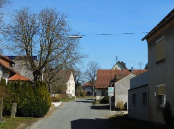
Wonsees : découvrez les meilleures randonnées : 11 a pied. Tous ces circuits, parcours, itinéraires et activités en plein air sont disponibles dans nos applications SityTrail pour smartphones et tablettes.
Les meilleurs parcours (11)
![Randonnée A pied Wonsees - Rundwanderweg blauer Ring - Photo](https://media.geolcdn.com/t/350/260/be4429f4-4295-4ae3-bd5f-a675ea71e1d9.jpeg&format=jpg&maxdim=2)
![A pied A pied](https://static1.geolcdn.com/sitytour/trail-icons/100.png)
Km
A pied
![](/images/other/stat-length.png)
![](https://static1.geolcdn.com/siteimages/upload/files/1508320355ic_sort_den_pos_24dp.png)
![](https://static1.geolcdn.com/siteimages/upload/files/1508320355ic_sort_den_neg_24dp.png)
![](https://static1.geolcdn.com/siteimages/upload/files/16400158638029165_repeat_loop_refresh_sync_direction_icon.png)
• Symbole: Blauer Ring auf weißem Hintergrund
![Randonnée A pied Wonsees - Wonsees Rundwanderweg roter Ring - Photo](https://media.geolcdn.com/t/350/260/d406bcc3-a10c-46ac-9d22-900ef624702c.jpeg&format=jpg&maxdim=2)
![A pied A pied](https://static1.geolcdn.com/sitytour/trail-icons/100.png)
Km
A pied
![](/images/other/stat-length.png)
![](https://static1.geolcdn.com/siteimages/upload/files/1508320355ic_sort_den_pos_24dp.png)
![](https://static1.geolcdn.com/siteimages/upload/files/1508320355ic_sort_den_neg_24dp.png)
![](https://static1.geolcdn.com/siteimages/upload/files/16400158638029165_repeat_loop_refresh_sync_direction_icon.png)
• Randonnée créée par Gemeinde Wonsees. Symbole: Roter Ring auf weißem Hintergrund
![Randonnée A pied Wonsees - Wacholderweg Wonsees - Photo](https://media.geolcdn.com/t/350/260/22a22661-ea8f-43f2-9035-b9f41ee36c86.jpeg&format=jpg&maxdim=2)
![A pied A pied](https://static1.geolcdn.com/sitytour/trail-icons/100.png)
Km
A pied
![](/images/other/stat-length.png)
![](https://static1.geolcdn.com/siteimages/upload/files/1508320355ic_sort_den_pos_24dp.png)
![](https://static1.geolcdn.com/siteimages/upload/files/1508320355ic_sort_den_neg_24dp.png)
![](https://static1.geolcdn.com/siteimages/upload/files/16400158638029165_repeat_loop_refresh_sync_direction_icon.png)
• Randonnée créée par Gemeinde Wonsees. Symbole: Schwarzer Wacholderzweig auf gelbem Hintergrund
![Randonnée A pied Wonsees - Schirradorf Rundwanderweg 4 - Photo](https://media.geolcdn.com/t/350/260/7313764d-ae4a-464f-b457-1cc80e419261.jpeg&format=jpg&maxdim=2)
![A pied A pied](https://static1.geolcdn.com/sitytour/trail-icons/100.png)
Km
A pied
![](/images/other/stat-length.png)
![](https://static1.geolcdn.com/siteimages/upload/files/1508320355ic_sort_den_pos_24dp.png)
![](https://static1.geolcdn.com/siteimages/upload/files/1508320355ic_sort_den_neg_24dp.png)
![](https://static1.geolcdn.com/siteimages/upload/files/16400158638029165_repeat_loop_refresh_sync_direction_icon.png)
• Randonnée créée par Markt Wonsees. Markierung sehr unvollständig Symbole: Schwarze 4 weißem Hintergrund
![Randonnée A pied Wonsees - Rundwanderweg gelber Ring - Photo](https://media.geolcdn.com/t/350/260/7313764d-ae4a-464f-b457-1cc80e419261.jpeg&format=jpg&maxdim=2)
![A pied A pied](https://static1.geolcdn.com/sitytour/trail-icons/100.png)
Km
A pied
![](/images/other/stat-length.png)
![](https://static1.geolcdn.com/siteimages/upload/files/1508320355ic_sort_den_pos_24dp.png)
![](https://static1.geolcdn.com/siteimages/upload/files/1508320355ic_sort_den_neg_24dp.png)
![](https://static1.geolcdn.com/siteimages/upload/files/16400158638029165_repeat_loop_refresh_sync_direction_icon.png)
• Randonnée créée par Gemeinde Wonsees. Symbole: Gelber Ring auf weißem Grund
![Randonnée A pied Wonsees - Schirradorf Rundwanderweg 3 - Photo](https://media.geolcdn.com/t/350/260/7313764d-ae4a-464f-b457-1cc80e419261.jpeg&format=jpg&maxdim=2)
![A pied A pied](https://static1.geolcdn.com/sitytour/trail-icons/100.png)
Km
A pied
![](/images/other/stat-length.png)
![](https://static1.geolcdn.com/siteimages/upload/files/1508320355ic_sort_den_pos_24dp.png)
![](https://static1.geolcdn.com/siteimages/upload/files/1508320355ic_sort_den_neg_24dp.png)
![](https://static1.geolcdn.com/siteimages/upload/files/16400158638029165_repeat_loop_refresh_sync_direction_icon.png)
• Randonnée créée par Landkreis Kulmbach. Symbole: Schwarze 3 auf weißem Hintergrund
![Randonnée A pied Wonsees - Schirradorf Rundwanderweg 2 - Photo](https://media.geolcdn.com/t/350/260/7313764d-ae4a-464f-b457-1cc80e419261.jpeg&format=jpg&maxdim=2)
![A pied A pied](https://static1.geolcdn.com/sitytour/trail-icons/100.png)
Km
A pied
![](/images/other/stat-length.png)
![](https://static1.geolcdn.com/siteimages/upload/files/1508320355ic_sort_den_pos_24dp.png)
![](https://static1.geolcdn.com/siteimages/upload/files/1508320355ic_sort_den_neg_24dp.png)
![](https://static1.geolcdn.com/siteimages/upload/files/16400158638029165_repeat_loop_refresh_sync_direction_icon.png)
• Randonnée créée par Landkreis Lichtenfels. Auch schwarze 2 auf weißem Hintergrund Symbole: Schwarze 2 zwischen zwei...
![Randonnée A pied Wonsees - Buckendorfer Rundweg - Photo](https://media.geolcdn.com/t/350/260/4a744e6e-ad3c-455c-a223-6c382462362d.jpeg&format=jpg&maxdim=2)
![A pied A pied](https://static1.geolcdn.com/sitytour/trail-icons/100.png)
Km
A pied
![](/images/other/stat-length.png)
![](https://static1.geolcdn.com/siteimages/upload/files/1508320355ic_sort_den_pos_24dp.png)
![](https://static1.geolcdn.com/siteimages/upload/files/1508320355ic_sort_den_neg_24dp.png)
![](https://static1.geolcdn.com/siteimages/upload/files/16400158638029165_repeat_loop_refresh_sync_direction_icon.png)
• Randonnée créée par Landkreis Lichtenfels. Symbole: Grüner Punkt auf weißem Hintergrund
![Randonnée A pied Wonsees - Sansparail Rundwanderweg schwarzer Ring - Photo](https://media.geolcdn.com/t/350/260/7313764d-ae4a-464f-b457-1cc80e419261.jpeg&format=jpg&maxdim=2)
![A pied A pied](https://static1.geolcdn.com/sitytour/trail-icons/100.png)
Km
A pied
![](/images/other/stat-length.png)
![](https://static1.geolcdn.com/siteimages/upload/files/1508320355ic_sort_den_pos_24dp.png)
![](https://static1.geolcdn.com/siteimages/upload/files/1508320355ic_sort_den_neg_24dp.png)
![](https://static1.geolcdn.com/siteimages/upload/files/16400158638029165_repeat_loop_refresh_sync_direction_icon.png)
• Symbole: Schwarzer Ring auf weißem Hintergrund
![Randonnée A pied Wonsees - Wonsees Schwalbachtal-Wanderweg - Photo](https://media.geolcdn.com/t/350/260/7313764d-ae4a-464f-b457-1cc80e419261.jpeg&format=jpg&maxdim=2)
![A pied A pied](https://static1.geolcdn.com/sitytour/trail-icons/100.png)
Km
A pied
![](/images/other/stat-length.png)
![](https://static1.geolcdn.com/siteimages/upload/files/1508320355ic_sort_den_pos_24dp.png)
![](https://static1.geolcdn.com/siteimages/upload/files/1508320355ic_sort_den_neg_24dp.png)
![](https://static1.geolcdn.com/siteimages/upload/files/16400158638029165_repeat_loop_refresh_sync_direction_icon.png)
• Symbole: Grüne Raute auf weißem Hintergrund
![Randonnée A pied Wonsees - Schirradorf Rundwanderweg 1 - Photo](https://media.geolcdn.com/t/350/260/fb84a498-b9cc-4b31-bf83-4221315a1267.jpeg&format=jpg&maxdim=2)
![A pied A pied](https://static1.geolcdn.com/sitytour/trail-icons/100.png)
Km
A pied
![](/images/other/stat-length.png)
![](https://static1.geolcdn.com/siteimages/upload/files/1508320355ic_sort_den_pos_24dp.png)
![](https://static1.geolcdn.com/siteimages/upload/files/1508320355ic_sort_den_neg_24dp.png)
![](https://static1.geolcdn.com/siteimages/upload/files/16400158638029165_repeat_loop_refresh_sync_direction_icon.png)
• Randonnée créée par Landkreis Lichtenfels. Markierung sehr unvollständig, auch schwarze 1 auf weißem Hintergrund Sy...
11 randonnées affichées sur 11
Application GPS de randonnée GRATUITE