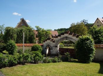
![](/images/other/stat-length.png)
- Randonnées
- A pied
- Allemagne
- Bavière
- Nuremberg-Campagne
Nuremberg-Campagne, Bavière, A pied : Les meilleures randonnées, itinéraires, parcours, balades et promenades
Nuremberg-Campagne : découvrez les meilleures randonnées : 237 a pied. Tous ces circuits, parcours, itinéraires et activités en plein air sont disponibles dans nos applications SityTrail pour smartphones et tablettes.
Les meilleurs parcours (237)
![Randonnée A pied Kirchensittenbach - Kirchensittenbach 5 - Photo](https://media.geolcdn.com/t/350/260/0a2f4069-1436-4b4e-8f0f-cc1a0a762c2a.jpeg&format=jpg&maxdim=2)
![A pied A pied](https://static1.geolcdn.com/sitytour/trail-icons/100.png)
Km
A pied
![](/images/other/stat-length.png)
![](https://static1.geolcdn.com/siteimages/upload/files/1508320355ic_sort_den_pos_24dp.png)
![](https://static1.geolcdn.com/siteimages/upload/files/1508320355ic_sort_den_neg_24dp.png)
![](https://static1.geolcdn.com/siteimages/upload/files/16400158638029165_repeat_loop_refresh_sync_direction_icon.png)
• Randonnée créée par Gemeinde Kirchensittenbach. geprüft (März 2015, by cycling_zno) Symbole: t.b.d.
![Randonnée A pied Kirchensittenbach - Kirchensittenbach 4a - Photo](https://media.geolcdn.com/t/350/260/814dae09-5fb1-442e-abdf-4f3252bdd922.jpeg&format=jpg&maxdim=2)
![A pied A pied](https://static1.geolcdn.com/sitytour/trail-icons/100.png)
Km
A pied
![](/images/other/stat-length.png)
![](https://static1.geolcdn.com/siteimages/upload/files/1508320355ic_sort_den_pos_24dp.png)
![](https://static1.geolcdn.com/siteimages/upload/files/1508320355ic_sort_den_neg_24dp.png)
![](https://static1.geolcdn.com/siteimages/upload/files/16400158638029165_repeat_loop_refresh_sync_direction_icon.png)
• Randonnée créée par Gemeinde Kirchensittenbach. geprüft (März 2015, by cycling_zno) Symbole: t.b.d.
![Randonnée A pied Kirchensittenbach - Kirchensittenbach 4 - Photo](https://media.geolcdn.com/t/350/260/143d5234-ad74-4965-bef0-21d79ad60f89.jpeg&format=jpg&maxdim=2)
![A pied A pied](https://static1.geolcdn.com/sitytour/trail-icons/100.png)
Km
A pied
![](/images/other/stat-length.png)
![](https://static1.geolcdn.com/siteimages/upload/files/1508320355ic_sort_den_pos_24dp.png)
![](https://static1.geolcdn.com/siteimages/upload/files/1508320355ic_sort_den_neg_24dp.png)
![](https://static1.geolcdn.com/siteimages/upload/files/16400158638029165_repeat_loop_refresh_sync_direction_icon.png)
• Randonnée créée par Gemeinde Kirchensittenbach. geprüft (März 2015, by cycling_zno) Symbole: t.b.d.
![Randonnée A pied Kirchensittenbach - Kirchensittenbach 3 - Photo](https://media.geolcdn.com/t/350/260/0a2f4069-1436-4b4e-8f0f-cc1a0a762c2a.jpeg&format=jpg&maxdim=2)
![A pied A pied](https://static1.geolcdn.com/sitytour/trail-icons/100.png)
Km
A pied
![](/images/other/stat-length.png)
![](https://static1.geolcdn.com/siteimages/upload/files/1508320355ic_sort_den_pos_24dp.png)
![](https://static1.geolcdn.com/siteimages/upload/files/1508320355ic_sort_den_neg_24dp.png)
![](https://static1.geolcdn.com/siteimages/upload/files/16400158638029165_repeat_loop_refresh_sync_direction_icon.png)
• Randonnée créée par Gemeinde Kirchensittenbach. geprüft (März 2015, by cycling_zno) Symbole: t.b.d.
![Randonnée A pied Kirchensittenbach - Kirchensittenbach 1 - Photo](https://media.geolcdn.com/t/350/260/ecf22806-f952-4517-a5bd-f1b223beb6a6.jpeg&format=jpg&maxdim=2)
![A pied A pied](https://static1.geolcdn.com/sitytour/trail-icons/100.png)
Km
A pied
![](/images/other/stat-length.png)
![](https://static1.geolcdn.com/siteimages/upload/files/1508320355ic_sort_den_pos_24dp.png)
![](https://static1.geolcdn.com/siteimages/upload/files/1508320355ic_sort_den_neg_24dp.png)
![](https://static1.geolcdn.com/siteimages/upload/files/16400158638029165_repeat_loop_refresh_sync_direction_icon.png)
• Randonnée créée par Gemeinde Kirchensittenbach. geprüft (März 2015, by cycling_zno) Symbole: t.b.d.
![Randonnée A pied Kirchensittenbach - Oberkrumbach-Kleedorf - Photo](https://media.geolcdn.com/t/350/260/43473ef1-7005-47bb-9daa-75911118c670.jpeg&format=jpg&maxdim=2)
![A pied A pied](https://static1.geolcdn.com/sitytour/trail-icons/100.png)
Km
A pied
![](/images/other/stat-length.png)
![](https://static1.geolcdn.com/siteimages/upload/files/1508320355ic_sort_den_pos_24dp.png)
![](https://static1.geolcdn.com/siteimages/upload/files/1508320355ic_sort_den_neg_24dp.png)
![](https://static1.geolcdn.com/siteimages/upload/files/16400158638029165_repeat_loop_refresh_sync_direction_icon.png)
• Randonnée créée par Gemeinde Kirchensittenbach. geprüft (März 2015, by cycling_zno) Symbole: Grüner Punkt auf weiss...
![Randonnée A pied Pommelsbrunn - 1000hmr - Photo](https://media.geolcdn.com/t/350/260/fecafec4-f503-48df-ae84-f1de1fe8dfa4.jpeg&format=jpg&maxdim=2)
![A pied A pied](https://static1.geolcdn.com/sitytour/trail-icons/100.png)
Km
A pied
![](/images/other/stat-length.png)
![](https://static1.geolcdn.com/siteimages/upload/files/1508320355ic_sort_den_pos_24dp.png)
![](https://static1.geolcdn.com/siteimages/upload/files/1508320355ic_sort_den_neg_24dp.png)
![](https://static1.geolcdn.com/siteimages/upload/files/16400158638029165_repeat_loop_refresh_sync_direction_icon.png)
• Symbole: 1000hmr in weißer Schrift auf rotem Grund
![Randonnée A pied Pommelsbrunn - 1000hmr Nordkette - Photo](https://media.geolcdn.com/t/350/260/fecafec4-f503-48df-ae84-f1de1fe8dfa4.jpeg&format=jpg&maxdim=2)
![A pied A pied](https://static1.geolcdn.com/sitytour/trail-icons/100.png)
Km
A pied
![](/images/other/stat-length.png)
![](https://static1.geolcdn.com/siteimages/upload/files/1508320355ic_sort_den_pos_24dp.png)
![](https://static1.geolcdn.com/siteimages/upload/files/1508320355ic_sort_den_neg_24dp.png)
![](https://static1.geolcdn.com/siteimages/upload/files/16400158638029165_repeat_loop_refresh_sync_direction_icon.png)
• Randonnée créée par Naturfreunde Pommelsbrunn. geprüft (Feb. 2015 cy cycling_zno) Symbole: 1000hmr in weißer Schrif...
![Randonnée A pied Altdorf bei Nürnberg - Wallenstein Rundwanderweg - Photo](https://media.geolcdn.com/t/350/260/e0af5a98-9b39-463a-9573-9cc5443036f1.jpeg&format=jpg&maxdim=2)
![A pied A pied](https://static1.geolcdn.com/sitytour/trail-icons/100.png)
Km
A pied
![](/images/other/stat-length.png)
![](https://static1.geolcdn.com/siteimages/upload/files/1508320355ic_sort_den_pos_24dp.png)
![](https://static1.geolcdn.com/siteimages/upload/files/1508320355ic_sort_den_neg_24dp.png)
![](https://static1.geolcdn.com/siteimages/upload/files/16400158638029165_repeat_loop_refresh_sync_direction_icon.png)
• Randonnée créée par Stadt Altdorf. Symbole: Blauer Wallenstein und Altdorf auf gelbem Grund
![Randonnée A pied Happurg - Happurg E.ON Bayern-Trail 2 - Photo](https://media.geolcdn.com/t/350/260/465de4e6-cf81-4e26-8466-93f70ba11869.jpeg&format=jpg&maxdim=2)
![A pied A pied](https://static1.geolcdn.com/sitytour/trail-icons/100.png)
Km
A pied
![](/images/other/stat-length.png)
![](https://static1.geolcdn.com/siteimages/upload/files/1508320355ic_sort_den_pos_24dp.png)
![](https://static1.geolcdn.com/siteimages/upload/files/1508320355ic_sort_den_neg_24dp.png)
![](https://static1.geolcdn.com/siteimages/upload/files/16400158638029165_repeat_loop_refresh_sync_direction_icon.png)
• Randonnée créée par DSV nordic aktiv Zentrum Happurg. Symbole: t.b.d.
![Randonnée A pied Happurg - Happurg E.ON Bayern-Trail 1 - Photo](https://media.geolcdn.com/t/350/260/9a5da231-2d90-4d01-9b1a-17ff9cd9b7d6.jpeg&format=jpg&maxdim=2)
![A pied A pied](https://static1.geolcdn.com/sitytour/trail-icons/100.png)
Km
A pied
![](/images/other/stat-length.png)
![](https://static1.geolcdn.com/siteimages/upload/files/1508320355ic_sort_den_pos_24dp.png)
![](https://static1.geolcdn.com/siteimages/upload/files/1508320355ic_sort_den_neg_24dp.png)
![](https://static1.geolcdn.com/siteimages/upload/files/16400158638029165_repeat_loop_refresh_sync_direction_icon.png)
• Randonnée créée par DSV nordic aktiv Zentrum Happurg. Symbole: t.b.d.
![Randonnée A pied Happurg - Happurg Bad Brückenauer Mineralwasser-Trail - Photo](https://media.geolcdn.com/t/350/260/8dde1503-8f93-441d-b8d1-0f2592b63883.jpeg&format=jpg&maxdim=2)
![A pied A pied](https://static1.geolcdn.com/sitytour/trail-icons/100.png)
Km
A pied
![](/images/other/stat-length.png)
![](https://static1.geolcdn.com/siteimages/upload/files/1508320355ic_sort_den_pos_24dp.png)
![](https://static1.geolcdn.com/siteimages/upload/files/1508320355ic_sort_den_neg_24dp.png)
![](https://static1.geolcdn.com/siteimages/upload/files/16400158638029165_repeat_loop_refresh_sync_direction_icon.png)
• Randonnée créée par DSV nordic aktiv Zentrum Happurg. Symbole: t.b.d.
![Randonnée A pied Happurg - Happurg Haas Fertigbau-Trail - Photo](https://media.geolcdn.com/t/350/260/4feb4ff8-e3b8-4ad7-9095-07526436368f.jpeg&format=jpg&maxdim=2)
![A pied A pied](https://static1.geolcdn.com/sitytour/trail-icons/100.png)
Km
A pied
![](/images/other/stat-length.png)
![](https://static1.geolcdn.com/siteimages/upload/files/1508320355ic_sort_den_pos_24dp.png)
![](https://static1.geolcdn.com/siteimages/upload/files/1508320355ic_sort_den_neg_24dp.png)
![](https://static1.geolcdn.com/siteimages/upload/files/16400158638029165_repeat_loop_refresh_sync_direction_icon.png)
• Randonnée créée par DSV nordic aktiv Zentrum Happurg. Symbole: t.b.d.
![Randonnée A pied Happurg - Rundwanderweg GEO - Photo](https://media.geolcdn.com/t/350/260/81c131f9-b30b-44f8-be5a-f2aa7e346c1a.jpeg&format=jpg&maxdim=2)
![A pied A pied](https://static1.geolcdn.com/sitytour/trail-icons/100.png)
Km
A pied
![](/images/other/stat-length.png)
![](https://static1.geolcdn.com/siteimages/upload/files/1508320355ic_sort_den_pos_24dp.png)
![](https://static1.geolcdn.com/siteimages/upload/files/1508320355ic_sort_den_neg_24dp.png)
![](https://static1.geolcdn.com/siteimages/upload/files/16400158638029165_repeat_loop_refresh_sync_direction_icon.png)
• Randonnée créée par Gemeinde Happurg. geprüft (Dez. 2014, by cycling_zno) Symbole: Schwarzes Geo auf gelbem Grund
![Randonnée A pied Leinburg - Im Buchenwald - Photo](https://media.geolcdn.com/t/350/260/4d1231e1-4bdb-4a19-afaf-48cfde7b893d.jpeg&format=jpg&maxdim=2)
![A pied A pied](https://static1.geolcdn.com/sitytour/trail-icons/100.png)
Km
A pied
![](/images/other/stat-length.png)
![](https://static1.geolcdn.com/siteimages/upload/files/1508320355ic_sort_den_pos_24dp.png)
![](https://static1.geolcdn.com/siteimages/upload/files/1508320355ic_sort_den_neg_24dp.png)
![](https://static1.geolcdn.com/siteimages/upload/files/16400158638029165_repeat_loop_refresh_sync_direction_icon.png)
• Randonnée créée par Deutscher Volkssportverband. geprüft (März 2015, by cycling_zno) Symbole: DVV mit Pfeil auf wei...
![Randonnée A pied Schwarzenbruck - Wasserwirtschaftlicher Lehrpfad - Photo](https://media.geolcdn.com/t/350/260/b0319dda-20db-4be0-af00-785a7535acd1.jpeg&format=jpg&maxdim=2)
![A pied A pied](https://static1.geolcdn.com/sitytour/trail-icons/100.png)
Km
A pied
![](/images/other/stat-length.png)
![](https://static1.geolcdn.com/siteimages/upload/files/1508320355ic_sort_den_pos_24dp.png)
![](https://static1.geolcdn.com/siteimages/upload/files/1508320355ic_sort_den_neg_24dp.png)
![](https://static1.geolcdn.com/siteimages/upload/files/16400158638029165_repeat_loop_refresh_sync_direction_icon.png)
• Randonnée créée par Gemeinde Schwarzenbruck. geprüft (März 2015, by cycling_zno) Symbole: Blaue Tafeln
![Randonnée A pied Schwarzenbruck - Ludwig-Donau-Main-Kanal - Photo](https://media.geolcdn.com/t/350/260/e0041d59-f977-4019-9bca-73a18aaf906d.jpeg&format=jpg&maxdim=2)
![A pied A pied](https://static1.geolcdn.com/sitytour/trail-icons/100.png)
Km
A pied
![](/images/other/stat-length.png)
![](https://static1.geolcdn.com/siteimages/upload/files/1508320355ic_sort_den_pos_24dp.png)
![](https://static1.geolcdn.com/siteimages/upload/files/1508320355ic_sort_den_neg_24dp.png)
![](https://static1.geolcdn.com/siteimages/upload/files/16400158638029165_repeat_loop_refresh_sync_direction_icon.png)
• Randonnée créée par Markt Wendelstein. abgeschlossen (Nov. 2013 by cycling_zno) Symbole: Weiße 1 auf blauem Grund
![Randonnée A pied Rückersdorf - Sportplatzrunde (weiß) - Photo](https://media.geolcdn.com/t/350/260/deb4165e-15ff-426e-992f-5a5045a93a7f.jpeg&format=jpg&maxdim=2)
![A pied A pied](https://static1.geolcdn.com/sitytour/trail-icons/100.png)
Km
A pied
![](/images/other/stat-length.png)
![](https://static1.geolcdn.com/siteimages/upload/files/1508320355ic_sort_den_pos_24dp.png)
![](https://static1.geolcdn.com/siteimages/upload/files/1508320355ic_sort_den_neg_24dp.png)
![](https://static1.geolcdn.com/siteimages/upload/files/16400158638029165_repeat_loop_refresh_sync_direction_icon.png)
• Randonnée créée par TSV Rückersdorf. geprüft (März 2015, by cycling_zno) Symbole: weißer Kreis mit Walker, Wanderer...
![Randonnée A pied Behringersdorfer Forst - Große Runde - Photo](https://media.geolcdn.com/t/350/260/405d0f16-cef8-4921-994d-4dc0c23080d6.jpeg&format=jpg&maxdim=2)
![A pied A pied](https://static1.geolcdn.com/sitytour/trail-icons/100.png)
Km
A pied
![](/images/other/stat-length.png)
![](https://static1.geolcdn.com/siteimages/upload/files/1508320355ic_sort_den_pos_24dp.png)
![](https://static1.geolcdn.com/siteimages/upload/files/1508320355ic_sort_den_neg_24dp.png)
![](https://static1.geolcdn.com/siteimages/upload/files/16400158638029165_repeat_loop_refresh_sync_direction_icon.png)
• Randonnée créée par Stadt Lauf a.d.Pegnitz. geprüft (März 2015, by cycling_zno) Symbole: gelber Punkt mit schwarzen...
![Randonnée A pied Rückersdorfer Forst - Giftige Natter - Photo](https://media.geolcdn.com/t/350/260/405d0f16-cef8-4921-994d-4dc0c23080d6.jpeg&format=jpg&maxdim=2)
![A pied A pied](https://static1.geolcdn.com/sitytour/trail-icons/100.png)
Km
A pied
![](/images/other/stat-length.png)
![](https://static1.geolcdn.com/siteimages/upload/files/1508320355ic_sort_den_pos_24dp.png)
![](https://static1.geolcdn.com/siteimages/upload/files/1508320355ic_sort_den_neg_24dp.png)
![](https://static1.geolcdn.com/siteimages/upload/files/16400158638029165_repeat_loop_refresh_sync_direction_icon.png)
• Randonnée créée par Stadt Lauf a.d.Pegnitz. geprüft (März 2015, by cycling_zno) Symbole: hellgrüner Punkt
20 randonnées affichées sur 237
Application GPS de randonnée GRATUITE
Activités
Régions proches
- Alfeld
- Altdorf bei Nürnberg
- Behringersdorfer Forst
- Brunn
- Burgthann
- Engelthal
- Feucht
- Feuchter Forst
- Günthersbühler Forst
- Haimendorfer Forst
- Happurg
- Hartenstein
- Henfenfeld
- Hersbruck
- Kirchensittenbach
- Lauf an der Pegnitz
- Laufamholzer Forst
- Leinburg
- Neuhaus a.d.Pegnitz
- Neunkirchen a. Sand
- Offenhausen
- Pommelsbrunn
- Reichenschwand
- Röthenbach an der Pegnitz
- Rückersdorf
- Rückersdorfer Forst
- Schnaittach
- Schönberg
- Schwaig bei Nürnberg
- Schwarzenbruck
- Simmelsdorf
- Velden
- Vorra
- Winkelhaid
- Zerzabelshofer Forst