![](/images/other/stat-length.png)
- Randonnées
- A pied
- Allemagne
- Bavière
- Nuremberg-Campagne
- Simmelsdorf
Simmelsdorf, Nuremberg-Campagne, A pied : Les meilleures randonnées, itinéraires, parcours, balades et promenades
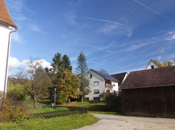
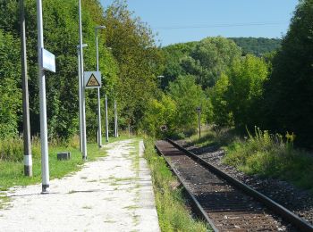
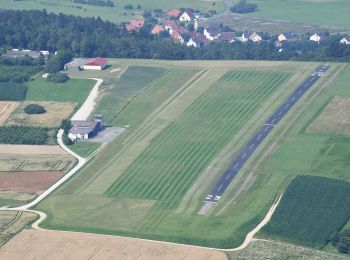
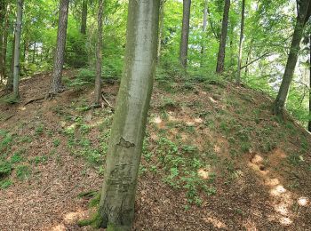
Simmelsdorf : découvrez les meilleures randonnées : 26 a pied. Tous ces circuits, parcours, itinéraires et activités en plein air sont disponibles dans nos applications SityTrail pour smartphones et tablettes.
Les meilleurs parcours (26)
![Randonnée A pied Simmelsdorf - Simmelsdorfer Rundwanderweg Rot 7 - Photo](https://media.geolcdn.com/t/350/260/6c570f5b-0d96-4962-a9b4-b7e7fcad2afe.jpeg&format=jpg&maxdim=2)
![A pied A pied](https://static1.geolcdn.com/sitytour/trail-icons/100.png)
Km
A pied
![](/images/other/stat-length.png)
![](https://static1.geolcdn.com/siteimages/upload/files/1508320355ic_sort_den_pos_24dp.png)
![](https://static1.geolcdn.com/siteimages/upload/files/1508320355ic_sort_den_neg_24dp.png)
![](https://static1.geolcdn.com/siteimages/upload/files/16400158638029165_repeat_loop_refresh_sync_direction_icon.png)
• Randonnée créée par Gemeinde Simmelsdorf. geprüft (Feb. 2015 by cycling_zno) Symbole: weisse 7 auf rotem Grund
![Randonnée A pied Simmelsdorf - Simmelsdorfer Rundwanderweg Rot 9 - Photo](https://media.geolcdn.com/t/350/260/04593a31-0873-4687-bc39-259cc2a1081a.jpeg&format=jpg&maxdim=2)
![A pied A pied](https://static1.geolcdn.com/sitytour/trail-icons/100.png)
Km
A pied
![](/images/other/stat-length.png)
![](https://static1.geolcdn.com/siteimages/upload/files/1508320355ic_sort_den_pos_24dp.png)
![](https://static1.geolcdn.com/siteimages/upload/files/1508320355ic_sort_den_neg_24dp.png)
![](https://static1.geolcdn.com/siteimages/upload/files/16400158638029165_repeat_loop_refresh_sync_direction_icon.png)
• Randonnée créée par Gemeinde Simmelsdorf. geprüft (Feb. 2015 by cycling_zno) Symbole: weisse 9 auf rotem Grund
![Randonnée A pied Simmelsdorf - Simmelsdorfer Rundwanderweg Blau 4 - Photo](https://media.geolcdn.com/t/350/260/d73e4444-d775-496b-99b0-2b50714ef2fe.jpeg&format=jpg&maxdim=2)
![A pied A pied](https://static1.geolcdn.com/sitytour/trail-icons/100.png)
Km
A pied
![](/images/other/stat-length.png)
![](https://static1.geolcdn.com/siteimages/upload/files/1508320355ic_sort_den_pos_24dp.png)
![](https://static1.geolcdn.com/siteimages/upload/files/1508320355ic_sort_den_neg_24dp.png)
![](https://static1.geolcdn.com/siteimages/upload/files/16400158638029165_repeat_loop_refresh_sync_direction_icon.png)
• Randonnée créée par Gemeinde Simmelsdorf. geprüft (Feb. 2015, by cycling_zno) Symbole: weisse 4 auf blauem Grund
![Randonnée A pied Simmelsdorf - Simmelsdorfer Rundwanderweg Rot 8 - Photo](https://media.geolcdn.com/t/350/260/6c570f5b-0d96-4962-a9b4-b7e7fcad2afe.jpeg&format=jpg&maxdim=2)
![A pied A pied](https://static1.geolcdn.com/sitytour/trail-icons/100.png)
Km
A pied
![](/images/other/stat-length.png)
![](https://static1.geolcdn.com/siteimages/upload/files/1508320355ic_sort_den_pos_24dp.png)
![](https://static1.geolcdn.com/siteimages/upload/files/1508320355ic_sort_den_neg_24dp.png)
![](https://static1.geolcdn.com/siteimages/upload/files/16400158638029165_repeat_loop_refresh_sync_direction_icon.png)
• Randonnée créée par Gemeinde Simmelsdorf. geprüft (Feb. 2015 by cycling_zno) Symbole: weisse 8 auf rotem Grund
![Randonnée A pied Simmelsdorf - Simmelsdorfer Rundwanderweg Gelb 5 - Photo](https://media.geolcdn.com/t/350/260/4b3ec6c1-e7fe-4b9a-890e-68e11ef3781c.jpeg&format=jpg&maxdim=2)
![A pied A pied](https://static1.geolcdn.com/sitytour/trail-icons/100.png)
Km
A pied
![](/images/other/stat-length.png)
![](https://static1.geolcdn.com/siteimages/upload/files/1508320355ic_sort_den_pos_24dp.png)
![](https://static1.geolcdn.com/siteimages/upload/files/1508320355ic_sort_den_neg_24dp.png)
![](https://static1.geolcdn.com/siteimages/upload/files/16400158638029165_repeat_loop_refresh_sync_direction_icon.png)
• Randonnée créée par Gemeinde Simmelsdorf. geprüft (Feb. 2015, by cycling_zno) Symbole: weisse 5 auf gelbem Grund
![Randonnée A pied Simmelsdorf - Simmelsdorfer Rundwanderweg Rot 2 - Photo](https://media.geolcdn.com/t/350/260/abff5f7e-aafe-437f-9d3a-bf04e660ea77.jpeg&format=jpg&maxdim=2)
![A pied A pied](https://static1.geolcdn.com/sitytour/trail-icons/100.png)
Km
A pied
![](/images/other/stat-length.png)
![](https://static1.geolcdn.com/siteimages/upload/files/1508320355ic_sort_den_pos_24dp.png)
![](https://static1.geolcdn.com/siteimages/upload/files/1508320355ic_sort_den_neg_24dp.png)
![](https://static1.geolcdn.com/siteimages/upload/files/16400158638029165_repeat_loop_refresh_sync_direction_icon.png)
• Randonnée créée par Gemeinde Simmelsdorf. geprüft (Feb. 2015 by cycling_zno) Symbole: weisse 2 auf rotem Grund
![Randonnée A pied Simmelsdorf - Simmelsdorfer Rundwanderweg Gelb 6 - Photo](https://media.geolcdn.com/t/350/260/4b3ec6c1-e7fe-4b9a-890e-68e11ef3781c.jpeg&format=jpg&maxdim=2)
![A pied A pied](https://static1.geolcdn.com/sitytour/trail-icons/100.png)
Km
A pied
![](/images/other/stat-length.png)
![](https://static1.geolcdn.com/siteimages/upload/files/1508320355ic_sort_den_pos_24dp.png)
![](https://static1.geolcdn.com/siteimages/upload/files/1508320355ic_sort_den_neg_24dp.png)
![](https://static1.geolcdn.com/siteimages/upload/files/16400158638029165_repeat_loop_refresh_sync_direction_icon.png)
• Randonnée créée par Gemeinde Simmelsdorf. geprüft (Feb. 2015, by cycling_zno) Symbole: weisse 6 auf gelbem Grund
![Randonnée A pied Simmelsdorf - Simmelsdorfer Rundwanderweg Gelb 9 - Photo](https://media.geolcdn.com/t/350/260/4b3ec6c1-e7fe-4b9a-890e-68e11ef3781c.jpeg&format=jpg&maxdim=2)
![A pied A pied](https://static1.geolcdn.com/sitytour/trail-icons/100.png)
Km
A pied
![](/images/other/stat-length.png)
![](https://static1.geolcdn.com/siteimages/upload/files/1508320355ic_sort_den_pos_24dp.png)
![](https://static1.geolcdn.com/siteimages/upload/files/1508320355ic_sort_den_neg_24dp.png)
![](https://static1.geolcdn.com/siteimages/upload/files/16400158638029165_repeat_loop_refresh_sync_direction_icon.png)
• Randonnée créée par Gemeinde Simmelsdorf. geprüft (Feb. 2015, by cycling_zno) Symbole: weisse 9 auf gelbem Grund
![Randonnée A pied Simmelsdorf - Simmelsdorfer Rundwanderweg Gelb 7 - Photo](https://media.geolcdn.com/t/350/260/4b3ec6c1-e7fe-4b9a-890e-68e11ef3781c.jpeg&format=jpg&maxdim=2)
![A pied A pied](https://static1.geolcdn.com/sitytour/trail-icons/100.png)
Km
A pied
![](/images/other/stat-length.png)
![](https://static1.geolcdn.com/siteimages/upload/files/1508320355ic_sort_den_pos_24dp.png)
![](https://static1.geolcdn.com/siteimages/upload/files/1508320355ic_sort_den_neg_24dp.png)
![](https://static1.geolcdn.com/siteimages/upload/files/16400158638029165_repeat_loop_refresh_sync_direction_icon.png)
• Randonnée créée par Gemeinde Simmelsdorf. geprüft (Feb. 2015, by cycling_zno) Symbole: weisse 7 auf gelbem Grund
![Randonnée A pied Simmelsdorf - Simmelsdorfer Rundwanderweg Grün 3 - Photo](https://media.geolcdn.com/t/350/260/c745658b-2bf3-447f-96b2-08813cebbcb9.jpeg&format=jpg&maxdim=2)
![A pied A pied](https://static1.geolcdn.com/sitytour/trail-icons/100.png)
Km
A pied
![](/images/other/stat-length.png)
![](https://static1.geolcdn.com/siteimages/upload/files/1508320355ic_sort_den_pos_24dp.png)
![](https://static1.geolcdn.com/siteimages/upload/files/1508320355ic_sort_den_neg_24dp.png)
![](https://static1.geolcdn.com/siteimages/upload/files/16400158638029165_repeat_loop_refresh_sync_direction_icon.png)
• Randonnée créée par Gemeinde Simmelsdorf. geprüft (Feb. 2015, by cycling_zno) Symbole: weisse 3 auf grünem Grund
![Randonnée A pied Simmelsdorf - Simmelsdorfer Rundwanderweg Gelb 10 - Photo](https://media.geolcdn.com/t/350/260/4b3ec6c1-e7fe-4b9a-890e-68e11ef3781c.jpeg&format=jpg&maxdim=2)
![A pied A pied](https://static1.geolcdn.com/sitytour/trail-icons/100.png)
Km
A pied
![](/images/other/stat-length.png)
![](https://static1.geolcdn.com/siteimages/upload/files/1508320355ic_sort_den_pos_24dp.png)
![](https://static1.geolcdn.com/siteimages/upload/files/1508320355ic_sort_den_neg_24dp.png)
![](https://static1.geolcdn.com/siteimages/upload/files/16400158638029165_repeat_loop_refresh_sync_direction_icon.png)
• Randonnée créée par Gemeinde Simmelsdorf. geprüft (Feb. 2015, by cycling_zno) Symbole: weisse 10 auf gelbem Grund
![Randonnée A pied Simmelsdorf - Simmelsdorfer Rundwanderweg Gelb 1 - Photo](https://media.geolcdn.com/t/350/260/abff5f7e-aafe-437f-9d3a-bf04e660ea77.jpeg&format=jpg&maxdim=2)
![A pied A pied](https://static1.geolcdn.com/sitytour/trail-icons/100.png)
Km
A pied
![](/images/other/stat-length.png)
![](https://static1.geolcdn.com/siteimages/upload/files/1508320355ic_sort_den_pos_24dp.png)
![](https://static1.geolcdn.com/siteimages/upload/files/1508320355ic_sort_den_neg_24dp.png)
![](https://static1.geolcdn.com/siteimages/upload/files/16400158638029165_repeat_loop_refresh_sync_direction_icon.png)
• Randonnée créée par Gemeinde Simmelsdorf. geprüft (Feb. 2015, by cycling_zno) Symbole: weisse 1 auf gelbem Grund
![Randonnée A pied Simmelsdorf - Rundwanderweg 1000 Jahre Ittling - Photo](https://media.geolcdn.com/t/350/260/6c570f5b-0d96-4962-a9b4-b7e7fcad2afe.jpeg&format=jpg&maxdim=2)
![A pied A pied](https://static1.geolcdn.com/sitytour/trail-icons/100.png)
Km
A pied
![](/images/other/stat-length.png)
![](https://static1.geolcdn.com/siteimages/upload/files/1508320355ic_sort_den_pos_24dp.png)
![](https://static1.geolcdn.com/siteimages/upload/files/1508320355ic_sort_den_neg_24dp.png)
![](https://static1.geolcdn.com/siteimages/upload/files/16400158638029165_repeat_loop_refresh_sync_direction_icon.png)
• Randonnée créée par Gemeinde Simmelsdorf. geprüft (Feb. 2015 by cycling_zno) Symbole: t.b.d.
![Randonnée A pied Simmelsdorf - Simmelsdorfer Rundwanderweg Blau 3 - Photo](https://media.geolcdn.com/t/350/260/d73e4444-d775-496b-99b0-2b50714ef2fe.jpeg&format=jpg&maxdim=2)
![A pied A pied](https://static1.geolcdn.com/sitytour/trail-icons/100.png)
Km
A pied
![](/images/other/stat-length.png)
![](https://static1.geolcdn.com/siteimages/upload/files/1508320355ic_sort_den_pos_24dp.png)
![](https://static1.geolcdn.com/siteimages/upload/files/1508320355ic_sort_den_neg_24dp.png)
![](https://static1.geolcdn.com/siteimages/upload/files/16400158638029165_repeat_loop_refresh_sync_direction_icon.png)
• Randonnée créée par Gemeinde Simmelsdorf. geprüft (Feb. 2015, by cycling_zno) Symbole: weisse 3 auf blauem Grund
![Randonnée A pied Simmelsdorf - Simmelsdorfer Rundwanderweg Blau 2 - Photo](https://media.geolcdn.com/t/350/260/f935d532-470a-41e6-89b6-9d8ef1a32866.jpeg&format=jpg&maxdim=2)
![A pied A pied](https://static1.geolcdn.com/sitytour/trail-icons/100.png)
Km
A pied
![](/images/other/stat-length.png)
![](https://static1.geolcdn.com/siteimages/upload/files/1508320355ic_sort_den_pos_24dp.png)
![](https://static1.geolcdn.com/siteimages/upload/files/1508320355ic_sort_den_neg_24dp.png)
![](https://static1.geolcdn.com/siteimages/upload/files/16400158638029165_repeat_loop_refresh_sync_direction_icon.png)
• Randonnée créée par Gemeinde Simmelsdorf. geprüft (Feb. 2015, by cycling_zno) Symbole: weisse 2 auf blauem Grund
![Randonnée A pied Simmelsdorf - Simmelsdorfer Rundwanderweg Grün 4 - Photo](https://media.geolcdn.com/t/350/260/f935d532-470a-41e6-89b6-9d8ef1a32866.jpeg&format=jpg&maxdim=2)
![A pied A pied](https://static1.geolcdn.com/sitytour/trail-icons/100.png)
Km
A pied
![](/images/other/stat-length.png)
![](https://static1.geolcdn.com/siteimages/upload/files/1508320355ic_sort_den_pos_24dp.png)
![](https://static1.geolcdn.com/siteimages/upload/files/1508320355ic_sort_den_neg_24dp.png)
![](https://static1.geolcdn.com/siteimages/upload/files/16400158638029165_repeat_loop_refresh_sync_direction_icon.png)
• Randonnée créée par Gemeinde Simmelsdorf. geprüft (Feb. 2015, by cycling_zno) Symbole: weisse 4 auf grünem Grund
![Randonnée A pied Simmelsdorf - Simmelsdorfer Rundwanderweg Gelb 8 - Photo](https://media.geolcdn.com/t/350/260/e1379b2b-9553-431a-ab03-0c744e864382.jpeg&format=jpg&maxdim=2)
![A pied A pied](https://static1.geolcdn.com/sitytour/trail-icons/100.png)
Km
A pied
![](/images/other/stat-length.png)
![](https://static1.geolcdn.com/siteimages/upload/files/1508320355ic_sort_den_pos_24dp.png)
![](https://static1.geolcdn.com/siteimages/upload/files/1508320355ic_sort_den_neg_24dp.png)
![](https://static1.geolcdn.com/siteimages/upload/files/16400158638029165_repeat_loop_refresh_sync_direction_icon.png)
• Randonnée créée par Gemeinde Simmelsdorf. geprüft (Feb. 2015, by cycling_zno) Symbole: weisse 8 auf gelbem Grund
![Randonnée A pied Simmelsdorf - Landkreislauf Nürnberger Land 2013 Etappe 5 - Photo](https://media.geolcdn.com/t/350/260/ext.jpg?maxdim=2&url=https%3A%2F%2Fstatic1.geolcdn.com%2Fsiteimages%2Fupload%2Ffiles%2F1545311037marcheuse_200dpi.jpg)
![A pied A pied](https://static1.geolcdn.com/sitytour/trail-icons/100.png)
Km
A pied
![](/images/other/stat-length.png)
![](https://static1.geolcdn.com/siteimages/upload/files/1508320355ic_sort_den_pos_24dp.png)
![](https://static1.geolcdn.com/siteimages/upload/files/1508320355ic_sort_den_neg_24dp.png)
![](https://static1.geolcdn.com/siteimages/upload/files/16400158638029165_repeat_loop_refresh_sync_direction_icon.png)
• Randonnée créée par Landratsamt Nürnberger Land. tag by Wankmann Site web: http://landkreislauf.de/
![Randonnée A pied Simmelsdorf - Landkreislauf Nürnberger Land 2013 Etappe 6 - Photo](https://media.geolcdn.com/t/350/260/ext.jpg?maxdim=2&url=https%3A%2F%2Fstatic1.geolcdn.com%2Fsiteimages%2Fupload%2Ffiles%2F1545311037marcheuse_200dpi.jpg)
![A pied A pied](https://static1.geolcdn.com/sitytour/trail-icons/100.png)
Km
A pied
![](/images/other/stat-length.png)
![](https://static1.geolcdn.com/siteimages/upload/files/1508320355ic_sort_den_pos_24dp.png)
![](https://static1.geolcdn.com/siteimages/upload/files/1508320355ic_sort_den_neg_24dp.png)
![](https://static1.geolcdn.com/siteimages/upload/files/16400158638029165_repeat_loop_refresh_sync_direction_icon.png)
• Randonnée créée par Landratsamt Nürnberger Land. tag by Wankmann Site web: http://landkreislauf.de/
![Randonnée A pied Simmelsdorf - Landkreislauf Nürnberger Land 2013 Etappe 7 - Photo](https://media.geolcdn.com/t/350/260/ext.jpg?maxdim=2&url=https%3A%2F%2Fstatic1.geolcdn.com%2Fsiteimages%2Fupload%2Ffiles%2F1545311037marcheuse_200dpi.jpg)
![A pied A pied](https://static1.geolcdn.com/sitytour/trail-icons/100.png)
Km
A pied
![](/images/other/stat-length.png)
![](https://static1.geolcdn.com/siteimages/upload/files/1508320355ic_sort_den_pos_24dp.png)
![](https://static1.geolcdn.com/siteimages/upload/files/1508320355ic_sort_den_neg_24dp.png)
![](https://static1.geolcdn.com/siteimages/upload/files/16400158638029165_repeat_loop_refresh_sync_direction_icon.png)
• Randonnée créée par Landratsamt Nürnberger Land. tag by Wankmann Site web: http://landkreislauf.de/
20 randonnées affichées sur 26
Application GPS de randonnée GRATUITE