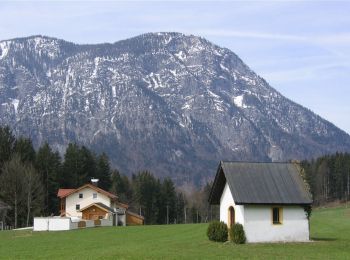
![](/images/other/stat-length.png)
- Randonnées
- A pied
- Autriche
- Tyrol
- Bezirk Kufstein
Bezirk Kufstein, Tyrol, A pied : Les meilleures randonnées, itinéraires, parcours, balades et promenades
Bezirk Kufstein : découvrez les meilleures randonnées : 91 a pied et 8 marche. Tous ces circuits, parcours, itinéraires et activités en plein air sont disponibles dans nos applications SityTrail pour smartphones et tablettes.
Les meilleurs parcours (99)
![Randonnée A pied Stadt Kufstein - Prinz Luitpold Weg - Photo](https://media.geolcdn.com/t/350/260/7aaf1793-4671-43af-9ad0-5e7767904bdf.jpeg&format=jpg&maxdim=2)
![A pied A pied](https://static1.geolcdn.com/sitytour/trail-icons/100.png)
Km
A pied
![](/images/other/stat-length.png)
![](https://static1.geolcdn.com/siteimages/upload/files/1508320355ic_sort_den_pos_24dp.png)
![](https://static1.geolcdn.com/siteimages/upload/files/1508320355ic_sort_den_neg_24dp.png)
![](https://static1.geolcdn.com/siteimages/upload/files/16400158638029165_repeat_loop_refresh_sync_direction_icon.png)
• Randonnée créée par IVV. Symbole: Hellblaue Rechtecke mit Ordenssilhouette und der Aufschrift "Kaiser Max Weg"
![Randonnée A pied Stadt Kufstein - Kapellenweg - Photo](https://media.geolcdn.com/t/350/260/e7b6607e-c32c-4d8c-b4a0-d43dc902835a.jpeg&format=jpg&maxdim=2)
![A pied A pied](https://static1.geolcdn.com/sitytour/trail-icons/100.png)
Km
A pied
![](/images/other/stat-length.png)
![](https://static1.geolcdn.com/siteimages/upload/files/1508320355ic_sort_den_pos_24dp.png)
![](https://static1.geolcdn.com/siteimages/upload/files/1508320355ic_sort_den_neg_24dp.png)
![](https://static1.geolcdn.com/siteimages/upload/files/16400158638029165_repeat_loop_refresh_sync_direction_icon.png)
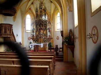
• Randonnée créée par IVV. Symbole: Violette Rechtecke mit Heiligensilhouette und der Aufschrift "Kapellenweg"
![Randonnée A pied Stadt Kufstein - Denkmalwanderung - Photo](https://media.geolcdn.com/t/350/260/050b7c40-79f2-444c-adf3-bc878881d4c9.jpeg&format=jpg&maxdim=2)
![A pied A pied](https://static1.geolcdn.com/sitytour/trail-icons/100.png)
Km
A pied
![](/images/other/stat-length.png)
![](https://static1.geolcdn.com/siteimages/upload/files/1508320355ic_sort_den_pos_24dp.png)
![](https://static1.geolcdn.com/siteimages/upload/files/1508320355ic_sort_den_neg_24dp.png)
![](https://static1.geolcdn.com/siteimages/upload/files/16400158638029165_repeat_loop_refresh_sync_direction_icon.png)
• Randonnée créée par IVV. Symbole: Dunkelgraue Rechtecke mit Oberkörpersilhouette und der Aufschrift "Denkmalwanderung"
![Randonnée A pied Stadt Kufstein - Energieweg Kufstein - Photo](https://media.geolcdn.com/t/350/260/768c9069-4cc0-4c9d-965e-70eff8e8e6d4.jpeg&format=jpg&maxdim=2)
![A pied A pied](https://static1.geolcdn.com/sitytour/trail-icons/100.png)
Km
A pied
![](/images/other/stat-length.png)
![](https://static1.geolcdn.com/siteimages/upload/files/1508320355ic_sort_den_pos_24dp.png)
![](https://static1.geolcdn.com/siteimages/upload/files/1508320355ic_sort_den_neg_24dp.png)
![](https://static1.geolcdn.com/siteimages/upload/files/16400158638029165_repeat_loop_refresh_sync_direction_icon.png)
• Symbole: Braune Rechtecke mit Kreissymbol und der Aufschrift "Energieweg Kufstein"
![Randonnée A pied Stadt Kufstein - Rund um Kufstein - Photo](https://media.geolcdn.com/t/350/260/e1bd58f2-db1d-4ff1-908f-b08c89061459.jpeg&format=jpg&maxdim=2)
![A pied A pied](https://static1.geolcdn.com/sitytour/trail-icons/100.png)
Km
A pied
![](/images/other/stat-length.png)
![](https://static1.geolcdn.com/siteimages/upload/files/1508320355ic_sort_den_pos_24dp.png)
![](https://static1.geolcdn.com/siteimages/upload/files/1508320355ic_sort_den_neg_24dp.png)
![](https://static1.geolcdn.com/siteimages/upload/files/16400158638029165_repeat_loop_refresh_sync_direction_icon.png)
• Randonnée créée par IVV. Symbole: Olive Rechtecke mit Stadtsilhouette und der Aufschrift "Rund um Kufstein"
![Randonnée A pied Stadt Kufstein - Elfenhain-Trail - Photo](https://media.geolcdn.com/t/350/260/bf877ae3-7b85-40db-872a-fc43df081ae7.jpeg&format=jpg&maxdim=2)
![A pied A pied](https://static1.geolcdn.com/sitytour/trail-icons/100.png)
Km
A pied
![](/images/other/stat-length.png)
![](https://static1.geolcdn.com/siteimages/upload/files/1508320355ic_sort_den_pos_24dp.png)
![](https://static1.geolcdn.com/siteimages/upload/files/1508320355ic_sort_den_neg_24dp.png)
![](https://static1.geolcdn.com/siteimages/upload/files/16400158638029165_repeat_loop_refresh_sync_direction_icon.png)
• Randonnée créée par Kufsteinerland. Symbole: Weiße Schilder mit Richtungspfeil und rotem Streifen mit dem Namen "Elf...
![Randonnée A pied Gemeinde Ebbs - Inn Rundweg - Photo](https://media.geolcdn.com/t/350/260/daaecc59-bccf-4b5e-b34b-e9247f0a0214.jpeg&format=jpg&maxdim=2)
![A pied A pied](https://static1.geolcdn.com/sitytour/trail-icons/100.png)
Km
A pied
![](/images/other/stat-length.png)
![](https://static1.geolcdn.com/siteimages/upload/files/1508320355ic_sort_den_pos_24dp.png)
![](https://static1.geolcdn.com/siteimages/upload/files/1508320355ic_sort_den_neg_24dp.png)
![](https://static1.geolcdn.com/siteimages/upload/files/16400158638029165_repeat_loop_refresh_sync_direction_icon.png)
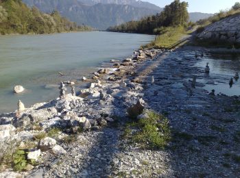
• Symbole: Türkise Rechtecke mit Wellensymbol und der Aufschrift "Inn Rundweg"
![Randonnée A pied Stadt Kufstein - Brentenjoch-Trail - Photo](https://media.geolcdn.com/t/350/260/1c6a7877-1f15-44ce-859e-d53183c65a67.jpeg&format=jpg&maxdim=2)
![A pied A pied](https://static1.geolcdn.com/sitytour/trail-icons/100.png)
Km
A pied
![](/images/other/stat-length.png)
![](https://static1.geolcdn.com/siteimages/upload/files/1508320355ic_sort_den_pos_24dp.png)
![](https://static1.geolcdn.com/siteimages/upload/files/1508320355ic_sort_den_neg_24dp.png)
![](https://static1.geolcdn.com/siteimages/upload/files/16400158638029165_repeat_loop_refresh_sync_direction_icon.png)
• Randonnée créée par Kufsteinerland. Symbole: Weiße Schilder mit Richtungspfeil und blauem Streifen mit dem Namen "Br...
![Randonnée A pied Gemeinde Erl - Euregio Marien-Wege - Photo](https://media.geolcdn.com/t/350/260/797c713e-12d0-48f6-8c0e-6e9af5a814a9.jpeg&format=jpg&maxdim=2)
![A pied A pied](https://static1.geolcdn.com/sitytour/trail-icons/100.png)
Km
A pied
![](/images/other/stat-length.png)
![](https://static1.geolcdn.com/siteimages/upload/files/1508320355ic_sort_den_pos_24dp.png)
![](https://static1.geolcdn.com/siteimages/upload/files/1508320355ic_sort_den_neg_24dp.png)
![](https://static1.geolcdn.com/siteimages/upload/files/16400158638029165_repeat_loop_refresh_sync_direction_icon.png)
• Symbole: Weiße Rechtecke mit Farbpunkten und der Aufschrift "EUREGIO Marien-Wege"
![Randonnée A pied Gemeinde Ebbs - St. Nikolaus Rundweg - Photo](https://media.geolcdn.com/t/350/260/3503f523-6992-40ce-bbac-ceb7704c0996.jpeg&format=jpg&maxdim=2)
![A pied A pied](https://static1.geolcdn.com/sitytour/trail-icons/100.png)
Km
A pied
![](/images/other/stat-length.png)
![](https://static1.geolcdn.com/siteimages/upload/files/1508320355ic_sort_den_pos_24dp.png)
![](https://static1.geolcdn.com/siteimages/upload/files/1508320355ic_sort_den_neg_24dp.png)
![](https://static1.geolcdn.com/siteimages/upload/files/16400158638029165_repeat_loop_refresh_sync_direction_icon.png)
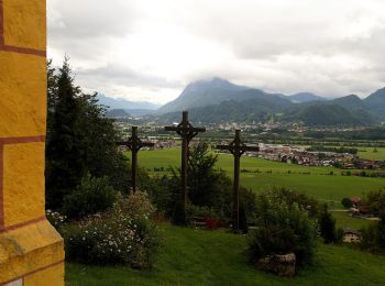
• Symbole: Violette Rechtecke mit Kirchensymbol und der Aufschrift "St. Nikolaus Rundweg"
![Randonnée A pied Gemeinde Ebbs - Haflinger Rundweg - Photo](https://media.geolcdn.com/t/350/260/c486675e-7789-4fa8-85da-a10fdec7f7ad.jpeg&format=jpg&maxdim=2)
![A pied A pied](https://static1.geolcdn.com/sitytour/trail-icons/100.png)
Km
A pied
![](/images/other/stat-length.png)
![](https://static1.geolcdn.com/siteimages/upload/files/1508320355ic_sort_den_pos_24dp.png)
![](https://static1.geolcdn.com/siteimages/upload/files/1508320355ic_sort_den_neg_24dp.png)
![](https://static1.geolcdn.com/siteimages/upload/files/16400158638029165_repeat_loop_refresh_sync_direction_icon.png)
• Randonnée créée par Gemeinde Ebbs. Symbole: Braune Rechtecke mit Pferdekopf und der Aufschrift "Haflinger Rundweg"
![Randonnée A pied Gemeinde Ebbs - Oberndorf Rundweg - Photo](https://media.geolcdn.com/t/350/260/2f7b1df5-b971-4e18-8b9b-3fe840dfd0dd.jpeg&format=jpg&maxdim=2)
![A pied A pied](https://static1.geolcdn.com/sitytour/trail-icons/100.png)
Km
A pied
![](/images/other/stat-length.png)
![](https://static1.geolcdn.com/siteimages/upload/files/1508320355ic_sort_den_pos_24dp.png)
![](https://static1.geolcdn.com/siteimages/upload/files/1508320355ic_sort_den_neg_24dp.png)
![](https://static1.geolcdn.com/siteimages/upload/files/16400158638029165_repeat_loop_refresh_sync_direction_icon.png)
• Randonnée créée par Gemeinde Ebbs. Symbole: Rote Rechtecke mit Berg/Haussymbol und der Aufschrift "Oberndorf Rundweg"
![Randonnée A pied Gemeinde Ebbs - KOASA-Halbmarathon - Photo](https://media.geolcdn.com/t/350/260/649bb04a-41da-4465-a1b9-73917ea16bfa.jpeg&format=jpg&maxdim=2)
![A pied A pied](https://static1.geolcdn.com/sitytour/trail-icons/100.png)
Km
A pied
![](/images/other/stat-length.png)
![](https://static1.geolcdn.com/siteimages/upload/files/1508320355ic_sort_den_pos_24dp.png)
![](https://static1.geolcdn.com/siteimages/upload/files/1508320355ic_sort_den_neg_24dp.png)
![](https://static1.geolcdn.com/siteimages/upload/files/16400158638029165_repeat_loop_refresh_sync_direction_icon.png)
• Symbole: Rechteckige Schilder mit Richtungspfeil und farbigem Balken mit Namen und Nummer
![Randonnée A pied Gemeinde Ebbs - KOASA-Classic-Run - Photo](https://media.geolcdn.com/t/350/260/649bb04a-41da-4465-a1b9-73917ea16bfa.jpeg&format=jpg&maxdim=2)
![A pied A pied](https://static1.geolcdn.com/sitytour/trail-icons/100.png)
Km
A pied
![](/images/other/stat-length.png)
![](https://static1.geolcdn.com/siteimages/upload/files/1508320355ic_sort_den_pos_24dp.png)
![](https://static1.geolcdn.com/siteimages/upload/files/1508320355ic_sort_den_neg_24dp.png)
![](https://static1.geolcdn.com/siteimages/upload/files/16400158638029165_repeat_loop_refresh_sync_direction_icon.png)
• Symbole: Rechteckige Schilder mit Richtungspfeil und farbigem Balken mit Namen und Nummer
![Randonnée A pied Gemeinde Ebbs - KOASA-Marathon - Photo](https://media.geolcdn.com/t/350/260/be1f2f78-3256-4500-bf2a-b62a2fe3b621.jpeg&format=jpg&maxdim=2)
![A pied A pied](https://static1.geolcdn.com/sitytour/trail-icons/100.png)
Km
A pied
![](/images/other/stat-length.png)
![](https://static1.geolcdn.com/siteimages/upload/files/1508320355ic_sort_den_pos_24dp.png)
![](https://static1.geolcdn.com/siteimages/upload/files/1508320355ic_sort_den_neg_24dp.png)
![](https://static1.geolcdn.com/siteimages/upload/files/16400158638029165_repeat_loop_refresh_sync_direction_icon.png)
• Symbole: Rechteckige Schilder mit Richtungspfeil und farbigem Balken mit Namen und Nummer
![Randonnée A pied Gemeinde Scheffau am Wilden Kaiser - Auwaldrunde - Photo](https://media.geolcdn.com/t/350/260/3a82ec08-361f-407c-b990-092670ab9561.jpeg&format=jpg&maxdim=2)
![A pied A pied](https://static1.geolcdn.com/sitytour/trail-icons/100.png)
Km
A pied
![](/images/other/stat-length.png)
![](https://static1.geolcdn.com/siteimages/upload/files/1508320355ic_sort_den_pos_24dp.png)
![](https://static1.geolcdn.com/siteimages/upload/files/1508320355ic_sort_den_neg_24dp.png)
![](https://static1.geolcdn.com/siteimages/upload/files/16400158638029165_repeat_loop_refresh_sync_direction_icon.png)
• Randonnée créée par Lauf- und Nordic Walking Region Wilder Kaiser. Route 2020 vor Ort Übersichtskarte und nur noch v...
![Randonnée A pied Gemeinde Scheffau am Wilden Kaiser - Blaikenrunde - Photo](https://media.geolcdn.com/t/350/260/f62c0da4-e38c-4f86-bb60-08e7cedb9a5c.jpeg&format=jpg&maxdim=2)
![A pied A pied](https://static1.geolcdn.com/sitytour/trail-icons/100.png)
Km
A pied
![](/images/other/stat-length.png)
![](https://static1.geolcdn.com/siteimages/upload/files/1508320355ic_sort_den_pos_24dp.png)
![](https://static1.geolcdn.com/siteimages/upload/files/1508320355ic_sort_den_neg_24dp.png)
![](https://static1.geolcdn.com/siteimages/upload/files/16400158638029165_repeat_loop_refresh_sync_direction_icon.png)
• Randonnée créée par Lauf- und Nordic Walking Region Wilder Kaiser. Route 2020 vor Ort Übersichtskarte und nur noch v...
![Randonnée A pied Gemeinde Schwoich - VBA-Runde - Photo](https://media.geolcdn.com/t/350/260/a2db4e88-f51b-4cd3-a9a0-def1d3cf7f1b.jpeg&format=jpg&maxdim=2)
![A pied A pied](https://static1.geolcdn.com/sitytour/trail-icons/100.png)
Km
A pied
![](/images/other/stat-length.png)
![](https://static1.geolcdn.com/siteimages/upload/files/1508320355ic_sort_den_pos_24dp.png)
![](https://static1.geolcdn.com/siteimages/upload/files/1508320355ic_sort_den_neg_24dp.png)
![](https://static1.geolcdn.com/siteimages/upload/files/16400158638029165_repeat_loop_refresh_sync_direction_icon.png)
• Randonnée créée par Gemeinde Bad Häring. Symbole: Hellgrüne Schilder mit dunkelgrünem, oberen Rand und Richtungspfeil
![Randonnée A pied Gemeinde Schwoich - Waldschönauer Runde - Photo](https://media.geolcdn.com/t/350/260/611dbb3a-95cb-44c3-b8d9-20a695284e74.jpeg&format=jpg&maxdim=2)
![A pied A pied](https://static1.geolcdn.com/sitytour/trail-icons/100.png)
Km
A pied
![](/images/other/stat-length.png)
![](https://static1.geolcdn.com/siteimages/upload/files/1508320355ic_sort_den_pos_24dp.png)
![](https://static1.geolcdn.com/siteimages/upload/files/1508320355ic_sort_den_neg_24dp.png)
![](https://static1.geolcdn.com/siteimages/upload/files/16400158638029165_repeat_loop_refresh_sync_direction_icon.png)
• Randonnée créée par Kufsteinerland. Symbole: Gelbe Schilder mit weißem Richtungspfeil und rotem Streifen mit dem Nam...
![Randonnée A pied Gemeinde Schwoich - Schmieder Runde - Photo](https://media.geolcdn.com/t/350/260/b1044541-dd3e-49cc-bd81-37d812d18204.jpeg&format=jpg&maxdim=2)
![A pied A pied](https://static1.geolcdn.com/sitytour/trail-icons/100.png)
Km
A pied
![](/images/other/stat-length.png)
![](https://static1.geolcdn.com/siteimages/upload/files/1508320355ic_sort_den_pos_24dp.png)
![](https://static1.geolcdn.com/siteimages/upload/files/1508320355ic_sort_den_neg_24dp.png)
![](https://static1.geolcdn.com/siteimages/upload/files/16400158638029165_repeat_loop_refresh_sync_direction_icon.png)
• Randonnée créée par Kufsteinerland. Symbole: Gelbe Schilder mit weißem Richtungspfeil und violettem Streifen mit dem...
20 randonnées affichées sur 99
Application GPS de randonnée GRATUITE
Activités
Régions proches
- Gemeinde Alpbach
- Gemeinde Angerberg
- Gemeinde Bad Häring
- Gemeinde Brandenberg
- Gemeinde Breitenbach am Inn
- Gemeinde Ebbs
- Gemeinde Ellmau
- Gemeinde Erl
- Gemeinde Kirchbichl
- Gemeinde Kramsach
- Gemeinde Langkampfen
- Gemeinde Münster
- Gemeinde Niederndorf
- Gemeinde Reith im Alpbachtal
- Gemeinde Rettenschöss
- Gemeinde Scheffau am Wilden Kaiser
- Gemeinde Schwoich
- Gemeinde Söll
- Gemeinde Thiersee
- Gemeinde Walchsee
- Gemeinde Wildschönau
- Marktgemeinde Brixlegg
- Stadt Kufstein
- Stadt Wörgl