![](/images/other/stat-length.png)
![Excursión A pie Arnbruck - L 6 Lam](https://media.geolcdn.com/t/1900/400/ext.pjpeg?maxdim=2&url=https%3A%2F%2Fstatic1.geolcdn.com%2Fsiteimages%2Fupload%2Ffiles%2F1545311037marcheuse_200dpi.jpg)
L 6 Lam "Durch den Kloster-Rotter-Wald"
SityTrail - itinéraires balisés pédestres
Tous les sentiers balisés d’Europe GUIDE+
![Longitud](/images/other/stat-length.png)
Longitud
3,5 km
![Altitud máxima](https://static1.geolcdn.com/siteimages/upload/files/1508320355ic_sort_altitude_max_24dp.png)
Altitud máxima
1180 m
![Desnivel positivo](https://static1.geolcdn.com/siteimages/upload/files/1508320355ic_sort_den_pos_24dp.png)
Desnivel positivo
65 m
![Km-Effort](/images/other/stat-length.png)
Km-Effort
4,9 km
![Altitud mínima](https://static1.geolcdn.com/siteimages/upload/files/1508320355ic_sort_altitude_min_24dp.png)
Altitud mínima
998 m
![Desnivel negativo](https://static1.geolcdn.com/siteimages/upload/files/1508320355ic_sort_den_neg_24dp.png)
Desnivel negativo
224 m
![Boucle](https://static1.geolcdn.com/siteimages/upload/files/16400158638029165_repeat_loop_refresh_sync_direction_icon.png)
Boucle
No
Baliza
Fecha de creación :
2022-02-21 08:14:29.861
Última modificación :
2022-02-21 08:14:29.861
![A pie](https://static1.geolcdn.com/sitytour/trail-icons/100.png)
1h06
Dificultad : Fácil
![Escanee este código QR para abrir la excursión en la aplicación SityTrail](https://capi.geolives.com/qq0zvz2zws4bq2lad0pu/sitytour/trails/3136321/qr.png?size=200)
Aplicación GPS de excursión GRATIS
A propósito
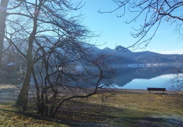
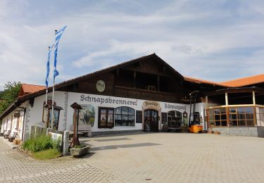
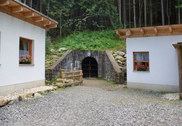
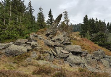
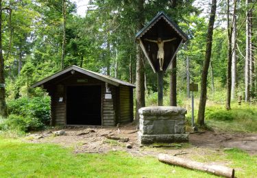
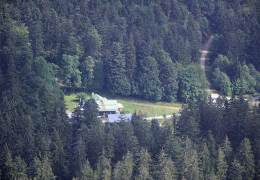
Ruta A pie de 3,5 km a descubrir en Baviera, Landkreis Regen, Arnbruck. Esta ruta ha sido propuesta por SityTrail - itinéraires balisés pédestres.
Descripción
Trail created by Naturpark Oberer Bayerischer Wald.
Symbol: Auf oben weißem / unten rotem, rechteckigem Hintergrund in schwarz die Wegnummer
Localización
País:
Germany
Región :
Baviera
Departamento/provincia :
Landkreis Regen
Municipio :
Arnbruck
Localidad:
Unknown
Salida:(Dec)
Salida:(UTM)
357727 ; 5446499 (33U) N.
Comentarios
Excursiones cerca
![Excursión A pie - Lo 5 Zwerchecker-Steig (Lohberg) - Photo](https://media.geolcdn.com/t/375/260/afdf211f-3378-4ccf-a493-44a5d1b4a1ef.jpeg&format=jpg&maxdim=2)
![A pie A pie](https://static1.geolcdn.com/sitytour/trail-icons/100.png)
Lo 5 Zwerchecker-Steig (Lohberg)
A pie
Medio
,
Baviera,
Landkreis Cham,
Germany
![](/images/other/stat-length.png)
13,4 km | 23 km-effort
5h 11min
![](https://static1.geolcdn.com/siteimages/upload/files/16400158638029165_repeat_loop_refresh_sync_direction_icon.png)
No
![Excursión A pie Arrach - Kaitersberg-Panorama-Weg - Photo](https://media.geolcdn.com/t/375/260/9a6f7fe4-88f4-4cf7-9770-b514d4cd75e5.jpeg&format=jpg&maxdim=2)
![A pie A pie](https://static1.geolcdn.com/sitytour/trail-icons/100.png)
Kaitersberg-Panorama-Weg
A pie
Medio
Arrach,
Baviera,
Landkreis Cham,
Germany
![](/images/other/stat-length.png)
14,7 km | 24 km-effort
5h 27min
![](https://static1.geolcdn.com/siteimages/upload/files/16400158638029165_repeat_loop_refresh_sync_direction_icon.png)
Sí
![Excursión A pie Lam - LP Lamer Panoramaweg - Photo](https://media.geolcdn.com/t/375/260/e25ed577-2416-4f93-9100-e7f7f39724fa.jpeg&format=jpg&maxdim=2)
![A pie A pie](https://static1.geolcdn.com/sitytour/trail-icons/100.png)
LP Lamer Panoramaweg
A pie
Fácil
Lam,
Baviera,
Landkreis Cham,
Germany
![](/images/other/stat-length.png)
5 km | 7,4 km-effort
1h 41min
![](https://static1.geolcdn.com/siteimages/upload/files/16400158638029165_repeat_loop_refresh_sync_direction_icon.png)
No
![Excursión A pie - Lo 1 Osserpfad (Lohberg) - Photo](https://media.geolcdn.com/t/375/260/cd6368dc-f40d-41f9-a41b-727bb4be759d.jpeg&format=jpg&maxdim=2)
![A pie A pie](https://static1.geolcdn.com/sitytour/trail-icons/100.png)
Lo 1 Osserpfad (Lohberg)
A pie
Fácil
,
Baviera,
Landkreis Cham,
Germany
![](/images/other/stat-length.png)
4,6 km | 10,7 km-effort
2h 25min
![](https://static1.geolcdn.com/siteimages/upload/files/16400158638029165_repeat_loop_refresh_sync_direction_icon.png)
No
![Excursión A pie Arnbruck - Wanderweg 10 Arnbruck - Waldwiesmarterl - Photo](https://media.geolcdn.com/t/375/260/02d03139-d984-4b10-8d73-1326f3a5aa52.jpeg&format=jpg&maxdim=2)
![A pie A pie](https://static1.geolcdn.com/sitytour/trail-icons/100.png)
Wanderweg 10 Arnbruck - Waldwiesmarterl
A pie
Fácil
Arnbruck,
Baviera,
Landkreis Regen,
Germany
![](/images/other/stat-length.png)
4,8 km | 10,5 km-effort
2h 22min
![](https://static1.geolcdn.com/siteimages/upload/files/16400158638029165_repeat_loop_refresh_sync_direction_icon.png)
No
![Excursión A pie - Lo 7 Schwarzecker Rundweg (Lohberg) - Photo](https://media.geolcdn.com/t/375/260/2bfa9bab-e1c5-4d5a-b12a-2ca23425ef68.jpeg&format=jpg&maxdim=2)
![A pie A pie](https://static1.geolcdn.com/sitytour/trail-icons/100.png)
Lo 7 Schwarzecker Rundweg (Lohberg)
A pie
Fácil
,
Baviera,
Landkreis Cham,
Germany
![](/images/other/stat-length.png)
4,7 km | 6,5 km-effort
1h 28min
![](https://static1.geolcdn.com/siteimages/upload/files/16400158638029165_repeat_loop_refresh_sync_direction_icon.png)
No
![Excursión A pie Bodenmais - Wanderweg 3 (Grün) - Photo](https://media.geolcdn.com/t/375/260/a7154ca9-bf40-4d63-8c63-a3670ae72d52.jpeg&format=jpg&maxdim=2)
![A pie A pie](https://static1.geolcdn.com/sitytour/trail-icons/100.png)
Wanderweg 3 (Grün)
A pie
Fácil
Bodenmais,
Baviera,
Landkreis Regen,
Germany
![](/images/other/stat-length.png)
6,3 km | 8,2 km-effort
1h 51min
![](https://static1.geolcdn.com/siteimages/upload/files/16400158638029165_repeat_loop_refresh_sync_direction_icon.png)
No
![Excursión A pie Bodenmais - Wanderweg 2a (Grün) - Photo](https://media.geolcdn.com/t/375/260/ceb580b6-e693-48f5-bb2a-35b04ce4f465.jpeg&format=jpg&maxdim=2)
![A pie A pie](https://static1.geolcdn.com/sitytour/trail-icons/100.png)
Wanderweg 2a (Grün)
A pie
Fácil
Bodenmais,
Baviera,
Landkreis Regen,
Germany
![](/images/other/stat-length.png)
3 km | 4,1 km-effort
55min
![](https://static1.geolcdn.com/siteimages/upload/files/16400158638029165_repeat_loop_refresh_sync_direction_icon.png)
No
![Excursión A pie Drachselsried - Wanderweg 5 - Photo](https://media.geolcdn.com/t/375/260/6d6b599b-224f-4af7-a891-6a4c53725071.jpeg&format=jpg&maxdim=2)
![A pie A pie](https://static1.geolcdn.com/sitytour/trail-icons/100.png)
Wanderweg 5
A pie
Fácil
Drachselsried,
Baviera,
Landkreis Regen,
Germany
![](/images/other/stat-length.png)
3,5 km | 4,5 km-effort
1h 1min
![](https://static1.geolcdn.com/siteimages/upload/files/16400158638029165_repeat_loop_refresh_sync_direction_icon.png)
No