![](/images/other/stat-length.png)
- Excursiones
- Outdoor
- Germany
- Baviera
- Landkreis Regen
- Arnbruck
Arnbruck, Landkreis Regen: Los mejores itinerarios de excursión, recorridos, paseos y sendas
Arnbruck: Descubra las mejores excursiones: 2 a pie. Todos estos circuitos, recorridos, itinerarios y actividades al aire libre están disponibles en nuestras aplicaciones SityTrail para smartphone y tablet.
Los mejores recorridos (2)
![Excursión A pie Arnbruck - Wanderweg 10 Arnbruck - Waldwiesmarterl - Photo](https://media.geolcdn.com/t/350/260/ext.jpg?maxdim=2&url=https%3A%2F%2Fmedia.geolcdn.com%2Ff%2F02d03139-d984-4b10-8d73-1326f3a5aa52.jpeg)
![A pie A pie](https://static1.geolcdn.com/sitytour/trail-icons/100.png)
Km
A pie
![](/images/other/stat-length.png)
![](https://static1.geolcdn.com/siteimages/upload/files/1508320355ic_sort_den_pos_24dp.png)
![](https://static1.geolcdn.com/siteimages/upload/files/1508320355ic_sort_den_neg_24dp.png)
![](https://static1.geolcdn.com/siteimages/upload/files/16400158638029165_repeat_loop_refresh_sync_direction_icon.png)
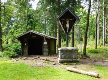
• Trail created by Naturpark Bayerischer Wald. Symbol: Auf blauem, rechteckigem Hintergrund mit weißem Rand eine weiße...
![Excursión A pie Arnbruck - L 6 Lam](https://media.geolcdn.com/t/350/260/ext.jpg?maxdim=2&url=https%3A%2F%2Fstatic1.geolcdn.com%2Fsiteimages%2Fupload%2Ffiles%2F1545311037marcheuse_200dpi.jpg)
![A pie A pie](https://static1.geolcdn.com/sitytour/trail-icons/100.png)
Km
A pie
![](/images/other/stat-length.png)
![](https://static1.geolcdn.com/siteimages/upload/files/1508320355ic_sort_den_pos_24dp.png)
![](https://static1.geolcdn.com/siteimages/upload/files/1508320355ic_sort_den_neg_24dp.png)
![](https://static1.geolcdn.com/siteimages/upload/files/16400158638029165_repeat_loop_refresh_sync_direction_icon.png)
• Trail created by Naturpark Oberer Bayerischer Wald. Symbol: Auf oben weißem / unten rotem, rechteckigem Hintergrund ...
2 excursiones mostradas en 2
Aplicación GPS de excursión GRATIS