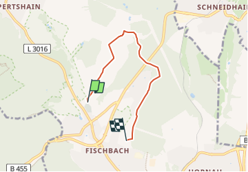
![](/images/other/stat-length.png)
![Excursión A pie Kelkheim - Rund um den Rettershof: Weg 2 - Photo](https://media.geolcdn.com/t/1900/400/736e4eee-d674-4ce3-82f4-648ebee3c386.jpeg&format=pjpeg&maxdim=2)
Rund um den Rettershof: Weg 2
SityTrail - itinéraires balisés pédestres
Tous les sentiers balisés d’Europe GUIDE+
![Longitud](/images/other/stat-length.png)
![Altitud máxima](https://static1.geolcdn.com/siteimages/upload/files/1508320355ic_sort_altitude_max_24dp.png)
![Desnivel positivo](https://static1.geolcdn.com/siteimages/upload/files/1508320355ic_sort_den_pos_24dp.png)
![Km-Effort](/images/other/stat-length.png)
![Altitud mínima](https://static1.geolcdn.com/siteimages/upload/files/1508320355ic_sort_altitude_min_24dp.png)
![Desnivel negativo](https://static1.geolcdn.com/siteimages/upload/files/1508320355ic_sort_den_neg_24dp.png)
![Boucle](https://static1.geolcdn.com/siteimages/upload/files/16400158638029165_repeat_loop_refresh_sync_direction_icon.png)
![A pie](https://static1.geolcdn.com/sitytour/trail-icons/100.png)
1h10
Dificultad : Fácil
![Escanee este código QR para abrir la excursión en la aplicación SityTrail](https://capi.geolives.com/qq0zvz2zws4bq2lad0pu/sitytour/trails/3097935/qr.png?size=200)
Aplicación GPS de excursión GRATIS
A propósito
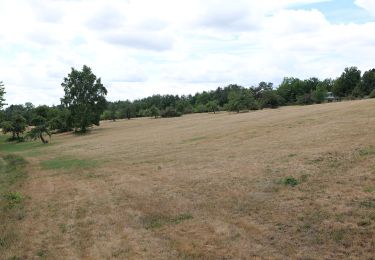
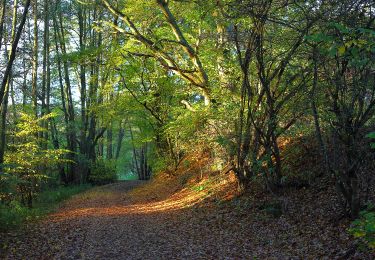
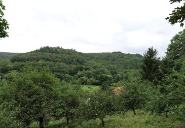
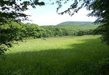
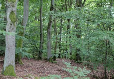
Ruta A pie de 4,1 km a descubrir en Hesse, Main-Taunus-Kreis, Kelkheim. Esta ruta ha sido propuesta por SityTrail - itinéraires balisés pédestres.
Descripción
Trail created by Taunusklub.
Symbol: Grüner Kreis, darin links ein rotes R, rechts eine rote 2 und mittig das Taunusclub-Symbol in grün, überschrieben mit Rundwanderweg. Unterhalb des Kreises der Text "Rund um den Rettershof"
Localización
Comentarios
Excursiones cerca
![Excursión A pie Eppstein - Bauwaldfels: Geweih - Photo](https://media.geolcdn.com/t/375/260/e819c04a-2838-4852-bdcd-c0c51534d926.jpeg&format=jpg&maxdim=2)
![A pie A pie](https://static1.geolcdn.com/sitytour/trail-icons/100.png)
A pie
![](/images/other/stat-length.png)
![](https://static1.geolcdn.com/siteimages/upload/files/16400158638029165_repeat_loop_refresh_sync_direction_icon.png)
![Excursión A pie Kelkheim - Silberbach: Forelle - Photo](https://media.geolcdn.com/t/375/260/4edbeddd-bfe5-4d3f-a307-ed38e1016ca2.jpeg&format=jpg&maxdim=2)
![A pie A pie](https://static1.geolcdn.com/sitytour/trail-icons/100.png)
A pie
![](/images/other/stat-length.png)
![](https://static1.geolcdn.com/siteimages/upload/files/16400158638029165_repeat_loop_refresh_sync_direction_icon.png)
![Excursión A pie Kelkheim - Landsgraben: Eichenblatt - Photo](https://media.geolcdn.com/t/375/260/968ac561-0174-405c-966b-bc7143b474c7.jpeg&format=jpg&maxdim=2)
![A pie A pie](https://static1.geolcdn.com/sitytour/trail-icons/100.png)
A pie
![](/images/other/stat-length.png)
![](https://static1.geolcdn.com/siteimages/upload/files/16400158638029165_repeat_loop_refresh_sync_direction_icon.png)
![Excursión A pie Kelkheim - Rund um den Rettershof: Weg 4 - Photo](https://media.geolcdn.com/t/375/260/88b3917f-76a9-4222-9853-139c56b0135a.jpeg&format=jpg&maxdim=2)
![A pie A pie](https://static1.geolcdn.com/sitytour/trail-icons/100.png)
A pie
![](/images/other/stat-length.png)
![](https://static1.geolcdn.com/siteimages/upload/files/16400158638029165_repeat_loop_refresh_sync_direction_icon.png)
![Excursión A pie Hofheim am Taunus - Rundwanderweg Reh - Photo](https://media.geolcdn.com/t/375/260/30d6e8fb-5c92-4904-a31a-f345e9c5e9dd.jpeg&format=jpg&maxdim=2)
![A pie A pie](https://static1.geolcdn.com/sitytour/trail-icons/100.png)
A pie
![](/images/other/stat-length.png)
![](https://static1.geolcdn.com/siteimages/upload/files/16400158638029165_repeat_loop_refresh_sync_direction_icon.png)
![Excursión A pie Hofheim am Taunus - Rundwanderweg Keiler - Photo](https://media.geolcdn.com/t/375/260/dff68d21-ed03-40e3-b311-aa561cf9a180.jpeg&format=jpg&maxdim=2)
![A pie A pie](https://static1.geolcdn.com/sitytour/trail-icons/100.png)
A pie
![](/images/other/stat-length.png)
![](https://static1.geolcdn.com/siteimages/upload/files/16400158638029165_repeat_loop_refresh_sync_direction_icon.png)
![Excursión A pie Kelkheim - Rund um den Rettershof: Weg 8 - Photo](https://media.geolcdn.com/t/375/260/99ceee7b-7b2a-40cc-a11c-86dac2d01c14.jpeg&format=jpg&maxdim=2)
![A pie A pie](https://static1.geolcdn.com/sitytour/trail-icons/100.png)
A pie
![](/images/other/stat-length.png)
![](https://static1.geolcdn.com/siteimages/upload/files/16400158638029165_repeat_loop_refresh_sync_direction_icon.png)
![Excursión A pie Kelkheim - Hollerbusch: Milan - Photo](https://media.geolcdn.com/t/375/260/d60e7ac4-a9eb-4204-8b05-640272e8ca0b.jpeg&format=jpg&maxdim=2)
![A pie A pie](https://static1.geolcdn.com/sitytour/trail-icons/100.png)
A pie
![](/images/other/stat-length.png)
![](https://static1.geolcdn.com/siteimages/upload/files/16400158638029165_repeat_loop_refresh_sync_direction_icon.png)
![Excursión A pie Kelkheim - Hollerbusch: Eule - Photo](https://media.geolcdn.com/t/375/260/9864c77a-1aaf-46fb-a9e8-f155dd3d614f.jpeg&format=jpg&maxdim=2)
![A pie A pie](https://static1.geolcdn.com/sitytour/trail-icons/100.png)
A pie
![](/images/other/stat-length.png)
![](https://static1.geolcdn.com/siteimages/upload/files/16400158638029165_repeat_loop_refresh_sync_direction_icon.png)