![](/images/other/stat-length.png)
- Excursiones
- Outdoor
- Germany
- Hesse
- Main-Taunus-Kreis
- Kelkheim
Kelkheim, Main-Taunus-Kreis: Los mejores itinerarios de excursión, recorridos, paseos y sendas
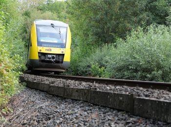
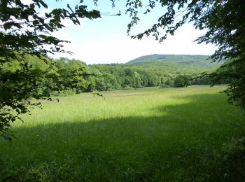
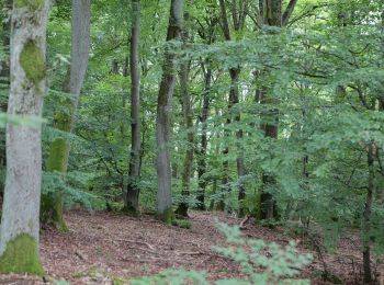
Kelkheim: Descubra las mejores excursiones: 8 a pie. Todos estos circuitos, recorridos, itinerarios y actividades al aire libre están disponibles en nuestras aplicaciones SityTrail para smartphone y tablet.
Los mejores recorridos (8)
![Excursión A pie Kelkheim - Silberbach: Forelle - Photo](https://media.geolcdn.com/t/350/260/4edbeddd-bfe5-4d3f-a307-ed38e1016ca2.jpeg&format=jpg&maxdim=2)
![A pie A pie](https://static1.geolcdn.com/sitytour/trail-icons/100.png)
Km
A pie
![](/images/other/stat-length.png)
![](https://static1.geolcdn.com/siteimages/upload/files/1508320355ic_sort_den_pos_24dp.png)
![](https://static1.geolcdn.com/siteimages/upload/files/1508320355ic_sort_den_neg_24dp.png)
![](https://static1.geolcdn.com/siteimages/upload/files/16400158638029165_repeat_loop_refresh_sync_direction_icon.png)
• Trail created by Naturpark Taunus. Symbol: Blaue Forelle auf weißem Grund
![Excursión A pie Kelkheim - Landsgraben: Eichenblatt - Photo](https://media.geolcdn.com/t/350/260/968ac561-0174-405c-966b-bc7143b474c7.jpeg&format=jpg&maxdim=2)
![A pie A pie](https://static1.geolcdn.com/sitytour/trail-icons/100.png)
Km
A pie
![](/images/other/stat-length.png)
![](https://static1.geolcdn.com/siteimages/upload/files/1508320355ic_sort_den_pos_24dp.png)
![](https://static1.geolcdn.com/siteimages/upload/files/1508320355ic_sort_den_neg_24dp.png)
![](https://static1.geolcdn.com/siteimages/upload/files/16400158638029165_repeat_loop_refresh_sync_direction_icon.png)
• Symbol: Grünes Eichblatt auf weißem Grund
![Excursión A pie Kelkheim - Rund um den Rettershof: Weg 4 - Photo](https://media.geolcdn.com/t/350/260/88b3917f-76a9-4222-9853-139c56b0135a.jpeg&format=jpg&maxdim=2)
![A pie A pie](https://static1.geolcdn.com/sitytour/trail-icons/100.png)
Km
A pie
![](/images/other/stat-length.png)
![](https://static1.geolcdn.com/siteimages/upload/files/1508320355ic_sort_den_pos_24dp.png)
![](https://static1.geolcdn.com/siteimages/upload/files/1508320355ic_sort_den_neg_24dp.png)
![](https://static1.geolcdn.com/siteimages/upload/files/16400158638029165_repeat_loop_refresh_sync_direction_icon.png)
• Trail created by Taunusklub. Symbol: Grüner Kreis, darin links ein rotes R, rechts eine rote 4 und mittig das Taunus...
![Excursión A pie Kelkheim - Rund um den Rettershof: Weg 2 - Photo](https://media.geolcdn.com/t/350/260/736e4eee-d674-4ce3-82f4-648ebee3c386.jpeg&format=jpg&maxdim=2)
![A pie A pie](https://static1.geolcdn.com/sitytour/trail-icons/100.png)
Km
A pie
![](/images/other/stat-length.png)
![](https://static1.geolcdn.com/siteimages/upload/files/1508320355ic_sort_den_pos_24dp.png)
![](https://static1.geolcdn.com/siteimages/upload/files/1508320355ic_sort_den_neg_24dp.png)
![](https://static1.geolcdn.com/siteimages/upload/files/16400158638029165_repeat_loop_refresh_sync_direction_icon.png)
• Trail created by Taunusklub. Symbol: Grüner Kreis, darin links ein rotes R, rechts eine rote 2 und mittig das Taunus...
![Excursión A pie Kelkheim - Rund um den Rettershof: Weg 8 - Photo](https://media.geolcdn.com/t/350/260/99ceee7b-7b2a-40cc-a11c-86dac2d01c14.jpeg&format=jpg&maxdim=2)
![A pie A pie](https://static1.geolcdn.com/sitytour/trail-icons/100.png)
Km
A pie
![](/images/other/stat-length.png)
![](https://static1.geolcdn.com/siteimages/upload/files/1508320355ic_sort_den_pos_24dp.png)
![](https://static1.geolcdn.com/siteimages/upload/files/1508320355ic_sort_den_neg_24dp.png)
![](https://static1.geolcdn.com/siteimages/upload/files/16400158638029165_repeat_loop_refresh_sync_direction_icon.png)
• Trail created by Taunusklub. Symbol: Grüner Kreis, darin links ein rotes R, rechts eine rote 8 und mittig das Taunus...
![Excursión A pie Kelkheim - Hollerbusch: Milan - Photo](https://media.geolcdn.com/t/350/260/d60e7ac4-a9eb-4204-8b05-640272e8ca0b.jpeg&format=jpg&maxdim=2)
![A pie A pie](https://static1.geolcdn.com/sitytour/trail-icons/100.png)
Km
A pie
![](/images/other/stat-length.png)
![](https://static1.geolcdn.com/siteimages/upload/files/1508320355ic_sort_den_pos_24dp.png)
![](https://static1.geolcdn.com/siteimages/upload/files/1508320355ic_sort_den_neg_24dp.png)
![](https://static1.geolcdn.com/siteimages/upload/files/16400158638029165_repeat_loop_refresh_sync_direction_icon.png)
• Trail created by Naturpark Taunus. Symbol: Roter Milan auf weißem Grund
![Excursión A pie Kelkheim - Hollerbusch: Eule - Photo](https://media.geolcdn.com/t/350/260/9864c77a-1aaf-46fb-a9e8-f155dd3d614f.jpeg&format=jpg&maxdim=2)
![A pie A pie](https://static1.geolcdn.com/sitytour/trail-icons/100.png)
Km
A pie
![](/images/other/stat-length.png)
![](https://static1.geolcdn.com/siteimages/upload/files/1508320355ic_sort_den_pos_24dp.png)
![](https://static1.geolcdn.com/siteimages/upload/files/1508320355ic_sort_den_neg_24dp.png)
![](https://static1.geolcdn.com/siteimages/upload/files/16400158638029165_repeat_loop_refresh_sync_direction_icon.png)
• Trail created by Naturpark Taunus. Symbol: Schwarze Eule auf weißem Grund
![Excursión A pie Kelkheim - Rund um den Rettershof: Weg 9 - Photo](https://media.geolcdn.com/t/350/260/d60e7ac4-a9eb-4204-8b05-640272e8ca0b.jpeg&format=jpg&maxdim=2)
![A pie A pie](https://static1.geolcdn.com/sitytour/trail-icons/100.png)
Km
A pie
![](/images/other/stat-length.png)
![](https://static1.geolcdn.com/siteimages/upload/files/1508320355ic_sort_den_pos_24dp.png)
![](https://static1.geolcdn.com/siteimages/upload/files/1508320355ic_sort_den_neg_24dp.png)
![](https://static1.geolcdn.com/siteimages/upload/files/16400158638029165_repeat_loop_refresh_sync_direction_icon.png)
• Trail created by Taunusklub. Symbol: Grüner Kreis, darin links ein rotes R, rechts eine rote 9 und mittig das Taunus...
8 excursiones mostradas en 8
Aplicación GPS de excursión GRATIS