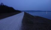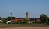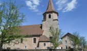

Rothsee Rundweg No.9
SityTrail - itinéraires balisés pédestres
Tous les sentiers balisés d’Europe GUIDE+

Longitud
14,2 km

Altitud máxima
404 m

Desnivel positivo
173 m

Km-Effort
16,5 km

Altitud mínima
352 m

Desnivel negativo
147 m
Boucle
No
Baliza
Fecha de creación :
2022-02-11 14:54:58.513
Última modificación :
2022-02-11 14:54:58.513
3h44
Dificultad : Fácil

Aplicación GPS de excursión GRATIS
A propósito
Ruta A pie de 14,2 km a descubrir en Baviera, Landkreis Roth, Roth. Esta ruta ha sido propuesta por SityTrail - itinéraires balisés pédestres.
Descripción
Trail created by Zweckverband Rothsee.
abgeschlossen (Nov. 2013 by cycling_zno)
Symbol: Weisse 9 auf blauem Grund
Localización
País:
Germany
Región :
Baviera
Departamento/provincia :
Landkreis Roth
Municipio :
Roth
Localidad:
Unknown
Salida:(Dec)
Salida:(UTM)
655969 ; 5453405 (32U) N.
Comentarios
Excursiones cerca
Die Rothsee-Tour


A pie
Medio
Allersberg,
Baviera,
Landkreis Roth,
Germany

23 km | 27 km-effort
6h 9min
Sí
Rothsee Rundweg No.11


A pie
Fácil
Hilpoltstein,
Baviera,
Landkreis Roth,
Germany

14 km | 16,5 km-effort
3h 44min
No

Rothsee Rundweg No.8


A pie
Fácil
Hilpoltstein,
Baviera,
Landkreis Roth,
Germany

9 km | 10,6 km-effort
2h 24min
No
Quellen am Rothsee


A pie
Fácil
Allersberg,
Baviera,
Landkreis Roth,
Germany

6,1 km | 7,3 km-effort
1h 39min
Sí

Rothsee Rundweg No.6


A pie
Fácil
Roth,
Baviera,
Landkreis Roth,
Germany

7,9 km | 8,9 km-effort
2h 1min
No

Rothsee Rundweg No.2


A pie
Fácil
Roth,
Baviera,
Landkreis Roth,
Germany

6,7 km | 7,7 km-effort
1h 44min
Sí
Wasserweg (Roth)


A pie
Fácil
Roth,
Baviera,
Landkreis Roth,
Germany

10,2 km | 12,5 km-effort
2h 50min
No
Mühlenweg (Roth)


A pie
Fácil
Hilpoltstein,
Baviera,
Landkreis Roth,
Germany

7,1 km | 8,2 km-effort
1h 51min
No

Rothsee Rundweg No.10


A pie
Fácil
Hilpoltstein,
Baviera,
Landkreis Roth,
Germany

3 km | 3,4 km-effort
46min
No


 SityTrail


