![](/images/other/stat-length.png)
![Excursión Esquí de fondo Hauteluce - Rocher des enclaves et montagne d'outray - Photo](https://media.geolcdn.com/t/1900/400/022bbe64-5535-472f-aeaf-83ac5e47988e.jpg&format=pjpeg&maxdim=2)
Rocher des enclaves et montagne d'outray
nadd73
Usuario GUIDE
![Longitud](/images/other/stat-length.png)
![Altitud máxima](https://static1.geolcdn.com/siteimages/upload/files/1508320355ic_sort_altitude_max_24dp.png)
![Desnivel positivo](https://static1.geolcdn.com/siteimages/upload/files/1508320355ic_sort_den_pos_24dp.png)
![Km-Effort](/images/other/stat-length.png)
![Altitud mínima](https://static1.geolcdn.com/siteimages/upload/files/1508320355ic_sort_altitude_min_24dp.png)
![Desnivel negativo](https://static1.geolcdn.com/siteimages/upload/files/1508320355ic_sort_den_neg_24dp.png)
![Boucle](https://static1.geolcdn.com/siteimages/upload/files/16400158638029165_repeat_loop_refresh_sync_direction_icon.png)
![Esquí de fondo](https://static1.geolcdn.com/sitytour/trail-icons/503.png)
6h04
Dificultad : Medio
![Escanee este código QR para abrir la excursión en la aplicación SityTrail](https://capi.geolives.com/qq0zvz2zws4bq2lad0pu/sitytour/trails/3050561/qr.png?size=200)
Aplicación GPS de excursión GRATIS
A propósito
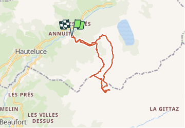
Ruta Esquí de fondo de 14 km a descubrir en Auvergne-Rhône-Alpes, Saboya, Hauteluce. Esta ruta ha sido propuesta por nadd73.
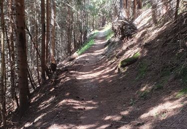
Descripción
Départ des Granges.
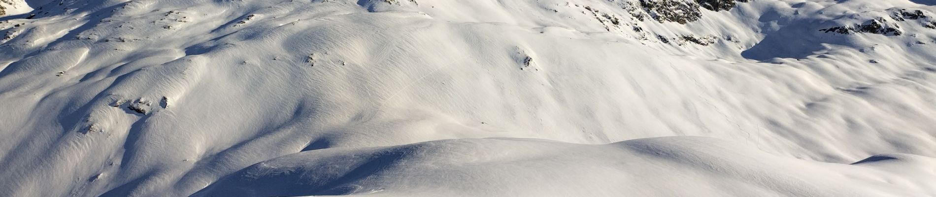
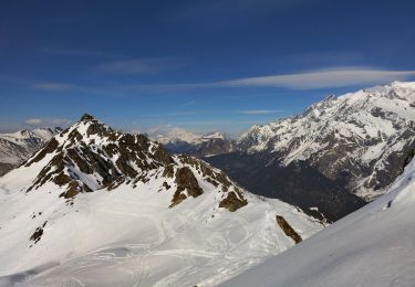
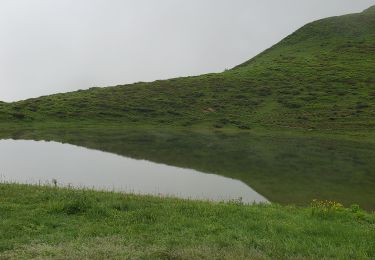
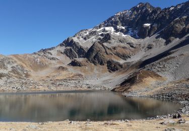
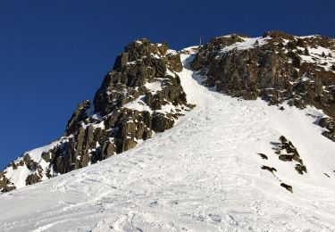
le Rocher des enclaves n'était pas tracé. je suis montée au dessus du col mais la neige et la pente m'ont fait renoncer. Après une descente je suis montée ailleurs, moins raide mais la neige était plaquée donc descente, montée à la montagne d'outray et une descente face Nord géniale, en poudre. Vers le ruisseau c'ést sanglier.
Localización
Comentarios
Excursiones cerca
![Excursión Esquí de fondo Hauteluce - Col de cicle en passant par un couloir et col de la fenêtre - Photo](https://media.geolcdn.com/t/375/260/acd15694-33bc-4a56-9530-736970ddd7df.jpg&format=jpg&maxdim=2)
![Esquí de fondo Esquí de fondo](https://static1.geolcdn.com/sitytour/trail-icons/503.png)
Esquí de fondo
![](/images/other/stat-length.png)
![](https://static1.geolcdn.com/siteimages/upload/files/16400158638029165_repeat_loop_refresh_sync_direction_icon.png)
![Excursión Senderismo Hauteluce - SityTrail - col de la fenêtre - Photo](https://media.geolcdn.com/t/375/260/dd46ff30-f5d6-4a8c-bd42-b5e111a120d9.jpg&format=jpg&maxdim=2)
![Senderismo Senderismo](https://static1.geolcdn.com/sitytour/trail-icons/101.png)
Senderismo
![](/images/other/stat-length.png)
![](https://static1.geolcdn.com/siteimages/upload/files/16400158638029165_repeat_loop_refresh_sync_direction_icon.png)
![Excursión Senderismo Hauteluce - Hauteluce - Photo](https://media.geolcdn.com/t/375/260/ext.jpg?maxdim=2&url=https%3A%2F%2Fstatic1.geolcdn.com%2Fsiteimages%2Fupload%2Ffiles%2F1553511878bg_sport_marche.png)
![Senderismo Senderismo](https://static1.geolcdn.com/sitytour/trail-icons/101.png)
Senderismo
![](/images/other/stat-length.png)
![](https://static1.geolcdn.com/siteimages/upload/files/16400158638029165_repeat_loop_refresh_sync_direction_icon.png)
![Excursión Senderismo Hauteluce - Mont Clocher - Photo](https://media.geolcdn.com/t/375/260/ext.jpg?maxdim=2&url=https%3A%2F%2Fservices.sitytrail.com%2FGeolivesWS%2FDownloadMedia.ashx%3FTrailID%3D85242%26Media%3D20110903163145.jpg)
![Senderismo Senderismo](https://static1.geolcdn.com/sitytour/trail-icons/101.png)
Senderismo
![](/images/other/stat-length.png)
![](https://static1.geolcdn.com/siteimages/upload/files/16400158638029165_repeat_loop_refresh_sync_direction_icon.png)
![Excursión Bici de montaña Hauteluce - tour lac girote - Photo](https://media.geolcdn.com/t/375/260/6e48c3b1-9cb3-4635-b4b3-d568e2c7b81a.jpg&format=jpg&maxdim=2)
![Bici de montaña Bici de montaña](https://static1.geolcdn.com/sitytour/trail-icons/202.png)
Bici de montaña
![](/images/other/stat-length.png)
![](https://static1.geolcdn.com/siteimages/upload/files/16400158638029165_repeat_loop_refresh_sync_direction_icon.png)
![Excursión Senderismo Hauteluce - lacs jovet col de joly 1015m 20kms - Photo](https://media.geolcdn.com/t/375/260/40e6ff73-9c33-483f-b0ca-4ba9aa46521a.jpg&format=jpg&maxdim=2)
![Senderismo Senderismo](https://static1.geolcdn.com/sitytour/trail-icons/101.png)
Senderismo
![](/images/other/stat-length.png)
![](https://static1.geolcdn.com/siteimages/upload/files/16400158638029165_repeat_loop_refresh_sync_direction_icon.png)
![Excursión Senderismo Hauteluce - val d arly mont clocher - Photo](https://media.geolcdn.com/t/375/260/ext.jpg?maxdim=2&url=https%3A%2F%2Fstatic1.geolcdn.com%2Fsiteimages%2Fupload%2Ffiles%2F1553511878bg_sport_marche.png)
![Senderismo Senderismo](https://static1.geolcdn.com/sitytour/trail-icons/101.png)
Senderismo
![](/images/other/stat-length.png)
![](https://static1.geolcdn.com/siteimages/upload/files/16400158638029165_repeat_loop_refresh_sync_direction_icon.png)
![Excursión Senderismo Les Contamines-Montjoie - lacs Jovet par le col de la fenêtre - Photo](https://media.geolcdn.com/t/375/260/8e44dfac-3537-47e6-94a9-1fab6c10e1cd.jpg&format=jpg&maxdim=2)
![Senderismo Senderismo](https://static1.geolcdn.com/sitytour/trail-icons/101.png)
Senderismo
![](/images/other/stat-length.png)
![](https://static1.geolcdn.com/siteimages/upload/files/16400158638029165_repeat_loop_refresh_sync_direction_icon.png)
![Excursión Esquí de fondo Beaufort - croix d'outray - Photo](https://media.geolcdn.com/t/375/260/704e301b-a3dc-463a-89b8-a42d7a428129.jpg&format=jpg&maxdim=2)
![Esquí de fondo Esquí de fondo](https://static1.geolcdn.com/sitytour/trail-icons/503.png)
Esquí de fondo
![](/images/other/stat-length.png)
![](https://static1.geolcdn.com/siteimages/upload/files/16400158638029165_repeat_loop_refresh_sync_direction_icon.png)