![](/images/other/stat-length.png)
![Excursión Senderismo Hauteluce - MONT JOLY - Photo](https://media.geolcdn.com/t/1900/400/10050260-9341-40aa-b30e-ae9f2adc0f91.jpg&format=pjpeg&maxdim=2)
MONT JOLY
djeepee74
Usuario
![Longitud](/images/other/stat-length.png)
![Altitud máxima](https://static1.geolcdn.com/siteimages/upload/files/1508320355ic_sort_altitude_max_24dp.png)
![Desnivel positivo](https://static1.geolcdn.com/siteimages/upload/files/1508320355ic_sort_den_pos_24dp.png)
![Km-Effort](/images/other/stat-length.png)
![Altitud mínima](https://static1.geolcdn.com/siteimages/upload/files/1508320355ic_sort_altitude_min_24dp.png)
![Desnivel negativo](https://static1.geolcdn.com/siteimages/upload/files/1508320355ic_sort_den_neg_24dp.png)
![Boucle](https://static1.geolcdn.com/siteimages/upload/files/16400158638029165_repeat_loop_refresh_sync_direction_icon.png)
![Senderismo](https://static1.geolcdn.com/sitytour/trail-icons/101.png)
5h15
Dificultad : Difícil
![Escanee este código QR para abrir la excursión en la aplicación SityTrail](https://capi.geolives.com/qq0zvz2zws4bq2lad0pu/sitytour/trails/2118889/qr.png?size=200)
Aplicación GPS de excursión GRATIS
A propósito
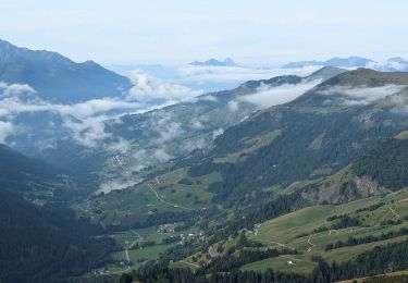
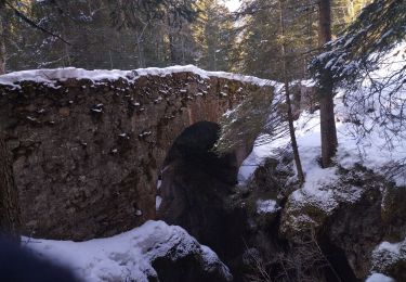
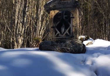
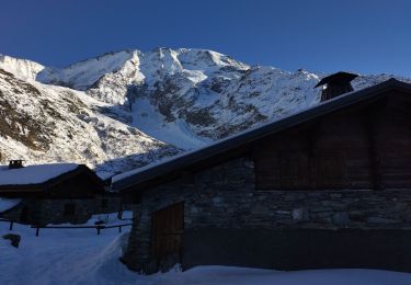
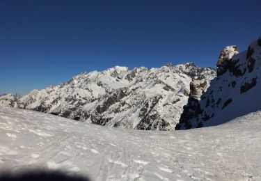
Ruta Senderismo de 14,9 km a descubrir en Auvergne-Rhône-Alpes, Saboya, Hauteluce. Esta ruta ha sido propuesta por djeepee74.
Descripción
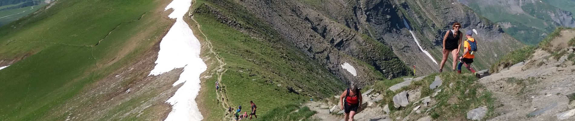
Pour le retour, à la descente, il est possible de ne pas suivre les crêtes jusqu'à l'Aiguille Croche"... mais de couper:
- Soit, juste avant la "Tête de la Combaz"... pour rejoindre le circuit de montée au niveau de la station inférieure du "Télésiège du Monument"... avec comme conséquence, un circuit de descente rallongé de 2 Km et pour un dénivelé positif augmenté de 100 mètres.
- Soit, en fin de descente de la "Tête de la Combaz" (à la cote 2354) ... pour rejoindre le circuit de montée au niveau de la station supérieure du "Télésiège des Tierces"... Attention: Eviter d'emprunter ce dernier itinéraire par temps humide car le sentier est truffé d'éboulis jusqu'à "Les Rebans"... par contre, votre circuit de descente s'en trouvera raccourci d'un kilomètre, tout en diminuant le dénivelé positif de 70 mètres !
Localización
Comentarios
Excursiones cerca
![Excursión Senderismo Les Contamines-Montjoie - suuntoapp-Hiking-2024-09-11T06-11-40Z - Photo](https://media.geolcdn.com/t/375/260/3bd03f88-8d5f-4a59-aa8b-ba38887cd8e5.jpg&format=jpg&maxdim=2)
![Senderismo Senderismo](https://static1.geolcdn.com/sitytour/trail-icons/101.png)
Senderismo
![](/images/other/stat-length.png)
![](https://static1.geolcdn.com/siteimages/upload/files/16400158638029165_repeat_loop_refresh_sync_direction_icon.png)
![Excursión Senderismo Megève - ENW24 Parcours Noir Rouge et Bleu - Photo](https://media.geolcdn.com/t/375/260/ext.jpg?maxdim=2&url=https%3A%2F%2Fstatic1.geolcdn.com%2Fsiteimages%2Fupload%2Ffiles%2F1553511878bg_sport_marche.png)
![Senderismo Senderismo](https://static1.geolcdn.com/sitytour/trail-icons/101.png)
Senderismo
![](/images/other/stat-length.png)
![](https://static1.geolcdn.com/siteimages/upload/files/16400158638029165_repeat_loop_refresh_sync_direction_icon.png)
![Excursión Esquí de fondo Hauteluce - Col de cicle en passant par un couloir et col de la fenêtre - Photo](https://media.geolcdn.com/t/375/260/acd15694-33bc-4a56-9530-736970ddd7df.jpg&format=jpg&maxdim=2)
![Esquí de fondo Esquí de fondo](https://static1.geolcdn.com/sitytour/trail-icons/503.png)
Esquí de fondo
![](/images/other/stat-length.png)
![](https://static1.geolcdn.com/siteimages/upload/files/16400158638029165_repeat_loop_refresh_sync_direction_icon.png)
![Excursión Esquí de fondo Les Contamines-Montjoie - tricotage vers la pointe de Chaborgne - Photo](https://media.geolcdn.com/t/375/260/dc2f0b79-ec9b-4a8c-8239-b2a04beff144.jpg&format=jpg&maxdim=2)
![Esquí de fondo Esquí de fondo](https://static1.geolcdn.com/sitytour/trail-icons/503.png)
Esquí de fondo
![](/images/other/stat-length.png)
![](https://static1.geolcdn.com/siteimages/upload/files/16400158638029165_repeat_loop_refresh_sync_direction_icon.png)
![Excursión Esquí de fondo Les Contamines-Montjoie - Pointe Nord du Mont Jovet - Photo](https://media.geolcdn.com/t/375/260/9d6d2299-8e56-40c0-8b26-0c7c6be83540.jpg&format=jpg&maxdim=2)
![Esquí de fondo Esquí de fondo](https://static1.geolcdn.com/sitytour/trail-icons/503.png)
Esquí de fondo
![](/images/other/stat-length.png)
![](https://static1.geolcdn.com/siteimages/upload/files/16400158638029165_repeat_loop_refresh_sync_direction_icon.png)
![Excursión Esquí de fondo Les Contamines-Montjoie - Le Monthieu - Photo](https://media.geolcdn.com/t/375/260/2801a48f-dd22-4fd5-9977-e949a424db1c.jpg&format=jpg&maxdim=2)
![Esquí de fondo Esquí de fondo](https://static1.geolcdn.com/sitytour/trail-icons/503.png)
Esquí de fondo
![](/images/other/stat-length.png)
![](https://static1.geolcdn.com/siteimages/upload/files/16400158638029165_repeat_loop_refresh_sync_direction_icon.png)
![Excursión Esquí de fondo Les Contamines-Montjoie - Couloir de la chèvre - Photo](https://media.geolcdn.com/t/375/260/7b0e2a8c-f557-4c8d-9a94-00ce575299e1.jpg&format=jpg&maxdim=2)
![Esquí de fondo Esquí de fondo](https://static1.geolcdn.com/sitytour/trail-icons/503.png)
Esquí de fondo
![](/images/other/stat-length.png)
![](https://static1.geolcdn.com/siteimages/upload/files/16400158638029165_repeat_loop_refresh_sync_direction_icon.png)
![Excursión Esquí de fondo Les Contamines-Montjoie - col de la Cigle - Photo](https://media.geolcdn.com/t/375/260/b5d2bc8c-14f8-4ce4-89cd-ce0c81c6c5a2.jpg&format=jpg&maxdim=2)
![Esquí de fondo Esquí de fondo](https://static1.geolcdn.com/sitytour/trail-icons/503.png)
Esquí de fondo
![](/images/other/stat-length.png)
![](https://static1.geolcdn.com/siteimages/upload/files/16400158638029165_repeat_loop_refresh_sync_direction_icon.png)
![Excursión Esquí de fondo Hauteluce - Rocher des enclaves et montagne d'outray - Photo](https://media.geolcdn.com/t/375/260/022bbe64-5535-472f-aeaf-83ac5e47988e.jpg&format=jpg&maxdim=2)
![Esquí de fondo Esquí de fondo](https://static1.geolcdn.com/sitytour/trail-icons/503.png)
Esquí de fondo
![](/images/other/stat-length.png)
![](https://static1.geolcdn.com/siteimages/upload/files/16400158638029165_repeat_loop_refresh_sync_direction_icon.png)