


8,2 km | 11,8 km-effort

Usuario


Aplicación GPS de excursión GRATIS
 SityTrail
IGN / Institutos geográficos
SityTrail World
El mundo es suyo
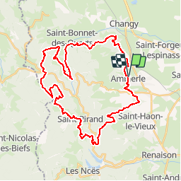
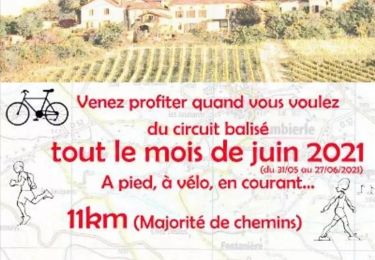
Ruta Bici de montaña de 41 km a descubrir en Auvergne-Rhône-Alpes, Loira, Ambierle. Esta ruta ha sido propuesta por tracegps.
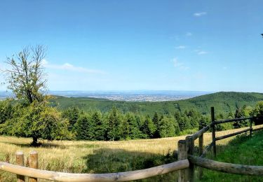
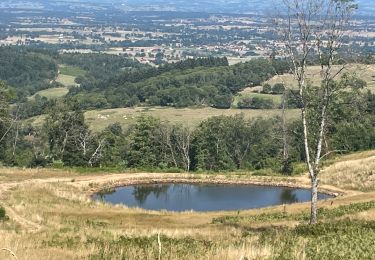
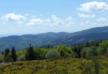
Parking et départ de la petite place entre la poste et la pharmacie. Cette boucle dans le Massif des Monts de la Madeleine est un pure merveille... mais elle se mérite ! En effet ce parcours, très sportif, est réservé aux pratiquants réguliers et endurants car il se montre assez technique et usant physiquement car il y a très peu de répit. Il est rythmé par de belles ascensions et de magnifiques descentes tout en évoluant sur des sentiers forestiers où le calme règne. Traversée de bourgs et hameaux isolés dans la montagne et sur les hauteurs les points de vue sont remarquables. Topoguides : Randonnée en Côte Roannaise (Balisage Blanc et Vert avec le petit Saint-Vincent) ; Pays de la Pacaudière (Balisage Blanc et Jaune avec une feuille de chêne).


Senderismo
Senderismo
Senderismo
Senderismo
Senderismo
Carrera
Senderismo

Senderismo

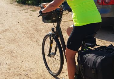
Bici de montaña