![](/images/other/stat-length.png)
- Excursiones
- Outdoor
- Germany
- Hesse
- Rheingau-Taunus-Kreis
Rheingau-Taunus-Kreis, Hesse: Los mejores itinerarios de excursión, recorridos, paseos y sendas
Rheingau-Taunus-Kreis: Descubra las mejores excursiones: 116 a pie. Todos estos circuitos, recorridos, itinerarios y actividades al aire libre están disponibles en nuestras aplicaciones SityTrail para smartphone y tablet.
Los mejores recorridos (118)
![Excursión A pie Heidenrod - Dickschieder Wildwechsel - Photo](https://media.geolcdn.com/t/350/260/1317a9d5-9d72-4b1c-b97f-77cebb4d5d55.jpeg&format=jpg&maxdim=2)
![A pie A pie](https://static1.geolcdn.com/sitytour/trail-icons/100.png)
Km
A pie
![](/images/other/stat-length.png)
![](https://static1.geolcdn.com/siteimages/upload/files/1508320355ic_sort_den_pos_24dp.png)
![](https://static1.geolcdn.com/siteimages/upload/files/1508320355ic_sort_den_neg_24dp.png)
![](https://static1.geolcdn.com/siteimages/upload/files/16400158638029165_repeat_loop_refresh_sync_direction_icon.png)
• Trail created by Wisper-Trails.
![Excursión A pie Geisenheim - Himmelssteig Stephanshausen - Photo](https://media.geolcdn.com/t/350/260/9223db67-e7da-4277-bf63-0b96616ead54.jpeg&format=jpg&maxdim=2)
![A pie A pie](https://static1.geolcdn.com/sitytour/trail-icons/100.png)
Km
A pie
![](/images/other/stat-length.png)
![](https://static1.geolcdn.com/siteimages/upload/files/1508320355ic_sort_den_pos_24dp.png)
![](https://static1.geolcdn.com/siteimages/upload/files/1508320355ic_sort_den_neg_24dp.png)
![](https://static1.geolcdn.com/siteimages/upload/files/16400158638029165_repeat_loop_refresh_sync_direction_icon.png)
• Trail created by Gemeinde Stephanshausen.
![Excursión A pie Heidenrod - Naurother Grubengold - Photo](https://media.geolcdn.com/t/350/260/ec400498-09c2-4027-a72a-02659a5d515d.jpeg&format=jpg&maxdim=2)
![A pie A pie](https://static1.geolcdn.com/sitytour/trail-icons/100.png)
Km
A pie
![](/images/other/stat-length.png)
![](https://static1.geolcdn.com/siteimages/upload/files/1508320355ic_sort_den_pos_24dp.png)
![](https://static1.geolcdn.com/siteimages/upload/files/1508320355ic_sort_den_neg_24dp.png)
![](https://static1.geolcdn.com/siteimages/upload/files/16400158638029165_repeat_loop_refresh_sync_direction_icon.png)
• Trail created by Wisper-Trails.
![Excursión A pie Lorch - Ranseler Höhenrausch - Photo](https://media.geolcdn.com/t/350/260/f828ac28-bdce-45ca-beb8-08b395de0ada.jpeg&format=jpg&maxdim=2)
![A pie A pie](https://static1.geolcdn.com/sitytour/trail-icons/100.png)
Km
A pie
![](/images/other/stat-length.png)
![](https://static1.geolcdn.com/siteimages/upload/files/1508320355ic_sort_den_pos_24dp.png)
![](https://static1.geolcdn.com/siteimages/upload/files/1508320355ic_sort_den_neg_24dp.png)
![](https://static1.geolcdn.com/siteimages/upload/files/16400158638029165_repeat_loop_refresh_sync_direction_icon.png)
• Symbol: Weißer Bachlauf in W-Form auf blauem Grund
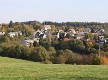
![Excursión A pie Lorch - Wispertaler Krönchen - Photo](https://media.geolcdn.com/t/350/260/a9438b40-625e-4c49-8e8d-e41177db7513.jpeg&format=jpg&maxdim=2)
![A pie A pie](https://static1.geolcdn.com/sitytour/trail-icons/100.png)
Km
A pie
![](/images/other/stat-length.png)
![](https://static1.geolcdn.com/siteimages/upload/files/1508320355ic_sort_den_pos_24dp.png)
![](https://static1.geolcdn.com/siteimages/upload/files/1508320355ic_sort_den_neg_24dp.png)
![](https://static1.geolcdn.com/siteimages/upload/files/16400158638029165_repeat_loop_refresh_sync_direction_icon.png)
• Symbol: Weißer Bachlauf in W-Form auf lila Grund
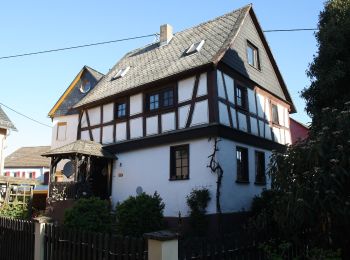
![Excursión A pie Rüdesheim am Rhein - Wisper-Trail: Via Monte Preso - Photo](https://media.geolcdn.com/t/350/260/8262b745-249b-4ce6-b227-7c3160ccff7d.jpeg&format=jpg&maxdim=2)
![A pie A pie](https://static1.geolcdn.com/sitytour/trail-icons/100.png)
Km
A pie
![](/images/other/stat-length.png)
![](https://static1.geolcdn.com/siteimages/upload/files/1508320355ic_sort_den_pos_24dp.png)
![](https://static1.geolcdn.com/siteimages/upload/files/1508320355ic_sort_den_neg_24dp.png)
![](https://static1.geolcdn.com/siteimages/upload/files/16400158638029165_repeat_loop_refresh_sync_direction_icon.png)
• Trail created by Gemeinde Heidenrod. Symbol: Geschwungenes weißes W auf blauem Grund mit weißem Rahmen. In weiß über...
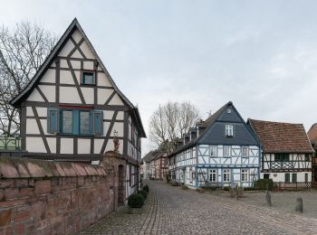
![Excursión A pie Eltville am Rhein - Gutenbergweg - Photo](https://media.geolcdn.com/t/350/260/cd0c3ee6-7087-46a1-8c63-f960173d82e9.jpeg&format=jpg&maxdim=2)
![A pie A pie](https://static1.geolcdn.com/sitytour/trail-icons/100.png)
Km
A pie
![](/images/other/stat-length.png)
![](https://static1.geolcdn.com/siteimages/upload/files/1508320355ic_sort_den_pos_24dp.png)
![](https://static1.geolcdn.com/siteimages/upload/files/1508320355ic_sort_den_neg_24dp.png)
![](https://static1.geolcdn.com/siteimages/upload/files/16400158638029165_repeat_loop_refresh_sync_direction_icon.png)
• Trail created by Stadt Eltville. Symbol: Grünes, aufgeschlagenes Buch mit großem, weißen G auf der linken Seite, sch...
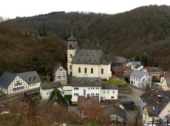
![Excursión A pie Schlangenbad - Glaabacher Almauftrieb - Photo](https://media.geolcdn.com/t/350/260/049417cf-441f-4e72-9098-4b7831623d7a.jpeg&format=jpg&maxdim=2)
![A pie A pie](https://static1.geolcdn.com/sitytour/trail-icons/100.png)
Km
A pie
![](/images/other/stat-length.png)
![](https://static1.geolcdn.com/siteimages/upload/files/1508320355ic_sort_den_pos_24dp.png)
![](https://static1.geolcdn.com/siteimages/upload/files/1508320355ic_sort_den_neg_24dp.png)
![](https://static1.geolcdn.com/siteimages/upload/files/16400158638029165_repeat_loop_refresh_sync_direction_icon.png)
• Trail created by Wisper-Trails.
![Excursión A pie Lorch - In Vino Veritas - Photo](https://media.geolcdn.com/t/350/260/2ec29448-62c5-4cec-a4db-d5879cbe80de.jpeg&format=jpg&maxdim=2)
![A pie A pie](https://static1.geolcdn.com/sitytour/trail-icons/100.png)
Km
A pie
![](/images/other/stat-length.png)
![](https://static1.geolcdn.com/siteimages/upload/files/1508320355ic_sort_den_pos_24dp.png)
![](https://static1.geolcdn.com/siteimages/upload/files/1508320355ic_sort_den_neg_24dp.png)
![](https://static1.geolcdn.com/siteimages/upload/files/16400158638029165_repeat_loop_refresh_sync_direction_icon.png)
• Trail created by Wisper-Trails.
![Excursión A pie Bad Schwalbach - Schwälbchen's Flug - Photo](https://media.geolcdn.com/t/350/260/af2a96e4-3837-4938-99ba-d57b1d943191.jpeg&format=jpg&maxdim=2)
![A pie A pie](https://static1.geolcdn.com/sitytour/trail-icons/100.png)
Km
A pie
![](/images/other/stat-length.png)
![](https://static1.geolcdn.com/siteimages/upload/files/1508320355ic_sort_den_pos_24dp.png)
![](https://static1.geolcdn.com/siteimages/upload/files/1508320355ic_sort_den_neg_24dp.png)
![](https://static1.geolcdn.com/siteimages/upload/files/16400158638029165_repeat_loop_refresh_sync_direction_icon.png)
• Trail created by Wisper-Trails.
![Excursión A pie Lorch - Rhein-Wisper-Glück - Photo](https://media.geolcdn.com/t/350/260/2682c977-9daa-49b1-a7db-33c065b1c3c8.jpeg&format=jpg&maxdim=2)
![A pie A pie](https://static1.geolcdn.com/sitytour/trail-icons/100.png)
Km
A pie
![](/images/other/stat-length.png)
![](https://static1.geolcdn.com/siteimages/upload/files/1508320355ic_sort_den_pos_24dp.png)
![](https://static1.geolcdn.com/siteimages/upload/files/1508320355ic_sort_den_neg_24dp.png)
![](https://static1.geolcdn.com/siteimages/upload/files/16400158638029165_repeat_loop_refresh_sync_direction_icon.png)
• Trail created by Wisper-Trails.
![Excursión A pie Niedernhausen - Apfelwein- & Obstwiesenroute - Photo](https://media.geolcdn.com/t/350/260/87dc28d5-eff7-4607-8859-08f5f63fa20a.jpeg&format=jpg&maxdim=2)
![A pie A pie](https://static1.geolcdn.com/sitytour/trail-icons/100.png)
Km
A pie
![](/images/other/stat-length.png)
![](https://static1.geolcdn.com/siteimages/upload/files/1508320355ic_sort_den_pos_24dp.png)
![](https://static1.geolcdn.com/siteimages/upload/files/1508320355ic_sort_den_neg_24dp.png)
![](https://static1.geolcdn.com/siteimages/upload/files/16400158638029165_repeat_loop_refresh_sync_direction_icon.png)
• Symbol: https://upload.wikimedia.org/wikipedia/commons/9/90/ApfelweinWiesen.jpg
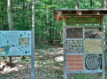
![Excursión A pie Niedernhausen - Waldinfo-Pfad - Photo](https://media.geolcdn.com/t/350/260/aabdab6a-1c6c-469f-b931-7870c4b794bd.jpeg&format=jpg&maxdim=2)
![A pie A pie](https://static1.geolcdn.com/sitytour/trail-icons/100.png)
Km
A pie
![](/images/other/stat-length.png)
![](https://static1.geolcdn.com/siteimages/upload/files/1508320355ic_sort_den_pos_24dp.png)
![](https://static1.geolcdn.com/siteimages/upload/files/1508320355ic_sort_den_neg_24dp.png)
![](https://static1.geolcdn.com/siteimages/upload/files/16400158638029165_repeat_loop_refresh_sync_direction_icon.png)
• Trail created by Naturpark Rhein-Taunus.
![Excursión A pie Idstein - Altehag: Fuchs - Photo](https://media.geolcdn.com/t/350/260/0a31c529-6444-4718-a0da-b80c185f3451.jpeg&format=jpg&maxdim=2)
![A pie A pie](https://static1.geolcdn.com/sitytour/trail-icons/100.png)
Km
A pie
![](/images/other/stat-length.png)
![](https://static1.geolcdn.com/siteimages/upload/files/1508320355ic_sort_den_pos_24dp.png)
![](https://static1.geolcdn.com/siteimages/upload/files/1508320355ic_sort_den_neg_24dp.png)
![](https://static1.geolcdn.com/siteimages/upload/files/16400158638029165_repeat_loop_refresh_sync_direction_icon.png)
• Trail created by Naturpark Rhein-Taunus.
![Excursión A pie Niedernhausen - Gusbacher Strandweg - Photo](https://media.geolcdn.com/t/350/260/d1e75f9a-a19f-4ee6-9b66-06eae109953e.jpeg&format=jpg&maxdim=2)
![A pie A pie](https://static1.geolcdn.com/sitytour/trail-icons/100.png)
Km
A pie
![](/images/other/stat-length.png)
![](https://static1.geolcdn.com/siteimages/upload/files/1508320355ic_sort_den_pos_24dp.png)
![](https://static1.geolcdn.com/siteimages/upload/files/1508320355ic_sort_den_neg_24dp.png)
![](https://static1.geolcdn.com/siteimages/upload/files/16400158638029165_repeat_loop_refresh_sync_direction_icon.png)
• Trail created by DE Oberjosbach. Symbol: https://upload.wikimedia.org/wikipedia/commons/3/34/Wegsymbol-Strandweg.jpg
![Excursión A pie Geisenheim - Geisenheimer Rundweg O - Photo](https://media.geolcdn.com/t/350/260/23caf65e-d1b0-432b-8cb1-95d45052c5b3.jpeg&format=jpg&maxdim=2)
![A pie A pie](https://static1.geolcdn.com/sitytour/trail-icons/100.png)
Km
A pie
![](/images/other/stat-length.png)
![](https://static1.geolcdn.com/siteimages/upload/files/1508320355ic_sort_den_pos_24dp.png)
![](https://static1.geolcdn.com/siteimages/upload/files/1508320355ic_sort_den_neg_24dp.png)
![](https://static1.geolcdn.com/siteimages/upload/files/16400158638029165_repeat_loop_refresh_sync_direction_icon.png)
• Trail created by Stadt Geisenheim. Symbol: Weißes Schild, oben in schwarz stilisierte Kirche hinter Baum und Rebe, d...
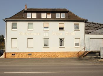
![Excursión A pie Geisenheim - Geisenheimer Rundweg M - Photo](https://media.geolcdn.com/t/350/260/0aad0740-e5ea-4eab-b9e4-1dc6f9e6e635.jpeg&format=jpg&maxdim=2)
![A pie A pie](https://static1.geolcdn.com/sitytour/trail-icons/100.png)
Km
A pie
![](/images/other/stat-length.png)
![](https://static1.geolcdn.com/siteimages/upload/files/1508320355ic_sort_den_pos_24dp.png)
![](https://static1.geolcdn.com/siteimages/upload/files/1508320355ic_sort_den_neg_24dp.png)
![](https://static1.geolcdn.com/siteimages/upload/files/16400158638029165_repeat_loop_refresh_sync_direction_icon.png)
• Trail created by Stadt Geisenheim. Symbol: Weißes Schild, oben in schwarz stilisierte Kirche hinter Baum und Rebe, d...
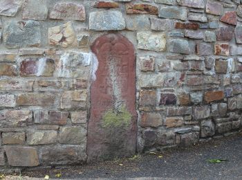
![Excursión A pie Geisenheim - Geisenheimer Rundweg I - Photo](https://media.geolcdn.com/t/350/260/a7b95e33-3a2b-44fc-8c9b-988116704fbb.jpeg&format=jpg&maxdim=2)
![A pie A pie](https://static1.geolcdn.com/sitytour/trail-icons/100.png)
Km
A pie
![](/images/other/stat-length.png)
![](https://static1.geolcdn.com/siteimages/upload/files/1508320355ic_sort_den_pos_24dp.png)
![](https://static1.geolcdn.com/siteimages/upload/files/1508320355ic_sort_den_neg_24dp.png)
![](https://static1.geolcdn.com/siteimages/upload/files/16400158638029165_repeat_loop_refresh_sync_direction_icon.png)
• Trail created by Stadt Geisenheim. Symbol: Weißes Schild, oben in schwarz stilisierte Kirche hinter Baum und Rebe, d...
![Excursión A pie Geisenheim - Geisenheimer Rundweg J - Photo](https://media.geolcdn.com/t/350/260/e4502c24-35a9-4c74-a651-9299cfecf071.jpeg&format=jpg&maxdim=2)
![A pie A pie](https://static1.geolcdn.com/sitytour/trail-icons/100.png)
Km
A pie
![](/images/other/stat-length.png)
![](https://static1.geolcdn.com/siteimages/upload/files/1508320355ic_sort_den_pos_24dp.png)
![](https://static1.geolcdn.com/siteimages/upload/files/1508320355ic_sort_den_neg_24dp.png)
![](https://static1.geolcdn.com/siteimages/upload/files/16400158638029165_repeat_loop_refresh_sync_direction_icon.png)
• Trail created by Stadt Geisenheim. Symbol: Weißes Schild, oben in schwarz stilisierte Kirche hinter Baum und Rebe, d...
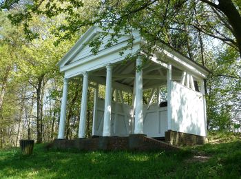
![Excursión A pie Bad Schwalbach - Nordic Walking Park 8 - Photo](https://media.geolcdn.com/t/350/260/64306b33-320a-4266-807e-3a311c77b146.jpeg&format=jpg&maxdim=2)
![A pie A pie](https://static1.geolcdn.com/sitytour/trail-icons/100.png)
Km
A pie
![](/images/other/stat-length.png)
![](https://static1.geolcdn.com/siteimages/upload/files/1508320355ic_sort_den_pos_24dp.png)
![](https://static1.geolcdn.com/siteimages/upload/files/1508320355ic_sort_den_neg_24dp.png)
![](https://static1.geolcdn.com/siteimages/upload/files/16400158638029165_repeat_loop_refresh_sync_direction_icon.png)
• Trail created by Stadt Bad Schwalbach. Symbol: NW8
20 excursiones mostradas en 118
Aplicación GPS de excursión GRATIS