![](/images/other/stat-length.png)
- Excursiones
- Outdoor
- Germany
- Baviera
- Landkreis Regen
Landkreis Regen, Baviera: Los mejores itinerarios de excursión, recorridos, paseos y sendas
Landkreis Regen: Descubra las mejores excursiones: 101 a pie y 1 en bici o bici de montaña. Todos estos circuitos, recorridos, itinerarios y actividades al aire libre están disponibles en nuestras aplicaciones SityTrail para smartphone y tablet.
Los mejores recorridos (102)
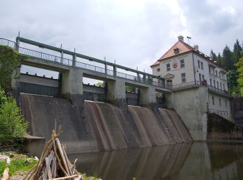
![Excursión A pie Bodenmais - 1 Bodenmais - Arber - Photo](https://media.geolcdn.com/t/350/260/e8c0da97-bdb2-480e-8b74-6125e1ab8c63.jpeg&format=jpg&maxdim=2)
![A pie A pie](https://static1.geolcdn.com/sitytour/trail-icons/100.png)
Km
A pie
![](/images/other/stat-length.png)
![](https://static1.geolcdn.com/siteimages/upload/files/1508320355ic_sort_den_pos_24dp.png)
![](https://static1.geolcdn.com/siteimages/upload/files/1508320355ic_sort_den_neg_24dp.png)
![](https://static1.geolcdn.com/siteimages/upload/files/16400158638029165_repeat_loop_refresh_sync_direction_icon.png)
• Trail created by Naturpark. Symbol: Weiße Wegnummer auf einem quadratischen, grünen Hintergrund mit weißem Rand
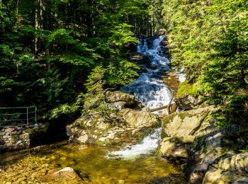
![Excursión A pie Bodenmais - 10 Bodenmais - Silberberg - Photo](https://media.geolcdn.com/t/350/260/c2442cba-fd82-4e24-b66a-3f45de73b779.jpeg&format=jpg&maxdim=2)
![A pie A pie](https://static1.geolcdn.com/sitytour/trail-icons/100.png)
Km
A pie
![](/images/other/stat-length.png)
![](https://static1.geolcdn.com/siteimages/upload/files/1508320355ic_sort_den_pos_24dp.png)
![](https://static1.geolcdn.com/siteimages/upload/files/1508320355ic_sort_den_neg_24dp.png)
![](https://static1.geolcdn.com/siteimages/upload/files/16400158638029165_repeat_loop_refresh_sync_direction_icon.png)
• Symbol: Weiße 10 auf rotem Kreis
![Excursión A pie Teisnach - Teisnach Nr. 9 Haselbergrundweg - Photo](https://media.geolcdn.com/t/350/260/bac36942-70c2-456f-b990-095f987d26cc.jpeg&format=jpg&maxdim=2)
![A pie A pie](https://static1.geolcdn.com/sitytour/trail-icons/100.png)
Km
A pie
![](/images/other/stat-length.png)
![](https://static1.geolcdn.com/siteimages/upload/files/1508320355ic_sort_den_pos_24dp.png)
![](https://static1.geolcdn.com/siteimages/upload/files/1508320355ic_sort_den_neg_24dp.png)
![](https://static1.geolcdn.com/siteimages/upload/files/16400158638029165_repeat_loop_refresh_sync_direction_icon.png)
• Trail created by Markt Teisnach. Symbol: weiße 9 auf rotem Kreis
![Excursión A pie Teisnach - DE-7 - Photo](https://media.geolcdn.com/t/350/260/7bd64374-60b0-453b-b0c8-7d0473801bc2.jpeg&format=jpg&maxdim=2)
![A pie A pie](https://static1.geolcdn.com/sitytour/trail-icons/100.png)
Km
A pie
![](/images/other/stat-length.png)
![](https://static1.geolcdn.com/siteimages/upload/files/1508320355ic_sort_den_pos_24dp.png)
![](https://static1.geolcdn.com/siteimages/upload/files/1508320355ic_sort_den_neg_24dp.png)
![](https://static1.geolcdn.com/siteimages/upload/files/16400158638029165_repeat_loop_refresh_sync_direction_icon.png)
• Trail created by Markt Teisnach. Symbol: weiße 7 auf rotem Kreis
![Excursión A pie Teisnach - Teisnach Nr. 15 Schleusenweg - Photo](https://media.geolcdn.com/t/350/260/bac36942-70c2-456f-b990-095f987d26cc.jpeg&format=jpg&maxdim=2)
![A pie A pie](https://static1.geolcdn.com/sitytour/trail-icons/100.png)
Km
A pie
![](/images/other/stat-length.png)
![](https://static1.geolcdn.com/siteimages/upload/files/1508320355ic_sort_den_pos_24dp.png)
![](https://static1.geolcdn.com/siteimages/upload/files/1508320355ic_sort_den_neg_24dp.png)
![](https://static1.geolcdn.com/siteimages/upload/files/16400158638029165_repeat_loop_refresh_sync_direction_icon.png)
• Trail created by Markt Teisnach. Symbol: weiße 15 auf rotem Kreis
![Excursión A pie Zwiesel - Schachtenbachrunde (Hennenkobel) 29 - Photo](https://media.geolcdn.com/t/350/260/e029c3c7-7273-4610-acb8-dfc4265c11d1.jpeg&format=jpg&maxdim=2)
![A pie A pie](https://static1.geolcdn.com/sitytour/trail-icons/100.png)
Km
A pie
![](/images/other/stat-length.png)
![](https://static1.geolcdn.com/siteimages/upload/files/1508320355ic_sort_den_pos_24dp.png)
![](https://static1.geolcdn.com/siteimages/upload/files/1508320355ic_sort_den_neg_24dp.png)
![](https://static1.geolcdn.com/siteimages/upload/files/16400158638029165_repeat_loop_refresh_sync_direction_icon.png)
• Trail created by Touristinfo Zwiesel. not yet complete! Noch nicht komplett!
![Excursión A pie Zwiesel - Leitenwaldrunde (23) - Photo](https://media.geolcdn.com/t/350/260/b86dd131-24aa-4779-b0f7-8eb2fad537f0.jpeg&format=jpg&maxdim=2)
![A pie A pie](https://static1.geolcdn.com/sitytour/trail-icons/100.png)
Km
A pie
![](/images/other/stat-length.png)
![](https://static1.geolcdn.com/siteimages/upload/files/1508320355ic_sort_den_pos_24dp.png)
![](https://static1.geolcdn.com/siteimages/upload/files/1508320355ic_sort_den_neg_24dp.png)
![](https://static1.geolcdn.com/siteimages/upload/files/16400158638029165_repeat_loop_refresh_sync_direction_icon.png)
• Trail created by Touristinfo Zwiesel. not yet complete! Noch nicht komplett!
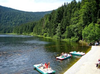
![Excursión A pie Bayerisch Eisenstein - 9 Bodenmais - Arbersee - Photo](https://media.geolcdn.com/t/350/260/f56e1f52-8d0e-4417-b0a5-1422cf04f446.jpeg&format=jpg&maxdim=2)
![A pie A pie](https://static1.geolcdn.com/sitytour/trail-icons/100.png)
Km
A pie
![](/images/other/stat-length.png)
![](https://static1.geolcdn.com/siteimages/upload/files/1508320355ic_sort_den_pos_24dp.png)
![](https://static1.geolcdn.com/siteimages/upload/files/1508320355ic_sort_den_neg_24dp.png)
![](https://static1.geolcdn.com/siteimages/upload/files/16400158638029165_repeat_loop_refresh_sync_direction_icon.png)
• Symbol: Weißer Text 9 auf grünem Grund
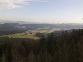
![Excursión A pie Bischofsmais - Bischofsmais Nr. 3 - Photo](https://media.geolcdn.com/t/350/260/a467a78b-e594-43cb-8c7b-0e2fd35f6809.jpeg&format=jpg&maxdim=2)
![A pie A pie](https://static1.geolcdn.com/sitytour/trail-icons/100.png)
Km
A pie
![](/images/other/stat-length.png)
![](https://static1.geolcdn.com/siteimages/upload/files/1508320355ic_sort_den_pos_24dp.png)
![](https://static1.geolcdn.com/siteimages/upload/files/1508320355ic_sort_den_neg_24dp.png)
![](https://static1.geolcdn.com/siteimages/upload/files/16400158638029165_repeat_loop_refresh_sync_direction_icon.png)
• Trail created by Gemeinde Bischofsmais. Symbol: weiße 3 auf rotem Kreis
![Excursión A pie Regen - Bischofsmais Nr. 9 - Photo](https://media.geolcdn.com/t/350/260/a467a78b-e594-43cb-8c7b-0e2fd35f6809.jpeg&format=jpg&maxdim=2)
![A pie A pie](https://static1.geolcdn.com/sitytour/trail-icons/100.png)
Km
A pie
![](/images/other/stat-length.png)
![](https://static1.geolcdn.com/siteimages/upload/files/1508320355ic_sort_den_pos_24dp.png)
![](https://static1.geolcdn.com/siteimages/upload/files/1508320355ic_sort_den_neg_24dp.png)
![](https://static1.geolcdn.com/siteimages/upload/files/16400158638029165_repeat_loop_refresh_sync_direction_icon.png)
• Trail created by Gemeinde Bischofsmais. Symbol: weißer Text 9 auf grünem Rechteck
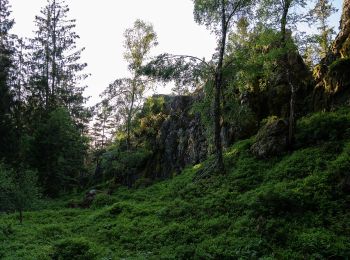
![Excursión A pie Bischofsmais - Bischofsmais Nr. 7 - Photo](https://media.geolcdn.com/t/350/260/a7ac251a-95fe-4841-a66c-becc1e8f2c5a.jpeg&format=jpg&maxdim=2)
![A pie A pie](https://static1.geolcdn.com/sitytour/trail-icons/100.png)
Km
A pie
![](/images/other/stat-length.png)
![](https://static1.geolcdn.com/siteimages/upload/files/1508320355ic_sort_den_pos_24dp.png)
![](https://static1.geolcdn.com/siteimages/upload/files/1508320355ic_sort_den_neg_24dp.png)
![](https://static1.geolcdn.com/siteimages/upload/files/16400158638029165_repeat_loop_refresh_sync_direction_icon.png)
• Trail created by Gemeinde Bischofsmais. Symbol: weißer Text 7 auf grünem Rechteck
![Excursión A pie Bischofsmais - Bischofsmais Nr. 6 - Photo](https://media.geolcdn.com/t/350/260/a467a78b-e594-43cb-8c7b-0e2fd35f6809.jpeg&format=jpg&maxdim=2)
![A pie A pie](https://static1.geolcdn.com/sitytour/trail-icons/100.png)
Km
A pie
![](/images/other/stat-length.png)
![](https://static1.geolcdn.com/siteimages/upload/files/1508320355ic_sort_den_pos_24dp.png)
![](https://static1.geolcdn.com/siteimages/upload/files/1508320355ic_sort_den_neg_24dp.png)
![](https://static1.geolcdn.com/siteimages/upload/files/16400158638029165_repeat_loop_refresh_sync_direction_icon.png)
• Trail created by Gemeinde Bischofsmais. Symbol: weißer Text 6 auf grünem Rechteck
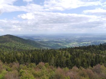
![Excursión A pie Achslach - Ferienregion Hirschenstein Rundwanderweg Nr. 4 - Photo](https://media.geolcdn.com/t/350/260/8d1a4ca6-bedb-4629-8e48-f8c38c0536e6.jpeg&format=jpg&maxdim=2)
![A pie A pie](https://static1.geolcdn.com/sitytour/trail-icons/100.png)
Km
A pie
![](/images/other/stat-length.png)
![](https://static1.geolcdn.com/siteimages/upload/files/1508320355ic_sort_den_pos_24dp.png)
![](https://static1.geolcdn.com/siteimages/upload/files/1508320355ic_sort_den_neg_24dp.png)
![](https://static1.geolcdn.com/siteimages/upload/files/16400158638029165_repeat_loop_refresh_sync_direction_icon.png)
• Symbol: Weisse 4 auf rotem Kreis
![Excursión A pie Viechtach - Viechtach, Rundweg Nr. 1 - Photo](https://media.geolcdn.com/t/350/260/83d3863e-0e60-4080-9f1d-a62dedb12bba.jpeg&format=jpg&maxdim=2)
![A pie A pie](https://static1.geolcdn.com/sitytour/trail-icons/100.png)
Km
A pie
![](/images/other/stat-length.png)
![](https://static1.geolcdn.com/siteimages/upload/files/1508320355ic_sort_den_pos_24dp.png)
![](https://static1.geolcdn.com/siteimages/upload/files/1508320355ic_sort_den_neg_24dp.png)
![](https://static1.geolcdn.com/siteimages/upload/files/16400158638029165_repeat_loop_refresh_sync_direction_icon.png)
• Trail created by Tourismusverband Viechtach. Symbol: Roter Punkt mit weißer Eins
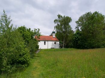
![Excursión A pie Viechtach - Viechtach, Rundweg Nr. 5 - Photo](https://media.geolcdn.com/t/350/260/84f57bdc-53e9-4ec0-a320-a30ff2b786c3.jpeg&format=jpg&maxdim=2)
![A pie A pie](https://static1.geolcdn.com/sitytour/trail-icons/100.png)
Km
A pie
![](/images/other/stat-length.png)
![](https://static1.geolcdn.com/siteimages/upload/files/1508320355ic_sort_den_pos_24dp.png)
![](https://static1.geolcdn.com/siteimages/upload/files/1508320355ic_sort_den_neg_24dp.png)
![](https://static1.geolcdn.com/siteimages/upload/files/16400158638029165_repeat_loop_refresh_sync_direction_icon.png)
• Trail created by Tourismusverband Viechtach. Symbol: Roter Punkt mit weißer Fünf
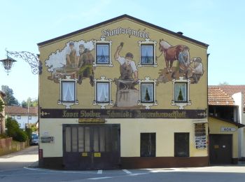
![Excursión A pie Viechtach - Viechtach, Rundweg Nr. 3 - Photo](https://media.geolcdn.com/t/350/260/1f5341d9-e9de-4a29-a3ca-fec50ca53a90.jpeg&format=jpg&maxdim=2)
![A pie A pie](https://static1.geolcdn.com/sitytour/trail-icons/100.png)
Km
A pie
![](/images/other/stat-length.png)
![](https://static1.geolcdn.com/siteimages/upload/files/1508320355ic_sort_den_pos_24dp.png)
![](https://static1.geolcdn.com/siteimages/upload/files/1508320355ic_sort_den_neg_24dp.png)
![](https://static1.geolcdn.com/siteimages/upload/files/16400158638029165_repeat_loop_refresh_sync_direction_icon.png)
• Trail created by Tourismusverband Viechtach. Symbol: Roter Punkt mit weißer Drei
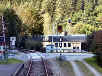
![Excursión A pie Geiersthal - Viechtach, Zielwanderweg 3 nach Gumpenried - Photo](https://media.geolcdn.com/t/350/260/4415a8ca-f550-4d93-bef8-c43ccc189119.jpeg&format=jpg&maxdim=2)
![A pie A pie](https://static1.geolcdn.com/sitytour/trail-icons/100.png)
Km
A pie
![](/images/other/stat-length.png)
![](https://static1.geolcdn.com/siteimages/upload/files/1508320355ic_sort_den_pos_24dp.png)
![](https://static1.geolcdn.com/siteimages/upload/files/1508320355ic_sort_den_neg_24dp.png)
![](https://static1.geolcdn.com/siteimages/upload/files/16400158638029165_repeat_loop_refresh_sync_direction_icon.png)
• Trail created by Tourismusverband Viechtach. Symbol: Blaues Rechteck mit weißer 3
![Excursión A pie Viechtach - Viechtach, Rundweg Nr. 13 - Photo](https://media.geolcdn.com/t/350/260/84f57bdc-53e9-4ec0-a320-a30ff2b786c3.jpeg&format=jpg&maxdim=2)
![A pie A pie](https://static1.geolcdn.com/sitytour/trail-icons/100.png)
Km
A pie
![](/images/other/stat-length.png)
![](https://static1.geolcdn.com/siteimages/upload/files/1508320355ic_sort_den_pos_24dp.png)
![](https://static1.geolcdn.com/siteimages/upload/files/1508320355ic_sort_den_neg_24dp.png)
![](https://static1.geolcdn.com/siteimages/upload/files/16400158638029165_repeat_loop_refresh_sync_direction_icon.png)
• Trail created by Tourismusverband Viechtach. Symbol: Roter Punkt mit weißer Dreizehn
![Excursión A pie Viechtach - Viechtach Rundweg Nr. 4 - Photo](https://media.geolcdn.com/t/350/260/531992dd-21e9-4e41-87bc-64d812b9e811.jpeg&format=jpg&maxdim=2)
![A pie A pie](https://static1.geolcdn.com/sitytour/trail-icons/100.png)
Km
A pie
![](/images/other/stat-length.png)
![](https://static1.geolcdn.com/siteimages/upload/files/1508320355ic_sort_den_pos_24dp.png)
![](https://static1.geolcdn.com/siteimages/upload/files/1508320355ic_sort_den_neg_24dp.png)
![](https://static1.geolcdn.com/siteimages/upload/files/16400158638029165_repeat_loop_refresh_sync_direction_icon.png)
• Trail created by Tourismusverband Viechtach. Symbol: Roter Punkt mit weißer Vier
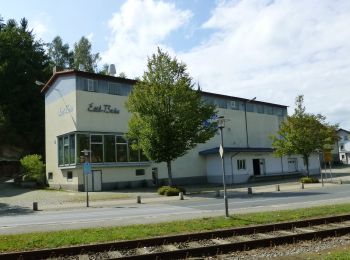
![Excursión A pie Geiersthal - Rundwanderweg Nr. 4 durch die Gemeinde Geiersthal - Photo](https://media.geolcdn.com/t/350/260/a500e00a-b7ac-4747-a48b-be7209c92562.jpeg&format=jpg&maxdim=2)
![A pie A pie](https://static1.geolcdn.com/sitytour/trail-icons/100.png)
Km
A pie
![](/images/other/stat-length.png)
![](https://static1.geolcdn.com/siteimages/upload/files/1508320355ic_sort_den_pos_24dp.png)
![](https://static1.geolcdn.com/siteimages/upload/files/1508320355ic_sort_den_neg_24dp.png)
![](https://static1.geolcdn.com/siteimages/upload/files/16400158638029165_repeat_loop_refresh_sync_direction_icon.png)
• Trail created by Gemeinde Geiersthal. Symbol: weiße 4 auf rotem Kreis
20 excursiones mostradas en 102
Aplicación GPS de excursión GRATIS