![](/images/other/stat-length.png)
- Excursiones
- Varios
- France
- Provenza-Alpes-Costa Azul
- Alpes de Alta Provenza
Alpes de Alta Provenza, Provenza-Alpes-Costa Azul, Varios: Los mejores itinerarios de excursión, recorridos, paseos y sendas
Alpes de Alta Provenza: Descubra las mejores excursiones: 1 patinaje, 8 vía ferrata y 7 escalada. Todos estos circuitos, recorridos, itinerarios y actividades al aire libre están disponibles en nuestras aplicaciones SityTrail para smartphone y tablet.
Los mejores recorridos (186)
![Excursión Otra actividad Les Mées - MEES Penitents. San Peyre. Panneaux Volcanique. Saint Antoine - Photo](https://media.geolcdn.com/t/350/260/ext.jpg?maxdim=2&url=https%3A%2F%2Fstatic1.geolcdn.com%2Fsiteimages%2Fupload%2Ffiles%2F1545311037marcheuse_200dpi.jpg)
![Otra actividad Otra actividad](https://static1.geolcdn.com/sitytour/trail-icons/900.png)
Km
Otra actividad
![](/images/other/stat-length.png)
![](https://static1.geolcdn.com/siteimages/upload/files/1508320355ic_sort_den_pos_24dp.png)
![](https://static1.geolcdn.com/siteimages/upload/files/1508320355ic_sort_den_neg_24dp.png)
![](https://static1.geolcdn.com/siteimages/upload/files/16400158638029165_repeat_loop_refresh_sync_direction_icon.png)
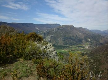
• Belle randonnée panneaux à longueur de vue .Descente un peu raide 5 heures de marche à refaire 300 mns 16 kms 500...
![Excursión Otra actividad Saint-Paul-sur-Ubaye - massour - Photo](https://media.geolcdn.com/t/350/260/ext.jpg?maxdim=2&url=https%3A%2F%2Fstatic1.geolcdn.com%2Fsiteimages%2Fupload%2Ffiles%2F1545311037marcheuse_200dpi.jpg)
![Otra actividad Otra actividad](https://static1.geolcdn.com/sitytour/trail-icons/900.png)
Km
Otra actividad
![](/images/other/stat-length.png)
![](https://static1.geolcdn.com/siteimages/upload/files/1508320355ic_sort_den_pos_24dp.png)
![](https://static1.geolcdn.com/siteimages/upload/files/1508320355ic_sort_den_neg_24dp.png)
![](https://static1.geolcdn.com/siteimages/upload/files/16400158638029165_repeat_loop_refresh_sync_direction_icon.png)
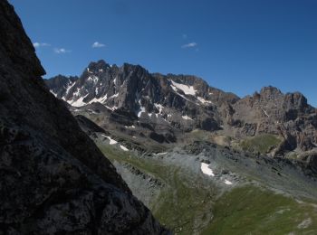
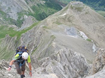
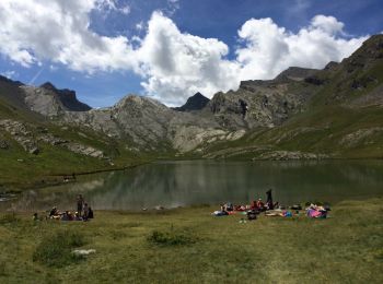
• Jeudi 15 sommet du massour avec bivouac
![Excursión Otra actividad La Garde - Crête du Teillon depuis La Garde - Photo](https://media.geolcdn.com/t/350/260/ext.jpg?maxdim=2&url=https%3A%2F%2Fstatic1.geolcdn.com%2Fsiteimages%2Fupload%2Ffiles%2F1545311037marcheuse_200dpi.jpg)
![Otra actividad Otra actividad](https://static1.geolcdn.com/sitytour/trail-icons/900.png)
Km
Otra actividad
![](/images/other/stat-length.png)
![](https://static1.geolcdn.com/siteimages/upload/files/1508320355ic_sort_den_pos_24dp.png)
![](https://static1.geolcdn.com/siteimages/upload/files/1508320355ic_sort_den_neg_24dp.png)
![](https://static1.geolcdn.com/siteimages/upload/files/16400158638029165_repeat_loop_refresh_sync_direction_icon.png)
![Excursión Otra actividad La Palud-sur-Verdon - circuit de la route des crètes - Photo](https://media.geolcdn.com/t/350/260/ext.jpg?maxdim=2&url=https%3A%2F%2Fservices.sitytrail.com%2FGeolivesWS%2FDownloadMedia.ashx%3FTrailID%3D954631%26Media%3D20180430123529.jpg)
![Otra actividad Otra actividad](https://static1.geolcdn.com/sitytour/trail-icons/900.png)
Km
Otra actividad
![](/images/other/stat-length.png)
![](https://static1.geolcdn.com/siteimages/upload/files/1508320355ic_sort_den_pos_24dp.png)
![](https://static1.geolcdn.com/siteimages/upload/files/1508320355ic_sort_den_neg_24dp.png)
![](https://static1.geolcdn.com/siteimages/upload/files/16400158638029165_repeat_loop_refresh_sync_direction_icon.png)
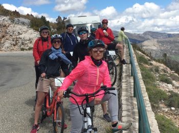
• Avec Verdon E-bike... 22 kms de BONHEUR !!!
![Excursión Otra actividad Gréoux-les-Bains - greoux 3 - Photo](https://media.geolcdn.com/t/350/260/ext.jpg?maxdim=2&url=https%3A%2F%2Fservices.sitytrail.com%2FGeolivesWS%2FDownloadMedia.ashx%3FTrailID%3D871104%26Media%3D20170803095120.jpg)
![Otra actividad Otra actividad](https://static1.geolcdn.com/sitytour/trail-icons/900.png)
Km
Otra actividad
![](/images/other/stat-length.png)
![](https://static1.geolcdn.com/siteimages/upload/files/1508320355ic_sort_den_pos_24dp.png)
![](https://static1.geolcdn.com/siteimages/upload/files/1508320355ic_sort_den_neg_24dp.png)
![](https://static1.geolcdn.com/siteimages/upload/files/16400158638029165_repeat_loop_refresh_sync_direction_icon.png)
• 3/8/2017
![Excursión Otra actividad Jausiers - La Chalanette - Photo](https://media.geolcdn.com/t/350/260/ext.jpg?maxdim=2&url=https%3A%2F%2Fservices.sitytrail.com%2FGeolivesWS%2FDownloadMedia.ashx%3FTrailID%3D786612%26Media%3Dfix__20170709112641.jpg)
![Otra actividad Otra actividad](https://static1.geolcdn.com/sitytour/trail-icons/900.png)
Km
Otra actividad
![](/images/other/stat-length.png)
![](https://static1.geolcdn.com/siteimages/upload/files/1508320355ic_sort_den_pos_24dp.png)
![](https://static1.geolcdn.com/siteimages/upload/files/1508320355ic_sort_den_neg_24dp.png)
![](https://static1.geolcdn.com/siteimages/upload/files/16400158638029165_repeat_loop_refresh_sync_direction_icon.png)
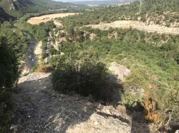
• tour du torrent et cascade
![Excursión Otra actividad Esparron-de-Verdon - Gorges du Verdon - Partie basse - Photo](https://media.geolcdn.com/t/350/260/ext.jpg?maxdim=2&url=https%3A%2F%2Fstatic1.geolcdn.com%2Fsiteimages%2Fupload%2Ffiles%2F1545311037marcheuse_200dpi.jpg)
![Otra actividad Otra actividad](https://static1.geolcdn.com/sitytour/trail-icons/900.png)
Km
Otra actividad
![](/images/other/stat-length.png)
![](https://static1.geolcdn.com/siteimages/upload/files/1508320355ic_sort_den_pos_24dp.png)
![](https://static1.geolcdn.com/siteimages/upload/files/1508320355ic_sort_den_neg_24dp.png)
![](https://static1.geolcdn.com/siteimages/upload/files/16400158638029165_repeat_loop_refresh_sync_direction_icon.png)
![Excursión Otra actividad Val-d'Oronaye - Ski Tête de Vauclave - Photo](https://media.geolcdn.com/t/350/260/ext.jpg?maxdim=2&url=https%3A%2F%2Fstatic1.geolcdn.com%2Fsiteimages%2Fupload%2Ffiles%2F1545311037marcheuse_200dpi.jpg)
![Otra actividad Otra actividad](https://static1.geolcdn.com/sitytour/trail-icons/900.png)
Km
Otra actividad
![](/images/other/stat-length.png)
![](https://static1.geolcdn.com/siteimages/upload/files/1508320355ic_sort_den_pos_24dp.png)
![](https://static1.geolcdn.com/siteimages/upload/files/1508320355ic_sort_den_neg_24dp.png)
![](https://static1.geolcdn.com/siteimages/upload/files/16400158638029165_repeat_loop_refresh_sync_direction_icon.png)
![Excursión Otra actividad Vergons - vergons par col de l iscle - Photo](https://media.geolcdn.com/t/350/260/ext.jpg?maxdim=2&url=https%3A%2F%2Fstatic1.geolcdn.com%2Fsiteimages%2Fupload%2Ffiles%2F1545311037marcheuse_200dpi.jpg)
![Otra actividad Otra actividad](https://static1.geolcdn.com/sitytour/trail-icons/900.png)
Km
Otra actividad
![](/images/other/stat-length.png)
![](https://static1.geolcdn.com/siteimages/upload/files/1508320355ic_sort_den_pos_24dp.png)
![](https://static1.geolcdn.com/siteimages/upload/files/1508320355ic_sort_den_neg_24dp.png)
![](https://static1.geolcdn.com/siteimages/upload/files/16400158638029165_repeat_loop_refresh_sync_direction_icon.png)
![Escalada Escalada](https://static1.geolcdn.com/sitytour/trail-icons/907.png)
Km
Escalada
![](/images/other/stat-length.png)
![](https://static1.geolcdn.com/siteimages/upload/files/1508320355ic_sort_den_pos_24dp.png)
![](https://static1.geolcdn.com/siteimages/upload/files/1508320355ic_sort_den_neg_24dp.png)
![](https://static1.geolcdn.com/siteimages/upload/files/16400158638029165_repeat_loop_refresh_sync_direction_icon.png)
![Excursión Otra actividad Moustiers-Sainte-Marie - chemin de la chaîne à Moustier - Photo](https://media.geolcdn.com/t/350/260/ext.jpg?maxdim=2&url=https%3A%2F%2Fservices.sitytrail.com%2FGeolivesWS%2FDownloadMedia.ashx%3FTrailID%3D770247%26Media%3D20170610120958.jpg)
![Otra actividad Otra actividad](https://static1.geolcdn.com/sitytour/trail-icons/900.png)
Km
Otra actividad
![](/images/other/stat-length.png)
![](https://static1.geolcdn.com/siteimages/upload/files/1508320355ic_sort_den_pos_24dp.png)
![](https://static1.geolcdn.com/siteimages/upload/files/1508320355ic_sort_den_neg_24dp.png)
![](https://static1.geolcdn.com/siteimages/upload/files/16400158638029165_repeat_loop_refresh_sync_direction_icon.png)
![Excursión Otra actividad Simiane-la-Rotonde - 29 09 Simiame Cereste - Photo](https://media.geolcdn.com/t/350/260/ext.jpg?maxdim=2&url=https%3A%2F%2Fservices.sitytrail.com%2FGeolivesWS%2FDownloadMedia.ashx%3FTrailID%3D639412%26Media%3Dfix__20160929150409.jpg)
![Otra actividad Otra actividad](https://static1.geolcdn.com/sitytour/trail-icons/900.png)
Km
Otra actividad
![](/images/other/stat-length.png)
![](https://static1.geolcdn.com/siteimages/upload/files/1508320355ic_sort_den_pos_24dp.png)
![](https://static1.geolcdn.com/siteimages/upload/files/1508320355ic_sort_den_neg_24dp.png)
![](https://static1.geolcdn.com/siteimages/upload/files/16400158638029165_repeat_loop_refresh_sync_direction_icon.png)
![Excursión Otra actividad Céreste - 30 09 Cereste Manosque - Photo](https://media.geolcdn.com/t/350/260/ext.jpg?maxdim=2&url=https%3A%2F%2Fservices.sitytrail.com%2FGeolivesWS%2FDownloadMedia.ashx%3FTrailID%3D639411%26Media%3Dfix__20160930142802.jpg)
![Otra actividad Otra actividad](https://static1.geolcdn.com/sitytour/trail-icons/900.png)
Km
Otra actividad
![](/images/other/stat-length.png)
![](https://static1.geolcdn.com/siteimages/upload/files/1508320355ic_sort_den_pos_24dp.png)
![](https://static1.geolcdn.com/siteimages/upload/files/1508320355ic_sort_den_neg_24dp.png)
![](https://static1.geolcdn.com/siteimages/upload/files/16400158638029165_repeat_loop_refresh_sync_direction_icon.png)
![Excursión Otra actividad Peipin - peipin - Photo](https://media.geolcdn.com/t/350/260/ext.jpg?maxdim=2&url=https%3A%2F%2Fservices.sitytrail.com%2FGeolivesWS%2FDownloadMedia.ashx%3FTrailID%3D552656%26Media%3Dfix__20160412101920.jpg)
![Otra actividad Otra actividad](https://static1.geolcdn.com/sitytour/trail-icons/900.png)
Km
Otra actividad
![](/images/other/stat-length.png)
![](https://static1.geolcdn.com/siteimages/upload/files/1508320355ic_sort_den_pos_24dp.png)
![](https://static1.geolcdn.com/siteimages/upload/files/1508320355ic_sort_den_neg_24dp.png)
![](https://static1.geolcdn.com/siteimages/upload/files/16400158638029165_repeat_loop_refresh_sync_direction_icon.png)
![Excursión Otra actividad Val-d'Oronaye - Lac du Lauzanier - Photo](https://media.geolcdn.com/t/350/260/ext.jpg?maxdim=2&url=https%3A%2F%2Fservices.sitytrail.com%2FGeolivesWS%2FDownloadMedia.ashx%3FTrailID%3D338480%26Media%3D20140807121611.jpg)
![Otra actividad Otra actividad](https://static1.geolcdn.com/sitytour/trail-icons/900.png)
Km
Otra actividad
![](/images/other/stat-length.png)
![](https://static1.geolcdn.com/siteimages/upload/files/1508320355ic_sort_den_pos_24dp.png)
![](https://static1.geolcdn.com/siteimages/upload/files/1508320355ic_sort_den_neg_24dp.png)
![](https://static1.geolcdn.com/siteimages/upload/files/16400158638029165_repeat_loop_refresh_sync_direction_icon.png)
![Excursión Otra actividad Val-d'Oronaye - Lac De Ruburent - Photo](https://media.geolcdn.com/t/350/260/ext.jpg?maxdim=2&url=https%3A%2F%2Fservices.sitytrail.com%2FGeolivesWS%2FDownloadMedia.ashx%3FTrailID%3D338479%26Media%3D20140817141720.jpg)
![Otra actividad Otra actividad](https://static1.geolcdn.com/sitytour/trail-icons/900.png)
Km
Otra actividad
![](/images/other/stat-length.png)
![](https://static1.geolcdn.com/siteimages/upload/files/1508320355ic_sort_den_pos_24dp.png)
![](https://static1.geolcdn.com/siteimages/upload/files/1508320355ic_sort_den_neg_24dp.png)
![](https://static1.geolcdn.com/siteimages/upload/files/16400158638029165_repeat_loop_refresh_sync_direction_icon.png)
![Excursión Otra actividad Uvernet-Fours - Col de la Moutiere - Photo](https://media.geolcdn.com/t/350/260/ext.jpg?maxdim=2&url=https%3A%2F%2Fservices.sitytrail.com%2FGeolivesWS%2FDownloadMedia.ashx%3FTrailID%3D338478%26Media%3D20140808151815.jpg)
![Otra actividad Otra actividad](https://static1.geolcdn.com/sitytour/trail-icons/900.png)
Km
Otra actividad
![](/images/other/stat-length.png)
![](https://static1.geolcdn.com/siteimages/upload/files/1508320355ic_sort_den_pos_24dp.png)
![](https://static1.geolcdn.com/siteimages/upload/files/1508320355ic_sort_den_neg_24dp.png)
![](https://static1.geolcdn.com/siteimages/upload/files/16400158638029165_repeat_loop_refresh_sync_direction_icon.png)
![Excursión Otra actividad Uvernet-Fours - Le Tour de la Pierre Éclatée - Photo](https://media.geolcdn.com/t/350/260/ext.jpg?maxdim=2&url=https%3A%2F%2Fservices.sitytrail.com%2FGeolivesWS%2FDownloadMedia.ashx%3FTrailID%3D338477%26Media%3D20140821143426.jpg)
![Otra actividad Otra actividad](https://static1.geolcdn.com/sitytour/trail-icons/900.png)
Km
Otra actividad
![](/images/other/stat-length.png)
![](https://static1.geolcdn.com/siteimages/upload/files/1508320355ic_sort_den_pos_24dp.png)
![](https://static1.geolcdn.com/siteimages/upload/files/1508320355ic_sort_den_neg_24dp.png)
![](https://static1.geolcdn.com/siteimages/upload/files/16400158638029165_repeat_loop_refresh_sync_direction_icon.png)
![Excursión Escalada Val-d'Oronaye - polygone#02 - Photo](https://media.geolcdn.com/t/350/260/ext.jpg?maxdim=2&url=https%3A%2F%2Fstatic1.geolcdn.com%2Fsiteimages%2Fupload%2Ffiles%2F1545311037marcheuse_200dpi.jpg)
![Escalada Escalada](https://static1.geolcdn.com/sitytour/trail-icons/907.png)
Km
Escalada
![](/images/other/stat-length.png)
![](https://static1.geolcdn.com/siteimages/upload/files/1508320355ic_sort_den_pos_24dp.png)
![](https://static1.geolcdn.com/siteimages/upload/files/1508320355ic_sort_den_neg_24dp.png)
![](https://static1.geolcdn.com/siteimages/upload/files/16400158638029165_repeat_loop_refresh_sync_direction_icon.png)
20 excursiones mostradas en 186
Aplicación GPS de excursión GRATIS
Actividades
Regiones próximas
- Aiglun
- Allemagne-en-Provence
- Allons
- Allos
- Angles
- Annot
- Archail
- Aubenas-les-Alpes
- Aubignosc
- Authon
- Auzet
- Banon
- Barcelonnette
- Barles
- Barras
- Barrême
- Bayons
- Beaujeu
- Beauvezer
- Bellaffaire
- Bevons
- Beynes
- Blieux
- Bras-d'Asse
- Braux
- Brunet
- Castellane
- Castellet-lès-Sausses
- Céreste
- Champtercier
- Château-Arnoux-Saint-Auban
- Châteaufort
- Châteauneuf-Miravail
- Châteauneuf-Val-Saint-Donat
- Châteauredon
- Chaudon-Norante
- Clamensane
- Claret
- Clumanc
- Colmars
- Corbières-en-Provence
- Cruis
- Curbans
- Curel
- Dauphin
- Demandolx
- Digne-les-Bains
- Draix
- Enchastrayes
- Entrages
- Entrepierres
- Entrevaux
- Entrevennes
- Esparron-de-Verdon
- Estoublon
- Faucon-de-Barcelonnette
- Faucon-du-Caire
- Fontienne
- Forcalquier
- Ganagobie
- Gigors
- Gréoux-les-Bains
- Hautes-Duyes
- Jausiers
- L'Escale
- L'Hospitalet
- La Brillanne
- La Condamine-Châtelard
- La Garde
- La Javie
- La Motte-du-Caire
- La Mure-Argens
- La Palud-sur-Verdon
- La Robine-sur-Galabre
- La Rochegiron
- La Rochette
- Lambruisse
- Lardiers
- Le Brusquet
- Le Caire
- Le Castellard-Mélan
- Le Castellet
- Le Chaffaut-Saint-Jurson
- Le Fugeret
- Le Lauzet-Ubaye
- Le Vernet
- Les Mées
- Les Omergues
- Les Thuiles
- Limans
- Lurs
- Majastres
- Malijai
- Mallefougasse-Augès
- Mallemoisson
- Mane
- Manosque
- Marcoux
- Méailles
- Melve
- Méolans-Revel
- Mézel
- Mirabeau
- Mison
- Montagnac-Montpezat
- Montclar
- Montfort
- Montfuron
- Montjustin
- Montlaux
- Montsalier
- Moriez
- Moustiers-Sainte-Marie
- Nibles
- Niozelles
- Noyers-sur-Jabron
- Ongles
- Oppedette
- Oraison
- Peipin
- Peyroules
- Peyruis
- Piégut
- Pierrerue
- Pierrevert
- Pontis
- Prads-Haute-Bléone
- Puimichel
- Puimoisson
- Quinson
- Redortiers
- Reillanne
- Revest-Saint-Martin
- Revest-des-Brousses
- Revest-du-Bion
- Riez
- Rougon
- Roumoules
- Saint-André-les-Alpes
- Saint-Benoît
- Saint-Étienne-les-Orgues
- Saint-Geniez
- Saint-Jacques
- Saint-Jeannet
- Saint-Julien-d'Asse
- Saint-Julien-du-Verdon
- Saint-Jurs
- Saint-Laurent-du-Verdon
- Saint-Lions
- Saint-Maime
- Saint-Martin-de-Brômes
- Saint-Martin-les-Eaux
- Saint-Martin-lès-Seyne
- Saint-Michel-l'Observatoire
- Saint-Paul-sur-Ubaye
- Saint-Pierre
- Saint-Pons
- Saint-Vincent-sur-Jabron
- Sainte-Croix-à-Lauze
- Sainte-Croix-du-Verdon
- Sainte-Tulle
- Salignac
- Saumane
- Sausses
- Selonnet
- Senez
- Seyne
- Sigonce
- Sigoyer
- Simiane-la-Rotonde
- Sisteron
- Soleilhas
- Sourribes
- Tartonne
- Thèze
- Thoard
- Thorame-Basse
- Thorame-Haute
- Turriers
- Ubaye-Serre-Ponçon
- Ubraye
- Uvernet-Fours
- Vachères
- Val-d'Oronaye
- Val-de-Chalvagne
- Valavoire
- Valbelle
- Valensole
- Valernes
- Vaumeilh
- Venterol
- Verdaches
- Vergons
- Villars-Colmars
- Villemus
- Villeneuve
- Volonne
- Volx