![](/images/other/stat-length.png)
- Excursiones
- A pie
- United Kingdom
- Inglaterra
Inglaterra, United Kingdom, A pie: Los mejores itinerarios de excursión, recorridos, paseos y sendas
Inglaterra: Descubra las mejores excursiones: 423 a pie, 114 senderismo, 1 marcha nórdica, 4 carrera y 1 ruta. Todos estos circuitos, recorridos, itinerarios y actividades al aire libre están disponibles en nuestras aplicaciones SityTrail para smartphone y tablet.
Los mejores recorridos (542)
![Excursión A pie - Purple Clover Leaf Walk - Photo](https://media.geolcdn.com/t/350/260/3f3ff681-2ef7-4544-b532-b8a09adc08c5.jpeg&format=jpg&maxdim=2)
![A pie A pie](https://static1.geolcdn.com/sitytour/trail-icons/100.png)
Km
A pie
![](/images/other/stat-length.png)
![](https://static1.geolcdn.com/siteimages/upload/files/1508320355ic_sort_den_pos_24dp.png)
![](https://static1.geolcdn.com/siteimages/upload/files/1508320355ic_sort_den_neg_24dp.png)
![](https://static1.geolcdn.com/siteimages/upload/files/16400158638029165_repeat_loop_refresh_sync_direction_icon.png)
• Ruta creada por West Rainton Green Group. Not clear whether route is extant (no current information) - some sections...
![Excursión A pie - Yellow Clover Leaf Walk - Photo](https://media.geolcdn.com/t/350/260/b3c04e01-2867-45ab-acad-3f59c0b5a9cb.jpeg&format=jpg&maxdim=2)
![A pie A pie](https://static1.geolcdn.com/sitytour/trail-icons/100.png)
Km
A pie
![](/images/other/stat-length.png)
![](https://static1.geolcdn.com/siteimages/upload/files/1508320355ic_sort_den_pos_24dp.png)
![](https://static1.geolcdn.com/siteimages/upload/files/1508320355ic_sort_den_neg_24dp.png)
![](https://static1.geolcdn.com/siteimages/upload/files/16400158638029165_repeat_loop_refresh_sync_direction_icon.png)
• Ruta creada por West Rainton Green Group. Símbolo: Yellow clover leaf on green round
![Excursión A pie King's Lynn and West Norfolk - Brancaster Circular Walk - Photo](https://media.geolcdn.com/t/350/260/11c1741a-ed2e-49db-919e-4ef3c763e46e.jpeg&format=jpg&maxdim=2)
![A pie A pie](https://static1.geolcdn.com/sitytour/trail-icons/100.png)
Km
A pie
![](/images/other/stat-length.png)
![](https://static1.geolcdn.com/siteimages/upload/files/1508320355ic_sort_den_pos_24dp.png)
![](https://static1.geolcdn.com/siteimages/upload/files/1508320355ic_sort_den_neg_24dp.png)
![](https://static1.geolcdn.com/siteimages/upload/files/16400158638029165_repeat_loop_refresh_sync_direction_icon.png)
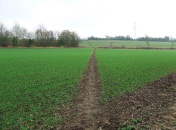
• This circular walk offers a rich and varied past for the heritage explorer to delve into Sitio web: https://www.norf...
![Excursión A pie King's Lynn and West Norfolk - Brancaster Staithe Circular - Photo](https://media.geolcdn.com/t/350/260/f4b5bd01-a8e8-478f-82fa-2b890c6d2a5a.jpeg&format=jpg&maxdim=2)
![A pie A pie](https://static1.geolcdn.com/sitytour/trail-icons/100.png)
Km
A pie
![](/images/other/stat-length.png)
![](https://static1.geolcdn.com/siteimages/upload/files/1508320355ic_sort_den_pos_24dp.png)
![](https://static1.geolcdn.com/siteimages/upload/files/1508320355ic_sort_den_neg_24dp.png)
![](https://static1.geolcdn.com/siteimages/upload/files/16400158638029165_repeat_loop_refresh_sync_direction_icon.png)
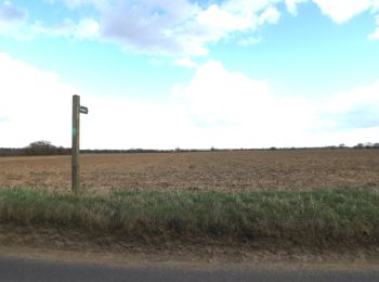
• The Brancaster Staithe walk is a contrast of saltmarsh and sailing regattas, wind and woodland Sitio web: https://w...
![Excursión A pie - Riverside Trail - Photo](https://media.geolcdn.com/t/350/260/565b65fe-7f4f-48af-a09a-2b0bdd1a7bcd.jpeg&format=jpg&maxdim=2)
![A pie A pie](https://static1.geolcdn.com/sitytour/trail-icons/100.png)
Km
A pie
![](/images/other/stat-length.png)
![](https://static1.geolcdn.com/siteimages/upload/files/1508320355ic_sort_den_pos_24dp.png)
![](https://static1.geolcdn.com/siteimages/upload/files/1508320355ic_sort_den_neg_24dp.png)
![](https://static1.geolcdn.com/siteimages/upload/files/16400158638029165_repeat_loop_refresh_sync_direction_icon.png)
• Ruta creada por Woodland Trust. Símbolo: Arrow pointer with three fish
![Excursión A pie North Norfolk - Sheringham Circular - Photo](https://media.geolcdn.com/t/350/260/a9edcb65-5663-4720-a358-566ab32be620.jpeg&format=jpg&maxdim=2)
![A pie A pie](https://static1.geolcdn.com/sitytour/trail-icons/100.png)
Km
A pie
![](/images/other/stat-length.png)
![](https://static1.geolcdn.com/siteimages/upload/files/1508320355ic_sort_den_pos_24dp.png)
![](https://static1.geolcdn.com/siteimages/upload/files/1508320355ic_sort_den_neg_24dp.png)
![](https://static1.geolcdn.com/siteimages/upload/files/16400158638029165_repeat_loop_refresh_sync_direction_icon.png)
• Sitio web: https://www.nationaltrail.co.uk/en_GB/short-routes/sheringham-circular-walk-6-2/
![Excursión A pie Gateshead - Red Kite Trail - Photo](https://media.geolcdn.com/t/350/260/e691b01b-c46e-49e9-a2fc-5cc9f2a773e4.jpeg&format=jpg&maxdim=2)
![A pie A pie](https://static1.geolcdn.com/sitytour/trail-icons/100.png)
Km
A pie
![](/images/other/stat-length.png)
![](https://static1.geolcdn.com/siteimages/upload/files/1508320355ic_sort_den_pos_24dp.png)
![](https://static1.geolcdn.com/siteimages/upload/files/1508320355ic_sort_den_neg_24dp.png)
![](https://static1.geolcdn.com/siteimages/upload/files/16400158638029165_repeat_loop_refresh_sync_direction_icon.png)
• Símbolo: red kite on white background
![Excursión A pie Gateshead - Boundary Walk - Photo](https://media.geolcdn.com/t/350/260/397a12b0-88bd-4f02-9345-74818f5e7e16.jpeg&format=jpg&maxdim=2)
![A pie A pie](https://static1.geolcdn.com/sitytour/trail-icons/100.png)
Km
A pie
![](/images/other/stat-length.png)
![](https://static1.geolcdn.com/siteimages/upload/files/1508320355ic_sort_den_pos_24dp.png)
![](https://static1.geolcdn.com/siteimages/upload/files/1508320355ic_sort_den_neg_24dp.png)
![](https://static1.geolcdn.com/siteimages/upload/files/16400158638029165_repeat_loop_refresh_sync_direction_icon.png)
• Ruta creada por Forestry England.
![Excursión A pie - Bedburn Valley Walk - Photo](https://media.geolcdn.com/t/350/260/0a41f570-2a9a-41da-9fe2-805b8113c01c.jpeg&format=jpg&maxdim=2)
![A pie A pie](https://static1.geolcdn.com/sitytour/trail-icons/100.png)
Km
A pie
![](/images/other/stat-length.png)
![](https://static1.geolcdn.com/siteimages/upload/files/1508320355ic_sort_den_pos_24dp.png)
![](https://static1.geolcdn.com/siteimages/upload/files/1508320355ic_sort_den_neg_24dp.png)
![](https://static1.geolcdn.com/siteimages/upload/files/16400158638029165_repeat_loop_refresh_sync_direction_icon.png)
• Símbolo: Black arrow on yellow background
![Excursión A pie - Three Becks Walk - Photo](https://media.geolcdn.com/t/350/260/340d9e1f-928a-48a2-8af8-1fc0e9529e41.jpeg&format=jpg&maxdim=2)
![A pie A pie](https://static1.geolcdn.com/sitytour/trail-icons/100.png)
Km
A pie
![](/images/other/stat-length.png)
![](https://static1.geolcdn.com/siteimages/upload/files/1508320355ic_sort_den_pos_24dp.png)
![](https://static1.geolcdn.com/siteimages/upload/files/1508320355ic_sort_den_neg_24dp.png)
![](https://static1.geolcdn.com/siteimages/upload/files/16400158638029165_repeat_loop_refresh_sync_direction_icon.png)
• Ruta creada por Forestry England. Símbolo: White arrow on orange background
![Excursión A pie - Red Clover Leaf Walk - Photo](https://media.geolcdn.com/t/350/260/b3c04e01-2867-45ab-acad-3f59c0b5a9cb.jpeg&format=jpg&maxdim=2)
![A pie A pie](https://static1.geolcdn.com/sitytour/trail-icons/100.png)
Km
A pie
![](/images/other/stat-length.png)
![](https://static1.geolcdn.com/siteimages/upload/files/1508320355ic_sort_den_pos_24dp.png)
![](https://static1.geolcdn.com/siteimages/upload/files/1508320355ic_sort_den_neg_24dp.png)
![](https://static1.geolcdn.com/siteimages/upload/files/16400158638029165_repeat_loop_refresh_sync_direction_icon.png)
• Ruta creada por West Rainton Green Group. Símbolo: Red clover leaf on green round
![Excursión A pie King's Lynn and West Norfolk - Circular Walk - Photo](https://media.geolcdn.com/t/350/260/78b8408f-41f3-4fcc-bea8-6b3ddd9670c3.jpeg&format=jpg&maxdim=2)
![A pie A pie](https://static1.geolcdn.com/sitytour/trail-icons/100.png)
Km
A pie
![](/images/other/stat-length.png)
![](https://static1.geolcdn.com/siteimages/upload/files/1508320355ic_sort_den_pos_24dp.png)
![](https://static1.geolcdn.com/siteimages/upload/files/1508320355ic_sort_den_neg_24dp.png)
![](https://static1.geolcdn.com/siteimages/upload/files/16400158638029165_repeat_loop_refresh_sync_direction_icon.png)
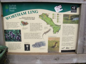
• Ruta creada por Norfolk Trails.
![Excursión A pie Mid Suffolk - A Taste of the Angles Way - Photo](https://media.geolcdn.com/t/350/260/f3ffea73-1d8e-40cf-8984-059d029ab30e.jpeg&format=jpg&maxdim=2)
![A pie A pie](https://static1.geolcdn.com/sitytour/trail-icons/100.png)
Km
A pie
![](/images/other/stat-length.png)
![](https://static1.geolcdn.com/siteimages/upload/files/1508320355ic_sort_den_pos_24dp.png)
![](https://static1.geolcdn.com/siteimages/upload/files/1508320355ic_sort_den_neg_24dp.png)
![](https://static1.geolcdn.com/siteimages/upload/files/16400158638029165_repeat_loop_refresh_sync_direction_icon.png)
• Símbolo: Green Arrow on White Round Background
![Excursión A pie South Norfolk - Diss Circular Walk - Photo](https://media.geolcdn.com/t/350/260/01e682a9-49be-442f-ba93-d3922014b7b7.jpeg&format=jpg&maxdim=2)
![A pie A pie](https://static1.geolcdn.com/sitytour/trail-icons/100.png)
Km
A pie
![](/images/other/stat-length.png)
![](https://static1.geolcdn.com/siteimages/upload/files/1508320355ic_sort_den_pos_24dp.png)
![](https://static1.geolcdn.com/siteimages/upload/files/1508320355ic_sort_den_neg_24dp.png)
![](https://static1.geolcdn.com/siteimages/upload/files/16400158638029165_repeat_loop_refresh_sync_direction_icon.png)
• Símbolo: Yellow Arrow on a Dark Blue Background
![Excursión A pie Mid Suffolk - The Burgate Walk - Photo](https://media.geolcdn.com/t/350/260/9f6066be-9ff5-4857-81a8-a88265919bba.jpeg&format=jpg&maxdim=2)
![A pie A pie](https://static1.geolcdn.com/sitytour/trail-icons/100.png)
Km
A pie
![](/images/other/stat-length.png)
![](https://static1.geolcdn.com/siteimages/upload/files/1508320355ic_sort_den_pos_24dp.png)
![](https://static1.geolcdn.com/siteimages/upload/files/1508320355ic_sort_den_neg_24dp.png)
![](https://static1.geolcdn.com/siteimages/upload/files/16400158638029165_repeat_loop_refresh_sync_direction_icon.png)
• Símbolo: Purple arrow on white background
![Excursión A pie Uttlesford - Turpin's Trail 1 - Photo](https://media.geolcdn.com/t/350/260/16463c10-e257-4e2a-8c27-eead6d323f15.jpeg&format=jpg&maxdim=2)
![A pie A pie](https://static1.geolcdn.com/sitytour/trail-icons/100.png)
Km
A pie
![](/images/other/stat-length.png)
![](https://static1.geolcdn.com/siteimages/upload/files/1508320355ic_sort_den_pos_24dp.png)
![](https://static1.geolcdn.com/siteimages/upload/files/1508320355ic_sort_den_neg_24dp.png)
![](https://static1.geolcdn.com/siteimages/upload/files/16400158638029165_repeat_loop_refresh_sync_direction_icon.png)
• Símbolo: pair of pistols
![Excursión A pie Uttlesford - Turpin's Trail 3 - Photo](https://media.geolcdn.com/t/350/260/87f77b80-7c3e-4990-a996-71bfb91f6c7e.jpeg&format=jpg&maxdim=2)
![A pie A pie](https://static1.geolcdn.com/sitytour/trail-icons/100.png)
Km
A pie
![](/images/other/stat-length.png)
![](https://static1.geolcdn.com/siteimages/upload/files/1508320355ic_sort_den_pos_24dp.png)
![](https://static1.geolcdn.com/siteimages/upload/files/1508320355ic_sort_den_neg_24dp.png)
![](https://static1.geolcdn.com/siteimages/upload/files/16400158638029165_repeat_loop_refresh_sync_direction_icon.png)
• Símbolo: pair of pistols
![Excursión A pie - High Force Geotrail - Photo](https://media.geolcdn.com/t/350/260/0d3b37d3-6c63-4a9c-a912-db39bdf86a74.jpeg&format=jpg&maxdim=2)
![A pie A pie](https://static1.geolcdn.com/sitytour/trail-icons/100.png)
Km
A pie
![](/images/other/stat-length.png)
![](https://static1.geolcdn.com/siteimages/upload/files/1508320355ic_sort_den_pos_24dp.png)
![](https://static1.geolcdn.com/siteimages/upload/files/1508320355ic_sort_den_neg_24dp.png)
![](https://static1.geolcdn.com/siteimages/upload/files/16400158638029165_repeat_loop_refresh_sync_direction_icon.png)
• Ruta creada por North Pennines AONB Partnership.
![Excursión A pie - Blanchland Geotrail - Photo](https://media.geolcdn.com/t/350/260/2e2ced63-7bf5-40f4-a5c7-c6b02c7708e4.jpeg&format=jpg&maxdim=2)
![A pie A pie](https://static1.geolcdn.com/sitytour/trail-icons/100.png)
Km
A pie
![](/images/other/stat-length.png)
![](https://static1.geolcdn.com/siteimages/upload/files/1508320355ic_sort_den_pos_24dp.png)
![](https://static1.geolcdn.com/siteimages/upload/files/1508320355ic_sort_den_neg_24dp.png)
![](https://static1.geolcdn.com/siteimages/upload/files/16400158638029165_repeat_loop_refresh_sync_direction_icon.png)
• Ruta creada por North Pennines AONB Partnership.
![Excursión A pie - Low Force Geotrail - Photo](https://media.geolcdn.com/t/350/260/f2409179-1f6c-45c5-ab05-f579bae92b61.jpeg&format=jpg&maxdim=2)
![A pie A pie](https://static1.geolcdn.com/sitytour/trail-icons/100.png)
Km
A pie
![](/images/other/stat-length.png)
![](https://static1.geolcdn.com/siteimages/upload/files/1508320355ic_sort_den_pos_24dp.png)
![](https://static1.geolcdn.com/siteimages/upload/files/1508320355ic_sort_den_neg_24dp.png)
![](https://static1.geolcdn.com/siteimages/upload/files/16400158638029165_repeat_loop_refresh_sync_direction_icon.png)
• Ruta creada por North Pennines AONB.
20 excursiones mostradas en 542
Aplicación GPS de excursión GRATIS
Actividades
Regiones próximas
- Bath and North East Somerset
- Blackburn with Darwen
- Blackpool
- Bournemouth, Christchurch and Poole
- Bracknell Forest
- Brighton and Hove
- Buckinghamshire
- Cambridgeshire
- Central Bedfordshire
- Cheshire East
- Cheshire West and Chester
- City de Londres
- City of Bristol
- City of Nottingham
- City of Peterborough
- Cornualles
- County Durham
- Cumbria
- Derbyshire
- Desconocido
- Devon
- Dorset
- East Riding of Yorkshire
- East Sussex
- Essex
- Gloucestershire
- Greater Manchester
- Hampshire
- Hartlepool
- Herefordshire
- Hertfordshire
- Islas Sorlingas
- Isle of Wight
- Kent
- Kingston upon Hull
- Lancashire
- Leicestershire
- Lincolnshire
- Londres
- Medway
- Middlesbrough
- Norfolk
- North East Lincolnshire
- North Lincolnshire
- North Somerset
- North Yorkshire
- Northamptonshire
- Northumberland
- Nottinghamshire
- Oxfordshire
- Plymouth
- Portsmouth
- Reading
- Redcar and Cleveland
- Rutland
- Shropshire
- Somerset
- South Gloucestershire
- Staffordshire
- Stockton-on-Tees
- Suffolk
- Surrey
- Torbay
- Warwickshire
- West Berkshire
- West Midlands Combined Authority
- West Sussex
- West Yorkshire
- Wiltshire
- Windsor and Maidenhead
- Worcestershire
- York