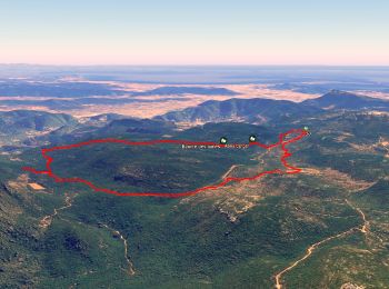
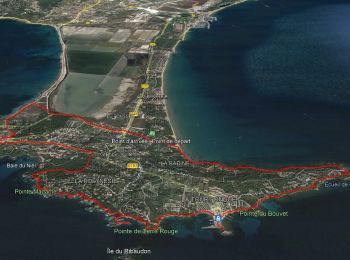
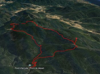
![](/images/other/stat-length.png)
Var, Provenza-Alpes-Costa Azul, A pie: Los mejores itinerarios de excursión, recorridos, paseos y sendas
Var: Descubra las mejores excursiones: 479 a pie, 11710 senderismo, 234 marcha nórdica, 290 carrera y 87 ruta. Todos estos circuitos, recorridos, itinerarios y actividades al aire libre están disponibles en nuestras aplicaciones SityTrail para smartphone y tablet.
Los mejores recorridos (12751)
![Excursión Senderismo Saint-Raphaël - Sommet du Bonnet de Capelan - Photo](https://media.geolcdn.com/t/350/260/05863c9a-49da-4f41-9bfb-5d37c8a1781d.jpg&format=jpg&maxdim=2)
![Senderismo Senderismo](https://static1.geolcdn.com/sitytour/trail-icons/101.png)
Km
Senderismo
![](/images/other/stat-length.png)
![](https://static1.geolcdn.com/siteimages/upload/files/1508320355ic_sort_den_pos_24dp.png)
![](https://static1.geolcdn.com/siteimages/upload/files/1508320355ic_sort_den_neg_24dp.png)
![](https://static1.geolcdn.com/siteimages/upload/files/16400158638029165_repeat_loop_refresh_sync_direction_icon.png)
![Excursión Senderismo Flassans-sur-Issole - SityTrail - Flassans rando Redon 2 - Photo](https://media.geolcdn.com/t/350/260/269bbef5-fac1-44bc-8839-608da7882967.jpg&format=jpg&maxdim=2)
![Senderismo Senderismo](https://static1.geolcdn.com/sitytour/trail-icons/101.png)
Km
Senderismo
![](/images/other/stat-length.png)
![](https://static1.geolcdn.com/siteimages/upload/files/1508320355ic_sort_den_pos_24dp.png)
![](https://static1.geolcdn.com/siteimages/upload/files/1508320355ic_sort_den_neg_24dp.png)
![](https://static1.geolcdn.com/siteimages/upload/files/16400158638029165_repeat_loop_refresh_sync_direction_icon.png)
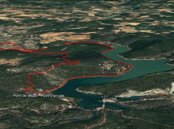
• 30-11-16 Rando GR1 dont l'objectif est la découverte du lac Redon, une mare temporaire comme il en existe peu en Médi...
![Excursión Senderismo Les Mayons - FFRandonnée-Sur_les_traces_du_decauville - Photo](https://media.geolcdn.com/t/350/260/bcb1604c-22f0-433d-9ea7-43bb42cd787e.jpg&format=jpg&maxdim=2)
![Senderismo Senderismo](https://static1.geolcdn.com/sitytour/trail-icons/101.png)
Km
Senderismo
![](/images/other/stat-length.png)
![](https://static1.geolcdn.com/siteimages/upload/files/1508320355ic_sort_den_pos_24dp.png)
![](https://static1.geolcdn.com/siteimages/upload/files/1508320355ic_sort_den_neg_24dp.png)
![](https://static1.geolcdn.com/siteimages/upload/files/16400158638029165_repeat_loop_refresh_sync_direction_icon.png)
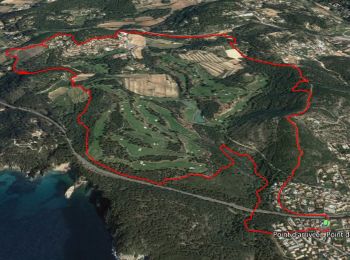
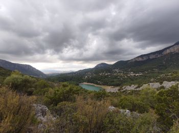
• En suivant le mythique tracé du « decauville », on atteint la crête des Maures à la rencontre de panoramas grandiose...
![Excursión Senderismo La Londe-les-Maures - SityTrail - Notre Dame des Maures-12-02-21 - Photo](https://media.geolcdn.com/t/350/260/0b9959c2-5f7c-4a9a-9278-b73c6a0d11e2.jpg&format=jpg&maxdim=2)
![Senderismo Senderismo](https://static1.geolcdn.com/sitytour/trail-icons/101.png)
Km
Senderismo
![](/images/other/stat-length.png)
![](https://static1.geolcdn.com/siteimages/upload/files/1508320355ic_sort_den_pos_24dp.png)
![](https://static1.geolcdn.com/siteimages/upload/files/1508320355ic_sort_den_neg_24dp.png)
![](https://static1.geolcdn.com/siteimages/upload/files/16400158638029165_repeat_loop_refresh_sync_direction_icon.png)
• Dolmen de Gautaby
![A pie A pie](https://static1.geolcdn.com/sitytour/trail-icons/100.png)
Km
A pie
![](/images/other/stat-length.png)
![](https://static1.geolcdn.com/siteimages/upload/files/1508320355ic_sort_den_pos_24dp.png)
![](https://static1.geolcdn.com/siteimages/upload/files/1508320355ic_sort_den_neg_24dp.png)
![](https://static1.geolcdn.com/siteimages/upload/files/16400158638029165_repeat_loop_refresh_sync_direction_icon.png)
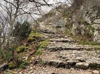
• 3 bonnes montées 1 passage sur corniche sous les falaises (cordes en place pour se tenir) Multiples points d'intérêts...
![Excursión Senderismo Ollioules - SityTrail - 1041295 - le-destel-grotte-des-joncs - Photo](https://media.geolcdn.com/t/350/260/b00c002a-3425-4f84-ae24-7620ef9e7315.jpg&format=jpg&maxdim=2)
![Senderismo Senderismo](https://static1.geolcdn.com/sitytour/trail-icons/101.png)
Km
Senderismo
![](/images/other/stat-length.png)
![](https://static1.geolcdn.com/siteimages/upload/files/1508320355ic_sort_den_pos_24dp.png)
![](https://static1.geolcdn.com/siteimages/upload/files/1508320355ic_sort_den_neg_24dp.png)
![](https://static1.geolcdn.com/siteimages/upload/files/16400158638029165_repeat_loop_refresh_sync_direction_icon.png)
• Cuves du Destel et plusieurs grottes. Très glissant par temps pluvieux. A éviter.
![Excursión Senderismo Le Muy - Pic du Castel Diaou - Fille d'Isnard - Pic Rébéquier - Photo](https://media.geolcdn.com/t/350/260/4f204571-7b19-40b2-95c4-b71e4d308f15.jpg&format=jpg&maxdim=2)
![Senderismo Senderismo](https://static1.geolcdn.com/sitytour/trail-icons/101.png)
Km
Senderismo
![](/images/other/stat-length.png)
![](https://static1.geolcdn.com/siteimages/upload/files/1508320355ic_sort_den_pos_24dp.png)
![](https://static1.geolcdn.com/siteimages/upload/files/1508320355ic_sort_den_neg_24dp.png)
![](https://static1.geolcdn.com/siteimages/upload/files/16400158638029165_repeat_loop_refresh_sync_direction_icon.png)
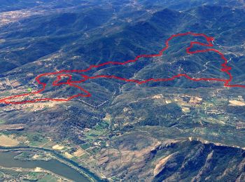
• Malgré son apparence aujourd'hui déserte la forêt du massif des Maures recèle de nombreux vestiges d'une occupation a...
![Excursión Senderismo La Môle - SityTrail - Barrage de la verne - Sommet de l'Argentière par les crêtes des Pradets - Retour par le bord du lac - Photo](https://media.geolcdn.com/t/350/260/760c7a83-a4d8-41d7-9ea7-3093b4adef8e.jpg&format=jpg&maxdim=2)
![Senderismo Senderismo](https://static1.geolcdn.com/sitytour/trail-icons/101.png)
Km
Senderismo
![](/images/other/stat-length.png)
![](https://static1.geolcdn.com/siteimages/upload/files/1508320355ic_sort_den_pos_24dp.png)
![](https://static1.geolcdn.com/siteimages/upload/files/1508320355ic_sort_den_neg_24dp.png)
![](https://static1.geolcdn.com/siteimages/upload/files/16400158638029165_repeat_loop_refresh_sync_direction_icon.png)
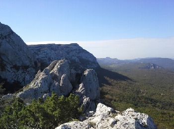
• Une seule vraie difficulté, lors de la montée du départ, le passage dans la zone rocheuse en crête. Chemin non balisé...
![Excursión Senderismo Plan-d'Aups-Sainte-Baume - Sainte Baume 8,5 km - Photo](https://media.geolcdn.com/t/350/260/02bfd54c-87ac-472a-9dd7-603e289d99c6.jpeg&format=jpg&maxdim=2)
![Senderismo Senderismo](https://static1.geolcdn.com/sitytour/trail-icons/101.png)
Km
Senderismo
![](/images/other/stat-length.png)
![](https://static1.geolcdn.com/siteimages/upload/files/1508320355ic_sort_den_pos_24dp.png)
![](https://static1.geolcdn.com/siteimages/upload/files/1508320355ic_sort_den_neg_24dp.png)
![](https://static1.geolcdn.com/siteimages/upload/files/16400158638029165_repeat_loop_refresh_sync_direction_icon.png)
![Excursión Senderismo Le Luc - SityTrail - Le Luc Mascaronne rando - Photo](https://media.geolcdn.com/t/350/260/f80c5f9b-41dd-4e6b-ab88-57c5d990921e.jpg&format=jpg&maxdim=2)
![Senderismo Senderismo](https://static1.geolcdn.com/sitytour/trail-icons/101.png)
Km
Senderismo
![](/images/other/stat-length.png)
![](https://static1.geolcdn.com/siteimages/upload/files/1508320355ic_sort_den_pos_24dp.png)
![](https://static1.geolcdn.com/siteimages/upload/files/1508320355ic_sort_den_neg_24dp.png)
![](https://static1.geolcdn.com/siteimages/upload/files/16400158638029165_repeat_loop_refresh_sync_direction_icon.png)
• 01-03-17 Guide : Fernand Rando de restons en Forme Draguignan. 22 au départ " et à l'arrivée", Beau temps, un peu fro...
![Excursión Senderismo Roquebrune-sur-Argens - SityTrail - Les 25 ponts-Roquebrune sur Argens-28-01-22 - Photo](https://media.geolcdn.com/t/350/260/605c9bb1-f90a-4cd2-a653-fe52e6d3d081.jpg&format=jpg&maxdim=2)
![Senderismo Senderismo](https://static1.geolcdn.com/sitytour/trail-icons/101.png)
Km
Senderismo
![](/images/other/stat-length.png)
![](https://static1.geolcdn.com/siteimages/upload/files/1508320355ic_sort_den_pos_24dp.png)
![](https://static1.geolcdn.com/siteimages/upload/files/1508320355ic_sort_den_neg_24dp.png)
![](https://static1.geolcdn.com/siteimages/upload/files/16400158638029165_repeat_loop_refresh_sync_direction_icon.png)
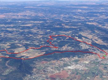
• Les 25 ponts-ravin de la petite Maurette-lac des Clots-la Maurette-GR 51-Roquebrune sur Argens.
![Excursión Senderismo Solliès-Toucas - Morières : la Garoute et la Baume des Lumes - Photo](https://media.geolcdn.com/t/350/260/3e6ddcf9-f59d-47f4-a0ee-582c12a1d8d8.jpg&format=jpg&maxdim=2)
![Senderismo Senderismo](https://static1.geolcdn.com/sitytour/trail-icons/101.png)
Km
Senderismo
![](/images/other/stat-length.png)
![](https://static1.geolcdn.com/siteimages/upload/files/1508320355ic_sort_den_pos_24dp.png)
![](https://static1.geolcdn.com/siteimages/upload/files/1508320355ic_sort_den_neg_24dp.png)
![](https://static1.geolcdn.com/siteimages/upload/files/16400158638029165_repeat_loop_refresh_sync_direction_icon.png)
• Un circuit facile qui passe par deux des plus belles curiosités du massif des Bidoufles, sur le plateau des Morières....
![Excursión Senderismo Hyères - SityTrail - presquile-de-giens-cote-est-france - Photo](https://media.geolcdn.com/t/350/260/111e178c-db2d-4519-839d-89c97a7ddc38.jpg&format=jpg&maxdim=2)
![Senderismo Senderismo](https://static1.geolcdn.com/sitytour/trail-icons/101.png)
Km
Senderismo
![](/images/other/stat-length.png)
![](https://static1.geolcdn.com/siteimages/upload/files/1508320355ic_sort_den_pos_24dp.png)
![](https://static1.geolcdn.com/siteimages/upload/files/1508320355ic_sort_den_neg_24dp.png)
![](https://static1.geolcdn.com/siteimages/upload/files/16400158638029165_repeat_loop_refresh_sync_direction_icon.png)
![Excursión Senderismo Bandol - SityTrail - fregate - Photo](https://media.geolcdn.com/t/350/260/2853a075-1e77-4b06-bf33-9c03418a8afd.jpg&format=jpg&maxdim=2)
![Senderismo Senderismo](https://static1.geolcdn.com/sitytour/trail-icons/101.png)
Km
Senderismo
![](/images/other/stat-length.png)
![](https://static1.geolcdn.com/siteimages/upload/files/1508320355ic_sort_den_pos_24dp.png)
![](https://static1.geolcdn.com/siteimages/upload/files/1508320355ic_sort_den_neg_24dp.png)
![](https://static1.geolcdn.com/siteimages/upload/files/16400158638029165_repeat_loop_refresh_sync_direction_icon.png)
![Excursión Senderismo Carcès - SityTrail - Carces les chutes - Photo](https://media.geolcdn.com/t/350/260/1a43adeb-f2d6-4934-8860-c1bc81aec290.jpg&format=jpg&maxdim=2)
![Senderismo Senderismo](https://static1.geolcdn.com/sitytour/trail-icons/101.png)
Km
Senderismo
![](/images/other/stat-length.png)
![](https://static1.geolcdn.com/siteimages/upload/files/1508320355ic_sort_den_pos_24dp.png)
![](https://static1.geolcdn.com/siteimages/upload/files/1508320355ic_sort_den_neg_24dp.png)
![](https://static1.geolcdn.com/siteimages/upload/files/16400158638029165_repeat_loop_refresh_sync_direction_icon.png)
![Excursión Senderismo Évenos - SityTrail - st anne d'evenos. - Photo](https://media.geolcdn.com/t/350/260/1a61a6ef-600e-4900-ae4e-54737b695f44.jpg&format=jpg&maxdim=2)
![Senderismo Senderismo](https://static1.geolcdn.com/sitytour/trail-icons/101.png)
Km
Senderismo
![](/images/other/stat-length.png)
![](https://static1.geolcdn.com/siteimages/upload/files/1508320355ic_sort_den_pos_24dp.png)
![](https://static1.geolcdn.com/siteimages/upload/files/1508320355ic_sort_den_neg_24dp.png)
![](https://static1.geolcdn.com/siteimages/upload/files/16400158638029165_repeat_loop_refresh_sync_direction_icon.png)
![Excursión Senderismo Collobrières - 10881733-Collobrières - La Verne - radar - Photo](https://media.geolcdn.com/t/350/260/da9d634a-9911-4550-a6f3-bff27c212c6d.jpg&format=jpg&maxdim=2)
![Senderismo Senderismo](https://static1.geolcdn.com/sitytour/trail-icons/101.png)
Km
Senderismo
![](/images/other/stat-length.png)
![](https://static1.geolcdn.com/siteimages/upload/files/1508320355ic_sort_den_pos_24dp.png)
![](https://static1.geolcdn.com/siteimages/upload/files/1508320355ic_sort_den_neg_24dp.png)
![](https://static1.geolcdn.com/siteimages/upload/files/16400158638029165_repeat_loop_refresh_sync_direction_icon.png)
![Excursión Senderismo Le Revest-les-Eaux - Boucle: La ripelle - Source de la ripelle - Le Chateau de Tourris - Les grottes de sable - La carrière aux fourmis - Les puits renovés de M. Lambicchi - Les ruines des Olivières - La ferme de la Touravelle - à Le Revest-les-Eaux - Photo](https://media.geolcdn.com/t/350/260/0dbff04b-2a84-4eed-a6e8-7a56bc074382.jpg&format=jpg&maxdim=2)
![Senderismo Senderismo](https://static1.geolcdn.com/sitytour/trail-icons/101.png)
Km
Senderismo
![](/images/other/stat-length.png)
![](https://static1.geolcdn.com/siteimages/upload/files/1508320355ic_sort_den_pos_24dp.png)
![](https://static1.geolcdn.com/siteimages/upload/files/1508320355ic_sort_den_neg_24dp.png)
![](https://static1.geolcdn.com/siteimages/upload/files/16400158638029165_repeat_loop_refresh_sync_direction_icon.png)
![Excursión Senderismo Nans-les-Pins - Le baou des glacières - Photo](https://media.geolcdn.com/t/350/260/ext.jpg?maxdim=2&url=https%3A%2F%2Fservices.sitytrail.com%2FGeolivesWS%2FDownloadMedia.ashx%3FTrailID%3D356935%26Media%3Dfix__20141025130409.jpg)
![Senderismo Senderismo](https://static1.geolcdn.com/sitytour/trail-icons/101.png)
Km
Senderismo
![](/images/other/stat-length.png)
![](https://static1.geolcdn.com/siteimages/upload/files/1508320355ic_sort_den_pos_24dp.png)
![](https://static1.geolcdn.com/siteimages/upload/files/1508320355ic_sort_den_neg_24dp.png)
![](https://static1.geolcdn.com/siteimages/upload/files/16400158638029165_repeat_loop_refresh_sync_direction_icon.png)
20 excursiones mostradas en 12751
Aplicación GPS de excursión GRATIS
Actividades
Regiones próximas
- Aiguines
- Ampus
- Artignosc-sur-Verdon
- Artigues
- Aups
- Bagnols-en-Forêt
- Bandol
- Bargème
- Bargemon
- Barjols
- Baudinard-sur-Verdon
- Bauduen
- Belgentier
- Besse-sur-Issole
- Bormes-les-Mimosas
- Bras
- Brenon
- Brignoles
- Brue-Auriac
- Cabasse
- Callas
- Callian
- Camps-la-Source
- Carcès
- Carnoules
- Carqueiranne
- Cavalaire-sur-Mer
- Châteaudouble
- Châteauvert
- Châteauvieux
- Claviers
- Cogolin
- Collobrières
- Comps-sur-Artuby
- Correns
- Cotignac
- Cuers
- Draguignan
- Entrecasteaux
- Esparron
- Évenos
- Fayence
- Figanières
- Flassans-sur-Issole
- Flayosc
- Forcalqueiret
- Fox-Amphoux
- Fréjus
- Garéoult
- Gassin
- Ginasservis
- Gonfaron
- Grimaud
- Hyères
- La Bastide
- La Cadière-d'Azur
- La Celle
- La Crau
- La Croix-Valmer
- La Farlède
- La Garde
- La Garde-Freinet
- La Londe-les-Maures
- La Martre
- La Môle
- La Motte
- La Roque-Esclapon
- La Roquebrussanne
- La Seyne-sur-Mer
- La Valette-du-Var
- La Verdière
- Le Beausset
- Le Bourguet
- Le Cannet-des-Maures
- Le Castellet
- Le Lavandou
- Le Luc
- Le Muy
- Le Plan-de-la-Tour
- Le Pradet
- Le Revest-les-Eaux
- Le Thoronet
- Le Val
- Les Adrets-de-l'Estérel
- Les Arcs-sur-Argens
- Les Mayons
- Les Salles-sur-Verdon
- Lorgues
- Mazaugues
- Méounes-lès-Montrieux
- Moissac-Bellevue
- Mons
- Montauroux
- Montferrat
- Montfort-sur-Argens
- Montmeyan
- Nans-les-Pins
- Néoules
- Ollières
- Ollioules
- Pierrefeu-du-Var
- Pignans
- Plan-d'Aups-Sainte-Baume
- Pontevès
- Pourcieux
- Pourrières
- Puget-Ville
- Puget-sur-Argens
- Ramatuelle
- Rayol-Canadel-sur-Mer
- Régusse
- Rians
- Riboux
- Rocbaron
- Roquebrune-sur-Argens
- Rougiers
- Saint-Antonin-du-Var
- Saint-Cyr-sur-Mer
- Saint-Julien
- Saint-Mandrier-sur-Mer
- Saint-Martin-de-Pallières
- Saint-Maximin-la-Sainte-Baume
- Saint-Paul-en-Forêt
- Saint-Raphaël
- Saint-Tropez
- Saint-Zacharie
- Sainte-Anastasie-sur-Issole
- Sainte-Maxime
- Salernes
- Sanary-sur-Mer
- Seillans
- Seillons-Source-d'Argens
- Signes
- Sillans-la-Cascade
- Six-Fours-les-Plages
- Solliès-Pont
- Solliès-Toucas
- Solliès-Ville
- Tanneron
- Taradeau
- Tavernes
- Tolón
- Tourrettes
- Tourtour
- Tourves
- Trans-en-Provence
- Trigance
- Varages
- Vérignon
- Vidauban
- Villecroze
- Vinon-sur-Verdon
- Vins-sur-Caramy