dan0406

Offline

Trails

Trail Walking Thorame-Haute - Serpegier retour Champlatte - Photo
Walking
dan0406

Walking

Difficult
Thorame-Haute, Provence-Alpes-Côte d'Azur, Alpes-de-Haute-Provence, France
11.4 km | 16.8 km-effort
3h 49min
No
Trail On foot Thorame-Haute - Serpegier Aller_unified - Photo
On foot
dan0406

On foot

Easy
Thorame-Haute, Provence-Alpes-Côte d'Azur, Alpes-de-Haute-Provence, France
9.9 km | 14.4 km-effort
3h 16min
Yes
Trail Walking Braux - NewTrackEditing3 - Photo
Walking
dan0406

Walking

Difficult
Braux, Provence-Alpes-Côte d'Azur, Alpes-de-Haute-Provence, France
9.1 km | 16.4 km-effort
3h 44min
Yes
Trail Walking Entrevaux - Aller Bayons Le Champ - Villevieille - Photo
Walking
dan0406

Walking

Medium
Entrevaux, Provence-Alpes-Côte d'Azur, Alpes-de-Haute-Provence, France
5.5 km | 9.8 km-effort
2h 13min
No
Trail Walking La Penne - Col Saint-Raphael en boucle - Photo
Walking
dan0406

Walking

Very difficult
La Penne, Provence-Alpes-Côte d'Azur, Maritime Alps, France
12.1 km | 19.3 km-effort
4h 23min
Yes
Trail Road bike Faux-la-Montagne - V87_La_Vagabonde_2022 - Photo
Road bike
dan0406

Road bike

Very difficult
Faux-la-Montagne, New Aquitaine, Creuse, France
157 km | 189 km-effort
11h 28min
No
Trail Walking Annot - randogps4-294 - Photo
Walking
dan0406

Walking

Difficult
Annot, Provence-Alpes-Côte d'Azur, Alpes-de-Haute-Provence, France
9.7 km | 16.8 km-effort
3h 48min
Yes
Trail Walking Annot - GPX Download: Le Roncheret Circuit à partir de Annot - Photo
Walking
dan0406

Walking

Very difficult
Annot, Provence-Alpes-Côte d'Azur, Alpes-de-Haute-Provence, France
10 km | 20 km-effort
4h 39min
No
Trail Road bike Le Cheylard - le-cheylard-saint-agreve - Photo
Road bike
dan0406

Road bike

Difficult
Le Cheylard, Auvergne-Rhône-Alpes, Ardèche, France
25 km | 34 km-effort
2h 2min
No
Trail Walking Entrevaux - Chapelle St-Pierre Bas Sumaure - Photo
Walking
dan0406

Walking

Medium
Entrevaux, Provence-Alpes-Côte d'Azur, Alpes-de-Haute-Provence, France
4.8 km | 10.7 km-effort
2h 26min
No
Trail Walking Thorame-Haute - Cabane Vielle - Photo
Walking
dan0406

Walking

Very difficult
Thorame-Haute, Provence-Alpes-Côte d'Azur, Alpes-de-Haute-Provence, France
11.7 km | 19.9 km-effort
4h 31min
Yes
Trail Walking Annot - D'Educh de Scaffarels à Pont Saint-Joseph - Photo
Walking
dan0406

Walking

Difficult
Annot, Provence-Alpes-Côte d'Azur, Alpes-de-Haute-Provence, France
8.5 km | 15.6 km-effort
3h 32min
No
Trail sport Léon - Velodyssee Anglet à Archachon - Photo
sport
dan0406

sport

Very easy
Léon, New Aquitaine, Landes, France
523 km | 585 km-effort
Unknown
No
Trail Walking Ubraye - Notre Dame de la riviere à St Jean du Désert_unified - Photo
Walking
dan0406

Walking

Difficult
Ubraye, Provence-Alpes-Côte d'Azur, Alpes-de-Haute-Provence, France
8.2 km | 16.8 km-effort
3h 49min
No
Trail Walking Castellet-lès-Sausses - retour par Balmont - Photo
Walking
dan0406

Walking

Medium
Castellet-lès-Sausses, Provence-Alpes-Côte d'Azur, Alpes-de-Haute-Provence, France
6.3 km | 8.6 km-effort
1h 55min
No
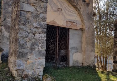
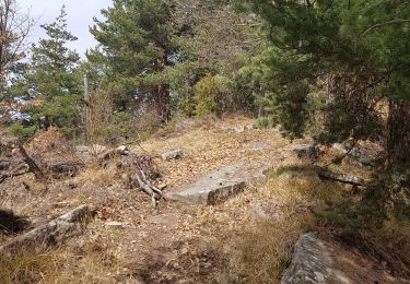
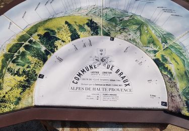
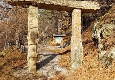
Trail Walking Braux - crete Martin  - Photo
Walking
dan0406

Walking

Medium
Braux, Provence-Alpes-Côte d'Azur, Alpes-de-Haute-Provence, France
4.6 km | 10 km-effort
3h 35min
No
Trail Walking Daluis - Les Gorges de Daluis - Photo
Walking
dan0406

Walking

Difficult
Daluis, Provence-Alpes-Côte d'Azur, Maritime Alps, France
8 km | 14.5 km-effort
3h 17min
Yes
Trail Walking Roubion - tête de Pommier - Photo
Walking
dan0406

Walking

Difficult
Roubion, Provence-Alpes-Côte d'Azur, Maritime Alps, France
12.7 km | 18.5 km-effort
4h 11min
Yes
Trail Cycle Annot - Annot - Entrevaux - Annot - Photo
Cycle
dan0406

Cycle

Very easy
Annot, Provence-Alpes-Côte d'Azur, Alpes-de-Haute-Provence, France
45 km | 59 km-effort
Unknown
Yes
Trail On foot Braux - Pont du Gay par Pont de Gassini - Photo
On foot
dan0406

On foot

Easy
Braux, Provence-Alpes-Côte d'Azur, Alpes-de-Haute-Provence, France
6.7 km | 9.8 km-effort
2h 13min
Yes
Trail Walking Annot - Plateau D'Edcuh - Photo
Walking
dan0406

Walking

Difficult
Annot, Provence-Alpes-Côte d'Azur, Alpes-de-Haute-Provence, France
10.6 km | 18.9 km-effort
4h 17min
Yes

Close
My subscriptions