![](/images/other/stat-length.png)
![Trail Mountain bike Corny-sur-Moselle - Autour du Rupt de Mad - Photo](https://media.geolcdn.com/t/1900/400/ext.pjpeg?maxdim=2&url=https%3A%2F%2Fstatic1.geolcdn.com%2Fsiteimages%2Fupload%2Ffiles%2F1524743154velo.jpg)
Autour du Rupt de Mad
Bitzlav
User
![Length](/images/other/stat-length.png)
Length
44 km
![Max alt](https://static1.geolcdn.com/siteimages/upload/files/1508320355ic_sort_altitude_max_24dp.png)
Max alt
371 m
![Uphill gradient](https://static1.geolcdn.com/siteimages/upload/files/1508320355ic_sort_den_pos_24dp.png)
Uphill gradient
921 m
![Km-Effort](/images/other/stat-length.png)
Km-Effort
57 km
![Min alt](https://static1.geolcdn.com/siteimages/upload/files/1508320355ic_sort_altitude_min_24dp.png)
Min alt
164 m
![Downhill gradient](https://static1.geolcdn.com/siteimages/upload/files/1508320355ic_sort_den_neg_24dp.png)
Downhill gradient
921 m
![Boucle](https://static1.geolcdn.com/siteimages/upload/files/16400158638029165_repeat_loop_refresh_sync_direction_icon.png)
Boucle
Yes
Creation date :
2014-12-10 00:00:00.0
Updated on :
2014-12-10 00:00:00.0
![Mountain bike](https://static1.geolcdn.com/sitytour/trail-icons/202.png)
3h50
Difficulty : Difficult
![Scan this QR Code to open this trail in the SityTrail application](https://capi.geolives.com/qq0zvz2zws4bq2lad0pu/sitytour/trails/99391/qr.png?size=200)
FREE GPS app for hiking
About
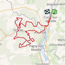
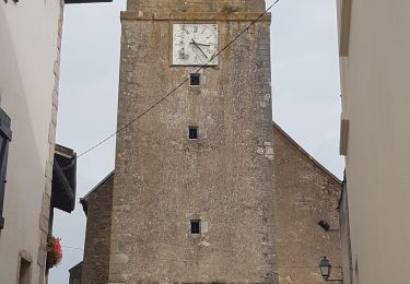
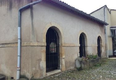
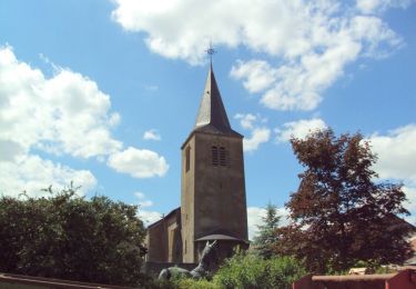
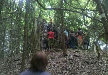
Trail Mountain bike of 44 km to be discovered at Grand Est, Moselle, Corny-sur-Moselle. This trail is proposed by Bitzlav.
Description
Départ de Corny direction Arnaville puis un long parcours dans les bois entre chemins et sentiers passage par Onville direction Bois de Rilieu ferme St Louis retour par le Col de Rudemont.
Positioning
Country:
France
Region :
Grand Est
Department/Province :
Moselle
Municipality :
Corny-sur-Moselle
Location:
Unknown
Start:(Dec)
Start:(UTM)
285118 ; 5435803 (32U) N.
Comments
Trails nearby
![Trail Walking Ancy-Dornot - Dornot - Croix saint clément - pierre qui tourne - rochers de la Fraze - Photo](https://media.geolcdn.com/t/375/260/ext.jpg?maxdim=2&url=https%3A%2F%2Fservices.sitytrail.com%2FGeolivesWS%2FDownloadMedia.ashx%3FTrailID%3D140680%26Media%3D20120722141216.jpeg)
![Walking Walking](https://static1.geolcdn.com/sitytour/trail-icons/101.png)
Dornot - Croix saint clément - pierre qui tourne - rochers de la Fraze
Walking
Medium
(3)
Ancy-Dornot,
Grand Est,
Moselle,
France
![](/images/other/stat-length.png)
13.2 km | 17.8 km-effort
3h 0min
![](https://static1.geolcdn.com/siteimages/upload/files/16400158638029165_repeat_loop_refresh_sync_direction_icon.png)
Yes
![Trail On foot Arry - Circuit d'Arry Nord - Photo](https://media.geolcdn.com/t/375/260/3c0e2cec-70a5-424b-afe0-bda5787030da.jpeg&format=jpg&maxdim=2)
![On foot On foot](https://static1.geolcdn.com/sitytour/trail-icons/100.png)
![Trail Walking Arry - Arry - côte Saint Pierre - Vezon - Marieulles - Lorry Mardigny - Arry - Photo](https://media.geolcdn.com/t/375/260/ff937aea-a994-4209-8ca1-ce9cd46d81d8.jpg&format=jpg&maxdim=2)
![Walking Walking](https://static1.geolcdn.com/sitytour/trail-icons/101.png)
Arry - côte Saint Pierre - Vezon - Marieulles - Lorry Mardigny - Arry
Walking
Medium
Arry,
Grand Est,
Moselle,
France
![](/images/other/stat-length.png)
13.9 km | 18 km-effort
24h 12min
![](https://static1.geolcdn.com/siteimages/upload/files/16400158638029165_repeat_loop_refresh_sync_direction_icon.png)
Yes
![Trail Walking Arnaville - ARNAVILLE - LES AÏTRES MEDIEVAUX - Photo](https://media.geolcdn.com/t/375/260/d37deaa3-5f14-412c-9d83-a46e5622a12e.jpg&format=jpg&maxdim=2)
![Walking Walking](https://static1.geolcdn.com/sitytour/trail-icons/101.png)
ARNAVILLE - LES AÏTRES MEDIEVAUX
Walking
Easy
Arnaville,
Grand Est,
Meurthe-et-Moselle,
France
![](/images/other/stat-length.png)
12.7 km | 15.6 km-effort
3h 51min
![](https://static1.geolcdn.com/siteimages/upload/files/16400158638029165_repeat_loop_refresh_sync_direction_icon.png)
Yes
![Trail Walking Arnaville - ARNAVILLE - LA VALLEE DU RUPT DE MAD - Photo](https://media.geolcdn.com/t/375/260/0c24bd03-483c-4f8f-b6a8-2e730119a0b2.jpg&format=jpg&maxdim=2)
![Walking Walking](https://static1.geolcdn.com/sitytour/trail-icons/101.png)
ARNAVILLE - LA VALLEE DU RUPT DE MAD
Walking
Easy
Arnaville,
Grand Est,
Meurthe-et-Moselle,
France
![](/images/other/stat-length.png)
9.9 km | 13.5 km-effort
3h 55min
![](https://static1.geolcdn.com/siteimages/upload/files/16400158638029165_repeat_loop_refresh_sync_direction_icon.png)
Yes
![Trail Walking Gorze - Gorze - Photo](https://media.geolcdn.com/t/375/260/ext.jpg?maxdim=2&url=https%3A%2F%2Fservices.sitytrail.com%2FGeolivesWS%2FDownloadMedia.ashx%3FTrailID%3D161946%26Media%3D20121107123154.jpg)
![Walking Walking](https://static1.geolcdn.com/sitytour/trail-icons/101.png)
![Trail Mountain bike Gorze - Le Pays Messin tourné vers sa capitale (Circuit n° 15 vtt) - Photo](https://media.geolcdn.com/t/375/260/ext.jpg?maxdim=2&url=https%3A%2F%2Fservices.sitytrail.com%2FGeolivesWS%2FDownloadMedia.ashx%3FTrailID%3D112329%26Media%3D10349_2.jpg)
![Mountain bike Mountain bike](https://static1.geolcdn.com/sitytour/trail-icons/202.png)
Le Pays Messin tourné vers sa capitale (Circuit n° 15 vtt)
Mountain bike
Easy
Gorze,
Grand Est,
Moselle,
France
![](/images/other/stat-length.png)
23 km | 28 km-effort
2h 0min
![](https://static1.geolcdn.com/siteimages/upload/files/16400158638029165_repeat_loop_refresh_sync_direction_icon.png)
Yes
![Trail Cycle Gorze - Le Pays Messin tourné vers sa capitale - Circuit n° 15 - Gorze - Photo](https://media.geolcdn.com/t/375/260/ext.jpg?maxdim=2&url=https%3A%2F%2Fservices.sitytrail.com%2FGeolivesWS%2FDownloadMedia.ashx%3FTrailID%3D111715%26Media%3D8035_5.jpg)
![Cycle Cycle](https://static1.geolcdn.com/sitytour/trail-icons/200.png)
Le Pays Messin tourné vers sa capitale - Circuit n° 15 - Gorze
Cycle
Medium
Gorze,
Grand Est,
Moselle,
France
![](/images/other/stat-length.png)
41 km | 48 km-effort
2h 0min
![](https://static1.geolcdn.com/siteimages/upload/files/16400158638029165_repeat_loop_refresh_sync_direction_icon.png)
Yes
![Trail Walking Gorze - Marche énergétique autour de Gorze - Photo](https://media.geolcdn.com/t/375/260/ext.jpg?maxdim=2&url=https%3A%2F%2Fservices.sitytrail.com%2FGeolivesWS%2FDownloadMedia.ashx%3FTrailID%3D69512%26Media%3D20110716173859.jpeg)
![Walking Walking](https://static1.geolcdn.com/sitytour/trail-icons/101.png)
Marche énergétique autour de Gorze
Walking
Easy
Gorze,
Grand Est,
Moselle,
France
![](/images/other/stat-length.png)
8.1 km | 11.3 km-effort
2h 26min
![](https://static1.geolcdn.com/siteimages/upload/files/16400158638029165_repeat_loop_refresh_sync_direction_icon.png)
Yes