


5.3 km | 9.6 km-effort


User GUIDE


FREE GPS app for hiking
 SityTrail
IGN / Geographical institutes
SityTrail World
The world is yours!
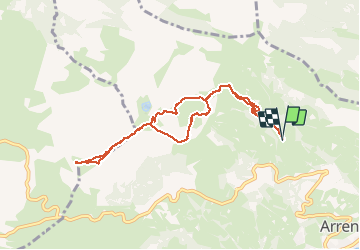
Trail Walking of 8.8 km to be discovered at Occitania, Hautespyrenees, Arrens-Marsous. This trail is proposed by marmotte65.
9km/502M
sens horaire
coordonnées départ à la cote 1183m
N42° 58' 14.6"
a Arrens prendre vers le soulor et apres une epingle a cheveus prendre le chemin des artigaux jusqu'a Artigaus (4km environ depuis arrens )
W000° 13'23.0"

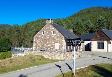
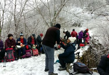
Snowshoes

Walking

Walking

Winter sports
Winter sports

Walking

Walking
Walking
Walking