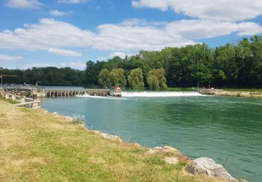
8.5 km | 10.6 km-effort
chateau matin
daniel77
User
Length
7.8 km
Max alt
108 m
Uphill gradient
100 m
Km-Effort
9.2 km
Min alt
55 m
Downhill gradient
100 m
Boucle
Yes
Creation date :
2018-06-26 15:14:12.921
Updated on :
2018-06-26 15:14:12.921
2h02
Difficulty : Medium
FREE GPS app for hiking
About
Trail Walking of 7.8 km to be discovered at Hauts-de-France, Aisne, Château-Thierry. This trail is proposed by daniel77.
Positioning
Country:
France
Region :
Hauts-de-France
Department/Province :
Aisne
Municipality :
Château-Thierry
Location:
Unknown
Start:(Dec)
Start:(UTM)
529107 ; 5432345 (31U) N.
Comments
Trails nearby
Château-Thierry du 20-10-2024
Walking
Medium
Château-Thierry,
Hauts-de-France,
Aisne,
France
2h 25min
Yes
Le chemin de St Colomban en IDF Etape 1 Chateau Thierry - Nanteuil sur Marne
Walking
Very difficult
Château-Thierry,
Hauts-de-France,
Aisne,
France
35 km | 44 km-effort
7h 12min
No
Les Vignes Castelles trace du 28-04-2024
Walking
Difficult
Château-Thierry,
Hauts-de-France,
Aisne,
France
12.6 km | 16.4 km-effort
3h 43min
Yes
Les vignes Castelles - version 8 km
Walking
Medium
Château-Thierry,
Hauts-de-France,
Aisne,
France
8.2 km | 10.3 km-effort
2h 20min
Yes
Chierry
Walking
Very easy
(1)
Chierry,
Hauts-de-France,
Aisne,
France
10.8 km | 13.3 km-effort
3h 1min
Yes
Nesles la Montagne du 02/06/2020
Walking
Very easy
Nesles-la-Montagne,
Hauts-de-France,
Aisne,
France
8.6 km | 11.1 km-effort
1h 45min
Yes
Château / Mont St Père / Azy / Château
Mountain bike
Very easy
Château-Thierry,
Hauts-de-France,
Aisne,
France
33 km | 35 km-effort
1h 40min
Yes
Château - Aulnois - Château du 26/05/2020
Walking
Very easy
Château-Thierry,
Hauts-de-France,
Aisne,
France
9.2 km | 11.1 km-effort
2h 4min
Yes
Verdilly Balcons de la Marne
Running
Medium
(1)
Verdilly,
Hauts-de-France,
Aisne,
France
32 km | 41 km-effort
Unknown
Yes