![](/images/other/stat-length.png)
Paysages & Patrimoine - A travers champs
grande_foret_sthubert
User GUIDE
![Length](/images/other/stat-length.png)
![Max alt](https://static1.geolcdn.com/siteimages/upload/files/1508320355ic_sort_altitude_max_24dp.png)
![Uphill gradient](https://static1.geolcdn.com/siteimages/upload/files/1508320355ic_sort_den_pos_24dp.png)
![Km-Effort](/images/other/stat-length.png)
![Min alt](https://static1.geolcdn.com/siteimages/upload/files/1508320355ic_sort_altitude_min_24dp.png)
![Downhill gradient](https://static1.geolcdn.com/siteimages/upload/files/1508320355ic_sort_den_neg_24dp.png)
![Boucle](https://static1.geolcdn.com/siteimages/upload/files/16400158638029165_repeat_loop_refresh_sync_direction_icon.png)
![Walking](https://static1.geolcdn.com/sitytour/trail-icons/101.png)
3h25
Difficulty : Difficult
![Scan this QR Code to open this trail in the SityTrail application](https://capi.geolives.com/qq0zvz2zws4bq2lad0pu/sitytour/trails/973525/qr.png?size=200)
FREE GPS app for hiking
About
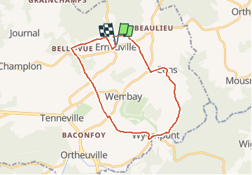
Trail Walking of 13 km to be discovered at Wallonia, Luxembourg, Tenneville. This trail is proposed by grande_foret_sthubert.
Description
Pour cette première édition dans la collection Tenneville Découvertes, chaussez vos bottines, car c’est un nouvel itinéraire pédestre qui est à parcourir au départ d’Erneuville.
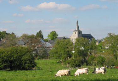
Le circuit Paysages & Patrimoine - A travers champs d’une distance de 13 km vous emmène vers Belle-Vue, Wyompont et Cens, en suivant le tracé de deux « ancêtres » de la Nationale 4 : l’antique voie romaine Metz-Tongres et la chaussée Marie-Thérèse.
Sur demande à tourisme@champlon.info, vous pouvez vous procurer le topo-guide. A l’observation d’éléments du patrimoine naturel, bâti ou paysager, s’ajouteront des anecdotes d’antan.
Une variante de 9 km est également proposée, permettant de raccourcir la promenade via le village de Wembay.
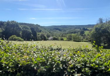
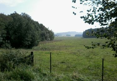
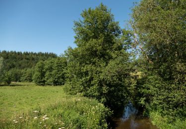
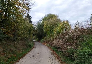
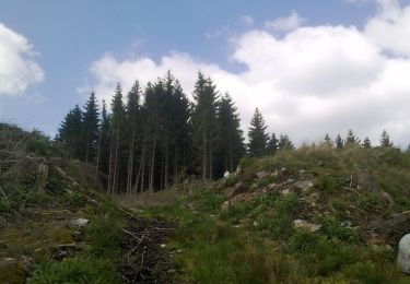
Le circuit qui est donc à travers champs, est très peu ombragé. Évitez les périodes fortes chaleurs pour le parcourir ou équipez-vous en conséquence.
Positioning
Comments
Trails nearby
![Trail Walking Tenneville - Marche ADEPS à Cens. 10km300 sur un bea parcours bien balisé. Beau dénivelé pour terminer. - Photo](https://media.geolcdn.com/t/375/260/fb70da56-e681-418d-85ec-0429bc16a3e1.jpg&format=jpg&maxdim=2)
![Walking Walking](https://static1.geolcdn.com/sitytour/trail-icons/101.png)
Walking
![](/images/other/stat-length.png)
![](https://static1.geolcdn.com/siteimages/upload/files/16400158638029165_repeat_loop_refresh_sync_direction_icon.png)
![Trail Walking La Roche-en-Ardenne - buisson - nagimont - Ortho - Photo](https://media.geolcdn.com/t/375/260/ext.jpg?maxdim=2&url=https%3A%2F%2Fservices.sitytrail.com%2FGeolivesWS%2FDownloadMedia.ashx%3FTrailID%3D343702%26Media%3Dfix__20140909123303.jpg)
![Walking Walking](https://static1.geolcdn.com/sitytour/trail-icons/101.png)
Walking
![](/images/other/stat-length.png)
![](https://static1.geolcdn.com/siteimages/upload/files/16400158638029165_repeat_loop_refresh_sync_direction_icon.png)
![Walking Walking](https://static1.geolcdn.com/sitytour/trail-icons/101.png)
Walking
![](/images/other/stat-length.png)
![](https://static1.geolcdn.com/siteimages/upload/files/16400158638029165_repeat_loop_refresh_sync_direction_icon.png)
![Trail Walking Tenneville - Marche ADEPS 10 km à Cens. - Photo](https://media.geolcdn.com/t/375/260/d0c7f57e-ac74-4c49-885b-799bca3f2343.jpg&format=jpg&maxdim=2)
![Walking Walking](https://static1.geolcdn.com/sitytour/trail-icons/101.png)
Walking
![](/images/other/stat-length.png)
![](https://static1.geolcdn.com/siteimages/upload/files/16400158638029165_repeat_loop_refresh_sync_direction_icon.png)
![Trail Walking Tenneville - Boucle agricole - Le circuit de la ferme des Frênes - Photo](https://media.geolcdn.com/t/375/260/fdb28ffa-e70f-493c-869c-e34bbc50b60b.jpg&format=jpg&maxdim=2)
![Walking Walking](https://static1.geolcdn.com/sitytour/trail-icons/101.png)
Walking
![](/images/other/stat-length.png)
![](https://static1.geolcdn.com/siteimages/upload/files/16400158638029165_repeat_loop_refresh_sync_direction_icon.png)
![Trail On foot Tenneville - 3. Promenade du Bronze - Photo](https://media.geolcdn.com/t/375/260/9ecc3efe-c3d2-4128-9241-135b3a7e54f2.jpeg&format=jpg&maxdim=2)
![On foot On foot](https://static1.geolcdn.com/sitytour/trail-icons/100.png)
On foot
![](/images/other/stat-length.png)
![](https://static1.geolcdn.com/siteimages/upload/files/16400158638029165_repeat_loop_refresh_sync_direction_icon.png)
![Trail On foot Sainte-Ode - L7. Promenade de Basseilles - Photo](https://media.geolcdn.com/t/375/260/2e190ee7-45c5-4928-b06e-43b3eab251d6.jpeg&format=jpg&maxdim=2)
![On foot On foot](https://static1.geolcdn.com/sitytour/trail-icons/100.png)
On foot
![](/images/other/stat-length.png)
![](https://static1.geolcdn.com/siteimages/upload/files/16400158638029165_repeat_loop_refresh_sync_direction_icon.png)
![Trail On foot La Roche-en-Ardenne - 5. La Clairière - Photo](https://media.geolcdn.com/t/375/260/97b7028a-fc94-48ce-8bb4-969333579eac.jpeg&format=jpg&maxdim=2)
![On foot On foot](https://static1.geolcdn.com/sitytour/trail-icons/100.png)
On foot
![](/images/other/stat-length.png)
![](https://static1.geolcdn.com/siteimages/upload/files/16400158638029165_repeat_loop_refresh_sync_direction_icon.png)
![Trail On foot La Roche-en-Ardenne - 3. Mont de Mousny - Photo](https://media.geolcdn.com/t/375/260/97b7028a-fc94-48ce-8bb4-969333579eac.jpeg&format=jpg&maxdim=2)
![On foot On foot](https://static1.geolcdn.com/sitytour/trail-icons/100.png)
On foot
![](/images/other/stat-length.png)
![](https://static1.geolcdn.com/siteimages/upload/files/16400158638029165_repeat_loop_refresh_sync_direction_icon.png)
les quelques chemins droits un peu monotones sont largement compensés par les magnifiques vues et le passage a wyopont. pensez a l eau !