
AND ter Roc de la Cauba - Pic de Solà

phidge
User


--
Difficulty : Difficult

FREE GPS app for hiking
About
Trail Walking of 9.2 km to be discovered at Andorra. This trail is proposed by phidge.
Description
Copié sur Wikiloc
Longueur: 9,86 kilomètres
Altitude min: 1 252 mètres, max: 2 048 mètres
Dénivelé cum. montée: 862 mètres, descente: 686 mètres
Degré de difficulté: skill Modéré
Durée: 3 hours 16 minutes
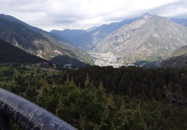
[EN]Route of about 3, 4 hours highly recommended, little crowded and with great views to the Andorra's valley. The trail starts from the town of la Massana, climbs up to the rocky hill called "Roc de la Cauba" (slippery and deathly dangerous if it's been raining or there's snow on the ground) it continues to the "Pic del Solà" summit and finally goes down through a beautiful forest to Arinsal. The tracklog ends in Arinsal in front of the bus station to return back to the start point in La Massana. If done by July/August, expect to take longer due to the frequent stops to eat delicious wild strawberries.
Positioning
Comments
Trails nearby

Walking


Walking


Walking


 SityTrail


