

De Mulhouse à Bruebach par le Tannenwald

argonneuweg
User

Length
8.4 km

Max alt
364 m

Uphill gradient
197 m

Km-Effort
11 km

Min alt
273 m

Downhill gradient
198 m
Boucle
Yes
Creation date :
2018-06-26 13:40:21.016
Updated on :
2020-12-26 16:34:53.455
2h35
Difficulty : Easy

FREE GPS app for hiking
About
Trail Walking of 8.4 km to be discovered at Grand Est, Haut-Rhin, Mulhouse. This trail is proposed by argonneuweg.
Description
Suivre le cercle rouge, puis le rectangle jaune jusqu'à Bruebach, et revenir ensuite en suivant le rectangle jaune.
Promenade facile et abritée.
Positioning
Country:
France
Region :
Grand Est
Department/Province :
Haut-Rhin
Municipality :
Mulhouse
Location:
Unknown
Start:(Dec)
Start:(UTM)
375910 ; 5288160 (32T) N.
Comments
Trails nearby

20230904 - Mulhouse - Visite


Walking
Easy
(1)
Mulhouse,
Grand Est,
Haut-Rhin,
France

4.2 km | 4.6 km-effort
1h 23min
Yes
Promenade circulaire - Noennenbruch - Anneau rouge


On foot
Easy
Lutterbach,
Grand Est,
Haut-Rhin,
France

6.6 km | 7.3 km-effort
1h 39min
No

Anneau rouge


On foot
Easy
Mulhouse,
Grand Est,
Haut-Rhin,
France

7.4 km | 9.7 km-effort
2h 11min
Yes
Mulhouse / Ferrette..02/05/2024..les Marcheurs


Walking
Very difficult
Riedisheim,
Grand Est,
Haut-Rhin,
France

37 km | 48 km-effort
4h 9min
No
circuit circulaire du Rothlaub


Walking
Very easy
Riedisheim,
Grand Est,
Haut-Rhin,
France

8.3 km | 10.7 km-effort
1h 45min
Yes

Montreux-Vieux


Electric bike
Easy
Zillisheim,
Grand Est,
Haut-Rhin,
France

69 km | 75 km-effort
4h 0min
Yes
promenade champêtre


Other activity
Very easy
Rixheim,
Grand Est,
Haut-Rhin,
France

6.4 km | 8 km-effort
1h 50min
Yes
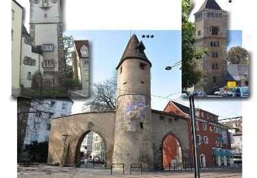
Grand Est - Ligne 4 - Paris Mulhouse (section de :Montreux-Vieux à Mulhouse)


Other activity
Very easy
Mulhouse,
Grand Est,
Haut-Rhin,
France

36 km | 39 km-effort
5min
No
Zillisheim


Walking
Easy
Zillisheim,
Grand Est,
Haut-Rhin,
France

4.7 km | 6.3 km-effort
1h 10min
Yes


 SityTrail


