Trail Walking Aurigo - Rando_Mario_Colle-San-Bartholoméo_G1 - Photo

Rando_Mario_Colle-San-Bartholoméo_G1

© OpenStreetMap contributors
Length
Length
12 km
Max alt
Max alt
1405 m
Uphill gradient
Uphill gradient
849 m
Km-Effort
Km-Effort  
23 km
Min alt
Min alt
981 m
Downhill gradient
Downhill gradient
844 m
Boucle
Boucle
Yes
Creation date :
2018-06-26 13:40:12.793
Updated on :
2018-06-26 13:40:12.793

(0 Reviews)

Walking
Walking
4h54
Difficulty : Medium

Scan this QR Code to open this trail in the SityTrail application

FREE GPS app for hiking

Logo SityTrail SityTrail

IGN / Geographical institutes

Download SityTrail from the App Store Download SityTrail from Google Play

Logo SityTrail SityTrail World

The world is yours!

Download SityTrail from the App Store Download SityTrail from Google Play Download SityTrail on Huawei AppGallery

About

Trail Walking of 12 km to be discovered at Liguria, Imperia, Aurigo. This trail is proposed by Patrick_Boistel.

Description

Randonnée à préparer pour Mario

Elevation profile

Positioning

Country:
Italy
Region :
Liguria
Department/Province :
Imperia
Municipality :
Aurigo
Location:
Unknown
Start:(UTM)
412581 ; 4872967 (32T) N.

Trails nearby

Trail On foot Montalto Carpasio - Anello Borghi Valle Carpasina - Photo
On foot
PRO

On foot

Medium
Montalto Carpasio, Liguria, Imperia, Italy
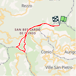
17.2 km | 30 km-effort
6h 44min
Yes
Trail On foot Borgomaro - Strada Reale - Photo
On foot
PRO

On foot

Easy
Borgomaro, Liguria, Imperia, Italy
7.3 km | 13.4 km-effort
3h 2min
No
Trail Walking Caravonica - Rando_Mario_Colle-San-Bartholoméo_G3A - Photo
Walking
Patrick_Boistel

Walking

Very easy
Caravonica, Liguria, Imperia, Italy
9.1 km | 15.4 km-effort
3h 7min
No


Close
My subscriptions