Trail Walking Biot - Vallon de la Brague - Photo
 Greg813
Greg813

User

© OpenStreetMap contributors
Length
Length
15 km
Max alt
Max alt
208 m
Uphill gradient
Uphill gradient
297 m
Km-Effort
Km-Effort  
19 km
Min alt
Min alt
44 m
Downhill gradient
Downhill gradient
297 m
Boucle
Boucle
Yes
Creation date :
2018-06-26 13:35:36.486
Updated on :
2018-06-26 13:35:36.486

(0 Reviews)

Walking
Walking
4h16
Difficulty : Medium

Scan this QR Code to open this trail in the SityTrail application

FREE GPS app for hiking

Logo SityTrail SityTrail

IGN / Geographical institutes

Download SityTrail from the App Store Download SityTrail from Google Play

Logo SityTrail SityTrail World

The world is yours!

Download SityTrail from the App Store Download SityTrail from Google Play Download SityTrail on Huawei AppGallery

About

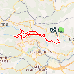
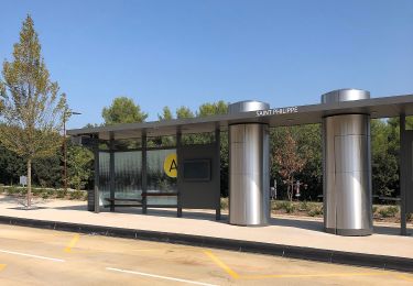
Trail Walking of 15 km to be discovered at Provence-Alpes-Côte d'Azur, Maritime Alps, Biot. This trail is proposed by Greg813.

Description

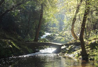
Ballade ombragée dans le vallon de la Brague.
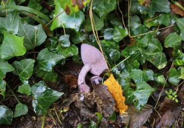
Attention, certaines parties ne sont pas praticables en cas de fortes précipitations (hausse du niveau des eaux)

Elevation profile

Points of interest

Point of interest Biot - Fort dénivelé - Photo
Greg813
Point of interest Biot - Unnamed POI - Photo
Greg813
Point of interest Valbonne - Unnamed POI - Photo
Greg813
VALBONNE 

Positioning

Country:
France
Region :
Provence-Alpes-Côte d'Azur
Department/Province :
Maritime Alps
Municipality :
Biot
Location:
Unknown
Start:(UTM)
344990 ; 4832631 (32T) N.

Trails nearby

Trail On foot Roquefort-les-Pins - Le Rucher - Photo
On foot
PRO

On foot

Easy
Roquefort-les-Pins, Provence-Alpes-Côte d'Azur, Maritime Alps, France
3.7 km | 4.8 km-effort
1h 5min
No
Trail On foot Biot - Sentier de la Vallée de la Brague - Photo
On foot
PRO

On foot

Easy
Biot, Provence-Alpes-Côte d'Azur, Maritime Alps, France
10 km | 12.5 km-effort
2h 50min
No
Trail On foot Valbonne - Circuit des Macarons - Photo
On foot
PRO

On foot

Easy
Valbonne, Provence-Alpes-Côte d'Azur, Maritime Alps, France
6.3 km | 8.6 km-effort
1h 57min
Yes
Trail On foot Valbonne - Circuit des Bouillides - Photo
On foot
PRO

On foot

Easy
Valbonne, Provence-Alpes-Côte d'Azur, Maritime Alps, France
10.6 km | 13.9 km-effort
3h 8min
Yes
Trail On foot Valbonne - Circuit de l'Aqueduc - Photo
On foot
PRO

On foot

Easy
Valbonne, Provence-Alpes-Côte d'Azur, Maritime Alps, France
6.3 km | 8 km-effort
1h 49min
Yes
Trail On foot Biot - Circuit de Saint-Philippe - Photo
On foot
PRO

On foot

Easy
Biot, Provence-Alpes-Côte d'Azur, Maritime Alps, France
3.3 km | 4.7 km-effort
1h 4min
No
Trail On foot Biot - Circuit des Pierres à Four - Photo
On foot
PRO

On foot

Easy
Biot, Provence-Alpes-Côte d'Azur, Maritime Alps, France
10.3 km | 13 km-effort
2h 57min
Yes
Trail On foot Roquefort-les-Pins - Circuit de Darbousson - Photo
On foot
PRO

On foot

Easy
Roquefort-les-Pins, Provence-Alpes-Côte d'Azur, Maritime Alps, France
9.2 km | 11.8 km-effort
2h 40min
Yes
Trail On foot Valbonne - Circuit de Font Martine - Photo
On foot
PRO

On foot

Easy
Valbonne, Provence-Alpes-Côte d'Azur, Maritime Alps, France
7.9 km | 10 km-effort
2h 16min
Yes


Close
My subscriptions