![](/images/other/stat-length.png)
![Trail Walking Aarau - Aarau au printemps, circuit 06.05.2018 - Photo](https://media.geolcdn.com/t/1900/400/ext.pjpeg?maxdim=2&url=https%3A%2F%2Fservices.sitytrail.com%2FGeolivesWS%2FDownloadMedia.ashx%3FTrailID%3D959377%26Media%3D46a055cf-722d-484c-8669-990af763813e.jpg)
Aarau au printemps, circuit 06.05.2018
duamerg
User
![Length](/images/other/stat-length.png)
![Max alt](https://static1.geolcdn.com/siteimages/upload/files/1508320355ic_sort_altitude_max_24dp.png)
![Uphill gradient](https://static1.geolcdn.com/siteimages/upload/files/1508320355ic_sort_den_pos_24dp.png)
![Km-Effort](/images/other/stat-length.png)
![Min alt](https://static1.geolcdn.com/siteimages/upload/files/1508320355ic_sort_altitude_min_24dp.png)
![Downhill gradient](https://static1.geolcdn.com/siteimages/upload/files/1508320355ic_sort_den_neg_24dp.png)
![Boucle](https://static1.geolcdn.com/siteimages/upload/files/16400158638029165_repeat_loop_refresh_sync_direction_icon.png)
![Walking](https://static1.geolcdn.com/sitytour/trail-icons/101.png)
2h40
Difficulty : Very easy
![Scan this QR Code to open this trail in the SityTrail application](https://capi.geolives.com/qq0zvz2zws4bq2lad0pu/sitytour/trails/959377/qr.png?size=200)
FREE GPS app for hiking
About
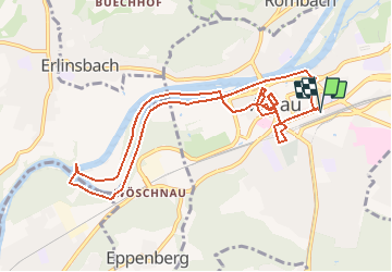
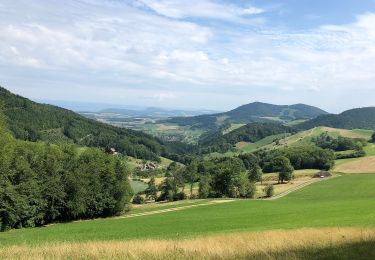
Trail Walking of 10.6 km to be discovered at Aargau, Bezirk Aarau, Aarau. This trail is proposed by duamerg.
Description
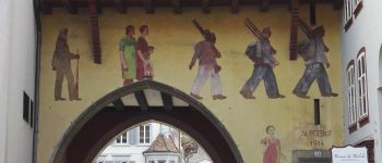
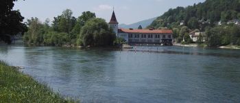
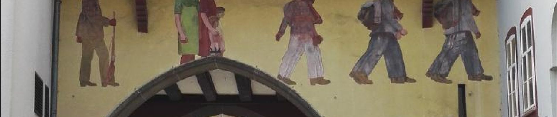
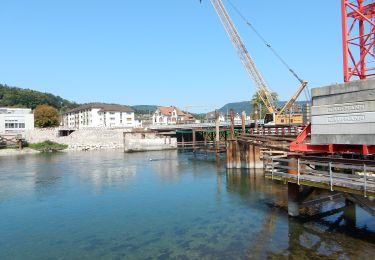
De la gare allez d'abord voir le bâtiment de l'image avant de monter et parcourir un joli parc. Ensuite direction la très jolie vieille ville que vous pouvez parcourir en long et en large et admirer les plus beaux avants-toits de suisse avant de rejoindre une passerelle sur l'Aar.
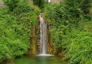
Prenez à gauche un joli chemin en forêt qui vous mène au captage d'eau pour la centrale électrique.
Retour par la rive opposée pour rejoindre la gare.
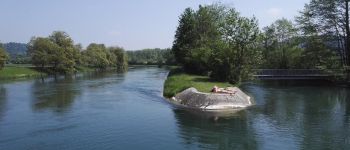
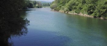
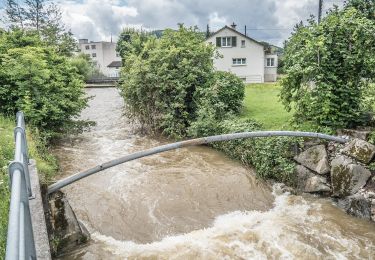
Très agréable balade avec de nombreuses possibilités de s'arrêter sur ce bras secondaire de l'Aar et d'y tremper les pieds.
Positioning
Comments
Trails nearby
![Trail On foot Aarau - Roggenhausen - Schönenwerd - Photo](https://media.geolcdn.com/t/375/260/510737bf-bc80-40df-a6c0-ca8497038e12.jpeg&format=jpg&maxdim=2)
![On foot On foot](https://static1.geolcdn.com/sitytour/trail-icons/100.png)
On foot
![](/images/other/stat-length.png)
![](https://static1.geolcdn.com/siteimages/upload/files/16400158638029165_repeat_loop_refresh_sync_direction_icon.png)
![Trail On foot Erlinsbach (SO) - Niedergösgen - Niedererlinsbach - Photo](https://media.geolcdn.com/t/375/260/a3a077c2-86d3-46dc-bb36-484832de3444.jpeg&format=jpg&maxdim=2)
![On foot On foot](https://static1.geolcdn.com/sitytour/trail-icons/100.png)
On foot
![](/images/other/stat-length.png)
![](https://static1.geolcdn.com/siteimages/upload/files/16400158638029165_repeat_loop_refresh_sync_direction_icon.png)
![Trail On foot Niedergösgen - Obergösgen - Niedergösgen - Photo](https://media.geolcdn.com/t/375/260/9fee5289-ebfc-4d99-96ac-1caeecc4396d.jpeg&format=jpg&maxdim=2)
![On foot On foot](https://static1.geolcdn.com/sitytour/trail-icons/100.png)
On foot
![](/images/other/stat-length.png)
![](https://static1.geolcdn.com/siteimages/upload/files/16400158638029165_repeat_loop_refresh_sync_direction_icon.png)
![Trail On foot Erlinsbach (AG) - Salhöhe - Obererlinsbach - Photo](https://media.geolcdn.com/t/375/260/94735ea1-0d35-483f-a24c-b1b67aa73858.jpeg&format=jpg&maxdim=2)
![On foot On foot](https://static1.geolcdn.com/sitytour/trail-icons/100.png)
On foot
![](/images/other/stat-length.png)
![](https://static1.geolcdn.com/siteimages/upload/files/16400158638029165_repeat_loop_refresh_sync_direction_icon.png)
![Trail On foot Aarau - Obererlinsbach - Alpenzeiger - Photo](https://media.geolcdn.com/t/375/260/8a1a4f6b-77be-485a-9c3d-bf44daca6eac.jpeg&format=jpg&maxdim=2)
![On foot On foot](https://static1.geolcdn.com/sitytour/trail-icons/100.png)
On foot
![](/images/other/stat-length.png)
![](https://static1.geolcdn.com/siteimages/upload/files/16400158638029165_repeat_loop_refresh_sync_direction_icon.png)
![Trail On foot Aarau - Rupperswil - Rohr - Photo](https://media.geolcdn.com/t/375/260/73e8795b-4a52-415c-a31b-419db32dc92f.jpeg&format=jpg&maxdim=2)
![On foot On foot](https://static1.geolcdn.com/sitytour/trail-icons/100.png)
On foot
![](/images/other/stat-length.png)
![](https://static1.geolcdn.com/siteimages/upload/files/16400158638029165_repeat_loop_refresh_sync_direction_icon.png)
![Trail On foot Gränichen - Gränichen - Rütihof - Photo](https://media.geolcdn.com/t/375/260/40290f85-b244-496f-93be-defce90f143e.jpeg&format=jpg&maxdim=2)
![On foot On foot](https://static1.geolcdn.com/sitytour/trail-icons/100.png)
On foot
![](/images/other/stat-length.png)
![](https://static1.geolcdn.com/siteimages/upload/files/16400158638029165_repeat_loop_refresh_sync_direction_icon.png)
![Trail On foot Biberstein - Hombergegg - Biberstein - Photo](https://media.geolcdn.com/t/375/260/dev_4b302756-625d-420a-82ae-d26c90d1b984.jpeg&format=jpg&maxdim=2)
![On foot On foot](https://static1.geolcdn.com/sitytour/trail-icons/100.png)
On foot
![](/images/other/stat-length.png)
![](https://static1.geolcdn.com/siteimages/upload/files/16400158638029165_repeat_loop_refresh_sync_direction_icon.png)
![Trail On foot Erlinsbach (AG) - Breitmis - Hinterfeld - Photo](https://media.geolcdn.com/t/375/260/935f15c7-2966-4595-9f14-16c84fb69989.jpeg&format=jpg&maxdim=2)
![On foot On foot](https://static1.geolcdn.com/sitytour/trail-icons/100.png)
On foot
![](/images/other/stat-length.png)
![](https://static1.geolcdn.com/siteimages/upload/files/16400158638029165_repeat_loop_refresh_sync_direction_icon.png)