![](/images/other/stat-length.png)
![Trail Walking Noirmoutier-en-l'Île - Noirmoutier en l'Ile et l'herbaudière entre marais et la côte - Photo](https://media.geolcdn.com/t/1900/400/ext.pjpeg?maxdim=2&url=https%3A%2F%2Fservices.sitytrail.com%2FGeolivesWS%2FDownloadMedia.ashx%3FTrailID%3D959057%26Media%3Dfix__20180504181600.jpg)
Noirmoutier en l'Ile et l'herbaudière entre marais et la côte
Axelloceane
User
![Length](/images/other/stat-length.png)
![Max alt](https://static1.geolcdn.com/siteimages/upload/files/1508320355ic_sort_altitude_max_24dp.png)
![Uphill gradient](https://static1.geolcdn.com/siteimages/upload/files/1508320355ic_sort_den_pos_24dp.png)
![Km-Effort](/images/other/stat-length.png)
![Min alt](https://static1.geolcdn.com/siteimages/upload/files/1508320355ic_sort_altitude_min_24dp.png)
![Downhill gradient](https://static1.geolcdn.com/siteimages/upload/files/1508320355ic_sort_den_neg_24dp.png)
![Boucle](https://static1.geolcdn.com/siteimages/upload/files/16400158638029165_repeat_loop_refresh_sync_direction_icon.png)
![Walking](https://static1.geolcdn.com/sitytour/trail-icons/101.png)
5h11
Difficulty : Easy
![Scan this QR Code to open this trail in the SityTrail application](https://capi.geolives.com/qq0zvz2zws4bq2lad0pu/sitytour/trails/959057/qr.png?size=200)
FREE GPS app for hiking
About
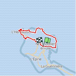
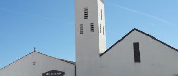
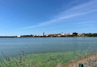
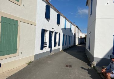
Trail Walking of 22 km to be discovered at Pays de la Loire, Vendée, Noirmoutier-en-l'Île. This trail is proposed by Axelloceane.
Description
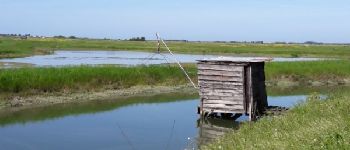
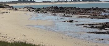
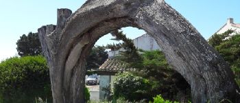
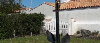
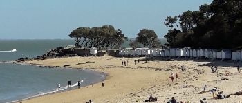
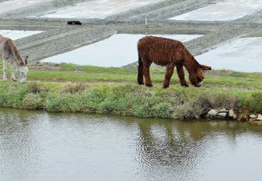
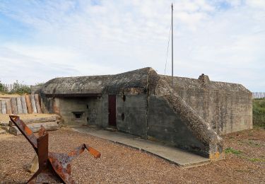
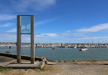
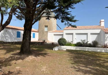
Départ du parking de Noirmoutier en direction de l'Herbaudière par les marais en suivant l'itinéraire rando vélo. Vue du port et à la sortie de la commune suivre de nouveau le balisage rando vélo jusqu'à le Petit Vieil.Puis suivre la côte jusqu'à la plage des Sableaux en passant par le bois de la Chaise et retour à Noirmoutier-en-L'Ile
Points of interest
Positioning
Comments
Trails nearby
![Trail Walking L'Épine - Les Marais de Luzeronde - Photo](https://media.geolcdn.com/t/375/260/ext.jpg?maxdim=2&url=https%3A%2F%2Fstatic1.geolcdn.com%2Fsiteimages%2Fupload%2Ffiles%2F1553511878bg_sport_marche.png)
![Walking Walking](https://static1.geolcdn.com/sitytour/trail-icons/101.png)
Walking
![](/images/other/stat-length.png)
![](https://static1.geolcdn.com/siteimages/upload/files/16400158638029165_repeat_loop_refresh_sync_direction_icon.png)
![Trail On foot Noirmoutier-en-l'Île - Sur les traces des Jacobsen - Photo](https://media.geolcdn.com/t/375/260/6222f97e-2beb-47c2-ac73-1db88481adbd.jpeg&format=jpg&maxdim=2)
![On foot On foot](https://static1.geolcdn.com/sitytour/trail-icons/100.png)
On foot
![](/images/other/stat-length.png)
![](https://static1.geolcdn.com/siteimages/upload/files/16400158638029165_repeat_loop_refresh_sync_direction_icon.png)
![Trail On foot Noirmoutier-en-l'Île - Roses trémières - Photo](https://media.geolcdn.com/t/375/260/504a4f09-026b-4f3b-a144-9641852cfb05.jpeg&format=jpg&maxdim=2)
![On foot On foot](https://static1.geolcdn.com/sitytour/trail-icons/100.png)
On foot
![](/images/other/stat-length.png)
![](https://static1.geolcdn.com/siteimages/upload/files/16400158638029165_repeat_loop_refresh_sync_direction_icon.png)
![Trail On foot La Guérinière - En Passant par les Moulins - Photo](https://media.geolcdn.com/t/375/260/ccc103f2-0cff-4e2a-b30b-b4e364a262b4.jpeg&format=jpg&maxdim=2)
![On foot On foot](https://static1.geolcdn.com/sitytour/trail-icons/100.png)
On foot
![](/images/other/stat-length.png)
![](https://static1.geolcdn.com/siteimages/upload/files/16400158638029165_repeat_loop_refresh_sync_direction_icon.png)
![Trail On foot L'Épine - Chemin de mer et de marais - Photo](https://media.geolcdn.com/t/375/260/ded2016b-df3d-4278-8be0-d3af6896ca41.jpeg&format=jpg&maxdim=2)
![On foot On foot](https://static1.geolcdn.com/sitytour/trail-icons/100.png)
On foot
![](/images/other/stat-length.png)
![](https://static1.geolcdn.com/siteimages/upload/files/16400158638029165_repeat_loop_refresh_sync_direction_icon.png)
![Trail Hybrid bike L'Épine - B02 - Boucle entre plages et ports - Photo](https://media.geolcdn.com/t/375/260/ext.jpg?maxdim=2&url=https%3A%2F%2Fstatic1.geolcdn.com%2Fsiteimages%2Fupload%2Ffiles%2F1524743154velo.jpg)
![Hybrid bike Hybrid bike](https://static1.geolcdn.com/sitytour/trail-icons/203.png)
Hybrid bike
![](/images/other/stat-length.png)
![](https://static1.geolcdn.com/siteimages/upload/files/16400158638029165_repeat_loop_refresh_sync_direction_icon.png)
![Trail Walking L'Épine - Noirmoutier 3 - Photo](https://media.geolcdn.com/t/375/260/640ca307-094e-454b-910c-add2497a7004.jpg&format=jpg&maxdim=2)
![Walking Walking](https://static1.geolcdn.com/sitytour/trail-icons/101.png)
Walking
![](/images/other/stat-length.png)
![](https://static1.geolcdn.com/siteimages/upload/files/16400158638029165_repeat_loop_refresh_sync_direction_icon.png)
![Trail Walking Noirmoutier-en-l'Île - Randonnée nord Noirmoutier - Photo](https://media.geolcdn.com/t/375/260/546cf5a8-bd2d-412f-a2bb-12023648116c.jpg&format=jpg&maxdim=2)
![Walking Walking](https://static1.geolcdn.com/sitytour/trail-icons/101.png)
Walking
![](/images/other/stat-length.png)
![](https://static1.geolcdn.com/siteimages/upload/files/16400158638029165_repeat_loop_refresh_sync_direction_icon.png)
![Trail Walking Noirmoutier-en-l'Île - Noirmoutier, premier jour, mise en jambe - Photo](https://media.geolcdn.com/t/375/260/44557226-b7a7-4ccf-bccc-db2a3325466d.jpg&format=jpg&maxdim=2)
![Walking Walking](https://static1.geolcdn.com/sitytour/trail-icons/101.png)
Walking
![](/images/other/stat-length.png)
![](https://static1.geolcdn.com/siteimages/upload/files/16400158638029165_repeat_loop_refresh_sync_direction_icon.png)