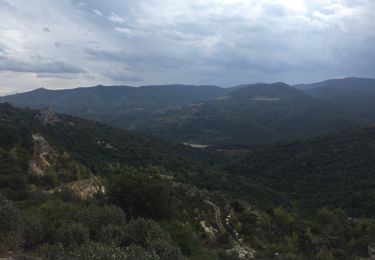
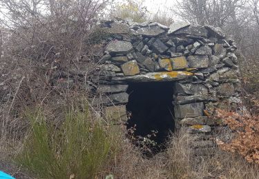
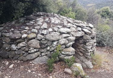
![](/images/other/stat-length.png)
![Trail Walking Ansignan - RP66 ANSIGNAN - aqueduc - rec de la Piquière - ST ARNAC - col de Lacroix - ANSIGNAN - Photo](https://media.geolcdn.com/t/1900/400/ext.pjpeg?maxdim=2&url=https%3A%2F%2Fstatic1.geolcdn.com%2Fsiteimages%2Fupload%2Ffiles%2F1553511878bg_sport_marche.png)
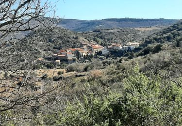
RP66 ANSIGNAN - aqueduc - rec de la Piquière - ST ARNAC - col de Lacroix - ANSIGNAN
jeff66
User
![Length](/images/other/stat-length.png)
Length
11.5 km
![Max alt](https://static1.geolcdn.com/siteimages/upload/files/1508320355ic_sort_altitude_max_24dp.png)
Max alt
444 m
![Uphill gradient](https://static1.geolcdn.com/siteimages/upload/files/1508320355ic_sort_den_pos_24dp.png)
Uphill gradient
349 m
![Km-Effort](/images/other/stat-length.png)
Km-Effort
16.1 km
![Min alt](https://static1.geolcdn.com/siteimages/upload/files/1508320355ic_sort_altitude_min_24dp.png)
Min alt
178 m
![Downhill gradient](https://static1.geolcdn.com/siteimages/upload/files/1508320355ic_sort_den_neg_24dp.png)
Downhill gradient
350 m
![Boucle](https://static1.geolcdn.com/siteimages/upload/files/16400158638029165_repeat_loop_refresh_sync_direction_icon.png)
Boucle
Yes
Creation date :
2018-06-26 12:53:50.147
Updated on :
2018-06-26 12:53:50.147
![Walking](https://static1.geolcdn.com/sitytour/trail-icons/101.png)
2h26
Difficulty : Medium
![Scan this QR Code to open this trail in the SityTrail application](https://capi.geolives.com/qq0zvz2zws4bq2lad0pu/sitytour/trails/955502/qr.png?size=200)
FREE GPS app for hiking
About
Trail Walking of 11.5 km to be discovered at Occitania, Pyrénées-Orientales, Ansignan. This trail is proposed by jeff66.
Description
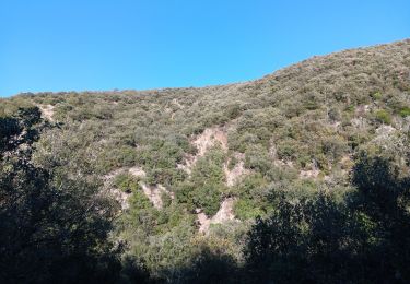
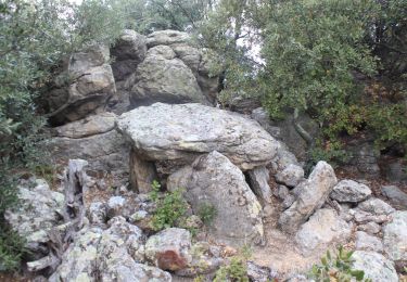
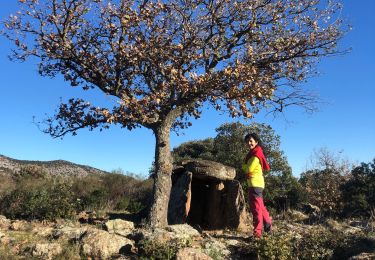
RP66 ANSIGNAN - aqueduc - rec de la Piquière - ST ARNAC - les Pujals - RD77 - col de Lacroix - piste DFCI53 - Sarrat Duc - camp de la Mourié - la Couillade du Rentadou - la guarrigue de roque rouge - Condomines - ANSIGNAN
Positioning
Country:
France
Region :
Occitania
Department/Province :
Pyrénées-Orientales
Municipality :
Ansignan
Location:
Unknown
Start:(Dec)
Start:(UTM)
460388 ; 4734874 (31T) N.
Comments
Trails nearby
![Trail Walking Trilla - 66 TRILLA - ANSIGNAN aqueduc romain - ballade en Fenouillédes - Photo](https://media.geolcdn.com/t/375/260/ext.jpg?maxdim=2&url=https%3A%2F%2Fservices.sitytrail.com%2FGeolivesWS%2FDownloadMedia.ashx%3FTrailID%3D468189%26Media%3D20150904183642.jpg)
![Walking Walking](https://static1.geolcdn.com/sitytour/trail-icons/101.png)
66 TRILLA - ANSIGNAN aqueduc romain - ballade en Fenouillédes
Walking
Difficult
(1)
Trilla,
Occitania,
Pyrénées-Orientales,
France
![](/images/other/stat-length.png)
17.6 km | 26 km-effort
3h 49min
![](https://static1.geolcdn.com/siteimages/upload/files/16400158638029165_repeat_loop_refresh_sync_direction_icon.png)
Yes
![Trail Walking Caramany - CARAMANY 66 - balcons retenue sur l'Agly - Photo](https://media.geolcdn.com/t/375/260/ext.jpg?maxdim=2&url=https%3A%2F%2Fstatic1.geolcdn.com%2Fsiteimages%2Fupload%2Ffiles%2F1553511878bg_sport_marche.png)
![Walking Walking](https://static1.geolcdn.com/sitytour/trail-icons/101.png)
CARAMANY 66 - balcons retenue sur l'Agly
Walking
Medium
(3)
Caramany,
Occitania,
Pyrénées-Orientales,
France
![](/images/other/stat-length.png)
25 km | 34 km-effort
3h 59min
![](https://static1.geolcdn.com/siteimages/upload/files/16400158638029165_repeat_loop_refresh_sync_direction_icon.png)
Yes
![Trail Walking Caramany - caramany - Photo](https://media.geolcdn.com/t/375/260/a6e7a0ea-152c-4eff-9a23-91b03d26cf6d.jpg&format=jpg&maxdim=2)
![Walking Walking](https://static1.geolcdn.com/sitytour/trail-icons/101.png)
caramany
Walking
Medium
Caramany,
Occitania,
Pyrénées-Orientales,
France
![](/images/other/stat-length.png)
8 km | 11.4 km-effort
3h 27min
![](https://static1.geolcdn.com/siteimages/upload/files/16400158638029165_repeat_loop_refresh_sync_direction_icon.png)
Yes
![Trail Walking Ansignan - sentier des dolmens en fenouillèdes - Photo](https://media.geolcdn.com/t/375/260/0846838b-f16b-4aa4-86fe-00f3a15fd2d6.jpg&format=jpg&maxdim=2)
![Walking Walking](https://static1.geolcdn.com/sitytour/trail-icons/101.png)
sentier des dolmens en fenouillèdes
Walking
Easy
Ansignan,
Occitania,
Pyrénées-Orientales,
France
![](/images/other/stat-length.png)
9.7 km | 14.5 km-effort
3h 57min
![](https://static1.geolcdn.com/siteimages/upload/files/16400158638029165_repeat_loop_refresh_sync_direction_icon.png)
Yes
![Trail Walking Feilluns - track - Photo](https://media.geolcdn.com/t/375/260/64946339-3878-4e98-9375-f37dd795d67a.jpg&format=jpg&maxdim=2)
![Walking Walking](https://static1.geolcdn.com/sitytour/trail-icons/101.png)
track
Walking
Very difficult
Feilluns,
Occitania,
Pyrénées-Orientales,
France
![](/images/other/stat-length.png)
17.3 km | 24 km-effort
5h 28min
![](https://static1.geolcdn.com/siteimages/upload/files/16400158638029165_repeat_loop_refresh_sync_direction_icon.png)
Yes
![Trail Walking Ansignan - 20230105 Ansignan - Photo](https://media.geolcdn.com/t/375/260/488937c0-a91f-49ed-8a64-a7a477dcda83.jpg&format=jpg&maxdim=2)
![Walking Walking](https://static1.geolcdn.com/sitytour/trail-icons/101.png)
20230105 Ansignan
Walking
Medium
Ansignan,
Occitania,
Pyrénées-Orientales,
France
![](/images/other/stat-length.png)
17 km | 27 km-effort
4h 38min
![](https://static1.geolcdn.com/siteimages/upload/files/16400158638029165_repeat_loop_refresh_sync_direction_icon.png)
Yes
![Trail Walking Lansac - 66 LANSAC - boucle, tour et Roc de LANSAC - Photo](https://media.geolcdn.com/t/375/260/ext.jpg?maxdim=2&url=https%3A%2F%2Fservices.sitytrail.com%2FGeolivesWS%2FDownloadMedia.ashx%3FTrailID%3D477866%26Media%3D20151001151431.jpg)
![Walking Walking](https://static1.geolcdn.com/sitytour/trail-icons/101.png)
66 LANSAC - boucle, tour et Roc de LANSAC
Walking
Medium
Lansac,
Occitania,
Pyrénées-Orientales,
France
![](/images/other/stat-length.png)
6.7 km | 9.5 km-effort
1h 29min
![](https://static1.geolcdn.com/siteimages/upload/files/16400158638029165_repeat_loop_refresh_sync_direction_icon.png)
Yes
![Trail Walking Prats-de-Sournia - prats de sournia hetre remarq.419 m 12km - Photo](https://media.geolcdn.com/t/375/260/d86ee142-b43a-408d-87d7-39a74d9838dd.jpg&format=jpg&maxdim=2)
![Walking Walking](https://static1.geolcdn.com/sitytour/trail-icons/101.png)
prats de sournia hetre remarq.419 m 12km
Walking
Medium
Prats-de-Sournia,
Occitania,
Pyrénées-Orientales,
France
![](/images/other/stat-length.png)
12.6 km | 18.2 km-effort
3h 27min
![](https://static1.geolcdn.com/siteimages/upload/files/16400158638029165_repeat_loop_refresh_sync_direction_icon.png)
Yes
![Trail Walking Lansac - lansac chemin du coq roc et tour 6km 200m limodore possible - Photo](https://media.geolcdn.com/t/375/260/fd8ca132-5964-4105-96c1-da2fbfd01630.jpg&format=jpg&maxdim=2)
![Walking Walking](https://static1.geolcdn.com/sitytour/trail-icons/101.png)
lansac chemin du coq roc et tour 6km 200m limodore possible
Walking
Easy
Lansac,
Occitania,
Pyrénées-Orientales,
France
![](/images/other/stat-length.png)
6.1 km | 8.8 km-effort
1h 43min
![](https://static1.geolcdn.com/siteimages/upload/files/16400158638029165_repeat_loop_refresh_sync_direction_icon.png)
Yes