


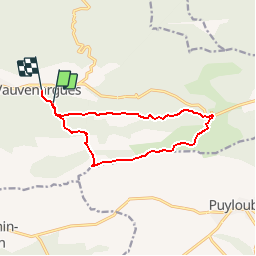

15.8 km | 28 km-effort


User


FREE GPS app for hiking
 SityTrail
IGN / Geographical institutes
SityTrail World
The world is yours!
Trail Walking of 12.3 km to be discovered at Provence-Alpes-Côte d'Azur, Bouches-du-Rhône, Vauvenargues. This trail is proposed by pourrier.
Randonnées sur la crête de la Sainte Victoire depuis Vauvenargues, le Pic des Mouches, le col des Portes.
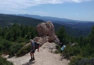
Chaines pour le passage du Bau de l'aigle bien appréciées car fin novembreles roches restent à l'ombre et sont très glissantes.

Walking

Walking

Walking

Walking

On foot

Walking
Walking

Walking

Walking
moyen