


21 km | 35 km-effort


User


FREE GPS app for hiking
 SityTrail
IGN / Geographical institutes
SityTrail World
The world is yours!
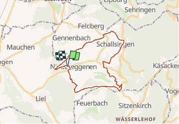
Trail Walking of 14.5 km to be discovered at Baden-Württemberg, Landkreis Lörrach, Schliengen. This trail is proposed by E.BURCK.
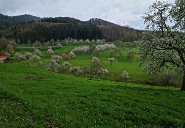
2018 04 19 Balade des cerisiers en fleurs à Eggenen
ACCÈS ET DÉPART :
Pour départ de Mulhouse et Est de la ville :
Passer la frontière à Chalampé - Neuenburg, puis Schliengen, et Niedereggenen : Schulstrasse 1-3
à 33 km – 35 min
Pour départ de Mulhouse Ouest : Idem mais 55 km – 45 min
PARKING :
Niedereggenen : Schulstrasse 1-3 (près de l'église)
47.754488 7.625828
47°45'15"N 7°37'32"E
RESTAURATION :
LandHotel Graf M.Mme Rabold
Kreuzweg 6
Obereggenen (79418 Schliengen)
47,756606 7,650256
47°45'26"N 7°39'00"E
Walking
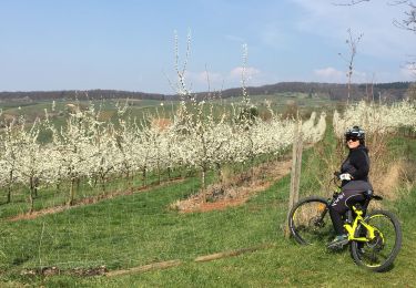
Mountain bike

Walking
Walking
Walking
Walking
Walking
Walking
Walking