Trail Walking Andrésy - Circuit Sentes et Chemins - Andrésy Naturellement - Photo

Circuit Sentes et Chemins - Andrésy Naturellement

 Andresy
Andresy

User

© OpenStreetMap contributors
Length
Length
7 km
Max alt
Max alt
77 m
Uphill gradient
Uphill gradient
97 m
Km-Effort
Km-Effort  
8.3 km
Min alt
Min alt
22 m
Downhill gradient
Downhill gradient
98 m
Boucle
Boucle
No
Creation date :
2018-04-17 23:10:09.076
Updated on :
2018-04-17 23:10:09.076

(0 Reviews)

Walking
Walking
1h50
Difficulty : Easy

Scan this QR Code to open this trail in the SityTrail application

FREE GPS app for hiking

Logo SityTrail SityTrail

IGN / Geographical institutes

Download SityTrail from the App Store Download SityTrail from Google Play

Logo SityTrail SityTrail World

The world is yours!

Download SityTrail from the App Store Download SityTrail from Google Play Download SityTrail on Huawei AppGallery

About

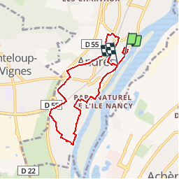
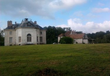
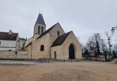
Trail Walking of 7 km to be discovered at Ile-de-France, Yvelines, Andrésy. This trail is proposed by Andresy.

Description

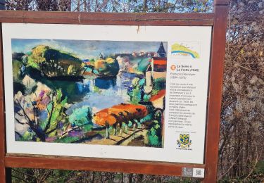
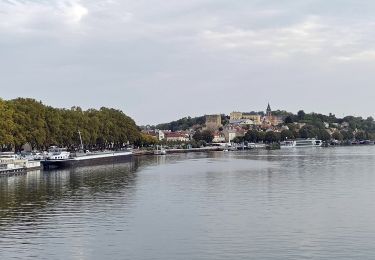
Sentes étroites, chemins éscarpés... Parcourez les sentes et chemins pittoresques de la ville d'Andrésy. Une façon de découvrir autrement le charme d'Andrésy, entre ville campagne et bord de Seine!

Elevation profile

Points of interest

Point of interest Andrésy - La porte royale - Photo
Andresy
ANDRÉSY 
Point of interest Andrésy - La Vierge de Denouval - Photo
Andresy

Positioning

Country:
France
Region :
Ile-de-France
Department/Province :
Yvelines
Municipality :
Andrésy
Location:
Unknown
Start:(UTM)
431167 ; 5425633 (31U) N.

Trails nearby

Trail On foot Conflans-Sainte-Honorine - Version définitive Conflans 7 janvier - Photo
On foot
GUIDE
chessyca

On foot

Medium
(1)
Conflans-Sainte-Honorine, Ile-de-France, Yvelines, France
23 km | 28 km-effort
6h 22min
No
Trail Walking Jouy-le-Moutier - GRP CV-IDF 2023 - Photo
Walking
clalaur

Walking

Difficult
(1)
Jouy-le-Moutier, Ile-de-France, Val-d'Oise, France
15.6 km | 18 km-effort
4h 4min
No
Trail Walking Saint-Germain-en-Laye - GRP CV-IDF 2023 - Photo
Walking
clalaur

Walking

Very difficult
(1)
Saint-Germain-en-Laye, Ile-de-France, Yvelines, France
16.5 km | 19.1 km-effort
4h 21min
No
Trail Walking Saint-Germain-en-Laye - circuit MA 271019  - Photo
Walking
runarlejou

Walking

Very easy
(1)
Saint-Germain-en-Laye, Ile-de-France, Yvelines, France
4.7 km | 5.2 km-effort
1h 3min
Yes
Trail Walking Saint-Germain-en-Laye - D'Achères Grand Cormier à Maison Laffitte - Photo
Walking
tracegps

Walking

Medium
(1)
Saint-Germain-en-Laye, Ile-de-France, Yvelines, France
12.9 km | 14.4 km-effort
3h 0min
No
Trail Walking Le Mesnil-le-Roi - RS 5 km porte chene corbeau - Photo
Walking
patb54

Walking

Easy
(1)
Le Mesnil-le-Roi, Ile-de-France, Yvelines, France
5.2 km | 5.8 km-effort
1h 18min
Yes
Trail On foot Conflans-Sainte-Honorine - Conflans fin d'oise - Andresy - La Frette - Photo
On foot
GUIDE
chessyca

On foot

Medium
Conflans-Sainte-Honorine, Ile-de-France, Yvelines, France
22 km | 27 km-effort
6h 14min
No
Trail Walking Saint-Germain-en-Laye - 20230824 5S 5KM - Photo
Walking
patb54

Walking

Medium
(1)
Saint-Germain-en-Laye, Ile-de-France, Yvelines, France
5.5 km | 6.3 km-effort
1h 25min
Yes
Trail Walking Saint-Germain-en-Laye - RS 5 le mesnil route des portes - Photo
Walking
patb54

Walking

Easy
(1)
Saint-Germain-en-Laye, Ile-de-France, Yvelines, France
4.8 km | 5.3 km-effort
1h 11min
Yes


Close
My subscriptions