![](/images/other/stat-length.png)
![Trail Walking Lussas - canyon de la Louyre Ardèche 07 Janvier 2018 - Photo](https://media.geolcdn.com/t/1900/400/ext.pjpeg?maxdim=2&url=https%3A%2F%2Fservices.sitytrail.com%2FGeolivesWS%2FDownloadMedia.ashx%3FTrailID%3D894826%26Media%3D20180124145222.jpg)
canyon de la Louyre Ardèche 07 Janvier 2018
Pacekall
User
![Length](/images/other/stat-length.png)
Length
10.1 km
![Max alt](https://static1.geolcdn.com/siteimages/upload/files/1508320355ic_sort_altitude_max_24dp.png)
Max alt
381 m
![Uphill gradient](https://static1.geolcdn.com/siteimages/upload/files/1508320355ic_sort_den_pos_24dp.png)
Uphill gradient
209 m
![Km-Effort](/images/other/stat-length.png)
Km-Effort
12.9 km
![Min alt](https://static1.geolcdn.com/siteimages/upload/files/1508320355ic_sort_altitude_min_24dp.png)
Min alt
214 m
![Downhill gradient](https://static1.geolcdn.com/siteimages/upload/files/1508320355ic_sort_den_neg_24dp.png)
Downhill gradient
201 m
![Boucle](https://static1.geolcdn.com/siteimages/upload/files/16400158638029165_repeat_loop_refresh_sync_direction_icon.png)
Boucle
Yes
Creation date :
2018-04-17 21:02:24.727
Updated on :
2018-04-17 21:02:24.727
![Walking](https://static1.geolcdn.com/sitytour/trail-icons/101.png)
4h51
Difficulty : Easy
![Scan this QR Code to open this trail in the SityTrail application](https://capi.geolives.com/qq0zvz2zws4bq2lad0pu/sitytour/trails/918239/qr.png?size=200)
FREE GPS app for hiking
About
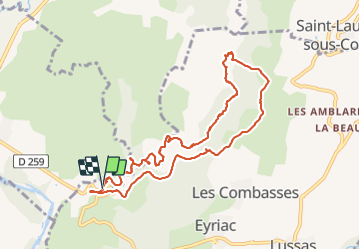
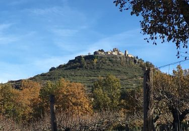
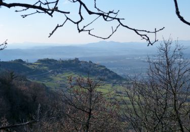
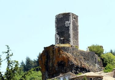
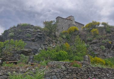
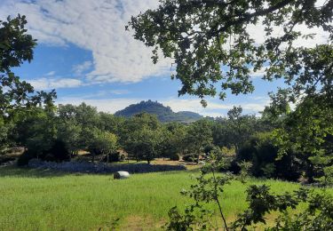
Trail Walking of 10.1 km to be discovered at Auvergne-Rhône-Alpes, Ardèche, Lussas. This trail is proposed by Pacekall.
Description
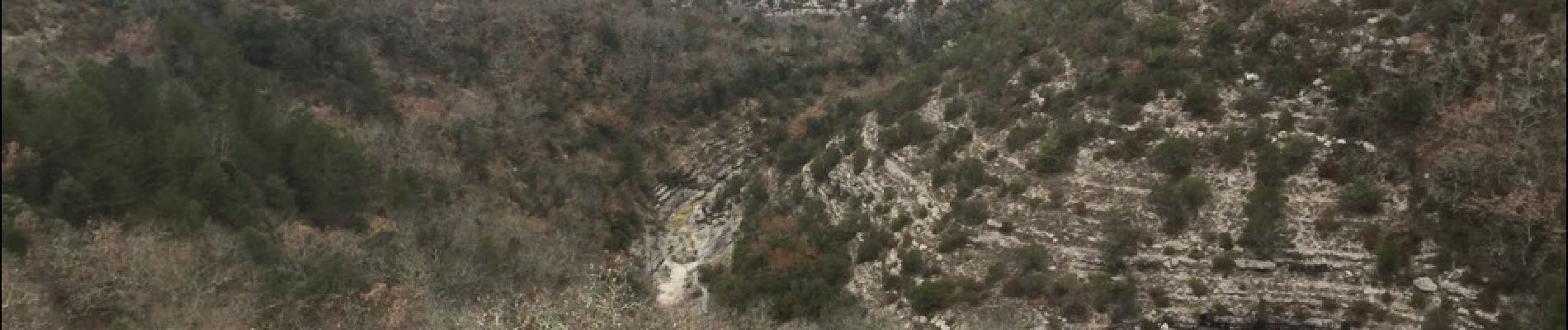
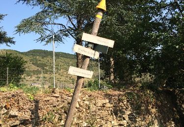
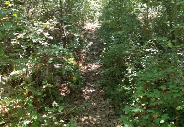
Depart 1er lacet de la route . Attention des passages parfois humide et glissant. Progression lente à travers le canyon
Positioning
Country:
France
Region :
Auvergne-Rhône-Alpes
Department/Province :
Ardèche
Municipality :
Lussas
Location:
Unknown
Start:(Dec)
Start:(UTM)
614271 ; 4941584 (31T) N.
Comments
Trails nearby
![Trail Walking Saint-Laurent-sous-Coiron - SityTrail - 2460537 - st-laurent - Photo](https://media.geolcdn.com/t/375/260/248a6b55-9b40-4f3e-9231-07b72c1a2693.jpg&format=jpg&maxdim=2)
![Walking Walking](https://static1.geolcdn.com/sitytour/trail-icons/101.png)
SityTrail - 2460537 - st-laurent
Walking
Easy
(2)
Saint-Laurent-sous-Coiron,
Auvergne-Rhône-Alpes,
Ardèche,
France
![](/images/other/stat-length.png)
10 km | 13.6 km-effort
3h 5min
![](https://static1.geolcdn.com/siteimages/upload/files/16400158638029165_repeat_loop_refresh_sync_direction_icon.png)
Yes
![Trail Walking Lavilledieu - Lavilledieu Vogüé 15,5km - Photo](https://media.geolcdn.com/t/375/260/1bdbb61c-3b5b-4058-bb64-9584eec194ea.jpg&format=jpg&maxdim=2)
![Walking Walking](https://static1.geolcdn.com/sitytour/trail-icons/101.png)
Lavilledieu Vogüé 15,5km
Walking
Difficult
(2)
Lavilledieu,
Auvergne-Rhône-Alpes,
Ardèche,
France
![](/images/other/stat-length.png)
14.9 km | 18.7 km-effort
4h 15min
![](https://static1.geolcdn.com/siteimages/upload/files/16400158638029165_repeat_loop_refresh_sync_direction_icon.png)
Yes
![Trail Walking Vesseaux - Vesseaux - Photo](https://media.geolcdn.com/t/375/260/ext.jpg?maxdim=2&url=https%3A%2F%2Fservices.sitytrail.com%2FGeolivesWS%2FDownloadMedia.ashx%3FTrailID%3D442802%26Media%3D20150708175142.jpg)
![Walking Walking](https://static1.geolcdn.com/sitytour/trail-icons/101.png)
Vesseaux
Walking
Easy
(2)
Vesseaux,
Auvergne-Rhône-Alpes,
Ardèche,
France
![](/images/other/stat-length.png)
11.3 km | 15.9 km-effort
3h 21min
![](https://static1.geolcdn.com/siteimages/upload/files/16400158638029165_repeat_loop_refresh_sync_direction_icon.png)
Yes
![Walking Walking](https://static1.geolcdn.com/sitytour/trail-icons/101.png)
Trace St Privat autour du Canyon de la Louyre (partie Basse) 19-03-2018
Walking
Difficult
(1)
Saint-Privat,
Auvergne-Rhône-Alpes,
Ardèche,
France
![](/images/other/stat-length.png)
12.1 km | 16.9 km-effort
3h 49min
![](https://static1.geolcdn.com/siteimages/upload/files/16400158638029165_repeat_loop_refresh_sync_direction_icon.png)
Yes
![Walking Walking](https://static1.geolcdn.com/sitytour/trail-icons/101.png)
St Laurent sous Coiron
Walking
Medium
(1)
Saint-Laurent-sous-Coiron,
Auvergne-Rhône-Alpes,
Ardèche,
France
![](/images/other/stat-length.png)
10.3 km | 14 km-effort
3h 36min
![](https://static1.geolcdn.com/siteimages/upload/files/16400158638029165_repeat_loop_refresh_sync_direction_icon.png)
Yes
![Trail Walking Mirabel - 2025-01-25_15h34m21_SityTrail - 3633141 - mirabel-11km-den367m- - Photo](https://media.geolcdn.com/t/375/260/e7aad9c3-6c53-4829-ad7f-8298786bbba5.jpg&format=jpg&maxdim=2)
![Walking Walking](https://static1.geolcdn.com/sitytour/trail-icons/101.png)
2025-01-25_15h34m21_SityTrail - 3633141 - mirabel-11km-den367m-
Walking
Difficult
Mirabel,
Auvergne-Rhône-Alpes,
Ardèche,
France
![](/images/other/stat-length.png)
10.8 km | 15.6 km-effort
3h 33min
![](https://static1.geolcdn.com/siteimages/upload/files/16400158638029165_repeat_loop_refresh_sync_direction_icon.png)
Yes
![Trail Walking Saint-Laurent-sous-Coiron - St-Laurent sous-Coiron](https://media.geolcdn.com/t/375/260/af45344e-33a5-4544-8743-643b0c5ac849.jpg&format=jpg&maxdim=2)
![Walking Walking](https://static1.geolcdn.com/sitytour/trail-icons/101.png)
St-Laurent sous-Coiron "sentier Thématique" 10km.
Walking
Difficult
Saint-Laurent-sous-Coiron,
Auvergne-Rhône-Alpes,
Ardèche,
France
![](/images/other/stat-length.png)
10.3 km | 13.9 km-effort
3h 9min
![](https://static1.geolcdn.com/siteimages/upload/files/16400158638029165_repeat_loop_refresh_sync_direction_icon.png)
Yes
![Trail Walking Lussas - 07 loutre gorges 09.07.2033 - Photo](https://media.geolcdn.com/t/375/260/b383ddff-373b-408a-8d2a-0f2891f1c4a5.jpg&format=jpg&maxdim=2)
![Walking Walking](https://static1.geolcdn.com/sitytour/trail-icons/101.png)
07 loutre gorges 09.07.2033
Walking
Medium
Lussas,
Auvergne-Rhône-Alpes,
Ardèche,
France
![](/images/other/stat-length.png)
10.8 km | 14.1 km-effort
5h 7min
![](https://static1.geolcdn.com/siteimages/upload/files/16400158638029165_repeat_loop_refresh_sync_direction_icon.png)
Yes
![Trail Walking Saint-Laurent-sous-Coiron - St Laurent sous Coiron La Louyre 19km - Photo](https://media.geolcdn.com/t/375/260/612250e6-8070-48f5-a522-aa1665a3802f.jpg&format=jpg&maxdim=2)
![Walking Walking](https://static1.geolcdn.com/sitytour/trail-icons/101.png)
St Laurent sous Coiron La Louyre 19km
Walking
Medium
Saint-Laurent-sous-Coiron,
Auvergne-Rhône-Alpes,
Ardèche,
France
![](/images/other/stat-length.png)
18.8 km | 26 km-effort
5h 0min
![](https://static1.geolcdn.com/siteimages/upload/files/16400158638029165_repeat_loop_refresh_sync_direction_icon.png)
Yes