![](/images/other/stat-length.png)
![Trail Walking Gommerville - Gommerville / Parc d'Anxtot / Gommerville - Photo](https://media.geolcdn.com/t/1900/400/ext.pjpeg?maxdim=2&url=https%3A%2F%2Fstatic1.geolcdn.com%2Fsiteimages%2Fupload%2Ffiles%2F1553511878bg_sport_marche.png)
Gommerville / Parc d'Anxtot / Gommerville
MarcherEnsemble
User
![Length](/images/other/stat-length.png)
Length
10.5 km
![Max alt](https://static1.geolcdn.com/siteimages/upload/files/1508320355ic_sort_altitude_max_24dp.png)
Max alt
140 m
![Uphill gradient](https://static1.geolcdn.com/siteimages/upload/files/1508320355ic_sort_den_pos_24dp.png)
Uphill gradient
146 m
![Km-Effort](/images/other/stat-length.png)
Km-Effort
12.4 km
![Min alt](https://static1.geolcdn.com/siteimages/upload/files/1508320355ic_sort_altitude_min_24dp.png)
Min alt
76 m
![Downhill gradient](https://static1.geolcdn.com/siteimages/upload/files/1508320355ic_sort_den_neg_24dp.png)
Downhill gradient
147 m
![Boucle](https://static1.geolcdn.com/siteimages/upload/files/16400158638029165_repeat_loop_refresh_sync_direction_icon.png)
Boucle
Yes
Creation date :
2018-04-17 18:35:21.682
Updated on :
2021-01-12 08:30:18.794
![Walking](https://static1.geolcdn.com/sitytour/trail-icons/101.png)
2h41
Difficulty : Medium
![Scan this QR Code to open this trail in the SityTrail application](https://capi.geolives.com/qq0zvz2zws4bq2lad0pu/sitytour/trails/904205/qr.png?size=200)
FREE GPS app for hiking
About
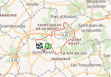
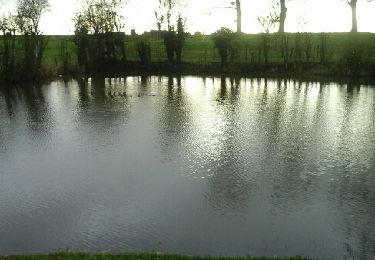
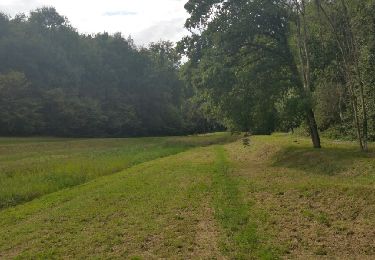
Trail Walking of 10.5 km to be discovered at Normandy, Seine-Maritime, Gommerville. This trail is proposed by MarcherEnsemble.
Description
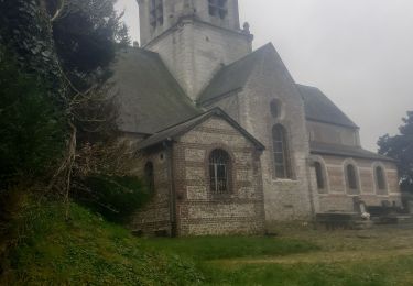
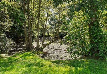
Départ du parking de la mairie, passage devant le cimetière animalier, le bois de la marnière, Parc d'Anxtot, le calvaire de St Gilles de la Neuville et Gommerville
Positioning
Country:
France
Region :
Normandy
Department/Province :
Seine-Maritime
Municipality :
Gommerville
Location:
Unknown
Start:(Dec)
Start:(UTM)
309645 ; 5492602 (31U) N.
Comments
Trails nearby
![Trail Walking Les Trois-Pierres - Les 3 pierres - Photo](https://media.geolcdn.com/t/375/260/ext.jpg?maxdim=2&url=https%3A%2F%2Fstatic1.geolcdn.com%2Fsiteimages%2Fupload%2Ffiles%2F1553511878bg_sport_marche.png)
![Walking Walking](https://static1.geolcdn.com/sitytour/trail-icons/101.png)
Les 3 pierres
Walking
Very easy
(1)
Les Trois-Pierres,
Normandy,
Seine-Maritime,
France
![](/images/other/stat-length.png)
19.6 km | 22 km-effort
Unknown
![](https://static1.geolcdn.com/siteimages/upload/files/16400158638029165_repeat_loop_refresh_sync_direction_icon.png)
Yes
![Trail Walking Étainhus - etainhus sur romain - Photo](https://media.geolcdn.com/t/375/260/41a320f0-00d5-4384-bb9e-c6b1373f691d.jpg&format=jpg&maxdim=2)
![Walking Walking](https://static1.geolcdn.com/sitytour/trail-icons/101.png)
etainhus sur romain
Walking
Medium
Étainhus,
Normandy,
Seine-Maritime,
France
![](/images/other/stat-length.png)
11.7 km | 13.4 km-effort
2h 53min
![](https://static1.geolcdn.com/siteimages/upload/files/16400158638029165_repeat_loop_refresh_sync_direction_icon.png)
Yes
![Trail Walking Étainhus - Etainhus - Photo](https://media.geolcdn.com/t/375/260/e04f2924-928f-460c-b828-06c898b7289d.jpg&format=jpg&maxdim=2)
![Walking Walking](https://static1.geolcdn.com/sitytour/trail-icons/101.png)
![Trail Walking Saint-Romain-de-Colbosc - St Romain de Colbosc / Les Trois Pierres - Photo](https://media.geolcdn.com/t/375/260/166ede3d-0753-4258-9fab-6e9b831e8eec.jpg&format=jpg&maxdim=2)
![Walking Walking](https://static1.geolcdn.com/sitytour/trail-icons/101.png)
St Romain de Colbosc / Les Trois Pierres
Walking
Easy
(1)
Saint-Romain-de-Colbosc,
Normandy,
Seine-Maritime,
France
![](/images/other/stat-length.png)
9.8 km | 10.7 km-effort
2h 24min
![](https://static1.geolcdn.com/siteimages/upload/files/16400158638029165_repeat_loop_refresh_sync_direction_icon.png)
Yes
![Trail Walking Épretot - Epretot / la ferme Mahiel Côté /Epretot - Photo](https://media.geolcdn.com/t/375/260/ext.jpg?maxdim=2&url=https%3A%2F%2Fservices.sitytrail.com%2FGeolivesWS%2FDownloadMedia.ashx%3FTrailID%3D879428%26Media%3Dfix__20171226102745.jpg)
![Walking Walking](https://static1.geolcdn.com/sitytour/trail-icons/101.png)
Epretot / la ferme Mahiel Côté /Epretot
Walking
Easy
Épretot,
Normandy,
Seine-Maritime,
France
![](/images/other/stat-length.png)
10.1 km | 11.3 km-effort
2h 28min
![](https://static1.geolcdn.com/siteimages/upload/files/16400158638029165_repeat_loop_refresh_sync_direction_icon.png)
Yes
![Trail Walking Saint-Romain-de-Colbosc - 76 Saint Romain de Cabocs 10km3 - Photo](https://media.geolcdn.com/t/375/260/ext.jpg?maxdim=2&url=https%3A%2F%2Fservices.sitytrail.com%2FGeolivesWS%2FDownloadMedia.ashx%3FTrailID%3D827993%26Media%3Dfix__20170912162142.jpg)
![Walking Walking](https://static1.geolcdn.com/sitytour/trail-icons/101.png)
76 Saint Romain de Cabocs 10km3
Walking
Medium
Saint-Romain-de-Colbosc,
Normandy,
Seine-Maritime,
France
![](/images/other/stat-length.png)
10.3 km | 11.9 km-effort
2h 30min
![](https://static1.geolcdn.com/siteimages/upload/files/16400158638029165_repeat_loop_refresh_sync_direction_icon.png)
Yes
![Trail Walking La Remuée - la remuee - Photo](https://media.geolcdn.com/t/375/260/ext.jpg?maxdim=2&url=https%3A%2F%2Fstatic1.geolcdn.com%2Fsiteimages%2Fupload%2Ffiles%2F1553511878bg_sport_marche.png)
![Walking Walking](https://static1.geolcdn.com/sitytour/trail-icons/101.png)
![Trail Walking Saint-Romain-de-Colbosc - la remuee - Photo](https://media.geolcdn.com/t/375/260/ext.jpg?maxdim=2&url=https%3A%2F%2Fstatic1.geolcdn.com%2Fsiteimages%2Fupload%2Ffiles%2F1553511878bg_sport_marche.png)
![Walking Walking](https://static1.geolcdn.com/sitytour/trail-icons/101.png)
la remuee
Walking
Medium
Saint-Romain-de-Colbosc,
Normandy,
Seine-Maritime,
France
![](/images/other/stat-length.png)
7.2 km | 7.9 km-effort
1h 49min
![](https://static1.geolcdn.com/siteimages/upload/files/16400158638029165_repeat_loop_refresh_sync_direction_icon.png)
Yes
![Trail Walking Étainhus - 25 11 24 rando courte - Photo](https://media.geolcdn.com/t/375/260/ext.jpg?maxdim=2&url=https%3A%2F%2Fstatic1.geolcdn.com%2Fsiteimages%2Fupload%2Ffiles%2F1553511878bg_sport_marche.png)
![Walking Walking](https://static1.geolcdn.com/sitytour/trail-icons/101.png)
25 11 24 rando courte
Walking
Medium
Étainhus,
Normandy,
Seine-Maritime,
France
![](/images/other/stat-length.png)
8.1 km | 9.2 km-effort
2h 5min
![](https://static1.geolcdn.com/siteimages/upload/files/16400158638029165_repeat_loop_refresh_sync_direction_icon.png)
Yes