Trail Mountain bike Veynes - VTT13 - Les balcons des montagnes - Photo

VTT13 - Les balcons des montagnes

Les Hautes Alpes à découvrir ! GUIDE+

© OpenStreetMap contributors
Length
Length
50 km
Max alt
Max alt
1322 m
Uphill gradient
Uphill gradient
1535 m
Km-Effort
Km-Effort  
70 km
Min alt
Min alt
755 m
Downhill gradient
Downhill gradient
1538 m
Boucle
Boucle
Yes
Creation date :
2018-03-23 05:40:34.647
Updated on :
2022-10-12 05:32:29.163

(0 Reviews)

Mountain bike
Mountain bike
3h55
Difficulty : Difficult

Scan this QR Code to open this trail in the SityTrail application

FREE GPS app for hiking

Logo SityTrail SityTrail

IGN / Geographical institutes

Download SityTrail from the App Store Download SityTrail from Google Play

Logo SityTrail SityTrail World

The world is yours!

Download SityTrail from the App Store Download SityTrail from Google Play Download SityTrail on Huawei AppGallery

About

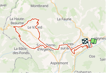
Trail Mountain bike of 50 km to be discovered at Provence-Alpes-Côte d'Azur, Hautes-Alpes, Veynes. This trail is proposed by Camping Les Rives du Lac.

Description

Route N ° 12 of the Buech Mountain Bike Area.
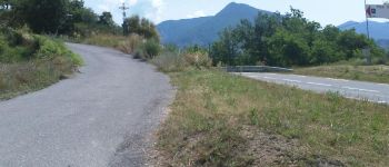
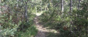
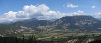
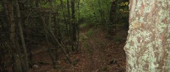
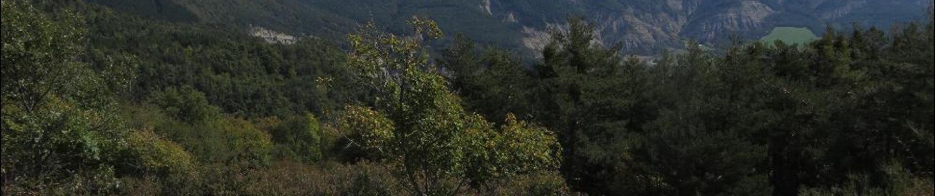
A very nice circuit that allows to appreciate the diversity of landscapes and trails here: Go adret side on stony trails, and return ubac side in the woods! A real treat !
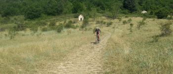
The first part is the most technical, with uphill thrust and steep descents. The second part is much more rolling.
Possibility to leave the village of Saint Pierre d'Argencon and the course is only about 25 kms.

Elevation profile

Photos

Points of interest

Point of interest Aspres-sur-Buëch - Fin du Single du Pont - Photo
CampingLesRivesduLac
ASPRES-SUR-BUËCH 
Point of interest Veynes - Point de vue sur le plan d'eau de Veynes - Photo
CampingLesRivesduLac
Point of interest Veynes - Village de Saint Marcellin - Photo
CampingLesRivesduLac
Point of interest Aspres-sur-Buëch - Le Col du Pignon - Photo
CampingLesRivesduLac
ASPRES-SUR-BUËCH 
Point of interest Aspres-sur-Buëch - Pont Train - Photo
CampingLesRivesduLac
ASPRES-SUR-BUËCH 
Point of interest Veynes - Fin descente plan d'eau - Photo
CampingLesRivesduLac
Point of interest Aspres-sur-Buëch - Single du pont - Photo
CampingLesRivesduLac
ASPRES-SUR-BUËCH 
Point of interest La Beaume - Versant Adret - Photo
CampingLesRivesduLac
LA BEAUME 
Point of interest La Beaume - Vue en montant - Photo
CampingLesRivesduLac
LA BEAUME 
Point of interest La Beaume - Descente forêt - Photo
CampingLesRivesduLac
LA BEAUME 
Point of interest Saint-Pierre-d'Argençon - Bifurcation Font Vineuse - Photo
CampingLesRivesduLac
SAINT-PIERRE-D'ARGENÇON 
Point of interest La Beaume - Bifurcation La Beaume - Photo
CampingLesRivesduLac
Point of interest La Beaume - Début single - Photo
CampingLesRivesduLac
LA BEAUME 

Positioning

Country:
France
Region :
Provence-Alpes-Côte d'Azur
Department/Province :
Hautes-Alpes
Municipality :
Veynes
Location:
Unknown
Start:(UTM)
722453 ; 4933326 (31T) N.

Trails nearby

Trail Walking Le Saix - R08 La boucle des cascades jaunes - Photo
Walking
GUIDE+

Walking

Very easy
(1)
Le Saix, Provence-Alpes-Côte d'Azur, Hautes-Alpes, France
5.5 km | 10.3 km-effort
2h 10min
Yes
Trail Mountain bike Veynes - VTT29 - Rando famille - Photo
Mountain bike
GUIDE+

Mountain bike

Easy
(1)
Veynes, Provence-Alpes-Côte d'Azur, Hautes-Alpes, France
10.9 km | 13.6 km-effort
54min
Yes
Trail Mountain bike Veynes - VTT14 - Les crêtes de la Longeagne - Photo
Mountain bike
GUIDE+

Mountain bike

Very difficult
(1)
Veynes, Provence-Alpes-Côte d'Azur, Hautes-Alpes, France
39 km | 57 km-effort
3h 15min
Yes
Trail Mountain bike Veynes - VTT03 - Tous les Eygaux - Photo
Mountain bike
GUIDE+

Mountain bike

Medium
(2)
Veynes, Provence-Alpes-Côte d'Azur, Hautes-Alpes, France
23 km | 31 km-effort
1h 31min
Yes
Trail Mountain bike Veynes - VTT02 - Aiguebelle - Photo
Mountain bike
GUIDE+

Mountain bike

Easy
(2)
Veynes, Provence-Alpes-Côte d'Azur, Hautes-Alpes, France
16.7 km | 21 km-effort
1h 23min
Yes
Trail Mountain bike Veynes - VTT01 - Les Eygaux - Photo
Mountain bike
GUIDE+

Mountain bike

Easy
(3)
Veynes, Provence-Alpes-Côte d'Azur, Hautes-Alpes, France
14.1 km | 19.2 km-effort
1h 13min
Yes
Trail Walking Veynes - R10   Le tour des Eygaux - Photo
Walking
GUIDE+

Walking

Very easy
(4)
Veynes, Provence-Alpes-Côte d'Azur, Hautes-Alpes, France
7.8 km | 11.3 km-effort
2h 24min
Yes
Trail Walking Veynes - R09   Le tour de Veynes - Photo
Walking
GUIDE+

Walking

Very easy
(3)
Veynes, Provence-Alpes-Côte d'Azur, Hautes-Alpes, France
9.5 km | 12.3 km-effort
2h 40min
Yes
Trail Walking Le Saix - R07   le fai - Photo
Walking
GUIDE+

Walking

Easy
(4)
Le Saix, Provence-Alpes-Côte d'Azur, Hautes-Alpes, France
5.1 km | 8 km-effort
1h 42min
Yes


Close
My subscriptions