Trail Walking Quelaines-Saint-Gault - Quelaines St-Gault - Photo
© OpenStreetMap contributors
Length
Length
19.2 km
Max alt
Max alt
114 m
Uphill gradient
Uphill gradient
190 m
Km-Effort
Km-Effort  
22 km
Min alt
Min alt
50 m
Downhill gradient
Downhill gradient
192 m
Boucle
Boucle
Yes
Creation date :
2018-04-17 16:59:05.375
Updated on :
2018-04-17 16:59:05.375

(1 Reviews)

Walking
Walking
5h00
Difficulty : Medium

Scan this QR Code to open this trail in the SityTrail application

FREE GPS app for hiking

Logo SityTrail SityTrail

IGN / Geographical institutes

Download SityTrail from the App Store Download SityTrail from Google Play

Logo SityTrail SityTrail World

The world is yours!

Download SityTrail from the App Store Download SityTrail from Google Play Download SityTrail on Huawei AppGallery

About

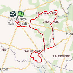
Trail Walking of 19.2 km to be discovered at Pays de la Loire, Mayenne, Quelaines-Saint-Gault. This trail is proposed by neoroll44.

Description

De Quelaines à St-Gault par le ruisseau de Brault.

Elevation profile

Positioning

Country:
France
Region :
Pays de la Loire
Department/Province :
Mayenne
Municipality :
Quelaines-Saint-Gault
Location:
Unknown
Start:(UTM)
664076 ; 5310289 (30T) N.

Comments

Please log in to post a review or rate the element


Trails nearby

Trail Walking Quelaines-Saint-Gault - QUELAINES - Photo
Walking
FOUCAULT

Walking

Quelaines-Saint-Gault, Pays de la Loire, Mayenne, France
7.6 km | 8.4 km-effort
2h 0min
Yes
Trail Horseback riding Houssay - melanie - Photo
Horseback riding
Jean-claude Ainé

Horseback riding

Easy
Houssay, Pays de la Loire, Mayenne, France
11.2 km | 13 km-effort
1h 56min
Yes


Close
My subscriptions