Trail Walking Chaux-des-Crotenay - EC8_Chaux de Crotenay-Foncine le haut - Photo

EC8_Chaux de Crotenay-Foncine le haut

© OpenStreetMap contributors
Length
Length
15.9 km
Max alt
Max alt
992 m
Uphill gradient
Uphill gradient
566 m
Km-Effort
Km-Effort  
23 km
Min alt
Min alt
679 m
Downhill gradient
Downhill gradient
337 m
Boucle
Boucle
No
Creation date :
2018-04-17 16:56:57.866
Updated on :
2018-04-17 16:56:57.866

(0 Reviews)

Walking
Walking
4h57
Difficulty : Very difficult

Scan this QR Code to open this trail in the SityTrail application

FREE GPS app for hiking

Logo SityTrail SityTrail

IGN / Geographical institutes

Download SityTrail from the App Store Download SityTrail from Google Play

Logo SityTrail SityTrail World

The world is yours!

Download SityTrail from the App Store Download SityTrail from Google Play Download SityTrail on Huawei AppGallery

About

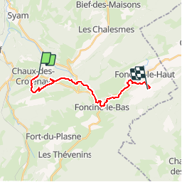
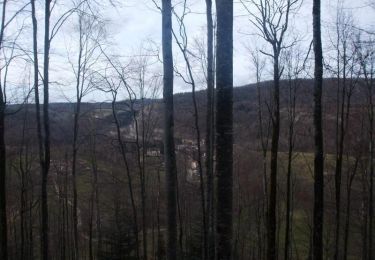
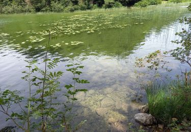
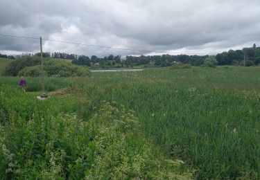
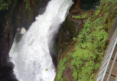
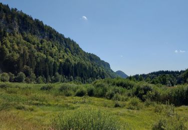
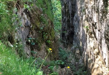
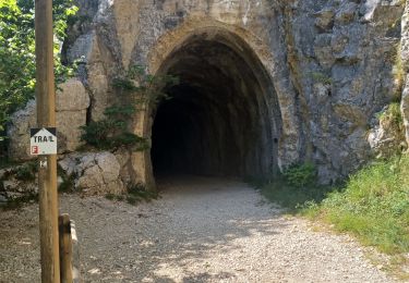
Trail Walking of 15.9 km to be discovered at Bourgogne-Franche-Comté, Jura, Chaux-des-Crotenay. This trail is proposed by bernard54.

Description

Échappée Jurassienne Etape 8 Chaux de Crotenay - Foncine le haut - Hôtel Club le Grand Chalet Val Foncine                       Val Foncine à 1,5 km du village                               39460 Foncine le haut                                                 03 84 51 95 51        

Elevation profile

Positioning

Country:
France
Region :
Bourgogne-Franche-Comté
Department/Province :
Jura
Municipality :
Chaux-des-Crotenay
Location:
Unknown
Start:(UTM)
727384 ; 5171535 (31T) N.

Trails nearby

Trail Walking Les Planches-en-Montagne - Gorges de la Saine - Les Planches en Montagne - Photo
Walking
tracegps

Walking

Easy
(4)
Les Planches-en-Montagne, Bourgogne-Franche-Comté, Jura, France
6.1 km | 8.1 km-effort
2h 30min
Yes
Trail Walking Les Planches-en-Montagne - à la découverte de la languette  - Photo
Walking
YannickPFENDT

Walking

Very easy
(2)
Les Planches-en-Montagne, Bourgogne-Franche-Comté, Jura, France
2.3 km | 2.7 km-effort
41min
Yes
Trail Walking Les Planches-en-Montagne - Les planches en Montagne - Saine et langouette - Photo
Walking
marcel.F

Walking

Medium
(4)
Les Planches-en-Montagne, Bourgogne-Franche-Comté, Jura, France
10.1 km | 13.5 km-effort
3h 2min
Yes
Trail Walking Le Frasnois - Pic de l'Aigle 14.7.24 - Photo
Walking
GUIDE
fredetpascale

Walking

Easy
Le Frasnois, Bourgogne-Franche-Comté, Jura, France
9.5 km | 13.7 km-effort
3h 0min
Yes
Trail Walking Les Planches-en-Montagne - Gorges Langouette et Malvaux 12.7.24 - Photo
Walking
GUIDE
fredetpascale

Walking

Easy
Les Planches-en-Montagne, Bourgogne-Franche-Comté, Jura, France
10.2 km | 13.6 km-effort
2h 45min
Yes
Trail Walking Les Planches-en-Montagne - Les Planches en Montagne Gorges de la Langouette  - Photo
Walking
grasgilbert

Walking

Medium
Les Planches-en-Montagne, Bourgogne-Franche-Comté, Jura, France
10.8 km | 14.8 km-effort
3h 5min
Yes
Trail Walking Le Frasnois - Tour du lac du Franoy - Photo
Walking
fizz1212

Walking

Very easy
Le Frasnois, Bourgogne-Franche-Comté, Jura, France
5.4 km | 6.5 km-effort
1h 36min
Yes
Trail Walking Foncine-le-Bas - Foncines-le-Bas, du viaduc des Douanets à  la cascade du Bief de la Ruine. - Photo
Walking
Mady Lambert

Walking

Easy
Foncine-le-Bas, Bourgogne-Franche-Comté, Jura, France
3.6 km | 4.9 km-effort
2h 21min
Yes
Trail Walking Chaux-des-Crotenay - Autour du plateau de chaux des Crotenay - Photo
Walking
zefreefly

Walking

Medium
Chaux-des-Crotenay, Bourgogne-Franche-Comté, Jura, France
18.5 km | 26 km-effort
4h 17min
Yes


Close
My subscriptions