![](/images/other/stat-length.png)
![Trail Walking Lazer - Boucle du lac de Lazer - Photo](https://media.geolcdn.com/t/1900/400/ext.pjpeg?maxdim=2&url=https%3A%2F%2Fstatic1.geolcdn.com%2Fsiteimages%2Fupload%2Ffiles%2F1553511878bg_sport_marche.png)
Boucle du lac de Lazer
rigol05
User
![Length](/images/other/stat-length.png)
Length
14 km
![Max alt](https://static1.geolcdn.com/siteimages/upload/files/1508320355ic_sort_altitude_max_24dp.png)
Max alt
734 m
![Uphill gradient](https://static1.geolcdn.com/siteimages/upload/files/1508320355ic_sort_den_pos_24dp.png)
Uphill gradient
250 m
![Km-Effort](/images/other/stat-length.png)
Km-Effort
17.3 km
![Min alt](https://static1.geolcdn.com/siteimages/upload/files/1508320355ic_sort_altitude_min_24dp.png)
Min alt
616 m
![Downhill gradient](https://static1.geolcdn.com/siteimages/upload/files/1508320355ic_sort_den_neg_24dp.png)
Downhill gradient
251 m
![Boucle](https://static1.geolcdn.com/siteimages/upload/files/16400158638029165_repeat_loop_refresh_sync_direction_icon.png)
Boucle
Yes
Creation date :
2018-04-17 16:21:11.848
Updated on :
2018-04-17 16:21:11.848
![Walking](https://static1.geolcdn.com/sitytour/trail-icons/101.png)
4h04
Difficulty : Easy
![Scan this QR Code to open this trail in the SityTrail application](https://capi.geolives.com/qq0zvz2zws4bq2lad0pu/sitytour/trails/888954/qr.png?size=200)
FREE GPS app for hiking
About
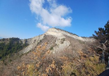
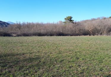
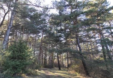
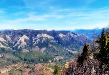
Trail Walking of 14 km to be discovered at Provence-Alpes-Côte d'Azur, Hautes-Alpes, Lazer. This trail is proposed by rigol05.
Description
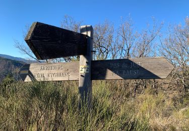
Les deux routes desservant le hameau de la Combe Neuve sont privées. Rejoindre la Gardette à travers champs en longeant le ruisseau. L'accès entre le Plan de l'Orne et la D942 est également privé, suivre les routes goudronnées.Sortie du 18/01/2018
Positioning
Country:
France
Region :
Provence-Alpes-Côte d'Azur
Department/Province :
Hautes-Alpes
Municipality :
Lazer
Location:
Unknown
Start:(Dec)
Start:(UTM)
726423 ; 4914136 (31T) N.
Comments
Trails nearby
![Trail Mountain bike Laragne-Montéglin - Laragne 2008 - Photo](https://media.geolcdn.com/t/375/260/ext.jpg?maxdim=2&url=https%3A%2F%2Fstatic1.geolcdn.com%2Fsiteimages%2Fupload%2Ffiles%2F1524743154velo.jpg)
![Mountain bike Mountain bike](https://static1.geolcdn.com/sitytour/trail-icons/202.png)
Laragne 2008
Mountain bike
Difficult
(1)
Laragne-Montéglin,
Provence-Alpes-Côte d'Azur,
Hautes-Alpes,
France
![](/images/other/stat-length.png)
35 km | 47 km-effort
3h 0min
![](https://static1.geolcdn.com/siteimages/upload/files/16400158638029165_repeat_loop_refresh_sync_direction_icon.png)
No
![Trail Walking Lazer - Le lac de Lazer par La Chapelle StJean - Photo](https://media.geolcdn.com/t/375/260/578d4a1c-7512-4632-8926-02aded433ec1.jpg&format=jpg&maxdim=2)
![Walking Walking](https://static1.geolcdn.com/sitytour/trail-icons/101.png)
Le lac de Lazer par La Chapelle StJean
Walking
Medium
Lazer,
Provence-Alpes-Côte d'Azur,
Hautes-Alpes,
France
![](/images/other/stat-length.png)
6.5 km | 7.4 km-effort
1h 40min
![](https://static1.geolcdn.com/siteimages/upload/files/16400158638029165_repeat_loop_refresh_sync_direction_icon.png)
Yes
![Trail Walking Ventavon - VENTAVON . crête de Colombier , roc de l Escubier o m s - Photo](https://media.geolcdn.com/t/375/260/eb2996c2-264a-421d-8745-31a34e3b5708.jpg&format=jpg&maxdim=2)
![Walking Walking](https://static1.geolcdn.com/sitytour/trail-icons/101.png)
VENTAVON . crête de Colombier , roc de l Escubier o m s
Walking
Difficult
Ventavon,
Provence-Alpes-Côte d'Azur,
Hautes-Alpes,
France
![](/images/other/stat-length.png)
12 km | 21 km-effort
4h 11min
![](https://static1.geolcdn.com/siteimages/upload/files/16400158638029165_repeat_loop_refresh_sync_direction_icon.png)
Yes
![Trail Mountain bike Thèze - 210322 rouviere theze a velo - Photo](https://media.geolcdn.com/t/375/260/11332bd4-f1eb-453a-b568-0b37b31d0a1b.jpg&format=jpg&maxdim=2)
![Mountain bike Mountain bike](https://static1.geolcdn.com/sitytour/trail-icons/202.png)
210322 rouviere theze a velo
Mountain bike
Very easy
Thèze,
Provence-Alpes-Côte d'Azur,
Alpes-de-Haute-Provence,
France
![](/images/other/stat-length.png)
4.5 km | 5.4 km-effort
1h 21min
![](https://static1.geolcdn.com/siteimages/upload/files/16400158638029165_repeat_loop_refresh_sync_direction_icon.png)
No
![Trail Walking Laragne-Montéglin - Vieil Arzellier/Vieil Eyguians.21/02/21. - Photo](https://media.geolcdn.com/t/375/260/addc1cc9-a190-4b69-a026-86524405f5ae.jpg&format=jpg&maxdim=2)
![Walking Walking](https://static1.geolcdn.com/sitytour/trail-icons/101.png)
Vieil Arzellier/Vieil Eyguians.21/02/21.
Walking
Easy
Laragne-Montéglin,
Provence-Alpes-Côte d'Azur,
Hautes-Alpes,
France
![](/images/other/stat-length.png)
3.5 km | 4.7 km-effort
59min
![](https://static1.geolcdn.com/siteimages/upload/files/16400158638029165_repeat_loop_refresh_sync_direction_icon.png)
No
![Trail Walking Lazer - Départ Lazer et Tour du Château d’Arzelier - Photo](https://media.geolcdn.com/t/375/260/2a914d9f-e070-4566-89b6-d5d17e8cc63d.jpg&format=jpg&maxdim=2)
![Walking Walking](https://static1.geolcdn.com/sitytour/trail-icons/101.png)
Départ Lazer et Tour du Château d’Arzelier
Walking
Easy
Lazer,
Provence-Alpes-Côte d'Azur,
Hautes-Alpes,
France
![](/images/other/stat-length.png)
53 km | 64 km-effort
4h 5min
![](https://static1.geolcdn.com/siteimages/upload/files/16400158638029165_repeat_loop_refresh_sync_direction_icon.png)
No
![Trail Walking Lazer - Roc de L'Esculier Via Le Lauza - Photo](https://media.geolcdn.com/t/375/260/cb4f9c34-5e6c-4839-86ea-8b005e203066.jpg&format=jpg&maxdim=2)
![Walking Walking](https://static1.geolcdn.com/sitytour/trail-icons/101.png)
Roc de L'Esculier Via Le Lauza
Walking
Very difficult
Lazer,
Provence-Alpes-Côte d'Azur,
Hautes-Alpes,
France
![](/images/other/stat-length.png)
13.2 km | 23 km-effort
5h 41min
![](https://static1.geolcdn.com/siteimages/upload/files/16400158638029165_repeat_loop_refresh_sync_direction_icon.png)
Yes
![Trail On foot Garde-Colombe - Crête de St Genis - Photo](https://media.geolcdn.com/t/375/260/ext.jpg?maxdim=2&url=https%3A%2F%2Fstatic1.geolcdn.com%2Fsiteimages%2Fupload%2Ffiles%2F1545311037marcheuse_200dpi.jpg)
![On foot On foot](https://static1.geolcdn.com/sitytour/trail-icons/100.png)
Crête de St Genis
On foot
Very easy
Garde-Colombe,
Provence-Alpes-Côte d'Azur,
Hautes-Alpes,
France
![](/images/other/stat-length.png)
13.6 km | 23 km-effort
Unknown
![](https://static1.geolcdn.com/siteimages/upload/files/16400158638029165_repeat_loop_refresh_sync_direction_icon.png)
Yes
![Trail Mountain bike Laragne-Montéglin - Grande Traversée des PréAlpes à VTT : Arzeliers - Ribiers - Photo](https://media.geolcdn.com/t/375/260/ext.jpg?maxdim=2&url=https%3A%2F%2Fservices.sitytrail.com%2FGeolivesWS%2FDownloadMedia.ashx%3FTrailID%3D102170%26Media%3D2560_2.jpg)
![Mountain bike Mountain bike](https://static1.geolcdn.com/sitytour/trail-icons/202.png)
Grande Traversée des PréAlpes à VTT : Arzeliers - Ribiers
Mountain bike
Difficult
Laragne-Montéglin,
Provence-Alpes-Côte d'Azur,
Hautes-Alpes,
France
![](/images/other/stat-length.png)
26 km | 33 km-effort
2h 30min
![](https://static1.geolcdn.com/siteimages/upload/files/16400158638029165_repeat_loop_refresh_sync_direction_icon.png)
No