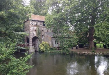
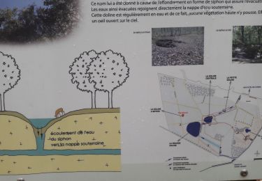
Trail Walking Orléans - Venelles La Source - Photo
 sylbois
sylbois

User

© OpenStreetMap contributors
Length
Length
12 km
Max alt
Max alt
124 m
Uphill gradient
Uphill gradient
83 m
Km-Effort
Km-Effort  
13.1 km
Min alt
Min alt
102 m
Downhill gradient
Downhill gradient
79 m
Boucle
Boucle
Yes
Creation date :
2018-04-17 14:51:42.69
Updated on :
2018-04-17 14:51:42.69

(0 Reviews)

Walking
Walking
2h53
Difficulty : Unknown

Scan this QR Code to open this trail in the SityTrail application

FREE GPS app for hiking

Logo SityTrail SityTrail

IGN / Geographical institutes

Download SityTrail from the App Store Download SityTrail from Google Play

Logo SityTrail SityTrail World

The world is yours!

Download SityTrail from the App Store Download SityTrail from Google Play Download SityTrail on Huawei AppGallery

About

Trail Walking of 12 km to be discovered at Centre-Loire Valley, Loiret, Orléans. This trail is proposed by sylbois.

Elevation profile

Positioning

Country:
France
Region :
Centre-Loire Valley
Department/Province :
Loiret
Municipality :
Orléans
Location:
Unknown
Start:(UTM)
420476 ; 5299834 (31T) N.

Comments

Please log in to post a review or rate the element


Ce circuit ,balisé en 2008, conduit dans les venelles insolites de La Source ainsi que vers ses lacs Le concept de cette ville nouvelle était que "Les princes en seraient les pietons "


Trails nearby

Trail Walking Ardon - dolines - Photo
Walking
skwick

Walking

Very easy
(1)
Ardon, Centre-Loire Valley, Loiret, France
9.1 km | 9.8 km-effort
2h 13min
Yes
Trail Walking Olivet - olivet chemin des moulins - Photo
Walking
ericpinot

Walking

Very easy
Olivet, Centre-Loire Valley, Loiret, France
12.5 km | 13.8 km-effort
2h 44min
Yes
Trail Walking Olivet - Olivet les bords du Loiret - Photo
Walking
tracegps

Walking

Medium
Olivet, Centre-Loire Valley, Loiret, France
8.4 km | 9.5 km-effort
2h 15min
Yes
Trail Walking Olivet - bord du loiret - Photo
Walking
cristinette

Walking

Easy
Olivet, Centre-Loire Valley, Loiret, France
11.6 km | 12.7 km-effort
2h 52min
Yes
Trail Road bike Orléans - 00 EXT Orléans Paron 139 km - Photo
Road bike
GUIDE
Specialized77

Road bike

Medium
Orléans, Centre-Loire Valley, Loiret, France
139 km | 152 km-effort
1h 23min
No
Trail Walking Ardon - ardon limere - Photo
Walking
lemuid

Walking

Very easy
Ardon, Centre-Loire Valley, Loiret, France
11.4 km | 12.1 km-effort
2h 12min
Yes
Trail Walking Olivet - Olivet _St Denis en Val  - Photo
Walking
Mecki

Walking

Easy
Olivet, Centre-Loire Valley, Loiret, France
17.9 km | 19.3 km-effort
3h 28min
No
Trail Walking Orléans - Des Lacs au venelles - Photo
Walking
danieltaillandier

Walking

Very easy
Orléans, Centre-Loire Valley, Loiret, France
11.5 km | 12.5 km-effort
2h 47min
Yes
Trail Other activity Olivet - Sentiers des moulins - Photo
Other activity
aubr

Other activity

Medium
(1)
Olivet, Centre-Loire Valley, Loiret, France
5.9 km | 6.6 km-effort
1h 40min
Yes


Close
My subscriptions