Trail Walking Valgrisenche - Grand Paradis - J4 - Photo

Grand Paradis - J4

 saphile
saphile

User

© OpenStreetMap contributors
Length
Length
14.1 km
Max alt
Max alt
3069 m
Uphill gradient
Uphill gradient
1108 m
Km-Effort
Km-Effort  
29 km
Min alt
Min alt
2277 m
Downhill gradient
Downhill gradient
1027 m
Boucle
Boucle
No
Creation date :
2018-04-17 14:32:38.02
Updated on :
2018-04-17 14:32:38.02

(0 Reviews)

Walking
Walking
5h52
Difficulty : Very difficult

Scan this QR Code to open this trail in the SityTrail application

FREE GPS app for hiking

Logo SityTrail SityTrail

IGN / Geographical institutes

Download SityTrail from the App Store Download SityTrail from Google Play

Logo SityTrail SityTrail World

The world is yours!

Download SityTrail from the App Store Download SityTrail from Google Play Download SityTrail on Huawei AppGallery

About

Trail Walking of 14.1 km to be discovered at Aosta Valley, Unknown, Valgrisenche. This trail is proposed by saphile.

Description

Grand Paradis 2018 - J4

Elevation profile

Points of interest

Point of interest Valgrisenche - Lacs Creusson - St Martin - Photo
saphile

Positioning

Country:
Italy
Region :
Aosta Valley
Department/Province :
Unknown
Municipality :
Valgrisenche
Location:
Unknown
Start:(UTM)
345260 ; 5044949 (32T) N.

Trails nearby

Trail On foot Valgrisenche - 11, Rif. Bezzi - Rif. Chalet de l'Epée - Photo
On foot
GUIDE+

On foot

Easy
Valgrisenche, Aosta Valley, Unknown, Italy
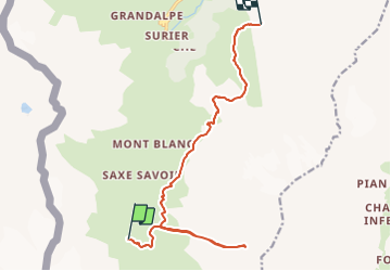
9.7 km | 18.4 km-effort
4h 10min
No
Trail On foot Valgrisenche - 12, Saxe Savoie-Rif. Bezzi - Photo
On foot
GUIDE+

On foot

Easy
Valgrisenche, Aosta Valley, Unknown, Italy
4.9 km | 6.5 km-effort
1h 28min
No
Trail On foot Valgrisenche - 12C, Rif. Bezzi-Col Bassac Deré - Photo
On foot
GUIDE+

On foot

Easy
(1)
Valgrisenche, Aosta Valley, Unknown, Italy
5.3 km | 13.4 km-effort
3h 2min
No
Trail Walking Valgrisenche - refuge Mario Bezzi Italie/ Ste Foy en Tarentaise parking Bon conseil  - Photo
Walking
GAPIED

Walking

Very difficult
Valgrisenche, Aosta Valley, Unknown, Italy
14 km | 24 km-effort
5h 20min
No
Trail On foot Valgrisenche - 9A, Surrier Rifugio Chalet De L'Epée - Photo
On foot
GUIDE+

On foot

Easy
Valgrisenche, Aosta Valley, Unknown, Italy
4.6 km | 10.4 km-effort
2h 21min
No
Trail On foot Rhêmes-Notre-Dame - Tour de Truc de Tsanteleina - Photo
On foot
GUIDE+

On foot

Easy
Rhêmes-Notre-Dame, Aosta Valley, Unknown, Italy
3.6 km | 4.8 km-effort
1h 6min
No
Trail Walking Tignes - seb aiguille sassiere 21/8/20 - Photo
Walking
geodidierch

Walking

Very difficult
Tignes, Auvergne-Rhône-Alpes, Savoy, France
89 km | 133 km-effort
8h 30min
No
Trail Walking Valgrisenche - 2015-GranParadiso Jour2 - Photo
Walking
i20

Walking

Very easy
Valgrisenche, Aosta Valley, Unknown, Italy
10.2 km | 21 km-effort
4h 16min
No
Trail Walking Valgrisenche - trace - Photo
Walking
GAPIAN43

Walking

Difficult
Valgrisenche, Aosta Valley, Unknown, Italy
9.6 km | 18.3 km-effort
4h 8min
No


Close
My subscriptions