


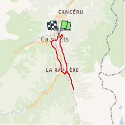

11.4 km | 17.5 km-effort


convivialite, sport et fiesta


FREE GPS app for hiking
 SityTrail
IGN / Geographical institutes
SityTrail World
The world is yours!
Trail Walking of 10 km to be discovered at Occitania, Hautespyrenees, Cauterets. This trail is proposed by Lous Passa camins.
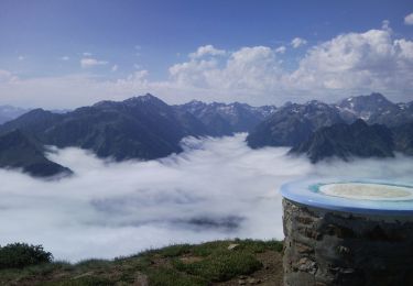
belle balade qui vous fera découvrir le chemins des pères (à vous de découvrir pourquoi chemin des pères)les bords du gave et la cascade du Lutour les thermes de griffons bref une super rando facile

Walking

Walking

Walking
Walking

Walking

Walking

Walking

Walking

Walking