Trail Walking Riva del Garda - Riva del Garda / Santa Barbara - Photo
© OpenStreetMap contributors
Length
Length
8.7 km
Max alt
Max alt
673 m
Uphill gradient
Uphill gradient
640 m
Km-Effort
Km-Effort  
17.2 km
Min alt
Min alt
79 m
Downhill gradient
Downhill gradient
640 m
Boucle
Boucle
Yes
Creation date :
2018-04-17 13:30:41.135
Updated on :
2021-02-22 08:54:41.551

(1 Reviews)

Walking
Walking
3h40
Difficulty : Difficult

Scan this QR Code to open this trail in the SityTrail application

FREE GPS app for hiking

Logo SityTrail SityTrail

IGN / Geographical institutes

Download SityTrail from the App Store Download SityTrail from Google Play

Logo SityTrail SityTrail World

The world is yours!

Download SityTrail from the App Store Download SityTrail from Google Play Download SityTrail on Huawei AppGallery

About

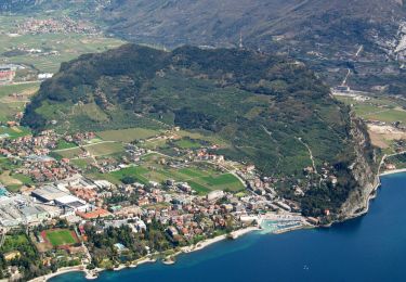
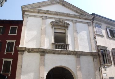
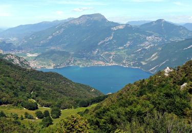
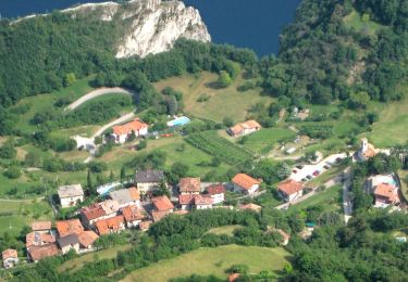
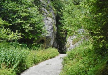
Trail Walking of 8.7 km to be discovered at Trentino-Alto Adige/Südtirol, Provincia di Trento, Riva del Garda. This trail is proposed by Dhendrickx71.

Description

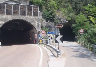
From Riva go up to the Bastione. Then take the path nr. 404 to Santa Barbara chapel.
The return will be done by the same path up to the crossing that goes down towards the Bastione. There, instead of going down, follow the forest path in the direction of Foci and San Giacomo. Return then to Riva del Garda.

Elevation profile

Positioning

Country:
Italy
Region :
Trentino-Alto Adige/Südtirol
Department/Province :
Provincia di Trento
Municipality :
Riva del Garda
Location:
Unknown
Start:(UTM)
642942 ; 5083456 (32T) N.

Comments

Please log in to post a review or rate the element


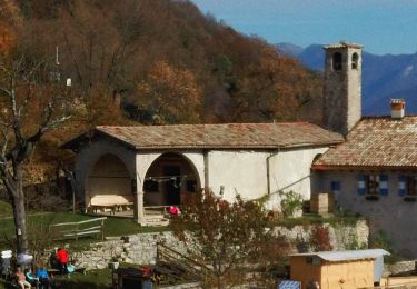
Belle balade assez dure. On la faisait en famille mais quand j'étais gamin. La vue sur Riva est magnifique.


Trails nearby

Trail On foot Riva del Garda - Sentiero delle Laste basse - Berghem
On foot
GUIDE+

On foot

Easy
Riva del Garda, Trentino-Alto Adige/Südtirol, Provincia di Trento, Italy
4.7 km | 11.3 km-effort
2h 34min
No
Trail On foot Arco - Sentiero del Monte Colt - Photo
On foot
GUIDE+

On foot

Easy
Arco, Trentino-Alto Adige/Südtirol, Provincia di Trento, Italy
4.2 km | 9 km-effort
2h 2min
No
Trail On foot Riva del Garda - Via ferrata
On foot
GUIDE+

On foot

Easy
Riva del Garda, Trentino-Alto Adige/Südtirol, Provincia di Trento, Italy
5.4 km | 15.3 km-effort
3h 28min
No
Trail On foot Tenno - IT-O480 - Photo
On foot
GUIDE+

On foot

Easy
Tenno, Trentino-Alto Adige/Südtirol, Provincia di Trento, Italy
4 km | 9.7 km-effort
2h 11min
No
Trail On foot Ledro - Via ferrata del Bastione e della Rocchetta - Photo
On foot
GUIDE+

On foot

Easy
Ledro, Trentino-Alto Adige/Südtirol, Provincia di Trento, Italy
4.9 km | 8.5 km-effort
1h 56min
No
Trail On foot Ledro - Via de Ari e sentiero Rino Zanotti - Photo
On foot
GUIDE+

On foot

Easy
Ledro, Trentino-Alto Adige/Südtirol, Provincia di Trento, Italy
6.1 km | 11.6 km-effort
2h 38min
No
Trail On foot Riva del Garda - Sentér di Cima Nara - Photo
On foot
GUIDE+

On foot

Easy
Riva del Garda, Trentino-Alto Adige/Südtirol, Provincia di Trento, Italy
4.7 km | 11 km-effort
2h 30min
No
Trail On foot Riva del Garda - Sentér de Palaer - Photo
On foot
GUIDE+

On foot

Easy
Riva del Garda, Trentino-Alto Adige/Südtirol, Provincia di Trento, Italy
4 km | 10.3 km-effort
2h 20min
No
Trail On foot Riva del Garda - IT-O422 - Photo
On foot
GUIDE+

On foot

Easy
Riva del Garda, Trentino-Alto Adige/Südtirol, Provincia di Trento, Italy
5.2 km | 12.7 km-effort
2h 53min
No


Close
My subscriptions