


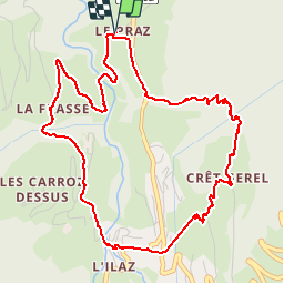

49 km | 74 km-effort


User


FREE GPS app for hiking
 SityTrail
IGN / Geographical institutes
SityTrail World
The world is yours!
Trail Walking of 5.9 km to be discovered at Auvergne-Rhône-Alpes, Savoy, Beaufort. This trail is proposed by BrunoMounier.
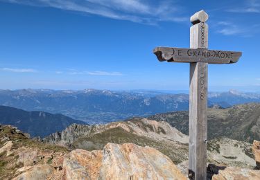
Très jolie boucle autour du village d'Arêches. Points de vues magnifiques sur le Grand Mont et sur la vallée. Montée et descente assez raides en fin de parcours. Les bâtons sont bienvenus.


Cycle

Walking

Walking
Walking

Touring skiing

Touring skiing

Walking
Walking
Walking