![](/images/other/stat-length.png)
![Trail Walking Blendecques - Blendecques (1) 12.8km Dén P 145m - Photo](https://media.geolcdn.com/t/1900/400/ext.pjpeg?maxdim=2&url=https%3A%2F%2Fstatic1.geolcdn.com%2Fsiteimages%2Fupload%2Ffiles%2F1553511878bg_sport_marche.png)
Blendecques (1) 12.8km Dén P 145m
alain62rando
User
![Length](/images/other/stat-length.png)
Length
12.8 km
![Max alt](https://static1.geolcdn.com/siteimages/upload/files/1508320355ic_sort_altitude_max_24dp.png)
Max alt
82 m
![Uphill gradient](https://static1.geolcdn.com/siteimages/upload/files/1508320355ic_sort_den_pos_24dp.png)
Uphill gradient
145 m
![Km-Effort](/images/other/stat-length.png)
Km-Effort
14.7 km
![Min alt](https://static1.geolcdn.com/siteimages/upload/files/1508320355ic_sort_altitude_min_24dp.png)
Min alt
18 m
![Downhill gradient](https://static1.geolcdn.com/siteimages/upload/files/1508320355ic_sort_den_neg_24dp.png)
Downhill gradient
137 m
![Boucle](https://static1.geolcdn.com/siteimages/upload/files/16400158638029165_repeat_loop_refresh_sync_direction_icon.png)
Boucle
Yes
Creation date :
2018-04-17 11:07:36.853
Updated on :
2019-02-08 06:49:03.229
![Walking](https://static1.geolcdn.com/sitytour/trail-icons/101.png)
2h40
Difficulty : Easy
![Scan this QR Code to open this trail in the SityTrail application](https://capi.geolives.com/qq0zvz2zws4bq2lad0pu/sitytour/trails/848856/qr.png?size=200)
FREE GPS app for hiking
About
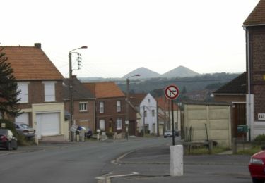
Trail Walking of 12.8 km to be discovered at Hauts-de-France, Pas-de-Calais, Blendecques. This trail is proposed by alain62rando.
Description
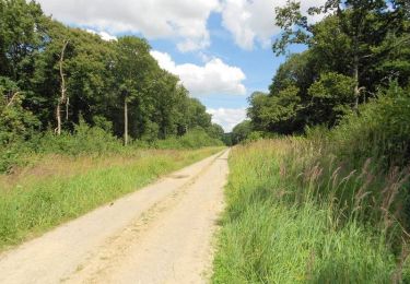
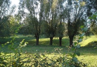
Au départ du stand de tir de Blendecques près des 2 lions une randonnée qui vous fera traversée les landes à Heuringhem et à Blendecques.
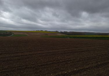
Rando avec 6.1km de chemins
Positioning
Country:
France
Region :
Hauts-de-France
Department/Province :
Pas-de-Calais
Municipality :
Blendecques
Location:
Unknown
Start:(Dec)
Start:(UTM)
448281 ; 5617985 (31U) N.
Comments
Trails nearby
![Trail Walking Arques - Balade en forêt de Rihoult-Clairmarais - Arques - Photo](https://media.geolcdn.com/t/375/260/ext.jpg?maxdim=2&url=https%3A%2F%2Fservices.sitytrail.com%2FGeolivesWS%2FDownloadMedia.ashx%3FTrailID%3D215206%26Media%3D15812_6.jpg)
![Walking Walking](https://static1.geolcdn.com/sitytour/trail-icons/101.png)
Balade en forêt de Rihoult-Clairmarais - Arques
Walking
Medium
Arques,
Hauts-de-France,
Pas-de-Calais,
France
![](/images/other/stat-length.png)
13.5 km | 15.7 km-effort
3h 30min
![](https://static1.geolcdn.com/siteimages/upload/files/16400158638029165_repeat_loop_refresh_sync_direction_icon.png)
Yes
![Trail Walking Quiestède - Sentier de Laprée - Quiestède - Photo](https://media.geolcdn.com/t/375/260/ext.jpg?maxdim=2&url=https%3A%2F%2Fservices.sitytrail.com%2FGeolivesWS%2FDownloadMedia.ashx%3FTrailID%3D172955%26Media%3D14435_6.jpg)
![Walking Walking](https://static1.geolcdn.com/sitytour/trail-icons/101.png)
Sentier de Laprée - Quiestède
Walking
Easy
Quiestède,
Hauts-de-France,
Pas-de-Calais,
France
![](/images/other/stat-length.png)
6.5 km | 7 km-effort
1h 40min
![](https://static1.geolcdn.com/siteimages/upload/files/16400158638029165_repeat_loop_refresh_sync_direction_icon.png)
Yes
![Trail Walking Bellinghem - Inghem - Le sentier des Bosquets - Photo](https://media.geolcdn.com/t/375/260/ext.jpg?maxdim=2&url=https%3A%2F%2Fservices.sitytrail.com%2FGeolivesWS%2FDownloadMedia.ashx%3FTrailID%3D109703%26Media%3D4404_4.jpg)
![Walking Walking](https://static1.geolcdn.com/sitytour/trail-icons/101.png)
Inghem - Le sentier des Bosquets
Walking
Medium
Bellinghem,
Hauts-de-France,
Pas-de-Calais,
France
![](/images/other/stat-length.png)
8.2 km | 9.4 km-effort
1h 45min
![](https://static1.geolcdn.com/siteimages/upload/files/16400158638029165_repeat_loop_refresh_sync_direction_icon.png)
Yes
![Trail Cycle Ecques - SF 2009 Circuit d'Aire sur la Lys - Photo](https://media.geolcdn.com/t/375/260/ext.jpg?maxdim=2&url=https%3A%2F%2Fservices.sitytrail.com%2FGeolivesWS%2FDownloadMedia.ashx%3FTrailID%3D104298%26Media%3D7524_5.jpg)
![Cycle Cycle](https://static1.geolcdn.com/sitytour/trail-icons/200.png)
SF 2009 Circuit d'Aire sur la Lys
Cycle
Medium
Ecques,
Hauts-de-France,
Pas-de-Calais,
France
![](/images/other/stat-length.png)
130 km | 144 km-effort
5h 57min
![](https://static1.geolcdn.com/siteimages/upload/files/16400158638029165_repeat_loop_refresh_sync_direction_icon.png)
Yes
![Trail Walking Pihem - rando du Lion - Photo](https://media.geolcdn.com/t/375/260/17c8a61f-7a03-4a55-9981-7341855c5163.jpg&format=jpg&maxdim=2)
![Walking Walking](https://static1.geolcdn.com/sitytour/trail-icons/101.png)
rando du Lion
Walking
Difficult
Pihem,
Hauts-de-France,
Pas-de-Calais,
France
![](/images/other/stat-length.png)
16.3 km | 18.8 km-effort
2h 52min
![](https://static1.geolcdn.com/siteimages/upload/files/16400158638029165_repeat_loop_refresh_sync_direction_icon.png)
Yes
![Trail Mountain bike Saint-Omer - 2092012 - Photo](https://media.geolcdn.com/t/375/260/ext.jpg?maxdim=2&url=https%3A%2F%2Fservices.sitytrail.com%2FGeolivesWS%2FDownloadMedia.ashx%3FTrailID%3D151052%26Media%3D20120902095703.jpg)
![Mountain bike Mountain bike](https://static1.geolcdn.com/sitytour/trail-icons/202.png)
2092012
Mountain bike
Medium
Saint-Omer,
Hauts-de-France,
Pas-de-Calais,
France
![](/images/other/stat-length.png)
41 km | 49 km-effort
2h 40min
![](https://static1.geolcdn.com/siteimages/upload/files/16400158638029165_repeat_loop_refresh_sync_direction_icon.png)
Yes
![Trail Walking Heuringhem - Heuringhem - Le sentier Perdu - Photo](https://media.geolcdn.com/t/375/260/ext.jpg?maxdim=2&url=https%3A%2F%2Fservices.sitytrail.com%2FGeolivesWS%2FDownloadMedia.ashx%3FTrailID%3D109707%26Media%3D4408_1.jpg)
![Walking Walking](https://static1.geolcdn.com/sitytour/trail-icons/101.png)
Heuringhem - Le sentier Perdu
Walking
Medium
Heuringhem,
Hauts-de-France,
Pas-de-Calais,
France
![](/images/other/stat-length.png)
14.5 km | 15.8 km-effort
3h 45min
![](https://static1.geolcdn.com/siteimages/upload/files/16400158638029165_repeat_loop_refresh_sync_direction_icon.png)
Yes
![Trail Electric bike Ecques - quiestede - Photo](https://media.geolcdn.com/t/375/260/ext.jpg?maxdim=2&url=https%3A%2F%2Fstatic1.geolcdn.com%2Fsiteimages%2Fupload%2Ffiles%2F1524743154velo.jpg)
![Electric bike Electric bike](https://static1.geolcdn.com/sitytour/trail-icons/205.png)
quiestede
Electric bike
Easy
Ecques,
Hauts-de-France,
Pas-de-Calais,
France
![](/images/other/stat-length.png)
47 km | 52 km-effort
2h 38min
![](https://static1.geolcdn.com/siteimages/upload/files/16400158638029165_repeat_loop_refresh_sync_direction_icon.png)
No
![Trail Walking Arques - Arques - Photo](https://media.geolcdn.com/t/375/260/ext.jpg?maxdim=2&url=https%3A%2F%2Fstatic1.geolcdn.com%2Fsiteimages%2Fupload%2Ffiles%2F1553511878bg_sport_marche.png)
![Walking Walking](https://static1.geolcdn.com/sitytour/trail-icons/101.png)
Arques
Walking
Easy
Arques,
Hauts-de-France,
Pas-de-Calais,
France
![](/images/other/stat-length.png)
8.6 km | 9.3 km-effort
2h 23min
![](https://static1.geolcdn.com/siteimages/upload/files/16400158638029165_repeat_loop_refresh_sync_direction_icon.png)
Yes