![](/images/other/stat-length.png)
![Trail Mountain bike Fareins - Fareins messimy lurcy francheleins montceaux beybleu sapeins chaleins retour - Photo](https://media.geolcdn.com/t/1900/400/ext.pjpeg?maxdim=2&url=https%3A%2F%2Fstatic1.geolcdn.com%2Fsiteimages%2Fupload%2Ffiles%2F1524743154velo.jpg)
Fareins messimy lurcy francheleins montceaux beybleu sapeins chaleins retour
plusdego
User
![Length](/images/other/stat-length.png)
Length
36 km
![Max alt](https://static1.geolcdn.com/siteimages/upload/files/1508320355ic_sort_altitude_max_24dp.png)
Max alt
274 m
![Uphill gradient](https://static1.geolcdn.com/siteimages/upload/files/1508320355ic_sort_den_pos_24dp.png)
Uphill gradient
359 m
![Km-Effort](/images/other/stat-length.png)
Km-Effort
41 km
![Min alt](https://static1.geolcdn.com/siteimages/upload/files/1508320355ic_sort_altitude_min_24dp.png)
Min alt
175 m
![Downhill gradient](https://static1.geolcdn.com/siteimages/upload/files/1508320355ic_sort_den_neg_24dp.png)
Downhill gradient
357 m
![Boucle](https://static1.geolcdn.com/siteimages/upload/files/16400158638029165_repeat_loop_refresh_sync_direction_icon.png)
Boucle
Yes
Creation date :
2018-04-17 10:34:27.466
Updated on :
2018-04-17 10:34:27.466
![Mountain bike](https://static1.geolcdn.com/sitytour/trail-icons/202.png)
2h44
Difficulty : Easy
![Scan this QR Code to open this trail in the SityTrail application](https://capi.geolives.com/qq0zvz2zws4bq2lad0pu/sitytour/trails/844464/qr.png?size=200)
FREE GPS app for hiking
About
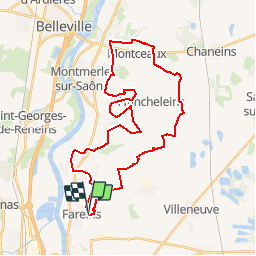
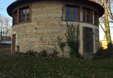
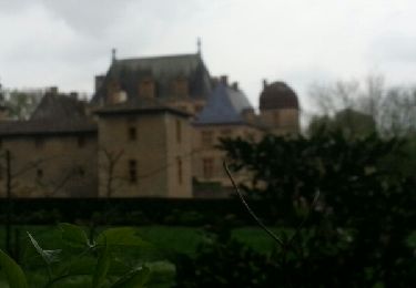
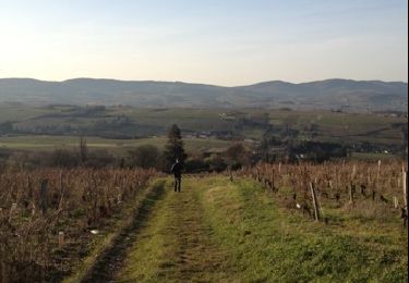
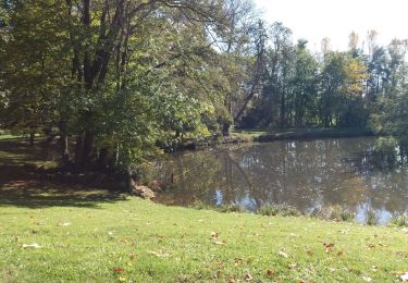
Trail Mountain bike of 36 km to be discovered at Auvergne-Rhône-Alpes, Ain, Fareins. This trail is proposed by plusdego.
Description
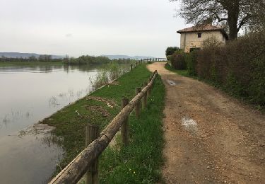
Grande boucle de 36km au départ de Fareins. Arrivée à Messimy par les champs, puis Lurcy, Francheleins, Montceaux, retour par Beybleu, Sapeins et Chaleins
Positioning
Country:
France
Region :
Auvergne-Rhône-Alpes
Department/Province :
Ain
Municipality :
Fareins
Location:
Unknown
Start:(Dec)
Start:(UTM)
636731 ; 5097718 (31T) N.
Comments
Trails nearby
![Trail Walking Lurcy - Lurcy (16 km - D. 134 m) - Photo](https://media.geolcdn.com/t/375/260/ext.jpg?maxdim=2&url=https%3A%2F%2Fmedia.geolcdn.com%2Ff%2Fe2042645-0d0c-4f8d-a036-e57dec048f59.jpg)
![Walking Walking](https://static1.geolcdn.com/sitytour/trail-icons/101.png)
Lurcy (16 km - D. 134 m)
Walking
Difficult
Lurcy,
Auvergne-Rhône-Alpes,
Ain,
France
![](/images/other/stat-length.png)
16.2 km | 18 km-effort
4h 57min
![](https://static1.geolcdn.com/siteimages/upload/files/16400158638029165_repeat_loop_refresh_sync_direction_icon.png)
Yes
![Trail Walking Ars-sur-Formans - Ars-s-formans (Cibeins) - Photo](https://media.geolcdn.com/t/375/260/ext.jpg?maxdim=2&url=https%3A%2F%2Fmedia.geolcdn.com%2Ff%2Fec90bbcc-0957-43a3-97d6-baf804ca93d7.jpg)
![Walking Walking](https://static1.geolcdn.com/sitytour/trail-icons/101.png)
Ars-s-formans (Cibeins)
Walking
Easy
Ars-sur-Formans,
Auvergne-Rhône-Alpes,
Ain,
France
![](/images/other/stat-length.png)
4.3 km | 5.3 km-effort
1h 14min
![](https://static1.geolcdn.com/siteimages/upload/files/16400158638029165_repeat_loop_refresh_sync_direction_icon.png)
Yes
![Trail Walking Ars-sur-Formans - Ars-Sur-Formans (13,5 km) - Photo](https://media.geolcdn.com/t/375/260/ext.jpg?maxdim=2&url=https%3A%2F%2Fmedia.geolcdn.com%2Ff%2Fdbdc7be9-af92-44af-8e66-bcc2600e0638.jpg)
![Walking Walking](https://static1.geolcdn.com/sitytour/trail-icons/101.png)
Ars-Sur-Formans (13,5 km)
Walking
Medium
Ars-sur-Formans,
Auvergne-Rhône-Alpes,
Ain,
France
![](/images/other/stat-length.png)
13.5 km | 15.7 km-effort
3h 25min
![](https://static1.geolcdn.com/siteimages/upload/files/16400158638029165_repeat_loop_refresh_sync_direction_icon.png)
Yes
![Trail Walking Chaleins - chaneins - Photo](https://media.geolcdn.com/t/375/260/ext.jpg?maxdim=2&url=https%3A%2F%2Fservices.sitytrail.com%2FGeolivesWS%2FDownloadMedia.ashx%3FTrailID%3D266784%26Media%3Dfix__20140405115211.jpg)
![Walking Walking](https://static1.geolcdn.com/sitytour/trail-icons/101.png)
chaneins
Walking
Easy
Chaleins,
Auvergne-Rhône-Alpes,
Ain,
France
![](/images/other/stat-length.png)
12.8 km | 14.3 km-effort
4h 2min
![](https://static1.geolcdn.com/siteimages/upload/files/16400158638029165_repeat_loop_refresh_sync_direction_icon.png)
Yes
![Trail Walking Chaleins - chaneins - Photo](https://media.geolcdn.com/t/375/260/ext.jpg?maxdim=2&url=https%3A%2F%2Fservices.sitytrail.com%2FGeolivesWS%2FDownloadMedia.ashx%3FTrailID%3D263439%26Media%3Dfix__20140405150716.jpg)
![Walking Walking](https://static1.geolcdn.com/sitytour/trail-icons/101.png)
chaneins
Walking
Easy
Chaleins,
Auvergne-Rhône-Alpes,
Ain,
France
![](/images/other/stat-length.png)
12.8 km | 14.3 km-effort
4h 2min
![](https://static1.geolcdn.com/siteimages/upload/files/16400158638029165_repeat_loop_refresh_sync_direction_icon.png)
Yes
![Trail Walking Limas - Limas - Photo](https://media.geolcdn.com/t/375/260/ext.jpg?maxdim=2&url=https%3A%2F%2Fservices.sitytrail.com%2FGeolivesWS%2FDownloadMedia.ashx%3FTrailID%3D166962%26Media%3D20121223151415.jpg)
![Walking Walking](https://static1.geolcdn.com/sitytour/trail-icons/101.png)
![Trail Walking Villefranche-sur-Saône - Itinérant Beaujolais etape 1 Villefranche sur Saone - Le Flagolet - Photo](https://media.geolcdn.com/t/375/260/ext.jpg?maxdim=2&url=https%3A%2F%2Fmedia.geolcdn.com%2Ff%2F265892a0-89c7-47ac-89f3-06f9bc929d8c.jpg)
![Walking Walking](https://static1.geolcdn.com/sitytour/trail-icons/101.png)
Itinérant Beaujolais etape 1 Villefranche sur Saone - Le Flagolet
Walking
Medium
Villefranche-sur-Saône,
Auvergne-Rhône-Alpes,
Rhône,
France
![](/images/other/stat-length.png)
20 km | 25 km-effort
4h 43min
![](https://static1.geolcdn.com/siteimages/upload/files/16400158638029165_repeat_loop_refresh_sync_direction_icon.png)
No
![Trail Walking Jassans-Riottier - de Jassans à Ars - Photo](https://media.geolcdn.com/t/375/260/ext.jpg?maxdim=2&url=https%3A%2F%2Fmedia.geolcdn.com%2Ff%2F69609df8-c7a8-4c16-85d6-78de1862e8ac.jpg)
![Walking Walking](https://static1.geolcdn.com/sitytour/trail-icons/101.png)
de Jassans à Ars
Walking
Very easy
Jassans-Riottier,
Auvergne-Rhône-Alpes,
Ain,
France
![](/images/other/stat-length.png)
19.5 km | 23 km-effort
6h 1min
![](https://static1.geolcdn.com/siteimages/upload/files/16400158638029165_repeat_loop_refresh_sync_direction_icon.png)
Yes
![Trail Walking Messimy-sur-Saône - rando tarot - Photo](https://media.geolcdn.com/t/375/260/ext.jpg?maxdim=2&url=https%3A%2F%2Fmedia.geolcdn.com%2Ff%2F57b5d7d4-d7eb-4096-9414-baa9f7b74f34.JPG)
![Walking Walking](https://static1.geolcdn.com/sitytour/trail-icons/101.png)
rando tarot
Walking
Medium
Messimy-sur-Saône,
Auvergne-Rhône-Alpes,
Ain,
France
![](/images/other/stat-length.png)
11.3 km | 12.6 km-effort
1h 54min
![](https://static1.geolcdn.com/siteimages/upload/files/16400158638029165_repeat_loop_refresh_sync_direction_icon.png)
Yes