![](/images/other/stat-length.png)
![Trail Walking Guillaumes - 28-08-2011-balade au départ du ''pont des roberts'' - Photo](https://media.geolcdn.com/t/1900/400/ext.pjpeg?maxdim=2&url=https%3A%2F%2Fservices.sitytrail.com%2FGeolivesWS%2FDownloadMedia.ashx%3FTrailID%3D84202%26Media%3D20110828134150.jpeg)
28-08-2011-balade au départ du ''pont des roberts''
sdraperi
User
![Length](/images/other/stat-length.png)
Length
16.3 km
![Max alt](https://static1.geolcdn.com/siteimages/upload/files/1508320355ic_sort_altitude_max_24dp.png)
Max alt
1482 m
![Uphill gradient](https://static1.geolcdn.com/siteimages/upload/files/1508320355ic_sort_den_pos_24dp.png)
Uphill gradient
767 m
![Km-Effort](/images/other/stat-length.png)
Km-Effort
26 km
![Min alt](https://static1.geolcdn.com/siteimages/upload/files/1508320355ic_sort_altitude_min_24dp.png)
Min alt
757 m
![Downhill gradient](https://static1.geolcdn.com/siteimages/upload/files/1508320355ic_sort_den_neg_24dp.png)
Downhill gradient
767 m
![Boucle](https://static1.geolcdn.com/siteimages/upload/files/16400158638029165_repeat_loop_refresh_sync_direction_icon.png)
Boucle
Yes
Creation date :
2014-12-10 00:00:00.0
Updated on :
2014-12-10 00:00:00.0
![Walking](https://static1.geolcdn.com/sitytour/trail-icons/101.png)
3h30
Difficulty : Medium
![Scan this QR Code to open this trail in the SityTrail application](https://capi.geolives.com/qq0zvz2zws4bq2lad0pu/sitytour/trails/84202/qr.png?size=200)
FREE GPS app for hiking
About
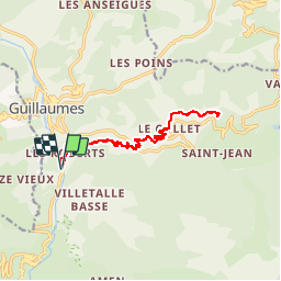
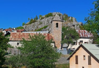
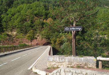
Trail Walking of 16.3 km to be discovered at Provence-Alpes-Côte d'Azur, Maritime Alps, Guillaumes. This trail is proposed by sdraperi.
Description
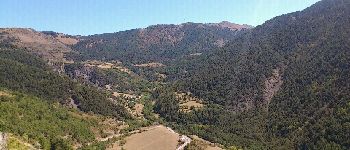
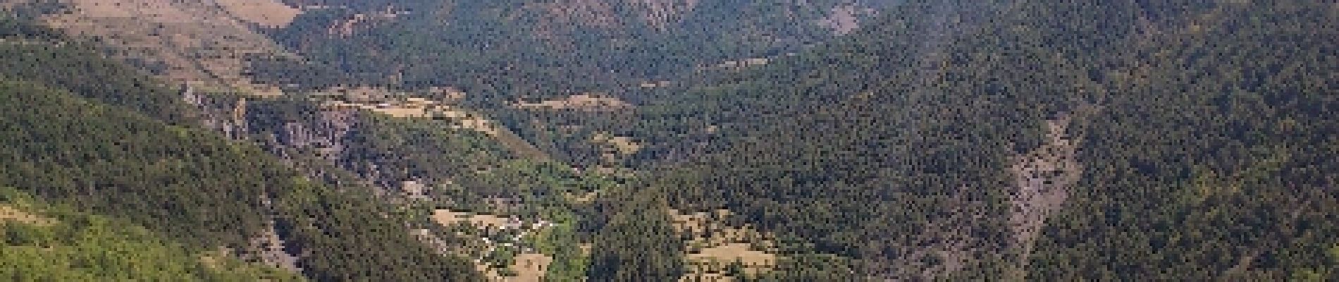
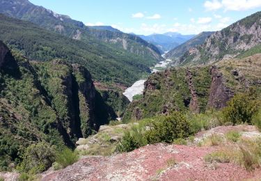
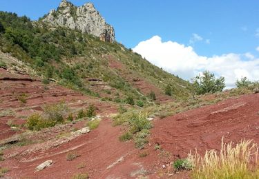
De splendides décors.
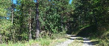
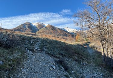
Ça monte vite, mais bon c'est sympa, il y a des routes a traverser, cependant les bornes sont pas toujours visibles donc bien respecter ce que dit votre gps !!!
Positioning
Country:
France
Region :
Provence-Alpes-Côte d'Azur
Department/Province :
Maritime Alps
Municipality :
Guillaumes
Location:
Unknown
Start:(Dec)
Start:(UTM)
328451 ; 4882597 (32T) N.
Comments
Trails nearby
![Trail On foot Guillaumes - Gorges de Daluis - Photo](https://media.geolcdn.com/t/375/260/cf6f6166-06c7-4fb4-b3e6-a1ea2ecf5d7a.jpeg&format=jpg&maxdim=2)
![On foot On foot](https://static1.geolcdn.com/sitytour/trail-icons/100.png)
Gorges de Daluis
On foot
Easy
Guillaumes,
Provence-Alpes-Côte d'Azur,
Maritime Alps,
France
![](/images/other/stat-length.png)
9.7 km | 18.3 km-effort
4h 9min
![](https://static1.geolcdn.com/siteimages/upload/files/16400158638029165_repeat_loop_refresh_sync_direction_icon.png)
Yes
![Trail On foot Péone - Circuit de Septenne - Photo](https://media.geolcdn.com/t/375/260/ece6b3bc-3f52-4b23-955d-de7c74062137.jpeg&format=jpg&maxdim=2)
![On foot On foot](https://static1.geolcdn.com/sitytour/trail-icons/100.png)
Circuit de Septenne
On foot
Easy
Péone,
Provence-Alpes-Côte d'Azur,
Maritime Alps,
France
![](/images/other/stat-length.png)
11 km | 19.2 km-effort
4h 21min
![](https://static1.geolcdn.com/siteimages/upload/files/16400158638029165_repeat_loop_refresh_sync_direction_icon.png)
Yes
![Trail On foot Sauze - Hameaux de Sauze - Photo](https://media.geolcdn.com/t/375/260/8de1e0fb-d754-4ba0-84e6-05cab893c487.jpeg&format=jpg&maxdim=2)
![On foot On foot](https://static1.geolcdn.com/sitytour/trail-icons/100.png)
Hameaux de Sauze
On foot
Easy
Sauze,
Provence-Alpes-Côte d'Azur,
Maritime Alps,
France
![](/images/other/stat-length.png)
8.8 km | 14 km-effort
3h 11min
![](https://static1.geolcdn.com/siteimages/upload/files/16400158638029165_repeat_loop_refresh_sync_direction_icon.png)
Yes
![Trail Walking Daluis - Daluis - Point Sublime - 4 km 150m - 2016 06 17 - Photo](https://media.geolcdn.com/t/375/260/ext.jpg?maxdim=2&url=https%3A%2F%2Fservices.sitytrail.com%2FGeolivesWS%2FDownloadMedia.ashx%3FTrailID%3D597790%26Media%3Dfix__20160617120004.jpg)
![Walking Walking](https://static1.geolcdn.com/sitytour/trail-icons/101.png)
Daluis - Point Sublime - 4 km 150m - 2016 06 17
Walking
Easy
Daluis,
Provence-Alpes-Côte d'Azur,
Maritime Alps,
France
![](/images/other/stat-length.png)
4.9 km | 8.5 km-effort
2h 10min
![](https://static1.geolcdn.com/siteimages/upload/files/16400158638029165_repeat_loop_refresh_sync_direction_icon.png)
Yes
![Trail Walking Daluis - Gorges de Daluis - Photo](https://media.geolcdn.com/t/375/260/ext.jpg?maxdim=2&url=https%3A%2F%2Fstatic1.geolcdn.com%2Fsiteimages%2Fupload%2Ffiles%2F1553511878bg_sport_marche.png)
![Walking Walking](https://static1.geolcdn.com/sitytour/trail-icons/101.png)
Gorges de Daluis
Walking
Medium
(3)
Daluis,
Provence-Alpes-Côte d'Azur,
Maritime Alps,
France
![](/images/other/stat-length.png)
8.9 km | 16 km-effort
3h 30min
![](https://static1.geolcdn.com/siteimages/upload/files/16400158638029165_repeat_loop_refresh_sync_direction_icon.png)
Yes
![Trail Walking Guillaumes - Gorges de Daluis - Boucle au départ du pont de Cante - Photo](https://media.geolcdn.com/t/375/260/ext.jpg?maxdim=2&url=https%3A%2F%2Fservices.sitytrail.com%2FGeolivesWS%2FDownloadMedia.ashx%3FTrailID%3D348279%26Media%3Dfix__20140925141956.jpg)
![Walking Walking](https://static1.geolcdn.com/sitytour/trail-icons/101.png)
Gorges de Daluis - Boucle au départ du pont de Cante
Walking
Medium
Guillaumes,
Provence-Alpes-Côte d'Azur,
Maritime Alps,
France
![](/images/other/stat-length.png)
13.4 km | 23 km-effort
4h 50min
![](https://static1.geolcdn.com/siteimages/upload/files/16400158638029165_repeat_loop_refresh_sync_direction_icon.png)
Yes
![Trail Walking Sauze - Mont St Honorât - Photo](https://media.geolcdn.com/t/375/260/60060653-5e59-4e6b-ba0a-f1f4b45ca880.jpg&format=jpg&maxdim=2)
![Walking Walking](https://static1.geolcdn.com/sitytour/trail-icons/101.png)
Mont St Honorât
Walking
Very difficult
(1)
Sauze,
Provence-Alpes-Côte d'Azur,
Maritime Alps,
France
![](/images/other/stat-length.png)
11.5 km | 28 km-effort
6h 31min
![](https://static1.geolcdn.com/siteimages/upload/files/16400158638029165_repeat_loop_refresh_sync_direction_icon.png)
Yes
![Trail Walking Daluis - Gorges de Daluis - Photo](https://media.geolcdn.com/t/375/260/617cb6d2-42fa-4d55-b1a3-65b3424d4778.jpg&format=jpg&maxdim=2)
![Walking Walking](https://static1.geolcdn.com/sitytour/trail-icons/101.png)
Gorges de Daluis
Walking
Medium
Daluis,
Provence-Alpes-Côte d'Azur,
Maritime Alps,
France
![](/images/other/stat-length.png)
14.2 km | 25 km-effort
5h 45min
![](https://static1.geolcdn.com/siteimages/upload/files/16400158638029165_repeat_loop_refresh_sync_direction_icon.png)
Yes
![Trail On foot Guillaumes - Circuit d'Amen - Photo](https://media.geolcdn.com/t/375/260/faf9e9ab-a880-4a21-b636-bc915b90fa63.jpeg&format=jpg&maxdim=2)
![On foot On foot](https://static1.geolcdn.com/sitytour/trail-icons/100.png)
Circuit d'Amen
On foot
Medium
(1)
Guillaumes,
Provence-Alpes-Côte d'Azur,
Maritime Alps,
France
![](/images/other/stat-length.png)
13.2 km | 22 km-effort
5h 4min
![](https://static1.geolcdn.com/siteimages/upload/files/16400158638029165_repeat_loop_refresh_sync_direction_icon.png)
Yes